Mount Everest formed through the ongoing collision between the Indian Plate and the Eurasian Plate, a massive tectonic process that began approximately 50 to 55 million years ago. This continent-continent collision closed the ancient Tethys Sea, compressed marine sediments, and uplifted the Himalayan mountain range into the highest elevation system on Earth. The limestone, shale, granite, and metamorphic rocks that make up Everest preserve evidence of this geological history, including marine fossils that once existed beneath an ancient ocean. Today, Everest stands at 8,848.86 meters (29,031.7 feet) above sea level, but the mountain remains geologically active as tectonic forces continue pushing the Himalayas upward every year.
.webp)
Mount Everest is not an isolated peak but the highest expression of the Himalayan collision zone, where crustal thickening, thrust faulting, glacial erosion, and seismic activity continue reshaping the landscape across Nepal and Tibet. Scientific evidence from GPS monitoring, radiometric dating, seismic imaging, structural geology mapping, and fossil analysis confirms that Everest is still rising while erosion simultaneously wears the mountain down. From the Khumbu Glacier and Kala Patthar to the summit limestone of the Qomolangma Formation, every section of Everest reveals a different stage of the mountain’s formation, making it one of the clearest geological records of active continental collision anywhere on Earth.
What Tectonic Plates Created Mount Everest?
Mount Everest was created by 2 tectonic plates: the Indian Plate and the Eurasian Plate. The Indian Plate, a northward-moving landmass, drove directly into the southern edge of the Eurasian Plate. Neither plate subducted cleanly beneath the other because both carried continental crust, dense, buoyant rock that resisted sinking into the mantle.
The Indian Plate moves at approximately 5 centimeters per year, a rate Caltech tectonics research confirming the 4–5 cm/year Indo-Eurasian convergence rate shows has remained essentially unchanged since the collision began 50 million years ago, making it one of the fastest-moving tectonic plates on Earth. This velocity, sustained over tens of millions of years, generated the compressive force necessary to raise an entire mountain range from sea level to nearly 9,000 meters.
The Eurasian Plate, by contrast, remained relatively stationary. The Indian Plate acted as the driving force, while the Eurasian Plate served as the resistive boundary that forced crustal material upward rather than sideways.
The Tethys Ocean: The Body of Water That Became Everest
Before these two plates collided, a large ancient ocean called the Tethys Sea separated the Indian subcontinent from Asia. This ocean accumulated marine sediments, limestone, sandstone, and shale, across hundreds of millions of years. When the collision began, those seafloor sediments were scraped off, compressed, and pushed skyward. The summit limestone visible at Everest's peak today is direct evidence of that ancient ocean floor.
How Did the Indian and Eurasian Plates Collide?
The Indian and Eurasian Plates collided through a process called continental collision, which differs fundamentally from oceanic subduction. The sequence unfolded across 3 distinct phases:
Initial contact (50–55 million years ago): The leading edge of the Indian Plate first made contact with the Eurasian Plate's margin, closing the Tethys Sea and initiating crustal compression.
Active convergence (50 million years ago to present): The Indian Plate continued pushing north at 4–5 cm/year, forcing the crust to buckle, fold, and thicken. The Himalayan range began rising as compressed rock layers stacked on top of one another like wrinkled fabric.
Ongoing collision (present): GPS measurements confirm the Indian Plate still moves northward, sustaining the uplift of the entire Himalayan system, including Everest itself.
What most trekking guides do not tell you: the collision zone is not a single clean boundary. It is a 300-kilometer-wide zone of deformation called the Main Himalayan Thrust (MHT). This fault system is the geological engine driving Everest's continued rise.
What Geological Processes Uplifted Mount Everest?
3 primary geological processes uplifted Mount Everest: crustal thickening, isostatic rebound, and thrust faulting.
Crustal thickening occurred as the Indian Plate compressed the Eurasian crust, doubling its normal thickness from approximately 35 km to 70 km beneath the Tibetan Plateau. This thicker crust, being lighter than the surrounding mantle, floated higher, pushing the surface upward.
Thrust faulting pushed large sheets of rock over one another along fault planes. The Main Central Thrust and the South Tibetan Detachment are the 2 major faults responsible for stacking Everest's rock layers into their current vertical position.
Isostatic rebound acts like a compressed sponge releasing pressure. As erosion strips material from Everest's surface, the remaining mass becomes lighter, and the crust rises to restore gravitational equilibrium. This process partially offsets erosion, keeping Everest tall despite losing surface rock continuously.
Isostatic rebound is the mechanism most competitors fail to explain, yet it is critical for trekkers who wonder why Everest stays so tall despite constant erosion from wind, ice, and freeze-thaw cycles.
What Types of Rocks Make Up Mount Everest?
Mount Everest is composed of 3 primary rock units, each occupying a distinct vertical zone of the mountain:
Rock Unit | Elevation Range | Rock Type | Origin |
Qomolangma Formation | 8,600 m – Summit | Ordovician limestone | Ancient Tethys Sea floor |
North Col Formation | 7,000 m – 8,600 m | Shales, phyllite, marble | Metamorphosed marine sediments |
Rongbuk Formation | Base – 7,000 m | Leucogranite, gneiss | Melted and recrystallized crustal rock |
The Qomolangma Formation at the summit is the most geologically striking. Climbers who reach the top are standing on 480-million-year-old limestone packed with fossilized marine organisms, trilobites, crinoids, and other creatures that lived in a shallow tropical sea.
The Rongbuk Formation granite formed when crustal thickening generated enough heat and pressure to partially melt the rock deep underground. That melted rock intruded upward and cooled into the granite visible on Everest's lower flanks today.
When Did Mount Everest Begin to Form?
Mount Everest began to form approximately 50 to 55 million years ago, when the Indian and Eurasian Plates first made contact. The Himalayas as a visible mountain range began rising significantly around 25 to 30 million years ago, as the rate of collision and crustal thickening accelerated.
For context on geological time:
540 million years ago: The limestone now at Everest's summit was deposited on the floor of the Tethys Sea.
250 million years ago: The Indian subcontinent began drifting northward from the ancient supercontinent Gondwana.
50–55 million years ago: Continental collision initiated. Everest's formation process began.
25–30 million years ago: The Himalayan range started rising to significant elevations.
2–3 million years ago: Everest reached elevations recognizable as a high Himalayan peak.
Present: Everest continues rising at 4–5 mm per year.
The mountain trekkers approach through the Khumbu Valley today is geologically young by planetary standards, younger than many mountain ranges in North America and Europe.
Is Mount Everest Still Growing Today?
Yes, Mount Everest is still growing today; the documented Everest growth per year is approximately 4 to 5 millimeters, driven by the Indian Plate continuing its northward push into the Eurasian Plate and the compressive forces that sustain crustal uplift.
GPS monitoring stations positioned across the Himalayas and Tibetan Plateau measure this movement continuously. Data from the Chinese and Nepalese survey teams, documented in Nepal Survey Department's official GNSS and gravity-survey report behind the 8,848.86 m figure, which combined precise leveling, gravimetric surveys, and summit GNSS observations, produced the revised official height of 8,848.86 meters in 2020.
Two processes work in opposition:
Tectonic uplift raises the summit at 4–5 mm/year.
Glacial and wind erosion removes surface material at a comparable rate.
The net result is a mountain that remains roughly stable in height over human timescales, while experiencing measurable geological activity beneath the surface. For trekkers, this means the Khumbu Glacier's crevasses and seracs, notoriously dangerous terrain, are partially a product of active crustal movement beneath them.
What Evidence Supports Everest's Formation Theory?
5 categories of evidence confirm Everest's formation by tectonic collision: fossil records, GPS movement data, seismic surveys, rock dating, and geochemical analysis.
Marine fossils at the summit: trilobites, crinoids, and brachiopods, sit within a 225-meter-thick limestone unit that an NSF-funded Lithosphere study dating the deformation history of Everest's summit limestone shows was reshaped by at least two separate deformation events, the most recent as recently as 18 million years ago. GPS velocity measurements: Continuous GPS stations across India and Tibet record the Indian Plate moving northward at 4–5 cm/year, directly confirming the active collision.
Seismic tomography: Imaging of the Earth's interior using seismic wave analysis reveals the subducting slab geometry and crustal thickness patterns consistent with continental collision tectonics.
Radiometric dating: including work published in National Science Review analysis dating Himalayan detachment shear zones to roughly 16–17 million years, shows ductile shearing on the structures bounding the Rongbuk granite occurred around 17 million years ago, consistent with the timing of crustal melting predicted by collision models.
Structural geology mapping: Field surveys document thrust faults, fold axes, and metamorphic grade patterns that match the predicted geometry of a continent-continent collision zone.
These 5 evidence types are mutually reinforcing. No single piece stands alone, together they form a convergent dataset that validates the plate tectonic model of Himalayan formation.
How Do Earthquakes Affect Mount Everest's Structure?
Earthquakes affect Mount Everest's structure by triggering rockfalls, altering glacier dynamics, and generating ground deformation along active fault lines. The Himalayas sit directly above the Main Himalayan Thrust, one of Earth's largest active fault systems.
The 2015 Gorkha earthquake (magnitude 7.8) produced measurable surface deformation across the Khumbu region. Post-event satellite InSAR data, detailed in Nature Geoscience InSAR analysis showing the high Himalaya actually subsided during the Gorkha rupture, revealed that the high Himalayan range around Everest Base Camp actually subsided during the earthquake, even as slip remained locked deep on the Main Himalayan Thrust. Avalanches triggered by the earthquake killed 19 people at Base Camp, the single deadliest day in Everest climbing history.
Geologically, each major earthquake represents a stress release along fault planes. Between earthquakes, elastic strain accumulates as the Indian Plate pushes against the locked Himalayan fault system. When rupture occurs, that stored energy releases rapidly.
For trekkers on the Everest approach routes, seismic risk is a real consideration. Trekking agencies reference the Nepal Seismic Hazard Catalog, which documents over 1,200 seismic events in the Khumbu region since 1900.
What Role Did the Himalayas Play in Everest's Formation?
The Himalayas are the direct product of the same collision that formed Everest, Everest is the Himalayas' highest expression, not a separate formation event. The 2,400-kilometer-long Himalayan arc formed as the Indian Plate compressed the Eurasian margin, producing a continuous chain of folded and thrust-faulted mountains.
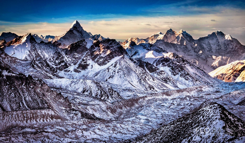
Everest's position within this system is not accidental. As the world's highest mountain, it sits within the Greater Himalayas, the most intensely deformed zone of the range, where crustal thickening reached its maximum and the highest-grade metamorphic and plutonic rocks were exhumed.
The Tibetan Plateau, north of the Himalayas, formed simultaneously as the thickened crust of the collision zone spread laterally and elevated. The plateau averages 4,500 meters in elevation, the world's highest and largest plateau, and represents the root zone of the same collision that built Everest.
How Fast Is Mount Everest Rising Each Year?
Mount Everest rises at approximately 4 to 5 millimeters per year due to ongoing tectonic compression from the Indian Plate. This measurement comes from continuous GPS monitoring networks operated by the Survey of India, the Chinese National Administration of Surveying, and international research institutions.
To place this in practical context:
At 5 mm/year, Everest rises 5 centimeters per decade.
Over 1,000 years, tectonic forces add 5 meters to the summit elevation.
Over 1 million years, assuming constant rates, the mountain would theoretically rise 5 kilometers, though erosion balances this considerably.
The 2020 revised summit measurement of 8,848.86 meters, 86 centimeters higher than the previous official measurement of 8,848 meters, reflects improved GPS and gravimetric survey methodology rather than actual mountain growth. However, ongoing tectonic activity confirms that the figure will require periodic revision as measurement technology improves.
What Fossils and Marine Evidence Exist on Everest?
The summit zone of Mount Everest contains fossils of at least 4 marine organism types: trilobites, crinoids, brachiopods, and ostracods, all documented in the Ordovician-age Qomolangma Formation limestone.
These organisms lived in the Tethys Sea approximately 470–480 million years ago. When the Indian Plate collided with Eurasia, the seafloor sediments containing these fossils were scraped off the descending plate and thrust upward, eventually forming Everest's summit cap.
The presence of marine fossils at 8,848 meters is the single most dramatic evidence of Everest's oceanic origin. Climbers who have reached the summit describe seeing clearly visible fossil fragments in the grey limestone bands near the Hillary Step.
British geologist Noel Odell first documented the marine character of Everest's summit rocks during the 1924 British expedition. Subsequent field surveys by Chinese and Nepalese geological teams confirmed the fossil assemblage and dated the limestone to the Ordovician Period using conodont biostratigraphy.
For trekkers reaching Kala Patthar (5,644 m), the limestone bands visible on Everest's upper pyramid are the same marine sedimentary units that contain these fossils, visible to the naked eye through binoculars on clear days.
How Do Scientists Study Mount Everest's Geology?
Scientists study Mount Everest's geology using 6 primary methods: field mapping, rock sample dating, GPS geodesy, seismic monitoring, satellite remote sensing, and ice core analysis.
Field geological mapping: Geologists on expedition collect rock samples, measure structural orientations, and document lithological boundaries across the mountain's flanks.
Radiometric dating: Uranium-lead (U-Pb) and argon-argon (Ar-Ar) dating of mineral grains determine the absolute age of Everest's rock units with precision to within 1 million years.
GPS geodesy: Networks of GPS receivers installed across the Himalayas and Tibet measure plate velocities, crustal strain accumulation, and post-earthquake deformation.
Seismic monitoring: The National Seismological Centre of Nepal operates seismograph stations across the country, recording earthquake activity that reveals fault plane geometries and stress patterns beneath Everest.
Satellite radar (InSAR): Interferometric Synthetic Aperture Radar detects millimeter-scale surface deformation across large areas, mapping tectonic uplift and earthquake-related displacement without requiring ground access.
Ice core drilling: Ice cores extracted from glaciers adjacent to Everest, including the East Rongbuk Glacier, record atmospheric composition, dust deposition, and climate history over thousands of years, revealing how the mountain's erosional environment changed over time.
The 2020 joint China-Nepal summit survey combined GPS, GNSS satellite positioning, and gravimetric measurements to produce the most accurate Everest elevation measurement in history: 8,848.86 meters.
What Myths or Misconceptions Exist About Everest Formation?
4 common misconceptions about Everest's formation circulate widely among trekkers and general audiences:
Misconception 1: Everest was formed by volcanic activity. Everest contains no volcanic rocks. It formed entirely by tectonic collision and metamorphism. The Himalayas are not a volcanic arc, they are a collision range, fundamentally different in origin from volcanic mountain systems like the Andes or Cascades.
Misconception 2: Everest has always been the world's tallest mountain. The Himalayas are geologically young. Older ranges, including ancient predecessors in North America and Central Asia, were taller in their time. Everest reached its current dominance only within the last few million years.
Misconception 3: Erosion is destroying Everest. Erosion and tectonic uplift are in rough equilibrium. The mountain loses surface material continuously to glacial erosion, freeze-thaw weathering, and wind abrasion, but isostatic rebound and ongoing tectonic uplift replace much of that loss. Everest is not disappearing.
Misconception 4: The 2020 height revision means Everest grew. The change from 8,848 m to 8,848.86 m reflects improved measurement methodology, not actual mountain growth. The 2020 survey used more accurate GPS equipment, snow depth radar, and a unified geoid model. The mountain's physical height did not change between the two surveys.
How Has Erosion Shaped Mount Everest Over Time?
Erosion has shaped Mount Everest through 3 primary processes: glacial erosion, freeze-thaw weathering, and wind abrasion. These processes have sculpted the mountain's distinctive pyramidal form over millions of years.
Glacial erosion is the dominant shaping force. The Khumbu Glacier on the southwest face, the Rongbuk Glacier on the north face, and the Kangshung Glacier on the east face have carved the mountain's cirques, the bowl-shaped depressions visible from trekking routes. Where 3 glaciers cut into a peak from different sides, they produce a sharp, three-sided pyramid called a horn. Everest's iconic summit shape is a textbook glacial horn.
Freeze-thaw weathering operates continuously on exposed rock faces above 7,000 meters. Water infiltrates rock fractures, freezes, expands by approximately 9%, and fractures the rock. This process generates the constant rockfall that makes routes like the Northeast Ridge and the Geneva Spur hazardous.
Wind abrasion at extreme altitude strips fine material from exposed surfaces. The jet stream passes directly over Everest's summit for much of the year, carrying wind speeds exceeding 200 km/h. This strips loose material and polishes exposed rock surfaces.
Despite these forces, Everest remains tall because tectonic uplift and isostatic rebound continuously compensate for erosional mass loss. The mountain exists in a dynamic geological balance, not static permanence.
How Can You Explore Mount Everest Geology Today?
Trekkers explore Mount Everest's geology through 3 primary access routes: the Everest Base Camp Trek (Nepal), the Tibetan North Face approach, and guided geology-focused expeditions.
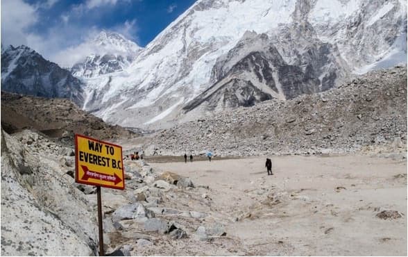
The Everest Base Camp Trek (approximately 130 km round trip from Lukla) passes through the full geological cross-section of the Himalayan range. Starting in Phakding at 2,610 meters and ascending to Base Camp at 5,364 meters, you traverse:
Lower Khumbu: Precambrian basement gneisses and schists in the valley floors near Namche Bazaar.
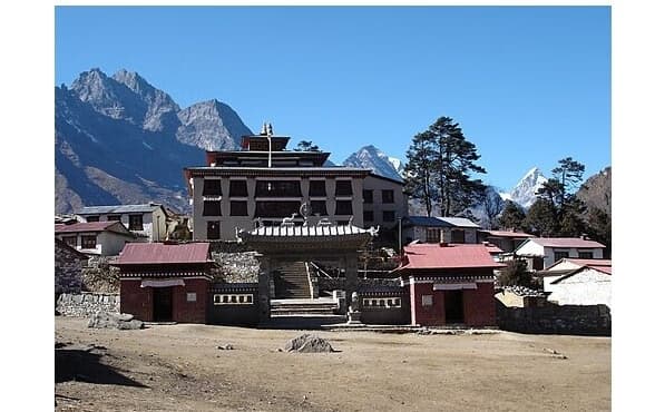
Mid-Khumbu: High-grade metamorphic rocks and leucogranite intrusions visible on valley walls between Tengboche and Lobuche.
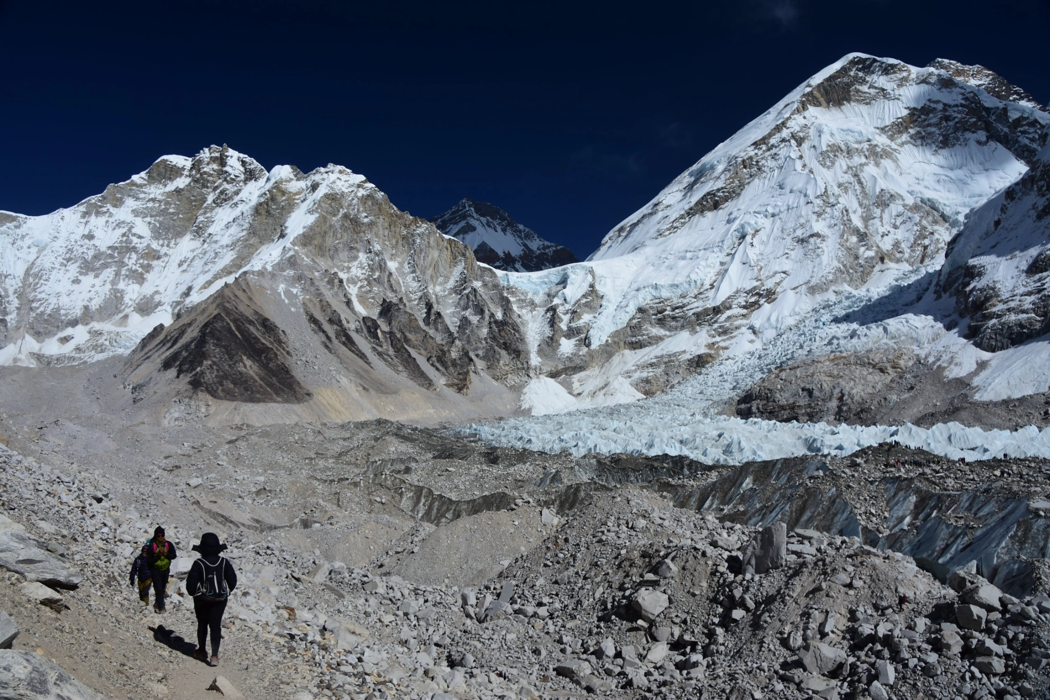
Upper Khumbu: The Rongbuk Formation granite at Gorak Shep and the contact zone between metamorphic and sedimentary units visible on Everest's lower pyramid from Kala Patthar (5,644 m).
The Kala Patthar viewpoint provides the clearest view of Everest's rock layers without requiring technical climbing permits. From this vantage point, you can distinguish the dark Qomolangma limestone at the summit from the lighter Rongbuk granite on the lower flanks.
The Renjo La, Cho La, and Kongma La passes, part of the Everest Three Passes Trek, expose additional geological cross-sections, including glacially polished basement rocks and structural fault traces visible in valley walls.
Can Guided Expeditions Help You Understand Everest's Formation?
Yes, guided expeditions with geology-trained leadership directly enhance understanding of Everest's formation by providing real-time interpretation of rock outcrops, structural features, and landscape processes that self-guided trekkers typically miss.
Several Nepal-based trekking operators offer geology-focused itineraries on the Everest Base Camp Trek route, walking you through the full geological cross-section of the Himalayan range. These expeditions typically include:
Rock identification stops at key outcrops between Namche Bazaar and Lobuche.
Structural geology interpretation of visible fold and fault features on valley walls.
Fossil observation sessions using hand lenses at accessible limestone outcrops.
Briefings on the Main Central Thrust, the major fault that separates the metamorphic Greater Himalayas from the lower Lesser Himalayas, which the Everest Base Camp trail crosses near Namche Bazaar.
The Main Central Thrust crossing near Namche Bazaar is a geological landmark that most trekkers pass without noticing. A guided geology expedition marks this point explicitly, transitioning from the schists and phyllites of the Lesser Himalayas to the high-grade gneisses and granites of the Greater Himalayas within a single day of walking.
For trekkers without a geology guide, the Himalayan Research Bulletin and the British Geological Survey's open-access Himalayan geological maps provide detailed reference materials downloadable before departure.
Key Takeaways About How Mount Everest Was Formed
Mount Everest's formation is the product of 5 interconnected geological facts that every trekker benefits from understanding:
The collision is still active. The Indian Plate continues pushing northward at 4–5 cm/year. Everest is not a finished structure, it is a work in geological progress.
The summit was once a seafloor. The limestone at 8,848.86 meters formed in the Tethys Sea 470–480 million years ago. Marine fossils at the summit are not anomalies, they are the expected evidence of this oceanic origin.
Everest rises approximately 4–5 mm every year. Tectonic uplift continuously adds elevation, while erosion continuously removes it. The two forces maintain a rough equilibrium that keeps Everest the world's highest point.
Three rock units define the mountain's vertical structure. The Qomolangma limestone (summit), North Col Formation (middle), and Rongbuk granite (base) each record a different phase of the geological history, from seafloor deposition to metamorphism to plutonic intrusion.
Earthquakes are geological expression of the same forces that built Everest. The Main Himalayan Thrust that drives Everest's uplift also generates seismic hazard across the Khumbu region. The 2015 Gorkha earthquake was not a separate event, it was a direct release of the same tectonic energy that formed the mountain.
The next time you look up at Everest from Kala Patthar or Gokyo Ri, you are not looking at static rock. You are watching, across a timescale longer than human civilization, a continent-scale collision in real time. That understanding is available to every trekker who chooses to look for it.