Mount Everest is the highest mountain on Earth and a tectonically active Himalayan peak that rises by about 4 to 5 millimeters per year. That upward movement comes from the ongoing collision between the Indian Plate and the Eurasian Plate, which compresses and thickens the crust along the Himalayan mountain belt. Everest grows through tectonic uplift, fault-driven rock displacement, and isostatic rebound, making it one of the clearest examples of an active continental collision zone.
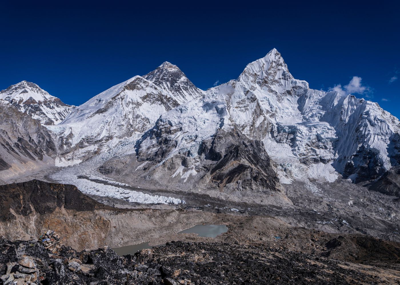
Measured growth at Everest is more complex than a single annual number because erosion, glacial retreat, snow depth, seismic activity, and survey methods all affect how height is recorded and interpreted. Scientists use Global Navigation Satellite System (GNSS) / Global Positioning System (GPS), Interferometric Synthetic Aperture Radar (InSAR), Light Detection and Ranging (LiDAR), gravimetry, and joint Nepal-China geodetic surveys to track millimeter-scale elevation change, distinguish rock height from snow height, and explain why different studies report different values. Everest’s annual rise matters beyond mountaineering because it helps researchers study Himalayan tectonics, earthquake strain, climate-linked landscape change, and the long-term evolution of Earth’s crust.
What Is Mount Everest's Annual Growth Rate?
Mount Everest rises approximately 4 millimeters per year due to compressional tectonic forces along the Himalayan convergent boundary. GPS and modern geodetic surveys show that Everest is still rising, but the exact annual rate depends on the time period studied and on whether scientists are discussing rock uplift, snow height, or net elevation change after erosion. Net elevation gain varies year to year based on erosion rates and seismic activity.
How many millimeters does Everest rise each year?
Tectonic uplift pushes Everest upward by 4 to 5 millimeters annually, as measured by continuous GPS receivers installed at base camp and surrounding triangulation points. The Survey of Nepal recorded 5 mm/year of vertical displacement in high-precision GNSS data collected between 2017 and 2019.
Is Everest's growth steady or does it vary over time?
Everest's growth rate varies across 3 timescales: annual variation (±1 mm), decadal variation (±5 mm), and geological variation (several cm per thousand years). Annual variation results from seasonal snowpack loading and unloading. Decadal variation reflects shifts in tectonic stress accumulation along the Main Himalayan Thrust fault. Geological variation responds to long-term erosion cycles.
Why Does Mount Everest Keep Growing?
Everest grows because the Indian Plate collides with the Eurasian Plate at 40 to 50 millimeters per year, compressing crustal material upward along thrust faults. Understanding how Everest was formed from this 50-million-year collision helps explain why the Himalayan orogenic belt continuously transfers compressional stress upward, forcing rock higher faster than erosion removes it at Everest's summit pyramid.
How do tectonic plates push Everest higher?
The Indian Plate, a rigid lithospheric slab moving northeast at 47 mm/year (according to GPS geodesy from the International GNSS Service), subducts beneath the Eurasian Plate along the Main Central Thrust and South Tibet Detachment fault systems. Crustal shortening along these 2 major fault zones transfers compressional energy into vertical rock displacement of 4 to 5 mm per year at Everest's summit.
Tectonic uplift operates through 3 primary mechanisms:
-
Crustal thickening: Himalayan crust measures 70 to 80 km thick, double the 35 km global continental average, forcing isostatic compensation upward.
-
Fault-bend folding: Movement along ramp-flat geometries in the Main Himalayan Thrust creates localized uplift rates exceeding the regional average.
-
Ductile flow in the lower crust: Mid-crustal ductile flow channels material from the collision zone toward Everest's footwall, amplifying vertical displacement.
How does erosion affect Everest's height?
Erosion removes 0.1 to 2 mm of rock per year from Everest's upper elevations through 4 active processes: frost weathering, glacial abrasion, wind ablation, and rockfall. According to research from the University of Bristol's Glaciology Group, the Khumbu and Rongbuk glaciers erode the flanks at 0.3 mm/year. Net growth subtracts this erosion from tectonic uplift of 4 mm/year, yielding a positive balance.
Does isostatic rebound make Everest taller?
Isostatic rebound, defined as the upward flexure of Earth's lithosphere in response to reduced surface mass loading, contributes an additional 1 to 2 mm/year of apparent elevation gain at Everest. Glacial retreat since the Last Glacial Maximum (21,000 years ago) removed ice mass from the Himalayan range. This deloading triggers ongoing isostatic uplift measured by GRACE satellite gravity data across the Khumbu region.
How Do Scientists Measure Everest's Height Changes?

Scientists measure Everest's height using 4 primary tools: GNSS receivers (GPS), terrestrial LiDAR scanners, gravimeters measuring the geoid, and trigonometric survey networks. The 2020 China-Nepal Joint Survey combined GNSS, gravity measurements, and snow-depth radar to produce the current official height of the world's highest mountain at 8,848.86 meters, the most precise measurement in Everest's surveying history.
What tools are used to track Everest's elevation?
The 4 active measurement systems tracking Everest's elevation are:
-
GNSS (Global Navigation Satellite Systems): Receivers at base camp and summit record millimeter-precision 3D coordinates. The Survey of Nepal operates 2 permanent GPS stations in the Khumbu valley.
-
Terrestrial LiDAR: Pulsed laser scanners resolve surface geometry to ±5 mm accuracy from distances of 10 km.
-
Satellite radar interferometry (InSAR): ESA Sentinel-1 satellites capture surface deformation at 3 mm precision over 12-day repeat passes.
-
Gravimetry: Absolute gravimeters measure geoid undulation, correcting ellipsoidal GPS heights to orthometric elevation above mean sea level.
How accurate are GPS and satellite measurements?
GPS measurements at Everest achieve ±30 mm vertical accuracy for single-epoch observations and ±5 mm accuracy with post-processed carrier-phase solutions using 72-hour observation windows. According to the 2020 China-Nepal Joint Survey report, geoid modeling introduced a vertical uncertainty of ±13 mm, the largest single error source in determining Everest's orthometric height.
InSAR satellite measurements detect 3 mm of vertical surface displacement over 250-km² areas. This precision captures seasonal snowpack changes, tectonic deformation, and post-seismic relaxation simultaneously across the entire Himalayan range.
Why do different studies report different numbers?
4 measurement differences produce conflicting Everest height values across published studies:
|
Measurement Variable |
Range of Difference |
Source of Discrepancy |
|
Rock summit vs. snow surface |
86 to 340 cm |
Seasonal and annual snow depth variation |
|
Geoid model used |
5 to 20 cm |
EGM2008 vs. local hybrid geoid models |
|
Epoch of measurement |
1 to 4 cm per decade |
Real tectonic uplift between surveys |
|
Atmospheric refraction correction |
5 to 15 cm |
Temperature and pressure differences during surveys |
The table above shows the 4 sources of discrepancy, with snow depth and geoid modeling producing the largest magnitude differences between independent studies.
Can Earthquakes Change Mount Everest's Height?
Major earthquakes change Everest's height by 1 to 3 centimeters within minutes, compared to the 4 mm annual tectonic growth rate. The 2015 Gorkha earthquake (Mw 7.8) lowered Everest's summit by approximately 2.5 cm according to GPS data from the Chinese Academy of Sciences. Sudden coseismic changes are distinct from the continuous interseismic uplift measured annually.
Can major earthquakes raise or lower Everest?
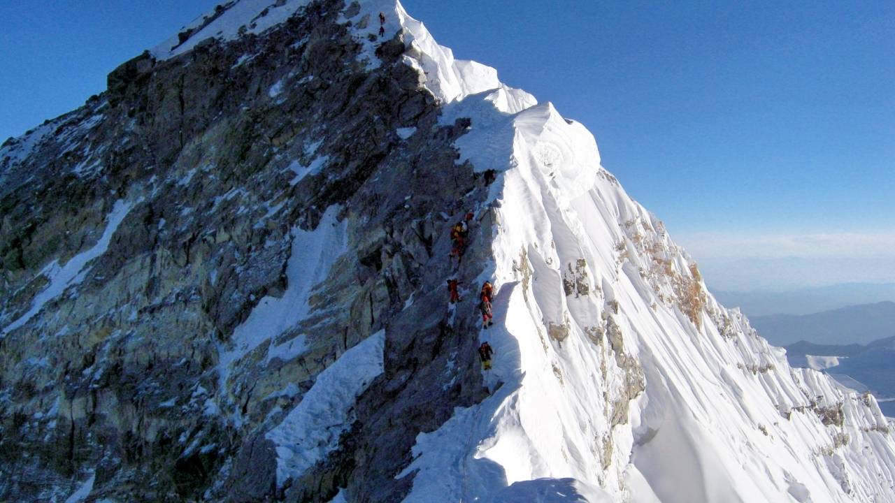
Earthquakes both raise and lower Everest depending on fault geometry and Everest's position relative to the rupture zone. Thrust-fault earthquakes above Everest's position lower the summit through hanging-wall subsidence. Thrust-fault earthquakes below Everest's position raise the summit through footwall uplift. The 2015 Gorkha earthquake ruptured the Main Himalayan Thrust 76 km southwest of Everest, placing Everest in the hanging-wall zone and producing 2.5 cm of subsidence — a shift felt even within Everest's death zone above 8,000 meters where climbers already face razor-thin oxygen margins.
How did past Himalayan earthquakes affect Everest?
The 3 major Himalayan earthquakes with documented Everest elevation effects are:
-
1934 Nepal-Bihar earthquake (Mw 8.0): Estimated 3 to 5 cm subsidence at Everest's summit based on trigonometric reanalysis of British Survey measurements before and after the event.
-
1950 Assam earthquake (Mw 8.6): Produced regional uplift of 2 to 8 cm across eastern Nepal, with modeling suggesting 1 to 3 cm net gain at Everest's summit.
-
2015 Gorkha earthquake (Mw 7.8): GPS networks recorded 2.5 cm subsidence at Everest's summit followed by 3 to 5 mm of post-seismic rebound over 18 months.
Are sudden height changes different from annual growth?
Coseismic height changes differ from annual tectonic growth in 4 ways: magnitude (cm vs. mm), timescale (seconds vs. years), spatial pattern (asymmetric around fault rupture vs. broadly distributed), and reversibility (partially reversed by post-seismic rebound vs. permanent accumulation). Annual tectonic uplift represents steady stress accumulation along locked faults. Earthquakes release this accumulated stress in seconds, producing sudden displacement that may partially undo years of incremental growth.
Has Mount Everest's Official Height Changed?
Everest's official height has been revised 4 times since 1856, moving from the original Survey of India value of 8,840 meters to the current 8,848.86 meters established by the 2020 China-Nepal Joint Survey. Each revision used superior geodetic instrumentation, improved geoid models, and more rigorous atmospheric correction procedures.
|
Year |
Official Height |
Surveying Authority |
Key Improvement |
|
1856 |
8,840 m |
Survey of India |
First trigonometric measurement |
|
1955 |
8,848 m |
Survey of India |
Refraction correction applied |
|
1999 |
8,850 m |
National Geographic / Bradford Washburn |
First GPS summit measurement |
|
2005 |
8,844.43 m |
State Bureau of Surveying and Mapping (China) |
Rock surface only, no snow |
|
2020 |
8,848.86 m |
China-Nepal Joint Survey |
GNSS + gravimetry + snow radar |
The table above documents Everest's 5 official elevation values across 164 years of surveying history, showing the progression from trigonometric to satellite-based measurement.
Why has Everest's official height been revised?
Everest's official height has been revised for 3 primary reasons: advancement in geodetic instrumentation (GPS replaced optical theodolites), refinement of geoid models (EGM2008 replaced the Everest spheroid), and resolution of the rock-versus-snow surface debate. The 2020 China-Nepal Joint Survey used 270 GHz frequency radar to penetrate 3.5 meters of ice and snow, measuring the rock summit at 8,848.86 meters with ±27 cm uncertainty, 6 times more precise than the 1999 GPS survey.
What is the difference between rock height and snow height?
Rock height measures Everest's elevation to the bare rock summit beneath the permanent snow cap. Snow height includes the variable snowpack sitting above this rock surface. The difference between the 2 measurements ranges from 86 cm to 340 cm depending on the season and annual snowfall. The 2005 Chinese survey reported rock height as 8,844.43 m. The 2020 China-Nepal survey reported rock height as 8,848.86 m, a 4.43-meter discrepancy explained by different geoid models, not actual geological change.
How often is Everest's official height remeasured?
Everest's official height has been formally remeasured 4 times in 164 years, approximately once every 40 years. The Survey of Nepal conducts continuous GPS monitoring via 2 permanent GNSS stations and publishes annual geodetic reports tracking displacement at the 1 to 3 mm precision level. A formal revision to the official height requires agreement between Nepal and China, a joint survey expedition to the summit, and international peer review of the measurement protocol.
Does Everest Grow Faster Than Other Himalayan Peaks?
Everest grows at 4 mm/year, slower than Nanga Parbat (7 to 9 mm/year) and faster than peaks in the eastern Himalaya (2 to 3 mm/year). Nanga Parbat, located at the western Himalayan syntaxis, experiences the fastest rock uplift rate of any mountain on Earth at 7 to 9 mm/year according to thermochronology data from the German Research Foundation's Himalaya Project. Beyond geology, climbers continue to push what is possible on Everest's slopes, see the latest Everest records in 2025 for the human achievements that match the mountain's own upward momentum.
How does Everest compare with nearby mountains?
The 5 Himalayan peaks with documented annual uplift rates are:
|
Mountain |
Elevation (m) |
Annual Uplift Rate |
Primary Driver |
|
Nanga Parbat |
8,126 |
7 to 9 mm/year |
Western Himalayan syntaxis |
|
Annapurna |
8,091 |
5 to 7 mm/year |
Main Central Thrust |
|
Mount Everest |
8,848.86 |
4 to 5 mm/year |
Indian-Eurasian convergence |
|
Kangchenjunga |
8,586 |
3 to 4 mm/year |
Eastern syntaxis flexure |
|
Dhaulagiri |
8,167 |
3 to 5 mm/year |
Dhaulagiri Himalaya segment |
The table above compares annual tectonic uplift rates for 5 major Himalayan peaks, showing Nanga Parbat's exceptional growth rate relative to Everest.
Which Himalayan forces affect regional uplift rates?
3 tectonic forces control regional uplift rate variation across the Himalaya:
-
Convergence rate partitioning: The Indo-Asian convergence distributes 40 to 50 mm/year of plate motion unevenly across the range, concentrating more uplift at syntaxis points.
-
Syntaxis geometry: Himalayan syntaxes (Nanga Parbat in the west, Namche Barwa in the east) act as pivot points where convergence energy concentrates, amplifying local uplift by 2 to 3 times the regional average.
-
Erosion-isostasy feedback: Peaks with higher precipitation and faster glacial erosion experience greater isostatic rebound, amplifying tectonic uplift rates.
Why is Everest not always the fastest-rising peak?
Everest rises slower than Nanga Parbat because its position at the central Himalayan segment places it away from syntaxis amplification zones. Nanga Parbat sits at the western Himalayan syntaxis where the Indus River incises 4,500 meters of vertical relief, removing crustal mass at 7 km³/year and triggering extreme isostatic rebound. Everest's position in the central Mahalangur Himal section receives 1 to 2 mm/year of additional syntaxis amplification, compared to Nanga Parbat's 4 to 5 mm/year amplification.
What Factors Can Make Everest Seem Taller or Shorter?
5 measurement factors create apparent height variation at Everest without real geological change: seasonal snowpack depth (±50 cm), atmospheric refraction variation (±15 cm), geoid model selection (±20 cm), tidal loading cycles (±5 mm), and measurement epoch offset (±4 mm per year between surveys). These factors explain most differences between independent elevation reports.
How do snow, ice, and weather affect measurements?
Snow accumulation on Everest's summit pyramid varies by 86 to 340 cm between monsoon season peak (October) and pre-monsoon minimum (April-May). Radar measurements from the 2020 China-Nepal survey recorded 3.5 meters of ice and snow above the bedrock summit. Weather conditions affect trigonometric surveys through atmospheric refraction, temperature inversions over Tibet change apparent vertical angles by 5 to 15 cm at Everest's distance from theodolite stations.
Can climate change influence Everest's measured height?
Climate change influences Everest's measured height through 3 active mechanisms:
-
Summit snow reduction: According to a 2022 study from the University of Maine's Climate Change Institute, Everest's Hillary Step ice feature lost 55 meters of ice thickness between 1984 and 2019. Reduced permanent snow lowers snow-height measurements while leaving rock height unchanged.
-
Accelerated glacial retreat: Khumbu Glacier has retreated 5 km since 1953 and thinned by 40 to 50 meters, reducing ice-load mass and accelerating isostatic rebound by an estimated 0.2 mm/year.
-
Permafrost degradation: High-altitude permafrost degradation at 8,000 m+ elevations destabilizes rock structure, increasing rockfall and sediment export that lowers erosional base levels.
Does erosion offset some of Everest's uplift?
Erosion offsets 2 to 10% of Everest's annual tectonic uplift, depending on the process. Frost weathering removes 0.1 to 0.3 mm/year from exposed rock faces above 8,000 m. Glacial erosion at 5,000 to 7,000 m elevation removes 0.3 to 0.8 mm/year from the flanks. Wind abrasion at the summit removes an estimated 0.1 mm/year. Combined erosional loss of 0.5 to 1.2 mm/year partially offsets the 4 to 5 mm/year of tectonic uplift, producing a net growth of 2.8 to 4.5 mm/year.
Why Does Everest's Growth Matter?
Everest's growth rate matters for 4 scientific and practical reasons: it quantifies active plate convergence rates, calibrates earthquake recurrence models along the Main Himalayan Thrust, tests isostasy theories in active orogenic belts, and establishes baseline elevation data for climate change impact assessments across the Hindu Kush-Himalaya region.
What does Everest's rise reveal about Earth's crust?
Everest's measured uplift rate of 4 to 5 mm/year confirms the Indo-Asian convergence velocity predicted by plate tectonic models and reveals 3 properties of Himalayan crustal dynamics:
-
Crustal rheology: The ratio of surface uplift to convergence rate indicates that 10 to 15% of plate convergence converts to vertical surface displacement, consistent with thin-skinned thrust belt models.
-
Erosion-uplift coupling: The near-balance between tectonic uplift (4 to 5 mm/year) and erosion (0.5 to 1.2 mm/year) at Everest's summit confirms that climate-driven erosion modulates topographic steady state in active orogens.
-
Earthquake cycle strain: GPS data showing 4 mm/year of vertical interseismic uplift at Everest validates strain accumulation models used to calculate M8.0+ earthquake recurrence intervals of 500 to 900 years along the Main Himalayan Thrust.
Why is Everest's growth important to geologists?
Geologists use Everest's growth rate as a calibration dataset for 3 research domains: thermochronology (dating when rocks were exhumed from depth), seismic hazard modeling (quantifying strain accumulation before major earthquakes), and continental collision dynamics (testing models of how India's northward drift distributes deformation across Central Asia). According to research from ETH Zürich's Geological Institute, Himalayan uplift rates constrain exhumation histories with 15% better precision when GPS data supplements apatite fission-track thermochronology.
Does Everest's growth affect climbers or trekkers?
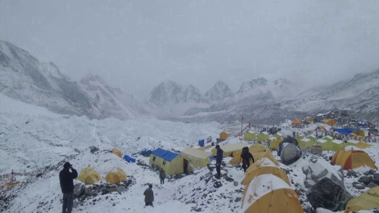
Everest's annual growth of 4 mm does not affect climbing routes, permit requirements, or safety assessments in any measurable way. At the decadal scale, cumulative growth of 40 mm (4 cm) over 10 years falls within the measurement uncertainty of base camp GPS altimeters. Climbers and trekking operators in the Khumbu region register practical effects from climate change, specifically glacier retreat, increased rockfall, and route instability, rather than from tectonic uplift directly. What matters far more for trekkers is a properly structured EBC trek acclimatization plan to safely navigate the altitude gain to Base Camp at 5,364 meters.
How Should You Use Everest Growth Data When Planning?
Trekkers and expedition teams use Everest elevation data across 3 planning dimensions: acclimatization schedules (calibrated to the official 8,848.86 m rock height), gear selection (pressurized oxygen systems rated to summit altitude), and permit applications (Nepal requires permits specifying the official peak height recognized by the Government of Nepal).
Can a trekking or expedition company help interpret it?
Trekking and expedition companies operating in the Khumbu region provide 4 practical services related to elevation data:
-
Acclimatization itinerary design: Companies calibrate rest-day schedules to the 8,848.86 m official summit height using the Wilderness Medical Society's altitude illness prevention protocols. If you are ready to experience Everest's living geology firsthand, our Everest Base Camp Trek packages include expert-guided acclimatization schedules designed around the mountain's official height and current route conditions.
-
Gear altitude rating verification: Oxygen regulators, masks, and pressure garments carry altitude ratings that expedition companies cross-reference against the current official summit elevation.
-
Route condition updates: Licensed guide companies receive annual pre-season route reports from the Nepal Mountaineering Association that document glacier change, fixed-rope anchor positions, and new crevasse hazards linked to ice thinning.
-
Permit coordination: Nepal's Department of Tourism issues Everest climbing permits specifying peak height and regulatory requirements. Expedition operators file these permits on behalf of climbing teams.
What Are the Key Takeaways About Everest's Growth?
Mount Everest's annual growth and elevation measurement produce 6 core scientific conclusions:
-
Growth rate: Everest rises 4 to 5 mm per year through Indian-Eurasian plate convergence at 47 mm/year.
-
Erosion offset: Erosional processes remove 0.5 to 1.2 mm/year from this growth, yielding a net uplift of 2.8 to 4.5 mm/year.
-
Earthquake disruption: Major earthquakes (Mw 7.5+) produce 1 to 3 cm of sudden elevation change, 25 to 75 times the annual tectonic growth rate.
-
Official height: The current official height of 8,848.86 m (established 2020) reflects rock surface elevation corrected to the geoid, not seasonal snow height.
-
Measurement precision: Modern GNSS surveys achieve ±27 cm uncertainty at Everest's summit, sufficient to detect decadal-scale growth accumulation of 4 to 5 cm.
-
Regional comparison: Everest grows slower than Nanga Parbat (7 to 9 mm/year) but faster than peaks in the eastern Himalayan syntaxis zone (2 to 3 mm/year).
Mount Everest's growth rate of 4 to 5 mm per year reflects the ongoing Indo-Asian plate collision that has built the Himalayan range over 50 million years. GPS geodesy, satellite InSAR, and gravimetric surveys continuously refine this measurement, connecting Everest's millimeter-scale annual rise to the kilometer-scale geological forces reshaping Central Asia's topography.
