Nepal is one of the world's premier trekking destinations, offering hiking trails that cross the Himalayas, UNESCO World Heritage Sites, national parks, high mountain passes, glacier valleys, alpine forests, and centuries-old Himalayan villages. From routes leading to the foot of Mount Everest to remote restricted regions shaped by Tibetan Buddhist culture, Nepal provides hiking experiences for every type of trekker. The best hikes in Nepal differ in altitude, duration, physical difficulty, accessibility, permit requirements, landscapes, and cultural experiences, making the right choice dependent on more than mountain views alone.
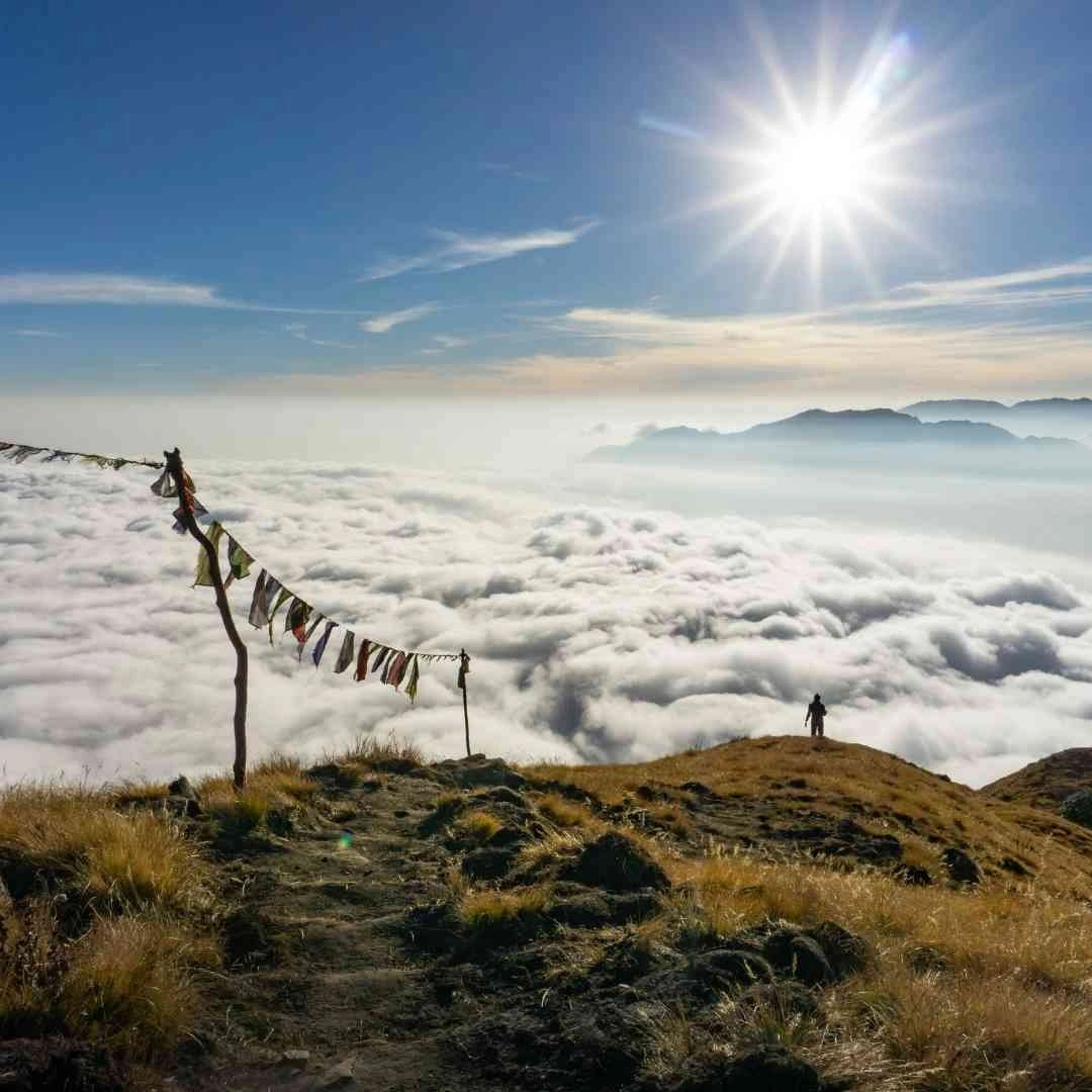
Choosing the best hike in Nepal requires balancing your available time, fitness level, altitude experience, travel budget, and preferred trekking season. Some trails reward trekkers with iconic Himalayan panoramas, while others emphasize remote wilderness, diverse ecosystems, pilgrimage sites, or preserved mountain cultures found nowhere else in the country. This guide compares Nepal's five best hikes using the latest 2026 route information, permit regulations, seasonal conditions, trekking difficulty, and major highlights to help you identify the route that best matches your travel goals and hiking experience.
1. Everest Base Camp Hike
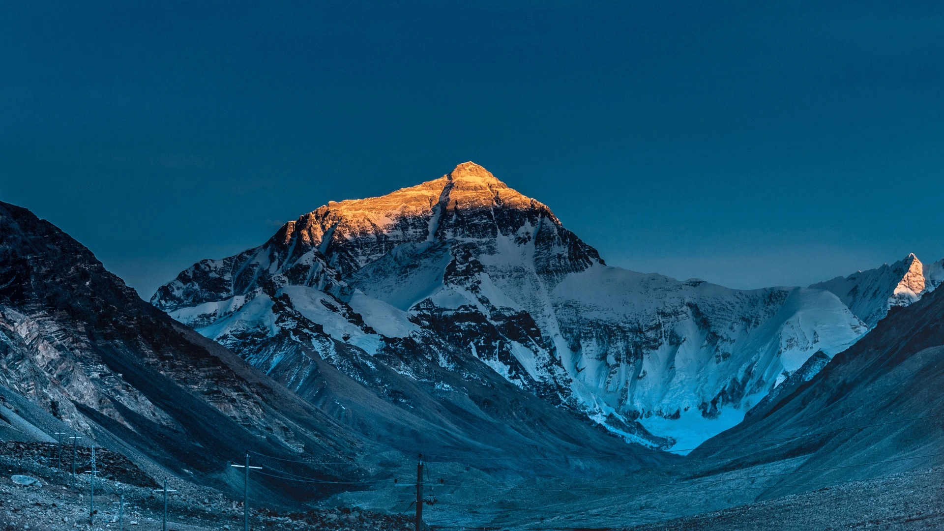
The Everest Base Camp Hike climbs through Sagarmatha National Park in northeastern Nepal to the foot of the world's highest mountain at 5,364 meters, covering roughly 130 kilometers round trip over 12 to 14 days. It remains Nepal's most recognized trek, and for good reason: no other route puts a trekker on foot, without ropes or technical climbing gear, this close to the summit of Everest.
Where Is the Everest Base Camp Hike Located?
The Everest Base Camp Hike sits in the Khumbu region of Solukhumbu district, inside Sagarmatha National Park, a UNESCO World Heritage Site covering 1,148 square kilometers along Nepal's border with Tibet. Most trekkers fly from Kathmandu (1,400 meters) to Lukla (2,860 meters), a 30-to-35-minute flight that opens the trail. During the busiest weeks of spring and autumn, flights often shift to Ramechhap airport, roughly five hours by road from Kathmandu, to reduce congestion at Tribhuvan International Airport. From Lukla, the trail follows the Dudh Koshi river valley through Phakding, Namche Bazaar, Tengboche, and Dingboche before reaching Gorak Shep and the base camp itself.
A smaller number of trekkers walk in from Jiri or Salleri instead of flying, adding 4 to 7 days to the itinerary but avoiding Lukla's notorious weather delays. The alternate route from Jiri requires the Gaurishankar Conservation Area Permit, though trekkers starting from Salleri bypass this conservation area and only need the standard Khumbu permits.
How Difficult Is the Everest Base Camp Hike?
The Everest Base Camp Hike rates as strenuous due to altitude, not technical climbing skill. Trekkers gain over 3,400 meters of elevation between Lukla and base camp, walking 5 to 7 hours a day on well-marked trails with no ropes, crampons, or climbing experience required. Two acclimatization days are built into every responsible itinerary: one at Namche Bazaar (3,440 meters) and one at Dingboche or Pheriche (around 4,400 meters), both involving a short hike higher followed by a return to sleep lower.
What trips up underprepared trekkers is not the walking distance but the thin air above 4,000 meters, where oxygen availability drops to roughly 60% of sea-level concentration. Symptoms of acute mountain sickness, including headache, nausea, and disrupted sleep, appear even in trekkers with strong cardiovascular fitness if they ascend too fast. A guided itinerary that follows the "climb high, sleep low" pattern and includes rest days reduces this risk substantially compared with a rushed independent schedule.
What Is the Best Time to Hike to Everest Base Camp?
Spring (March to May) and autumn (September to November) are the two best windows for the Everest Base Camp Hike, offering the clearest mountain visibility and the most stable trail conditions. Autumn follows the monsoon and typically delivers the sharpest, longest views of Everest, Lhotse, and Nuptse, along with the heaviest trail traffic. Spring brings rhododendron forests into bloom along the lower trail and slightly warmer nights at altitude, while running closer to the Everest climbing expedition season, which adds activity (and crowds) around base camp itself.
Winter (December to February) offers near-empty trails and crystal-clear mornings but brings sub-zero overnight temperatures at altitude and a higher chance of Lukla flight cancellations. Monsoon season (June to August) brings daily afternoon rain, leech-prone lower trails, and clouds that frequently block mountain views, making it the least practical season for this particular hike.
What Are the Main Highlights of the Everest Base Camp Hike?
The main highlights of the Everest Base Camp Hike are Namche Bazaar, Tengboche Monastery, Sherpa culture, and the sunrise view from Kala Patthar. Namche Bazaar, at 3,440 meters, functions as the unofficial capital of the Khumbu, with bakeries, gear shops, and a Saturday market that draws traders from surrounding villages. Tengboche Monastery, perched at 3,860 meters, is the largest Buddhist monastery in the Khumbu and a working center of Sherpa spiritual life, not a museum piece.
Kala Patthar, a rocky outcrop at 5,545 meters above Gorak Shep, gives a direct, unobstructed view of Everest's summit pyramid that base camp itself does not offer, since the mountain is partially blocked from base camp by the surrounding ridgeline. Trekkers who climb Kala Patthar before dawn watch first light hit Everest, Nuptse, and Ama Dablam in sequence. Along the way, the trail passes through Sherpa villages where Tibetan Buddhist prayer flags, mani walls, and chortens mark a culture shaped by centuries of trade across the Nangpa La into Tibet.
2. Annapurna Circuit Hike
.avif)
The Annapurna Circuit Hike loops around the Annapurna massif in central Nepal, crossing the 5,416-meter Thorong La pass between the villages of Manang and Muktinath, typically taking 12 to 18 days depending on the start and end points used. Where Everest Base Camp pushes toward one mountain, the Annapurna Circuit moves through an entire region, trading a single dramatic finish for variety across the whole route.
What Is the Route of the Annapurna Circuit Hike?
The classic Annapurna Circuit Hike begins in Besisahar (760 meters) or a roadhead slightly beyond it, follows the Marsyangdi River north through Chame and Pisang to Manang (3,540 meters), crosses Thorong La, and descends into Muktinath (3,800 meters) before continuing through Lower Mustang to Jomsom and on to Pokhara or Nayapul. Road construction over the past 15 years has shortened the walkable circuit considerably, and most operators now design itineraries that skip the lowest, most-vehicle-affected sections by jeep, focusing trekking days on the high country between Chame and Jomsom.
This single trail crosses through Annapurna Conservation Area, Nepal's largest protected area at 7,629 square kilometers, and links villages with markedly different architecture, language, and religion from one end of the circuit to the other.
How Challenging Is the Annapurna Circuit Hike?
The Annapurna Circuit Hike is moderately to highly challenging, with Thorong La as the technical and physical centerpiece of the trek. The pass itself involves a pre-dawn start from High Camp (around 4,925 meters), a long, cold ascent to the 5,416-meter summit, and a steep, knee-testing 1,600-meter descent to Muktinath in a single day. Outside of pass day, daily walking runs 5 to 6 hours over well-established trail and teahouse infrastructure, with an acclimatization day at Manang built into most itineraries.
Snow can close Thorong La in December, January, and early February, and several trekking fatalities have occurred in past decades when storms hit the pass during peak season without warning. A guided trek with a licensed local guide, who tracks real-time weather and snow conditions on the pass, removes most of this risk.
When Is the Best Season for the Annapurna Circuit Hike?
October and November give the clearest, driest conditions for the Annapurna Circuit Hike, immediately after monsoon clears the air and before winter snow threatens Thorong La. March and April form the second-best window, when rhododendron forests color the lower Marsyangdi valley and temperatures at altitude are milder than autumn's coldest nights. Both seasons see the trail's highest trekker volume, which means earlier teahouse bookings and a busier pass-crossing morning.
Monsoon (June to August) brings landslide risk to the lower Marsyangdi gorge sections and frequently obscures mountain views, while deep winter (December to February) carries real risk of Thorong La closing entirely after heavy snowfall.
What Makes the Annapurna Circuit Hike Unique?
The Annapurna Circuit Hike is unique because it passes through five distinct climate zones in a single trek, from subtropical river valley to high-altitude desert. Trekkers walk through terraced rice paddies and subtropical forest near Besisahar, then through temperate pine and rhododendron forest, alpine meadow near Manang, the barren high-altitude zone around Thorong La, and finally the Tibetan-influenced desert landscape of Lower Mustang beyond Muktinath, all within roughly two weeks.
Muktinath itself draws both Hindu and Buddhist pilgrims to a temple complex with 108 stone water spouts, making the Annapurna Circuit one of the only major Nepal treks that combines a high mountain pass with an active, multi-faith pilgrimage site at the end of the descent. Views along the way take in Annapurna I (8,091 meters), Dhaulagiri (8,167 meters), and Machhapuchhre, the sacred "Fishtail" peak that remains legally unclimbed. Trekkers ready to plan this route can review a full Annapurna Circuit trek package with season-specific itineraries and acclimatization days built in.
3. Manaslu Circuit Hike
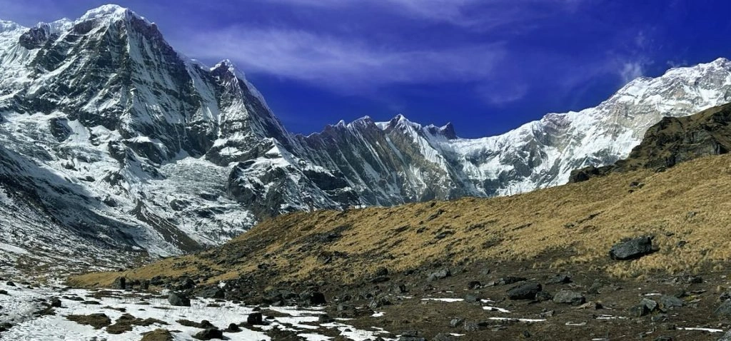
The Manaslu Circuit Hike circles Mount Manaslu, the world's eighth-highest peak at 8,163 meters, through the Nubri and Tsum valleys of Gorkha district, crossing the 5,106-meter Larkya La pass over a 14-to-16-day itinerary. Nepal has classified Manaslu as a restricted area since 1991, which keeps annual trekker numbers a fraction of those on Everest Base Camp or the Annapurna routes.
Where Does the Manaslu Circuit Hike Take You?
The Manaslu Circuit Hike begins near Soti Khola or Machha Khola, follows the Budhi Gandaki river through Jagat, Philim, and the Tibetan Buddhist village of Samagaun, crosses Larkya La, and descends through Bimthang to Dharapani, where the trail joins the lower Annapurna Circuit route. The trek runs through Manaslu Conservation Area for most of its length and exits into Annapurna Conservation Area territory at Dharapani, which is why both conservation permits apply to a single trek.
Side trips into the Tsum Valley, a separate restricted area north of the main circuit, extend the trip by 5 to 7 days and require an additional permit layer on top of the standard Manaslu documents.
How Difficult Is the Manaslu Circuit Hike?
The Manaslu Circuit Hike is strenuous, comparable to or slightly more demanding than the Annapurna Circuit, due to less-developed teahouse infrastructure and a technically involved Larkya La crossing. The pass-day route runs along glacier-edge moraine before a steep, often icy descent toward Bimthang, and trekking poles or microspikes make a measurable difference in late autumn or early spring snow. Trekkers walk 6 to 7 hours a day on average, with an acclimatization day at Samagaun (3,530 meters) standard on every responsible itinerary.
Until March 22, 2026, every foreign trekker needed a second person to share a Restricted Area Permit application, which meant solo travelers either found a trekking partner or paid for a placeholder second permit. Nepal's Department of Immigration removed that two-person minimum on that date, and a single foreign trekker can now apply individually, provided a licensed guide from a registered agency accompanies them for the entire restricted-area section. Independent trekking without a guide remains illegal on this route regardless of group size. Trekkers weighing this option can find the full rules in our guide to solo Manaslu Circuit trekking.
What Permits Are Required for the Manaslu Circuit Hike?
The Manaslu Circuit Hike requires four separate documents: a Restricted Area Permit (RAP), a Manaslu Conservation Area Permit (MCAP), an Annapurna Conservation Area Permit (ACAP), and a local Chum Nubri Rural Municipality fee. The RAP costs USD 100 per person for the first 7 days in September through November, or USD 75 per person for the first 7 days in December through August, with an additional USD 15 or USD 10 per day for each day beyond the first week. MCAP and ACAP each cost NPR 3,000 (roughly USD 30) for foreign nationals, with reduced rates for SAARC nationals, and the Chum Nubri municipality collects a smaller local fee, typically around NPR 1,000, at a checkpoint near Jagat.
A standard 14-day Manaslu Circuit therefore runs roughly USD 215 to USD 265 in permit costs alone during autumn's peak rate, slightly less in the December-to-August window. Only a registered Nepali trekking agency can submit the Restricted Area Permit application; individual foreign trekkers cannot apply for this specific document on their own, even after the 2026 solo-trekking rule change.
What Can You Expect Along the Manaslu Circuit Hike?
Trekkers on the Manaslu Circuit Hike find noticeably thinner crowds than on Everest Base Camp or the Annapurna routes, simple stone-and-timber teahouses rather than lodges with attached bathrooms, and a Tibetan Buddhist culture in Nubri that has changed little in recent decades. Samagaun and Samdo, the two highest permanent settlements on the route, sit close enough to the Tibetan border that yak caravans and Tibetan dialect remain part of daily village life. Mani walls, chortens, and the Pungyen Gompa monastery, reachable on a side trip from Samagaun, mark a religious landscape distinct from the more Sherpa-influenced Buddhism of the Khumbu.
Mountain views include Manaslu itself, Himal Chuli (7,893 meters), and Ngadi Chuli, with Larkya La offering a panoramic look back at the Manaslu massif rarely seen from any other trekking route in Nepal. Trekkers drawn to this remoteness can explore a full Manaslu Circuit trek itinerary built around the required permits and acclimatization schedule.
4. Langtang Valley Hike
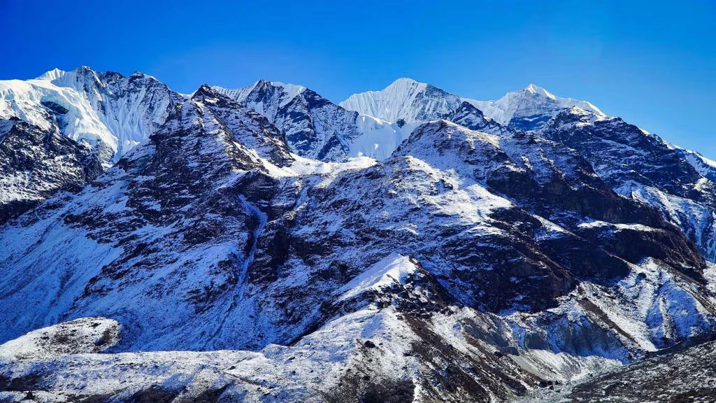
The Langtang Valley Hike runs through Langtang National Park north of Kathmandu, reaching Kyanjin Gompa at 3,870 meters over a 7-to-10-day round trip that requires no domestic flight. For trekkers with limited vacation time or a strict budget, this proximity to the capital makes Langtang the most accessible major trekking region in Nepal.
Where Is the Langtang Valley Hike Located?
The Langtang Valley Hike lies in Rasuwa district, inside Langtang National Park, Nepal's first Himalayan national park, established in 1976 and covering 1,710 square kilometers. The trailhead at Syabrubesi (1,460 meters) sits a 7-to-8-hour drive from Kathmandu on a winding mountain road, eliminating the flight-cancellation risk that affects the Everest region. From Syabrubesi, the trail follows the Langtang River past Lama Hotel and Langtang village to Kyanjin Gompa, with side hikes to Tserko Ri (4,984 meters) or Kyanjin Ri (4,773 meters) for the trek's best mountain panoramas.
How Long Does the Langtang Valley Hike Take?
The Langtang Valley Hike typically takes 7 to 10 days round trip from Kathmandu, including travel days at both ends and one acclimatization day at Kyanjin Gompa. This is roughly half the time commitment of Everest Base Camp or the Manaslu Circuit, which makes Langtang a practical option for trekkers with a single-week vacation block or a tighter overall Nepal itinerary that also includes Kathmandu sightseeing or a Chitwan safari.
A shorter 5-day version exists for trekkers who turn back at Langtang village rather than continuing to Kyanjin Gompa, though this skips the trek's highest viewpoints and its Swiss-founded cheese factory. Travelers planning the full round trip can check current dates on our Langtang Valley trek package before booking.
When Is the Best Time to Visit Langtang Valley?
Spring (March to May) and autumn (September to November) remain the strongest seasons for the Langtang Valley Hike, following the same broad pattern as Nepal's other major treks. Langtang's lower maximum altitude compared with Everest Base Camp or Manaslu makes winter (December to February) a more realistic option here than on the higher routes, since temperatures at 3,870 meters, while cold, are more manageable than those above 5,000 meters, and snow rarely closes the trail entirely.
Monsoon (June to August) brings the same landslide and visibility concerns found across Nepal's mid-hill trekking regions and is best avoided for this route as well.
What Are the Top Attractions Along the Langtang Valley Hike?
The top attractions along the Langtang Valley Hike are Langtang Lirung, Kyanjin Gompa, the valley's Tamang culture, and its 2015 earthquake recovery story. Langtang Lirung, rising to 7,227 meters directly above the valley, dominates the skyline for most of the trek's upper section. Kyanjin Gompa combines a working Buddhist monastery with a cheese factory established decades ago through Swiss development assistance, still producing yak-milk cheese sold to trekkers and exported to Kathmandu.
The valley's Tamang communities maintain distinct language, dress, and Buddhist practice from the Sherpa culture of the Khumbu or the Gurung villages of the Annapurna region. The April 2015 earthquake triggered a massive landslide that destroyed the original Langtang village and killed over 240 people, including locals, guides, and foreign trekkers, in a single morning; the village has since been rebuilt slightly above its original site, and walking through it today offers a direct, sobering look at both the disaster and the community's recovery.
5. Upper Mustang Hike
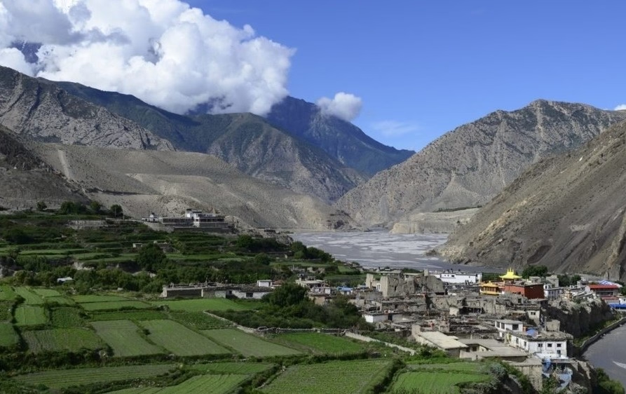
The Upper Mustang Hike crosses a high-altitude desert region in the rain shadow of the Annapurna and Dhaulagiri ranges, reaching the walled former royal capital of Lo Manthang at 3,840 meters. Closed to outsiders until 1992 and still classified as a restricted area, Upper Mustang offers a landscape and culture that has more in common with the Tibetan plateau than with the green Himalayan foothills most visitors picture when they think of Nepal.
What Makes Upper Mustang Different from Other Treks in Nepal?
Upper Mustang differs from every other major trek in Nepal in both geography and history. The region sits in a rain shadow, receiving under 250 millimeters of annual precipitation, which produces eroded red-cliff canyons, wind-carved rock formations, and a high desert palette closer to parts of Tibet or the American Southwest than to Nepal's lush mid-hills. Politically, Upper Mustang functioned as the independent Kingdom of Lo from 1380 CE, founded by Ame Pal, until Nepal's government formally ended the monarchy's local authority in 2008; the royal family still holds cultural standing in Lo Manthang today.
The Nepali government kept Upper Mustang closed to foreign visitors until 1992, decades after most of the rest of the country had opened to trekking tourism, specifically to protect the region's Tibetan Buddhist culture and to manage its sensitive position along the Chinese border.
When Is the Best Time to Trek in Upper Mustang?
Upper Mustang is one of the only major trekking regions in Nepal where monsoon season (June to August) ranks among the best times to visit, since its rain-shadow position keeps the trail largely dry while the rest of the country deals with daily downpours. Spring (March to May) draws trekkers timing their trip around the Tiji Festival trek in Lo Manthang, a three-day masked dance ceremony scheduled for May 14 to 16 in 2026, while autumn (September to November) offers stable weather that overlaps with the rest of Nepal's peak trekking season.
Winter (December to February) brings sub-zero nights and possible snow at higher points along the route, making it the least practical season for this particular trek despite the region's overall dry climate.
What Cultural and Natural Highlights Await in Upper Mustang?
The cultural and natural highlights of Upper Mustang are the walled city of Lo Manthang, the sky caves of Chhoser, centuries-old monasteries, and the Tiji Festival. Lo Manthang's perimeter wall encloses narrow alleyways, a former royal palace, and 15th-century monasteries, including Thubchen and Jampa, both holding Buddhist murals that predate most religious art found elsewhere in Nepal. The sky caves near Chhoser, carved high into cliff faces and used historically for burial, meditation, and shelter, remain a subject of ongoing archaeological study, since their full original purpose and age are not fully documented.
The Tiji Festival reenacts a Buddhist myth of a deity defeating a demon threatening Mustang, performed through masked dance by monks over three consecutive days, drawing both local Mustangi communities and a limited number of foreign visitors each year. Mani walls, chortens, and weathered prayer flags mark the trail throughout, reinforcing a Tibetan Buddhist identity that has persisted with little outside disruption for centuries.
What Permits Are Needed for the Upper Mustang Trek?
The Upper Mustang Trek requires a Restricted Area Permit (RAP) and an Annapurna Conservation Area Permit (ACAP). Nepal's government replaced the previous flat fee of USD 500 for the first 10 days with a pay-as-you-go rate, effective late 2025: the RAP now costs USD 50 per person for each day spent inside the restricted zone north of Kagbeni, with no minimum-day charge. A 5-day visit to Lo Manthang now costs USD 250 in permit fees rather than the old flat USD 500, while longer 14-day itineraries cost exactly the same (USD 700) as they did under the previous system. ACAP costs NPR 3,000 (roughly USD 25 to 30) for foreign nationals, since Upper Mustang sits within the Annapurna Conservation Area.
As with Manaslu, only a registered Nepali trekking agency can apply for the RAP, and a licensed guide must accompany every foreign trekker for the full restricted-area section. The longstanding two-person minimum for restricted-area permits was removed nationwide on March 22, 2026, so a solo foreign trekker with a licensed guide can now obtain an Upper Mustang permit without finding a second trekker to apply alongside them.
How Should You Choose the Best Hike in Nepal for Your Adventure?
Choosing among these five hikes comes down to four practical factors: available time, altitude tolerance, budget, and what kind of experience matters most. Trekkers with two weeks or more and a goal of standing near the world's highest mountain gravitate toward Everest Base Camp. Trekkers who want maximum landscape variety in one trip, from subtropical valley to high desert, choose the Annapurna Circuit. Those drawn to remoteness and lower trail traffic over a famous finish line lean toward Manaslu, while travelers short on time or new to high-altitude trekking often start with Langtang. Upper Mustang suits travelers prioritizing culture and desert scenery over a single dramatic mountain view, and a higher permit budget reflects that exclusivity.
Season planning matters as much as route choice. October and November deliver the clearest skies across all five regions except Upper Mustang, where the same window competes with a slightly wetter pattern than the region's ideal summer dry season.
Which Nepal Hike Matches Your Experience and Goals?
First-time high-altitude trekkers with one to two weeks available match well with Langtang Valley or a shortened lower-altitude Annapurna itinerary, both of which limit exposure above 4,000 meters while still delivering genuine Himalayan scenery. Trekkers chasing a bucket-list mountain view, with no technical climbing ambition, match with Everest Base Camp, provided they budget two full acclimatization days and accept Lukla's flight unpredictability. Experienced trekkers seeking solitude, cultural depth, and a less commercialized trail match with the Manaslu Circuit, especially now that the March 2026 rule change makes solo permits realistic for independent-minded travelers booked with a licensed guide.
Photographers, festival travelers, and anyone drawn to landscapes unlike the rest of Nepal match with Upper Mustang, particularly around the Tiji Festival dates. Trekkers who want the broadest single-trip variety, willing to handle one demanding high pass, match with the Annapurna Circuit.
Can Nepal Intrepid Treks Help You Plan the Perfect Nepal Hiking Adventure?
Nepal Intrepid Treks designs itineraries across all five of these regions, handling permit applications, licensed guide assignments, and acclimatization scheduling so trekkers can focus on the trail rather than government paperwork. Our team tracks permit fee changes, including the 2026 Manaslu and Upper Mustang solo-trekking rule updates and the new Upper Mustang daily permit structure, directly with the relevant Nepali authorities rather than relying on outdated blog posts.
If you are weighing two or three of these treks against your available time and fitness level, we can walk through realistic itinerary lengths, current permit costs, and season-specific trail conditions for your exact travel window before you commit to dates.
What Are the Key Takeaways About the 5 Best Hikes in Nepal?
Each of the 5 best hikes in Nepal serves a different kind of traveler, and the right choice depends on time, altitude comfort, and what kind of Himalayan experience matters most.
Hike | Duration | Maximum Altitude | Permit Cost (approx.) | Best Season |
Everest Base Camp | 12–14 days | 5,545 m (Kala Patthar) | USD 40–50 | March–May, Sept–Nov |
Annapurna Circuit | 12–18 days | 5,416 m (Thorong La) | USD 25–35 | Oct–Nov, March–April |
Manaslu Circuit | 14–16 days | 5,106 m (Larkya La) | USD 215–265 | Sept–Nov, March–May |
Langtang Valley | 7–10 days | 4,984 m (Tserko Ri) | USD 30–35 | March–May, Sept–Nov |
Upper Mustang | Varies by days used | 3,840 m (Lo Manthang) | USD 50/day + ACAP | June–Aug, March–May |
Everest Base Camp remains the trek of choice for trekkers focused on standing near the world's highest mountain. The Annapurna Circuit offers the widest single-trip variety in landscape and climate. Manaslu rewards trekkers seeking remoteness and lower trail traffic, particularly now that solo permits are realistic under the 2026 rule changes. Langtang fits short timelines and flight-free access from Kathmandu. Upper Mustang delivers a desert kingdom unlike anywhere else in Nepal, at a permit cost that reflects its restricted-area status.
Whichever of the 5 best hikes in Nepal fits your travel window, current permit rules, season timing, and altitude preparation will shape your experience as much as the trail itself.

