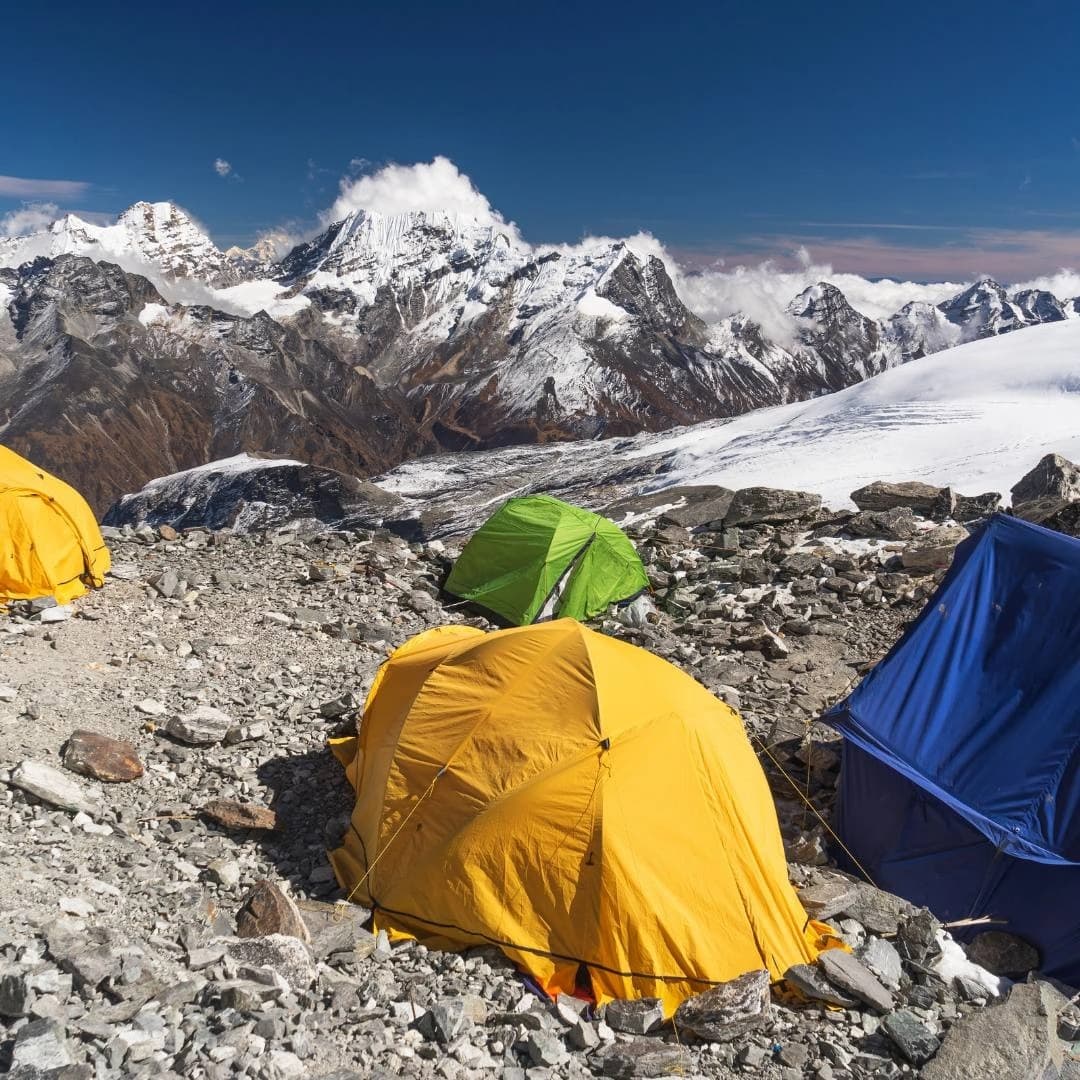
Mount Everest is the world's highest mountain, located on the international border between Nepal and the Tibet Autonomous Region of China in the Mahalangur Himal sub-range of the Himalayan mountain range. Standing 8,848.86 meters (29,031.7 feet) above sea level, the mountain occupies one of the world's most significant geographic and cultural landscapes. Known as Sagarmatha in Nepal and Qomolangma in Tibet, Everest is more than a summit, it is a shared natural landmark shaped by millions of years of tectonic activity, protected by internationally recognized conservation areas, and revered by the Sherpa and Tibetan communities.
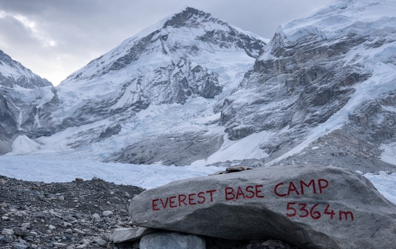
Understanding where Mount Everest is located involves more than identifying its position on a map. This guide explores Everest's exact coordinates, the countries that share the summit, its geological formation within the Himalayas, the Nepal and Tibet approaches, South and North Everest Base Camps, elevation, climate, best time to visit, permits, transportation, trekking routes, cultural significance, and essential travel planning. Whether you are researching Earth's highest peak, preparing for the Everest Base Camp Trek, or planning a climbing expedition, this comprehensive guide explains every geographic, environmental, and practical aspect of Mount Everest's location.
Where Is Mount Everest Located on the World Map?
Mount Everest sits in the Mahalangur Himal sub-range of the Himalayas, straddling the international border between Nepal to the south and the Tibet Autonomous Region (part of China) to the north. On a world map, Everest appears in the southern-central portion of the Asian continent, northeast of the Indian subcontinent.
The mountain occupies a geopolitically significant position. Nepal controls the southern approach, while China governs the northern face via Tibet. Both nations formally recognize the summit as the shared highest point on Earth, following a joint survey completed on December 8, 2020, that established the definitive elevation of 8,848.86 m.
Travelers approaching Everest from the south fly into Tribhuvan International Airport in Kathmandu, Nepal, approximately 140 km (87 miles) southwest of the summit. Those approaching from the north enter through Lhasa, Tibet, approximately 700 km (435 miles) northeast of the mountain.
Which Countries Share Mount Everest?
2 countries share Mount Everest: Nepal and China (Tibet Autonomous Region). The international border runs directly across the summit ridge, placing the highest point on Earth under the joint sovereignty of both nations.
Nepal refers to the mountain as Sagarmatha (सगरमाथा), a Sanskrit-Nepali name meaning "Goddess of the Sky" or "Forehead of the Ocean." Tibet and China refer to it as Qomolangma (珠穆朗玛峰), meaning "Holy Mother" in Tibetan. The western name "Mount Everest" was assigned in 1865 by British Surveyor General Andrew Waugh, honoring his predecessor Sir George Everest, who led the Great Trigonometrical Survey of India.
Both countries issue separate climbing and trekking permits. Nepal administers the southern (standard) route; China controls the northern route. Visitors cannot cross between the 2 sides while on the mountain, separate expeditions and separate permits are required for each approach.
What Are the Exact Coordinates of Mount Everest?
The exact geographic coordinates of Mount Everest's summit are 27°59′17″N, 86°55′31″E in degrees-minutes-seconds format, or 27.9881°N, 86.9253°E in decimal degrees.
These coordinates place the summit:
27.99 degrees north of the equator (approximately one-third of the way from the equator to the North Pole)
86.93 degrees east of the Prime Meridian, in the same longitudinal band as Bangladesh and northeastern India
The base of the mountain spans across both Nepal and Tibet, covering a footprint of approximately 1,300 km² (502 square miles). The summit itself is bisected perfectly by the international border, meaning the exact highest point on Earth is shared equally between Nepalese and Chinese territory.
GPS measurements confirm these coordinates to within 1 meter of accuracy, validated through the 2020 China-Nepal joint survey using satellite geodesy and gravity correction technology.
Why Is Mount Everest Part of the Himalayas?
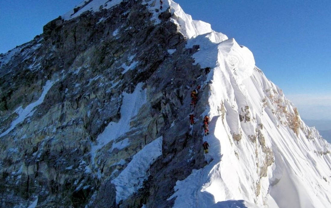
Mount Everest is part of the Himalayas because it formed directly from the same tectonic collision event that created the entire Himalayan mountain range, the ongoing convergence of the Indian tectonic plate and the Eurasian tectonic plate. Everest represents the highest expression of this geological process, making it inseparable from the Himalayan system both geographically and structurally.
Which Mountain Range Contains Mount Everest?
The Himalayan mountain range contains Mount Everest, specifically within the Mahalangur Himal sub-range. The Himalayas extend for approximately 2,400 km (1,491 miles) across 5 countries: India, Nepal, Bhutan, China, and Pakistan.
The Mahalangur Himal contains 4 of the world's 14 peaks above 8,000 meters, including:
Mount Everest: 8,848.86 m (the world's highest)
Lhotse: 8,516 m (4th highest in the world)
Makalu: 8,485 m (5th highest in the world)
Cho Oyu: 8,188 m (6th highest in the world)
Everest's position within this cluster of extreme altitude peaks reflects the extraordinary degree of crustal thickening in this region. The Tibetan Plateau, the high-altitude landmass north of Everest, averages 4,500 m (14,764 ft) in elevation and is the direct product of the same collisional event.
How Was Mount Everest Formed?
Mount Everest's geological formation dates back approximately 50 to 60 million years, when the Indian tectonic plate collided with the Eurasian plate at a convergence rate of approximately 5 cm (2 inches) per year. This collision uplifted marine sedimentary rock, originally deposited on the floor of the ancient Tethys Sea, to the highest elevations on Earth.
The formation process involved 3 primary geological mechanisms:
Crustal thickening: compression folded and stacked layers of continental crust, building mass vertically
Isostatic rebound: as surface rock eroded, the crust rebounded upward, continuing to push the summit higher
Fault-driven uplift: major thrust faults, including the Main Central Thrust, transported rock packages northward and upward
Marine limestone fossils from the Tethys Sea are present at Everest's summit zone, evidence that these rocks once lay beneath an ancient ocean floor. The Indian plate continues to move northward at 5 cm per year, meaning Everest technically continues to rise by approximately 4 mm per year, partially offset by erosion.
Where Is the Nepal Side of Mount Everest?
The Nepal side of Mount Everest occupies the southern and southwestern face of the mountain, accessed from the Khumbu region of northeastern Nepal. This approach corridor, known as the Khumbu Valley, extends from the highland market town of Namche Bazaar at 3,440 m (11,286 ft) up through the Khumbu Glacier to South Base Camp at 5,364 m (17,598 ft).
The Nepal side hosts the world's most-used Everest climbing route, the South Col Route, and the most heavily trekked mountain path on Earth. According to the Nepal Tourism Statistics 2023 published by the Ministry of Culture, Tourism & Civil Aviation (Table 5.4: Nepal Tourism Statistics 2023 PDF), Sagarmatha National Park received 52,499 foreign visitors in 2023, up from 21,210 in 2022, a 148% rebound reflecting the full post-pandemic recovery of Everest-region trekking.
Which National Park Protects Everest in Nepal?
Sagarmatha National Park, inscribed on the UNESCO World Heritage List in 1979 (UNESCO WHC List No. 120), covers 124,400 hectares and encompasses Mount Everest along with six other peaks above 7,000 metres, protecting rare species including the snow leopard, red panda, and the Himalayan tahr.
Sagarmatha National Park protects:
The entire Nepal-side approach to Everest, from below 2,800 m to the summit at 8,848.86 m
Rare wildlife including the snow leopard (Panthera uncia), red panda (Ailurus fulgens), and Himalayan tahr (Hemitragus jemlahicus)
356 species of birds, including the Himalayan griffon vulture and blood pheasant
Sherpa cultural heritage, including monasteries such as Tengboche Monastery (3,860 m) and Thame Monastery
All trekkers entering the park pay a Sagarmatha National Park entry fee, NPR 3,000 (approximately USD 22) for foreign nationals in 2025. This fee funds park infrastructure, trail maintenance, and conservation programs.
Which Villages Lead to Everest Base Camp?
8 primary settlements mark the trekking corridor to Everest Base Camp from Lukla, the standard entry point at 2,860 m (9,383 ft):
Lukla (2,860 m / 9,383 ft): gateway town with Tenzing-Hillary Airport, the starting point for most EBC treks
Phakding (2,610 m / 8,563 ft): first night camp, 3–4 hours from Lukla
Namche Bazaar (3,440 m / 11,286 ft): the Sherpa capital; primary acclimatization stop, altitude permits, internet access
Tengboche (3,860 m / 12,664 ft): location of the largest monastery in the Khumbu, with direct Everest views
Dingboche (4,410 m / 14,469 ft): secondary acclimatization village before entering high-altitude terrain
Lobuche (4,940 m / 16,207 ft): high-camp entry point into the Khumbu Glacier zone
Gorak Shep (5,164 m / 16,942 ft): the last permanent settlement before Base Camp
Everest Base Camp (5,364 m / 17,598 ft): the terminus of the trekking route
The standard EBC trek from Lukla to Base Camp covers approximately 65 km (40 miles) one way and takes 8 to 12 days depending on acclimatization schedule.
Why Do Most Trekkers Choose the Nepal Route?
Most trekkers choose the Nepal route because it requires no special travel permit beyond the standard Sagarmatha National Park entry fee and the Khumbu Pasang Lhamu Rural Municipality Permit, making it far more accessible than the Tibet route, which requires a Tibet Travel Permit and Chinese Group Visa.
4 additional reasons explain the Nepal route's dominance:
Infrastructure density: Over 200 tea houses and lodges operate along the Namche-to-Base-Camp corridor, providing accommodation, meals, and emergency shelter
Cultural richness: The Khumbu Valley contains active Sherpa monasteries, colorful festivals including Mani Rimdu, and a living mountain culture that adds depth to the experience
Established medical support: The Himalayan Rescue Association operates altitude clinics at Pheriche (4,371 m) staffed by medical volunteers during trekking seasons
Route flexibility: Trekkers can extend their trip to the Kala Patthar viewpoint (5,644 m) for panoramic Everest summit views without a climbing permit
Where Is the Tibet Side of Mount Everest?
The Tibet side of Mount Everest occupies the northern and northeastern face, accessed from the Qinghai-Tibet Plateau through the Rongbuk Valley in the Shigatse Prefecture of the Tibet Autonomous Region, China. The northern approach leads to the North Col Route, historically the first route attempted on Everest, and to Rongbuk Monastery (5,154 m), the world's highest Buddhist monastery.
How Can Visitors Reach Everest from Tibet?
Visitors reach Everest from Tibet by overland vehicle via the Friendship Highway from Lhasa, traveling approximately 690 km (429 miles) southwest to Shigatse and then south through Tingri to the Rongbuk Valley base camp area. The drive from Lhasa typically takes 2 to 3 days.
The access process for Tibet requires 3 specific documents:
Chinese Group Tourist Visa: A standard individual Chinese visa is required if entering from mainland China, whereas a specific Chinese Group Tourist Visa is mandatory if entering Tibet directly from Nepal.
Tibet Travel Permit (TTP): issued by the Tibet Tourism Bureau, required for all foreign visitors to the TAR
Aliens' Travel Permit (ATP): required for entry into restricted border areas including the Everest region
All permits must be arranged through a licensed Chinese travel agency before departure. Permit processing takes a minimum of 10 business days. Independent travel in Tibet is not legally permitted for foreign nationals.
How Does the Tibet Route Compare with Nepal?
The Tibet route offers higher vehicle access, lower trek distance, and fewer crowds than the Nepal route, but demands significantly more bureaucratic preparation and restricts individual travelers.
The table below summarizes the 6 key differences:
Factor | Nepal Route | Tibet Route |
Entry permit | Sagarmatha NP entry + Khumbu Pasang Lhamu Rural Municipality Permit | Tibet Travel Permit + ATP + Group Visa |
Road access altitude | 2,860 m (Lukla, by air) | 5,150 m (Rongbuk, by vehicle) |
Trek distance to Base Camp | ~65 km (40 miles) | ~8 km (5 miles) from road end |
Annual trekker volume | ~50,000+ | ~5,000 |
Independent travel | Permitted | Not permitted |
Accommodation at Base Camp | Seasonal tents and tea houses | Basic guesthouses at Rongbuk |
The Tibet route appeals to travelers who want close vehicle access to the Everest region and prefer a less-trafficked environment. The Nepal route serves trekkers seeking a full cultural and high-altitude walking experience.
What Is the Difference Between Everest Base Camp in Nepal and Tibet?
Everest has 2 separate base camps, one on the Nepal (south) side and one on the Tibet (north) side, located on opposite faces of the mountain at different elevations, accessed by different routes, and serving different climbing expeditions. They are not connected, and reaching one does not grant access to the other.
Where Is Nepal's Everest Base Camp?
Nepal's Everest Base Camp (South Base Camp) is located at 5,364 m (17,598 ft) on the Khumbu Glacier, within Sagarmatha National Park, at coordinates 27°59′N, 86°51′E. The camp sits directly below the Khumbu Icefall, the first major obstacle on the South Col climbing route.
During spring climbing season (April–May), South Base Camp accommodates 500 to 1,000 people simultaneously, including expedition teams, Sherpa support staff, liaison officers, and press. Facilities include expedition tents, solar charging stations, satellite communication equipment, and a Himalayan Rescue Association medical tent.
Trekkers who are not part of climbing expeditions reach a viewpoint above Gorak Shep, the Khumbu Base Camp viewpoint, and view the camp from a short distance. Entry to the active climbing camp is restricted to permit holders during expedition season.
Where Is Tibet's Everest Base Camp?
Tibet's Everest Base Camp (North Base Camp) is located at 5,150 m (16,900 ft) in the Rongbuk Valley, approximately 8 km (5 miles) south of the town of Tingri, at coordinates 28°08′N, 86°51′E. This base camp serves expeditions attempting the North Col and Northeast Ridge routes.
Rongbuk Monastery, the world's highest active Buddhist monastery at 5,154 m, stands 1 km north of North Base Camp. Visitors traveling to the Tibet base camp can drive directly to within 3 km of the camp, making it one of the most road-accessible high-altitude base camp zones of any 8,000-meter peak on Earth.
Which Base Camp Is Better for Visitors?
South Base Camp (Nepal) delivers a richer visitor experience for most trekkers, offering a classic multi-week trek through Sherpa culture, progressive altitude acclimatization, Himalayan ecosystem exposure, and direct arrival at the glacier. North Base Camp (Tibet) suits visitors who prioritize vehicle accessibility and minimal trekking distance over cultural immersion.
3 factors determine which base camp serves a visitor's goals:
Time available: South Base Camp requires 12 to 16 days round-trip; North Base Camp is reachable in 3 to 4 days from Lhasa by road
Physical preparation: South Base Camp demands trekking fitness and altitude tolerance; North Base Camp is accessible to those with limited trekking experience due to vehicle access
Budget: Nepal's EBC trek costs USD 1,500 to 3,500 for guides, permits, and accommodation; Tibet's route costs USD 3,000 to 5,000 due to mandatory guided group requirements
How High Is Mount Everest Above Sea Level?
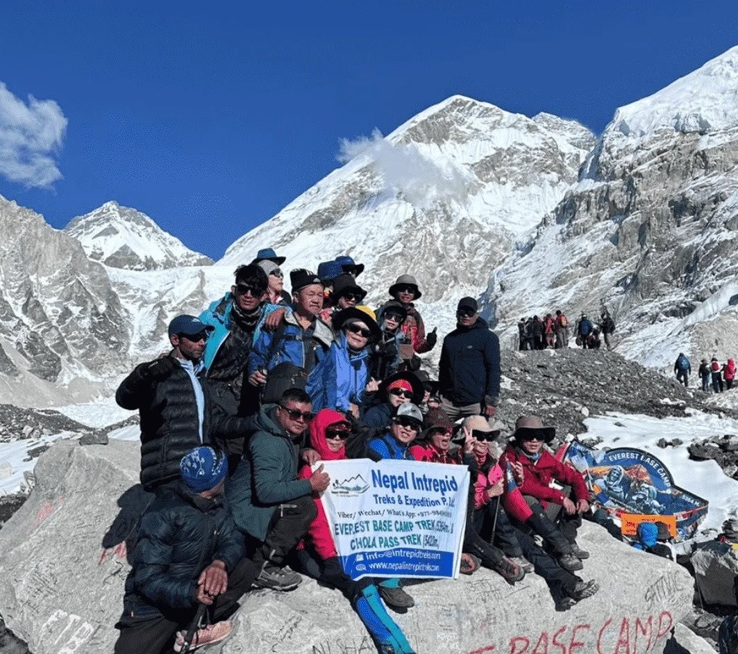
Mount Everest stands 8,848.86 meters (29,031.7 feet) above sea level, the official elevation established by the joint China-Nepal survey on December 8, 2020. This measurement represents the rock height of the summit plus a correction for the snow cap above the bedrock.
How Is Everest's Elevation Measured?
Everest's elevation is measured using a combination of GNSS satellite geodesy, gravimetry, and traditional trigonometric survey methods. The 2020 measurement, the most precise in history, deployed 3 measurement technologies simultaneously:
GNSS receivers placed directly on the summit by Chinese survey teams, recording raw positional data referenced to the WGS84 ellipsoid
Gravimetric corrections accounting for local variations in gravitational field strength, which affect ellipsoid-to-geoid conversion
Trigonometric cross-check surveys from 6 ground stations at known elevations in Nepal and China
The resulting official height of 8,848.86 m superseded the previous official figure of 8,848 m (established by the Survey of India in 1954 and confirmed by China in 1975). The 86 cm difference arises primarily from more accurate geoid modeling, not from an actual physical change in the mountain's height.
Why Does Everest's Height Change Slightly Over Time?
Everest's height changes slightly over time because of 3 active geological and glaciological processes: ongoing tectonic uplift, snow cap variation, and seismic subsidence.
Tectonic uplift: The Indian plate continues to push northward at 5 cm per year, applying compression that raises the Himalayan crust by approximately 4 mm per year at Everest's location
Snow and ice variation: The depth of permanent ice and snow on the summit fluctuates seasonally by up to 1 meter, affecting snow-corrected height measurements
Seismic events: The April 2015 Nepal earthquake (magnitude 7.8) caused measurable subsidence of approximately 2.8 cm at the summit according to GPS monitoring stations
These dynamic factors mean the rock elevation and snow-cap elevation of Everest are distinct values. Official surveys measure both, reporting the snow-corrected height as the formal elevation for mapping and record purposes.
What Is the Climate Like Around Mount Everest?
The climate around Mount Everest is classified as a subarctic and alpine tundra climate (Köppen classification ET), characterized by extreme cold, strong winds, low oxygen partial pressure, and 2 distinct weather seasons dictated by the South Asian monsoon cycle.
Summit temperatures range from approximately −36°C (−33°F) in May to −60°C (−76°F) in January. Wind speeds at the summit reach 280 km/h (174 mph) during jet stream events in winter. Below 5,000 m, temperatures are less extreme but still drop below −20°C (−4°F) at night during winter months.
When Is the Best Time to Visit the Everest Region?
The best time for EBC trek falls within 2 weather windows: the pre-monsoon spring season (mid-March to late May) and the post-monsoon autumn season (late September to early November).
Spring (April–May) offers:
Peak summit attempts: over 95% of all Everest summit bids occur in May
Stable daytime weather: temperatures at Base Camp average −10°C (14°F) during the day
Clear visibility: pre-monsoon atmospheric conditions produce excellent mountain views
Maximum trekking infrastructure: all tea houses, lodges, and rescue facilities fully operational
Autumn (October–November) offers:
Post-monsoon clarity: freshly washed air produces sharp mountain visibility
Lower trekker density: approximately 30% fewer trekkers than spring season
Stable winds: the jet stream retreats northward, reducing extreme wind events
Vibrant landscapes: autumn foliage in the lower Khumbu valleys from 2,500–3,500 m
Winter (December–February) and monsoon season (June–August) are inadvisable for most visitors. Monsoon snowfall closes high passes; winter cold produces life-threatening conditions above 4,000 m.
What Weather Challenges Should Visitors Expect?
Visitors to the Everest region face 5 specific weather challenges that require preparation, regardless of season:
Rapid temperature drops: temperatures at 5,000 m drop from 0°C at midday to −25°C (−13°F) after sunset
UV radiation intensity: UV index at 5,000 m is 3 times higher than at sea level due to thin atmosphere; SPF 50+ sunscreen is essential
Wind chill factor: wind speeds at Namche Bazaar average 25 km/h (15.5 mph), which reduces effective temperature by an additional 10–15°C
Sudden snowstorms: afternoon cloud build-up, particularly in late April and early October, produces rapid snowfall above 4,000 m
Low humidity and dehydration: relative humidity above 5,000 m averages 20–30%, accelerating fluid loss through respiration by 2 to 3 times normal rates
Why Is Mount Everest Important?
Mount Everest is important for 3 interconnected reasons: geographic significance as Earth's highest point, mountaineering significance as the ultimate climbing objective, and cultural significance as a sacred site for Himalayan peoples. These 3 dimensions operate simultaneously and cannot be separated from one another.
Why Is Everest Significant to Mountaineers?
Everest is significant to mountaineers because summiting it represents the absolute upper boundary of human high-altitude achievement, the highest point reachable on Earth's surface. As of December 2024, The Himalayan Database (Himalayan Database, Number of Everest Summits per Climber 1953–December 2024) records 12,884 summit ascents by 7,269 individual climbers. The climbing record has grown significantly: in the 2025 spring season alone, 820 summits were recorded, one of the highest single-season totals in the mountain's history.
The mountain's significance rests on 4 benchmarks:
The Everest death zone: above 8,000 m, the atmospheric pressure, and thus the partial pressure of oxygen, is approximately one-third of that at sea level, making every hour at altitude physiologically destructive
The 1953 first ascent: Edmund Hillary (New Zealand) and Tenzing Norgay Sherpa (Nepal/India) reached the summit on May 29, 1953, via the South Col Route, establishing the route used by the majority of climbers today
The record category: Everest holds the record for the most summits in a single day, 354 climbers reached the summit on May 23, 2019, during a brief favorable weather window in a season that produced 858 total summits (Himalayan Database, Attempts and Summits 1953–2025). The 2025 spring season continued the trend with 820 summits recorded.
Technical difficulty versus altitude: many mountains present greater technical climbing challenges, but none combine extreme altitude with the logistical and physiological demands of Everest
Why Is Everest Culturally Important to Local Communities?
Everest is culturally important to the Sherpa people and Tibetan Buddhists because the mountain is considered the home of the goddess Miyolangsangma, one of the 5 Long-Life Sisters in the Nyingma school of Tibetan Buddhism. Religious protocols surrounding the mountain, including puja ceremonies before all expeditions and restrictions on certain behaviors near sacred zones, reflect this deep spiritual relationship.
3 dimensions of cultural importance define Everest's role for local communities:
Spiritual identity: Tengboche Monastery (3,860 m) holds annual Mani Rimdu festivals attended by thousands of Sherpa from across the Khumbu; the rituals invoke protection for all who enter the mountain's domain
Economic foundation: the Everest trekking and climbing industry employs approximately 100,000 Nepalese directly and indirectly, generating over USD 500 million annually for Nepal's economy
Sherpa legacy: the Sherpa people's expertise in high-altitude mountaineering, built over generations of living above 3,500 m, is recognized worldwide and has elevated Sherpa culture from isolation to global visibility
How Can You Visit Mount Everest?
You can visit Mount Everest through 3 primary access pathways: the Nepal EBC trek (the standard route for most visitors), the Tibet overland drive, and a scenic flight over the Himalayas from Kathmandu. Each pathway serves a different visitor profile and requires different permits.
Do You Need Permits to Visit the Everest Region?
Yes, all visitors to the Everest region require permits. The specific permits vary by access pathway and activity level.
For the Nepal EBC trek, 2 permits are mandatory:
Sagarmatha National Park Entry Permit: NPR 3,000 (approximately USD 22) per person, obtained at the park entrance gate in Monjo or at the Department of National Parks in Kathmandu
Khumbu Pasang Lhamu Rural Municipality Entry Permit: NPR 3,000 (approximately USD 23) per person. This mandatory local permit funds regional infrastructure and entirely replaced the TIMS card in the Everest region
For the summit climb (Nepal side), the permit costs USD 15,000 per person (a fee increase implemented by the Nepal Government starting in 2025), remaining among the most expensive climbing permits on Earth.
For Tibet access, 3 primary documents are required: a valid Chinese Visa (Individual or Group, depending on your entry point), the Tibet Travel Permit, and the Aliens' Travel Permit (which grants access to the Everest restricted border area). All must be arranged through a licensed Chinese travel agency. All must be arranged through a licensed Chinese travel agency.
What Transportation Options Are Available?
4 transportation methods connect visitors to the Everest region, depending on their entry point and budget:
Kathmandu to Lukla by air: 30 to 45-minute flight on small aircraft (18-seat Twin Otter or similar); the most common entry for Nepal EBC trekkers; subject to weather cancellations
Kathmandu to Salleri/Phaplu by air + overland: an alternative for when Lukla is fog-bound; adds 1 to 2 trekking days
Overland helicopter: charter helicopter from Kathmandu to Namche Bazaar or higher; costs USD 2,000 to 3,500 per flight; used for evacuation or luxury access
Lhasa to Rongbuk by road (Tibet): 4WD vehicle along the Friendship Highway; 2 to 3-day drive covering 690 km (429 miles)
Tenzing-Hillary Airport in Lukla (IATA code: LUA) is consistently rated among the world's most challenging airports due to its 527-meter (1,729 ft) runway and 12% gradient.
Can You Visit Everest Without Climbing the Summit?
Yes, the overwhelming majority of Everest visitors never attempt the summit. The Everest Base Camp trek delivers an immersive high-altitude experience without requiring technical climbing skills, specialist gear, or a summit permit.
3 non-summit experience options exist:
Everest Base Camp Trek: reach 5,364 m on the south side; no climbing permit required; 12 to 16 days round-trip from Lukla
Kala Patthar ascent: hike to 5,644 m above Base Camp for a direct panoramic view of the Everest summit; considered the finest accessible viewpoint in the Khumbu
Everest scenic flight: 1-hour round-trip from Kathmandu, operated by multiple airlines, providing aerial views of Everest and 10 other 8,000-meter peaks; no permit required beyond a valid passport
What Should You Know Before Visiting Mount Everest?
Visitors to Everest face 3 primary preparation domains: equipment selection, altitude physiology management, and safety protocol awareness. Inadequate preparation in any of these areas significantly increases medical risk and the likelihood of evacuation.
What Should You Pack for the Everest Region?
Packing for the Everest region requires gear rated to −30°C (−22°F) for anyone trekking above 4,000 m. The following 12 items form the essential kit:
Down sleeping bag rated to −15°C (5°F) or below: synthetic fill absorbs moisture; down performs better in the dry Himalayan climate
Layering system: moisture-wicking base layer, insulating mid-layer (fleece or down jacket), and windproof outer shell
Insulated trekking boots: ankle-high with crampon compatibility above 5,000 m
Trekking poles: 2 adjustable poles reduce knee stress by 25% on descent
Altitude medication (Diamox / acetazolamide): consult a physician; standard prophylactic dose is 125 mg twice daily
High-SPF sun protection: SPF 50+ sunscreen, UV-blocking glacier glasses, and a wide-brimmed hat
Hydration capacity: 3-liter hydration system minimum; water purification tablets or a UV filter (SteriPen) for stream and lodge sources
First aid kit: blister supplies, rehydration salts, ibuprofen, and a pulse oximeter for SpO₂ monitoring
Headlamp with spare batteries: lithium batteries perform 40% better than alkaline in cold temperatures
Portable power bank: solar charging at lodges is unreliable above 4,000 m
Emergency satellite communicator: Garmin inReach or similar; cellular coverage is absent above Namche Bazaar on most networks
Trekking permits and copies: keep originals in a waterproof pouch; carry digital copies on a second device
How Can You Prepare for High Altitude?
Altitude preparation requires 3 to 6 months of cardiovascular conditioning and a structured acclimatization plan once in the field. Altitude sickness (AMS) is common on the EBC route: a peer-reviewed study of 332 trekkers ascending to 5,300 m found that 73.5% experienced AMS symptoms, with more than half developing moderate-to-severe cases (PMC, "Physiological responses during ascent to high altitude"). The "climb high, sleep low" protocol dramatically reduces this risk.
The acclimatization protocol for EBC trekkers follows the "climb high, sleep low" principle:
Ascend no more than 300 to 500 m (984 to 1,640 ft) in sleeping altitude per day above 3,000 m
Rest for 2 nights at Namche Bazaar (3,440 m) before continuing
Rest for 1 to 2 nights at Dingboche (4,410 m) before the push to Base Camp
Monitor blood oxygen saturation (SpO₂) daily using a pulse oximeter; readings below 80% indicate inadequate acclimatization
Pre-trek fitness preparation involves at least 8 weeks of structured cardio: 5 days per week of 45-minute sessions combining running, stair climbing, and hiking with a 10–15 kg pack. Altitude pre-exposure at a hypoxic training facility (where available) further reduces AMS risk.
What Safety Tips Should First-Time Visitors Follow?
First-time visitors to the Everest region reduce medical risk by following 6 evidence-based safety protocols:
Hire a licensed guide: Since April 2023, all foreign trekkers entering Nepal's national parks and conservation areas have been required to obtain an updated TIMS card and hire a licensed guide (Nepal Tourism Board TIMS Guideline). The Khumbu Pasang Lhamu Rural Municipality initially rejected the guide mandate for the Everest region; however, as of 2026, enforcement has expanded and visitors are strongly advised to verify current permit requirements directly with the Nepal Tourism Board before departure.
Purchase travel insurance with high-altitude helicopter evacuation coverage: standard travel insurance excludes rescue above 4,000 m; dedicated mountain rescue policies cover evacuation costs averaging USD 5,000 to 20,000
Descend immediately at HACE or HAPE symptoms: high altitude cerebral edema (headache, confusion, loss of coordination) and high altitude pulmonary edema (breathlessness at rest, pink frothy cough) require immediate descent of at least 500 m (1,640 ft)
Stay hydrated: drink 3 to 4 liters (101 to 135 fl oz) of water per day above 3,500 m; alcohol accelerates dehydration and impairs acclimatization
Do not trek alone at night: trail conditions above Namche Bazaar deteriorate rapidly after dark from ice, snow, and unstable rock; all movements above 4,000 m should occur during daylight hours
Register your trek with TAAN: the Trekking Agencies' Association of Nepal maintains a trekker registration database that activates search-and-rescue operations within 24 hours of a missing person report
How Can Nepal Intrepid Treks Help You Explore Mount Everest?
Nepal Intrepid Treks is a licensed Nepal trekking agency specializing in Himalayan adventure travel, including guided Everest Base Camp treks, peak climbing, and custom itineraries across the Khumbu, Langtang, and Annapurna regions. Their team includes certified high-altitude guides with extensive experience on Everest's southern approaches, Kala Patthar, and Island Peak.
Working with a licensed agency removes the 3 largest friction points for first-time Everest region visitors: permit acquisition, accommodation booking, and emergency logistics.
What Everest Trekking Services Does Nepal Intrepid Treks Offer?
Nepal Intrepid Treks offers 4 core Everest trekking service categories designed to match different experience levels, time frames, and goals:
Classic Everest Base Camp Trek (14 to 16 days): guided round-trip from Lukla to South Base Camp (5,364 m), including all permits, Sagarmatha National Park fees, tea house accommodation, breakfast and dinner, and emergency support
Everest Base Camp with Kala Patthar (15 to 17 days): extends the classic EBC itinerary to include the Kala Patthar summit (5,644 m), the highest freely accessible viewpoint of the Everest summit
Short Everest Treks (8 to 10 days): condensed itineraries reaching Namche Bazaar (3,440 m) or Tengboche (3,860 m), suited for travelers with limited time or those acclimatizing before a full EBC attempt
Island Peak Climbing (18 to 20 days): technical climbing expedition to Island Peak (Imja Tse, 6,189 m), combining the full EBC trek with a guided summit bid on a permitted trekking peak
All Nepal Intrepid Treks packages include government-certified English-speaking guides, experienced Sherpa porter support, comprehensive travel insurance guidance, and 24/7 emergency communication.
Travelers interested in exploring the Everest region through Nepal Intrepid Treks are advised to book at least 8 to 12 weeks in advance for spring season departures and 6 to 8 weeks in advance for autumn season, as Lukla flight quotas and permit availability fill rapidly.
What Are the Key Takeaways About Where Mount Everest Is Located?
Mount Everest is located on the Nepal–China (Tibet) border within the Mahalangur Himal sub-range of the Himalayan mountain system, at coordinates 27°59′17″N, 86°55′31″E, standing 8,848.86 m (29,031.7 ft) above sea level.
The 10 essential location facts every Everest visitor and researcher needs:
Countries: Nepal (south side) and China/Tibet (north side) share the summit
Mountain range: Mahalangur Himal sub-range, Himalayan system
Coordinates: 27.9881°N, 86.9253°E
Elevation: 8,848.86 m (29,031.7 ft); official 2020 China-Nepal joint measurement
Nepal access point: Tenzing-Hillary Airport, Lukla (2,860 m)
Tibet access point: Rongbuk Valley via Friendship Highway from Lhasa (~690 km)
South Base Camp: 5,364 m (17,598 ft), Khumbu Glacier, Nepal
North Base Camp: 5,150 m (16,900 ft), Rongbuk Valley, Tibet
Protected territory: Sagarmatha National Park (Nepal, UNESCO WHC 1979) and Qomolangma National Nature Preserve (China)
Best visit windows: April–May (spring) and October–November (autumn)
Everest's location is not merely a geographic coordinate. It represents the intersection of 2 sovereign nations, an ancient tectonic event 50 to 60 million years in the making, a living Sherpa culture, and the upper boundary of human endurance. Every trekker who reaches Base Camp and every climber who reaches the summit engages with all of these dimensions simultaneously.
Preparation, respect for the mountain's environment, and engagement with certified local experts define the difference between a transformative Himalayan experience and an incomplete or dangerous one.