Manaslu is an 8,163-meter Himalayan peak in Nepal and the world's eighth-highest mountain, but within the mountaineering community it has earned a far more ominous reputation as the "Killer Mountain." Located in the Mansiri Himal range of Gorkha District, Manaslu has become known for deadly serac avalanches, unstable post-monsoon snowpack, rapidly changing weather, and the extreme challenges of operating above 7,000 meters. Decades of climbing history, including several catastrophic avalanche disasters and nearly 90 documented fatalities since the first ascent in 1956, have made the mountain one of the most closely studied objective hazards among the world's fourteen 8,000-meter peaks.
Understanding why Manaslu carries this designation requires looking beyond fatality statistics alone. The mountain's reputation is shaped by the geography of its Northeast Face, the concentration of avalanche danger around Camp 3, the limitations of high-altitude rescue, and the experiences of climbers who have faced its unpredictable terrain over the past seven decades. Examining Manaslu's history, major accidents, seasonal conditions, comparison with other 8,000ers, and the strategies used by experienced expedition teams reveals why the mountain remains both a sought-after objective and one of the most respected challenges in Himalayan mountaineering.
Where Is Manaslu?
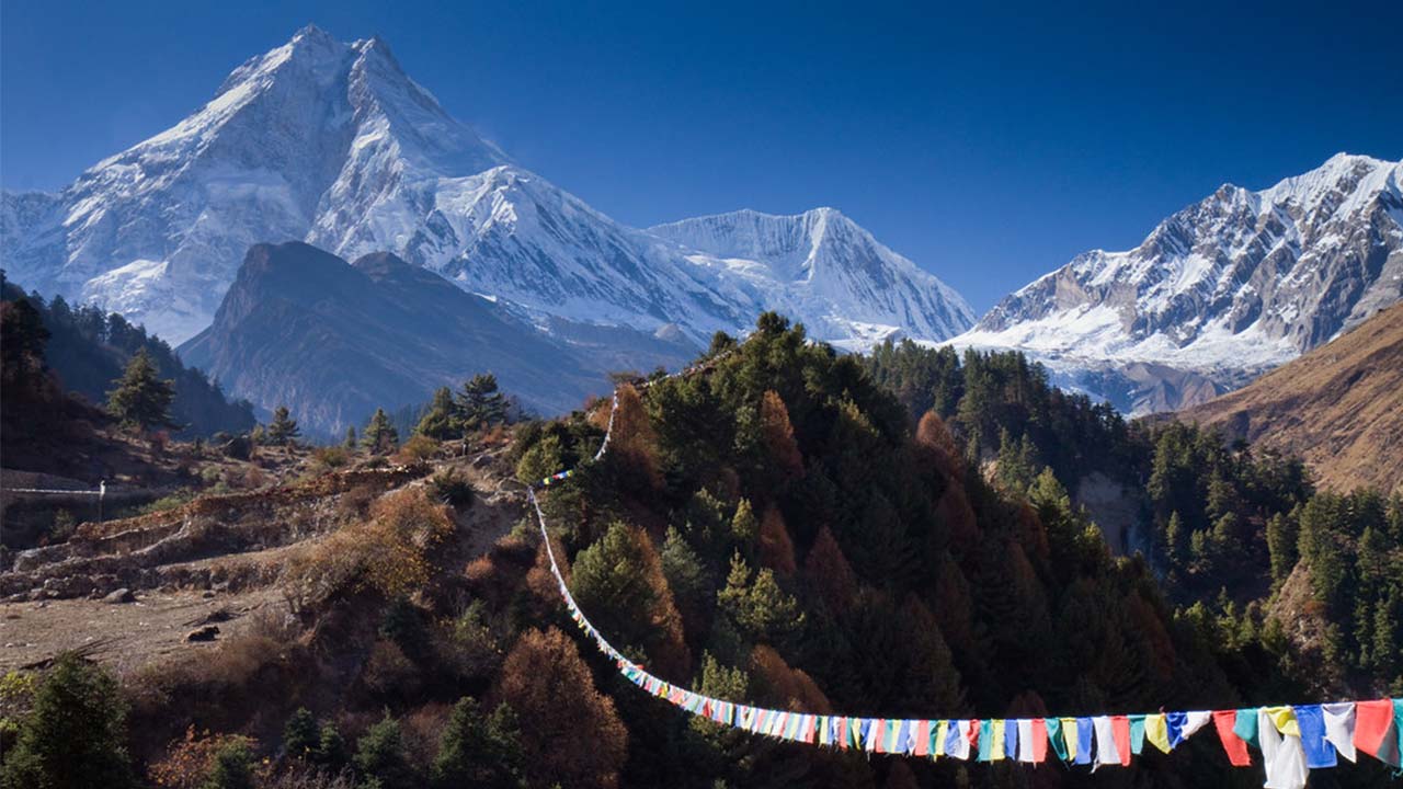
Manaslu is the 8th highest mountain on Earth, rising to 8,163 meters (26,781 feet) in the Mansiri Himal range within Nepal's Himalayas. It sits in the Gorkha District of Gandaki Province, approximately 64 kilometers east of Annapurna. Its name derives from the Sanskrit word manasa, meaning intellect or soul, earning it the poetic title "Mountain of the Spirit", a contrast to the brutal reputation it has built since the first expedition attempts in 1952.
How high is Manaslu, and where is it located?
Manaslu stands at 8,163 meters (26,781 feet) above sea level, placing it 8th among the world's 14 peaks exceeding 8,000 meters. The mountain occupies Nepal's Gorkha District at coordinates approximately 28°33′N, 84°33′E, within the Mansiri Himal sub-range of the Greater Himalayas.
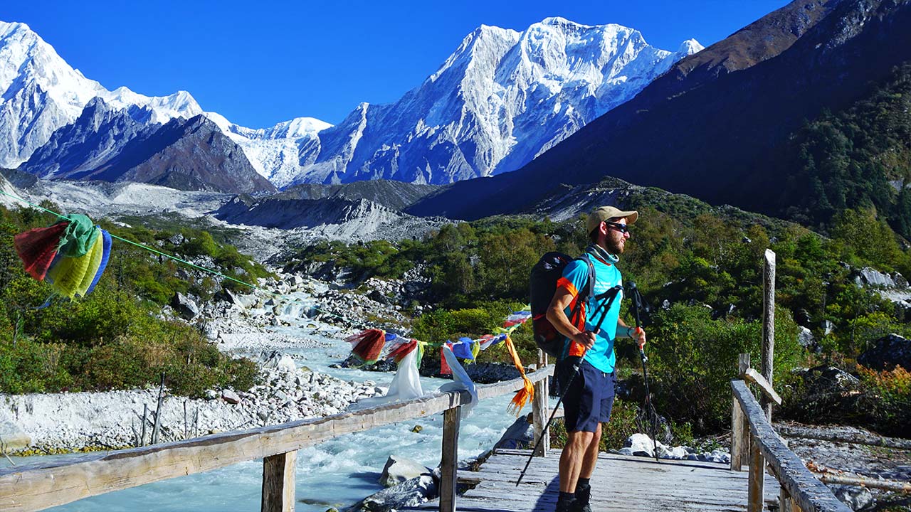
Three satellite peaks define Manaslu's massif: Manaslu North at 7,157 meters, Peak 29 (also called Ngadi Chuli) at 7,871 meters, and Himalchuli at 7,893 meters. The northeastern face, the primary climbing route, delivers a vertical gain exceeding 3,263 meters from base camp at 4,900 meters to the summit. Reaching base camp requires a 7-to-9-day trek from the trailhead at Soti Khola or Arughat in Gorkha District, passing through the villages of Bihi, Namrung, and Samagaon along the Budi Gandaki River valley. The Manaslu Conservation Area, established in 1998 across 1,663 square kilometers, enforces restricted area permits for every trekker and climber entering the zone.
Why is Manaslu important in Himalayan mountaineering?
Manaslu represents the last of the 8,000-meter peaks first summited by a national expedition before commercial operators became dominant in Himalayan climbing. Japan's team placed Toshio Imanishi and Gyalzen Norbu Sherpa on the summit on May 9, 1956, completing a 4-year national campaign that began with failed attempts in 1952 and 1953.
The mountain holds strategic importance in contemporary Himalayan climbing for a different reason: Nepal's open permit structure. The Department of Tourism allows simultaneous commercial and private expeditions on Manaslu, transforming it into one of the 3 most-climbed 8,000-meter peaks globally, alongside Cho Oyu and Everest. Autumn seasons since 2015 regularly see 300-to-500 climbers attempting the Northeast Face route. This creates a paradox that defines Manaslu's modern risk profile: extreme objective hazard combined with traffic volumes that concentrate dozens of climbers within narrow geographic zones during peak summit windows.
What Does the Name "Killer Mountain" Mean?
"Killer Mountain" is a climbing community designation applied to mountains with disproportionately high fatality rates relative to summit attempts, where the primary hazard is objective terrain rather than technical climbing difficulty. The label originated with Nanga Parbat in Pakistan, the 9th highest peak globally, after German-Austrian expeditions suffered 31 deaths between 1932 and 1953 before achieving the first ascent. The term later extended to Manaslu based on its documented avalanche deaths, serac-driven disaster events, and route-specific hazard concentration.
Is "Killer Mountain" an official name or a climbing nickname?
"Killer Mountain" is an unofficial designation used by mountaineers, expedition operators, and Himalayan record-keepers, not a formal geographic term assigned by Nepal's government or any international cartographic authority. The Department of Tourism lists Manaslu under its official name exclusively.
The nickname circulates through 4 primary channels:
-
Expedition reports and alpine journals documenting death-per-attempt ratios
-
Himalayan Database records tracking cumulative fatality statistics
-
Commercial expedition operators briefing prospective clients on objective hazard
-
International mountaineering media coverage following major avalanche events
The term carries informational precision beyond its dramatic surface reading. A climber who hears "Killer Mountain" receives an immediate signal that the mountain demands a category of respect beyond standard high-altitude preparation, that the danger comes from the terrain itself, not from technical moves that skill can overcome.
When did climbers start calling Manaslu the Killer Mountain?
Climbers began applying the "Killer Mountain" label to Manaslu consistently after the 1970s, when multiple expeditions suffered severe avalanche casualties within a single decade, establishing an undeniable pattern in Himalayan mountaineering literature.
The 1972 season proved catastrophic. A major avalanche struck a high camp on the Northeast Face, killing 15 expedition members and high-altitude workers in a single event, one of the largest single-incident death tolls recorded in Himalayan mountaineering history at that time. Korean expedition reports from this period documented Manaslu's serac-driven avalanche terrain in detail that entered the permanent alpine literature record.
The September 23, 2012 disaster cemented the nickname for the modern climbing generation. After 11 international climbers died in a pre-dawn avalanche, global mountaineering media consistently applied "Killer Mountain" language to Manaslu, and the designation embedded permanently into commercial expedition briefings, insurance frameworks, and trekking industry documentation.
Why Is Manaslu Considered So Dangerous?
Manaslu's danger derives from 3 primary factors that interact simultaneously: serac-driven avalanche release above occupied camps, sudden meteorological deterioration, and terrain that prevents helicopter rescue above 6,500 meters. These factors compound each other, a weather deterioration event accelerates avalanche release from the hanging glacier precisely when evacuation becomes physically impossible. No other single-route 8,000-meter peak in Nepal concentrates all 3 hazards with this degree of structural permanence.
How do avalanches make Manaslu especially deadly?
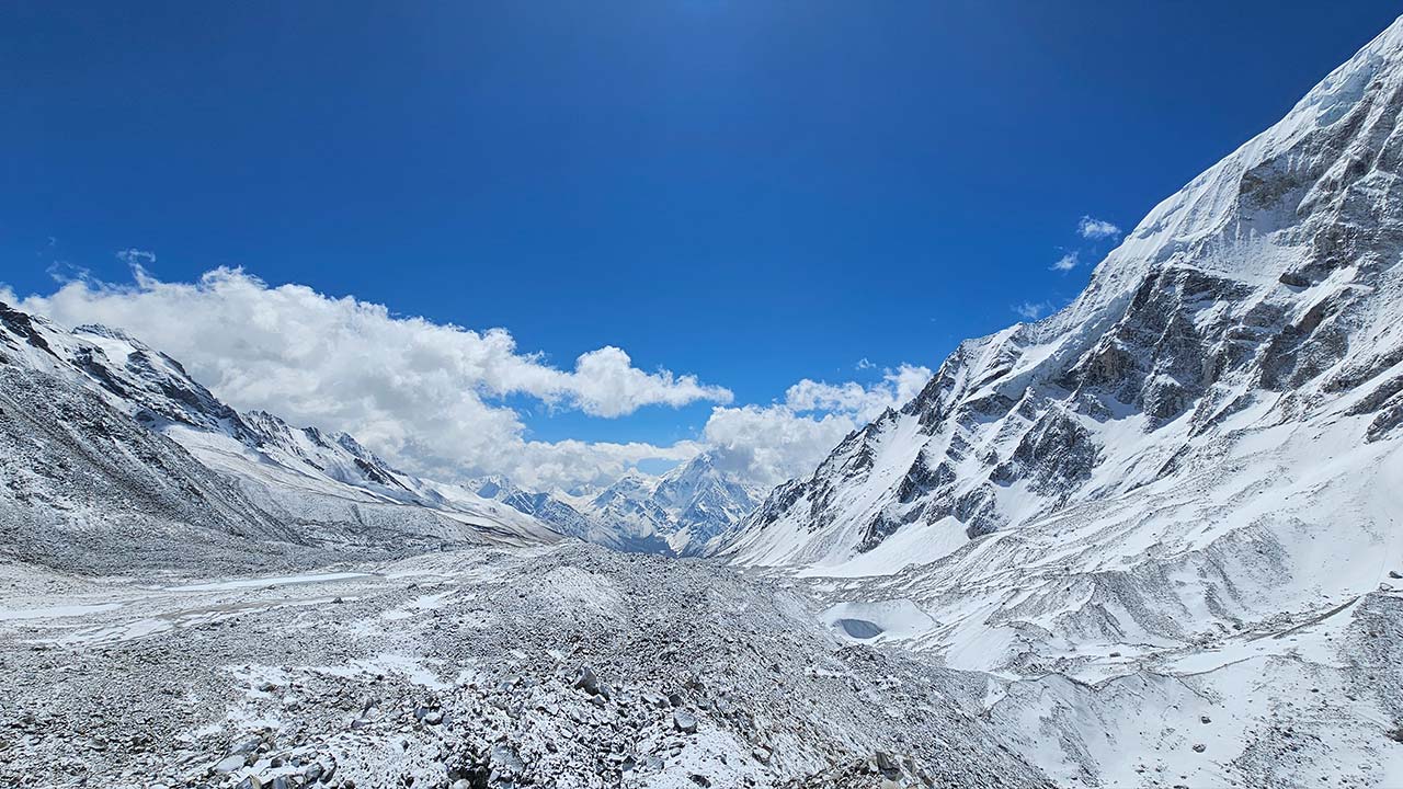
Avalanche exposure on Manaslu is categorically different from most 8,000-meter peers because the Northeast Face route passes directly beneath a serac band hanging at approximately 6,800-to-7,200 meters, with ice masses measuring 30-to-60 meters thick and a base width exceeding 400 meters.
Serac-generated avalanches behave differently from slope-failure avalanches in 3 critical ways:
-
They release without the surface cracking patterns climbers detect on standard snow slopes
-
They trigger independently of temperature, serac collapses occur at night and in cold conditions without solar loading
-
They follow no predictable cyclical timing that watch schedules or early-morning departure windows reliably avoid
The northeast aspect receives direct morning solar radiation beginning at approximately 7:00 AM local time. Pre-dawn summit pushes, the universal standard practice for Manaslu teams, position climbers directly beneath active serac zones during the highest-risk thermal window. Camp 3 at 7,050 meters sits within the primary avalanche runout zone from the hanging glacier above. Teams accepting this camp location accept the reality that a serac calving event at 3:00 AM offers zero warning time, regardless of preparation level.
How do weather and snow conditions increase the risk?
Manaslu's weather system generates hazard through 3 documented mechanisms: rapid cyclonic weather shifts tracking north from the Bay of Bengal, post-monsoon snowpack instability above 6,000 meters, and jet stream interaction at summit-level altitudes above 7,500 meters. Each mechanism operates independently but frequently combines during October, the month when 60-to-70% of annual Manaslu summit attempts occur.
Post-monsoon seasons deposit 2-to-4 meters of new snow above 6,000 meters during the Himalayan monsoon active from June through September. When expedition teams arrive in late September, this snowpack has consolidated for only 2-to-4 weeks. Buried weak layers, depth hoar and faceted crystal formations created by early-season temperature cycling, persist beneath the surface for 3-to-5 weeks after the monsoon withdraws, presenting avalanche trigger conditions that remain invisible to surface observation.
Bay of Bengal cyclones form with 48-to-72 hours of predictable advance warning. For large commercial expeditions with 50-to-100 personnel distributed across multiple high camps, 48 hours is insufficient evacuation time. A cyclone tracking north generates precipitation events across the entire Himalayan range, loading fresh snow onto already unstable mid-mountain layers at Manaslu simultaneously with forcing evacuation decisions.
How do altitude and terrain make rescues harder?
Helicopter rescue on Manaslu becomes physically impossible above approximately 6,500 meters due to air density limitations at extreme altitude. Nepal's high-altitude rescue helicopters operating AS350 B3e models reach maximum operational ceilings of 6,700-to-7,000 meters under ideal conditions. Above this threshold, rotor systems generate insufficient lift for hovering, landing, or patient pickup.
The Northeast Face route offers no viable descent alternative to the primary ascent line. Evacuating a severely injured climber from Camp 3 at 7,050 meters requires manually lowering them over steep 40-to-55-degree mixed terrain, demanding 6-to-10 physically capable climbers operating under significant hypoxic impairment. High-altitude cerebral edema (HACE) and pulmonary edema (HAPE), the 2 most common life-threatening conditions above 7,000 meters, deteriorate measurably over the 12-to-24 hours a technical self-rescue from high camp typically requires.
What Major Disasters Shaped Manaslu's Reputation?
5 major avalanche events between 1972 and the late 2010s collectively killed over 40 climbers and defined Manaslu's reputation as a mountain where objective terrain hazard dominates over human skill, preparation, or experience. Each disaster added specific institutional knowledge about when, where, and how the mountain produces mass-casualty events, yet the fundamental hazard geometry remains unchanged by any amount of documentation.
Which fatal expeditions made Manaslu infamous?
The 1972 season stands as the single deadliest in Manaslu's climbing history, when an avalanche killed 15 expedition members and high-altitude workers on the Northeast Face, 10 Sherpas, 4 Korean climbers, and 1 Japanese climber, in one event. This incident entered Himalayan mountaineering literature as the first clear demonstration that Manaslu's serac systems produce catastrophic mass-casualty events without progressive warning.
Subsequent seasons throughout the 1970s and 1980s recorded additional significant casualties from avalanche events at mid-mountain elevations. Himalayan Database records through this period document a cumulative pattern: deaths concentrated at 3 specific geographic zones, the Camp 1-to-Camp 2 approach traverse, the Camp 3 serac runout zone, and the ridge section above Camp 4. This concentration reveals that Manaslu kills at predictable locations rather than randomly across the route.
What happened in the deadliest Manaslu avalanche events?
The September 23, 2012 avalanche is the most extensively documented single mountaineering disaster in Manaslu's history, killing 11 climbers and affecting 30+ others in a pre-dawn event at approximately 5:00-5:15 AM local time. The avalanche released from the hanging glacier above Camp 3 at approximately 7,000 meters and swept through occupied tents before any occupant could react.
Victims came from multiple nationalities including French, German, Italian, Spanish, Canadian, and Nepali climbers. The broad international casualty composition elevated the event to global media coverage and triggered Himalayan safety reviews in mountaineering bodies across Europe and North America.
The 2012 disaster exposed a structural problem specific to the commercial expedition model: concentrating hundreds of climbers within a small geographic zone, the Camp 3 area covers approximately 200 meters of usable terrain, during the same 48-to-72-hour weather window maximizes the number of people exposed to a single avalanche event. Earlier disasters involved expedition teams of 8-to-20 members. The 2012 event involved climbers from 30+ separate expeditions occupying the same zone simultaneously.
How did those accidents change how climbers view the mountain?
The 2012 disaster directly changed expedition planning across 4 operational dimensions: camp placement protocol, summit push authorization timing, maximum occupancy limits per camp, and mandatory decision frameworks for weather deterioration events.
Experienced operators relocated Camp 3 placement coordinates in subsequent seasons, seeking terrain with marginally reduced serac exposure on the northeastern edge of the primary runout zone. This shift reduced, but did not eliminate, the structural hazard. The hanging glacier's debris path exceeds 600 meters in width during major calving events, wider than any lateral repositioning within viable camping terrain.
The disaster also triggered insurance and permit framework revisions. Nepal's government implemented stricter high-altitude worker insurance requirements following the disproportionate Sherpa casualty toll. Western operators faced pressure from client organizations and liability insurers to formalize turnaround protocols and atmospheric decision criteria in writing before departure from base camp.
Is Manaslu More Dangerous Than Other 8,000ers?
Manaslu's historical fatality rate once sat much higher, but the massive surge in commercial summits has brought the overall historical rate down to approximately 2.5% to 3%. Despite this mathematical drop, the sheer volume of climbers means it produces a high absolute number of fatalities. However, fatality rate percentage alone understates Manaslu's hazard because its high annual traffic volume produces a large absolute death count per decade, and its primary hazard, serac-driven avalanche, is non-survivable when it strikes occupied camps regardless of the victim's experience, equipment, or decision quality.
How does Manaslu compare with Everest and Annapurna?
The following table presents comparative fatality data for 5 major 8,000-meter peaks, compiled from Himalayan Database records through 2024.
|
Mountain |
Height |
Approx. Fatality Rate |
Primary Hazard Type |
|
Annapurna |
8,091m |
~32% |
Avalanche, complex serac systems |
|
K2 |
8,611m |
~22% |
Technical terrain, sudden storms |
|
Nanga Parbat |
8,126m |
~21% |
Mixed terrain, avalanche, remoteness |
|
Manaslu |
8,163m |
~3% |
Serac avalanche, post-monsoon snowpack |
|
Everest |
8,849m |
~1–2% |
Altitude illness, overcrowding, fixed-line dependency |
Annapurna kills at a rate over 10 times higher than Manaslu by percentage, but Annapurna receives far fewer annual permit holders, typically 50-to-100 attempts per autumn versus Manaslu's 300-to-500. This traffic difference means Manaslu's lower percentage rate produces a comparable or higher absolute annual death count. Everest's 1-to-2% fatality rate reflects extensive fixed infrastructure, supplemental oxygen availability from Camp 2 upward, multiple positioned emergency response teams, and a well-mapped route with no active serac band above primary camping zones.
Does Manaslu's fatality history justify the nickname?
Nearly 90 documented deaths across 70 years of climbing history justify the 'Killer Mountain' designation, particularly when analyzed against the specific geographic concentration of fatalities within the Camp 3 serac zone rather than distributed across the full route.
Justification rests on 3 observable and verifiable facts:
-
The serac band above Camp 3 has generated multiple mass-casualty events, not isolated statistical outliers
-
The primary Northeast Face route has no viable alternative traversal of this hazard zone
-
Death events consistently involve experienced, properly equipped climbers following contemporary best-practice protocols
The third fact distinguishes Manaslu from peaks where fatalities cluster primarily among underprepared climbers. Manaslu kills experienced alpinists. This evidence removes the argument that preparation alone resolves the risk. The mountain carries irreducible objective hazard that persists regardless of the climber's skill level, a characteristic that fully justifies the "Killer Mountain" designation in serious mountaineering literature.
Why can Manaslu seem easier than it really is?
Manaslu appears deceptively accessible because its Northeast Face route carries a moderate technical grade of PD+ to AD on the UIAA alpine scale, attracting climbers whose technical competence exceeds their objective-hazard assessment experience. A climber capable of Grade IV mixed climbing reads the route description accurately, the technical demands are real but manageable. The serac exposure assessment requires a different type of expertise that technical climbing skill does not develop.
Commercial expedition marketing amplifies this perception gap. Manaslu is routinely positioned as a "training peak" or "stepping stone" toward Everest. The framing carries partial validity, the altitude, acclimatization demands, and cold exposure are comparable to Everest. What the framing omits: Everest's standard South Col route does not pass beneath an active hanging glacier with a 400-to-600-meter debris path. This omission is not a marketing technicality. It is the difference between the mountain's experienced reputation and its commercial presentation.
Climbers who underestimate Manaslu consistently make 3 observable errors: accepting marginal Camp 3 weather windows because the technical moves feel manageable, camping at established coordinates without assessing current serac geometry, and moving too slowly above 7,000 meters because the route's moderate grade creates false confidence about time exposure.
When Is Manaslu Most Hazardous for Climbers?
Manaslu reaches peak hazard levels during the first 3 weeks of October, when post-monsoon snowpack instability combines with the highest concentration of climbers executing summit pushes, maximum Bay of Bengal cyclone probability, and fresh snowfall loading on unconsolidated mid-mountain layers. Avalanche danger during this 3-week window regularly reaches "High" to "Very High" on international avalanche rating frameworks.
Which climbing season carries the greatest avalanche danger?
The autumn season (September-November) carries statistically greater avalanche danger than the spring season (March-May), with 4 of the 5 most deadly recorded incidents occurring in autumn. Post-monsoon snowpack presents layered instability that spring's consolidated winter snowpack does not replicate.
Spring climbing occurs on snowpack that has undergone 5-to-7 months of cold-temperature sintering since the previous monsoon. Crystal bonding, load compression, and temperature stabilization produce a more homogeneous and predictable snow structure. Autumn climbing occurs on fresh monsoon snowfall that has consolidated for only 4-to-8 weeks. Buried weak layers from early-season temperature cycling remain active throughout October. Within autumn, the window from late September through October 15 presents the highest combined risk from all 3 simultaneously elevated hazard categories: fresh snowpack, cyclone probability, and maximum expedition traffic concentration.
How do route conditions change from year to year?
Manaslu's route conditions vary across 3 primary variables across seasons: monsoon precipitation volume, serac calving rate, and seasonal temperature departure from the 30-year mean. None of these variables are predictable reliably beyond 2 weeks in advance.
Heavy monsoon years, defined as seasons with 120%+ of average July-through-September precipitation, produce thicker, more unstable snowpack above 6,000 meters. Himalayan meteorologists track monsoon precipitation totals as leading indicators of autumn avalanche risk, and experienced operators factor this data into permit timing decisions.
Serac calving rates follow non-linear patterns tied to the preceding summer's temperature profile. The hanging glacier above Camp 3 does not calve predictably. High-summer temperatures accelerate basal melting within the serac system, producing active calving phases that can last 2-to-4 weeks. Experienced expedition operators review satellite imagery of the serac's current geometry compared to prior-season photographs before committing to specific camp coordinates, a practice that calibrates exposure assessment without eliminating the hazard.
What warning signs do teams watch before a summit push?
Experienced Manaslu expedition teams monitor 5 specific pre-summit warning signals: recent snowfall volume above 7,000 meters within the preceding 72 hours, visible wind slab formation on the northeast aspect above Camp 2, temperature inversion layers indicating near-term atmospheric instability, visible fracture lines or fresh calving debris below the serac band, and auditory evidence of serac movement such as cracking or collapse sounds during the overnight hours.
Snowpack layer assessment at Camp 2 and Camp 3 provides the most operationally actionable data. Teams use avalanche probes to test for buried weak layers at mid-mountain elevations. A faceted crystal layer beneath 30-to-60 centimeters of consolidated surface snow presents lethal avalanche trigger conditions even when surface conditions appear stable and visibility is optimal.
Weather forecasting from specialized services, MeteoBlue and dedicated Himalayan meteorological providers, delivers summit-level wind and precipitation data with 3-to-5-day reliability windows. Responsible expedition leaders define explicit quantitative turnaround conditions before the summit push begins: maximum acceptable summit wind speed, minimum acceptable visibility in meters, and latest turnaround time regardless of summit proximity. Defining these conditions in advance removes in-field cognitive bias under hypoxic impairment from the decision sequence.
Who Should Attempt Manaslu?
Manaslu is appropriate for climbers with documented high-altitude experience above 7,000 meters or at minimum 2 prior expeditions to peaks exceeding 6,500 meters in Himalayan or equivalent environments, combined with technical competence on mixed terrain, crevasse rescue capability, and high-altitude team decision-making experience. Technical alpine skills at lower altitude do not substitute for high-altitude physiological adaptation experience.
What experience should climbers have before Manaslu?
Climbers arriving at Manaslu base camp require documented experience across 6 specific domains: extreme altitude adaptation above 7,000 meters, multi-day camp management below -20°C, technical mixed terrain navigation using crampons and fixed lines, crevasse rescue execution under field conditions (not theoretical only), team decision-making under hypoxic cognitive impairment, and high-altitude emergency response protocols.
Preparatory peaks that build relevant experience include:
-
Cho Oyu (8,188m): the most commonly recommended direct 8,000-meter precursor, with lower objective serac hazard and more accessible evacuation terrain
-
Aconcagua (6,961m): extreme cold and altitude adaptation in a non-technical but demanding environment
-
Denali (6,190m): cold management, team glacier travel, and expedition self-sufficiency skills
-
Island Peak (6,189m) or Lobuche East (6,119m): Himalayan technical crampon and fixed-line skills in Nepal's specific environmental conditions
No volume of European Alpine routes, regardless of technical difficulty grade, replicates the physiological environment above 7,000 meters or the specific decision-making demands of Himalayan serac-exposed terrain.
Why are guided teams often recommended on this peak?
Guided expedition teams on Manaslu provide 4 measurable safety advantages over self-guided attempts: pre-established atmospheric decision frameworks built from prior Manaslu seasons, high-altitude Sherpa support with accumulated pattern recognition, direct communication networks connecting summit teams to base camp meteorologists in real time, and pre-arranged helicopter emergency contacts for the sub-6,500-meter evacuation zone.
High-altitude Sherpa guides on professional expeditions accumulate 50-to-150+ days above 7,000 meters over their careers. Their assessment of serac instability, snowpack condition, and team speed management above 7,500 meters draws on direct experience that no formal mountaineering curriculum replicates. This pattern recognition represents the most significant safety resource available on Manaslu beyond an individual climber's own preparation.
Nepal requires expedition liaison officers, environmental deposits, and permit compliance documentation for all Manaslu expeditions. Operators with established relationships with the Department of Tourism navigate this administrative infrastructure efficiently. Self-guided teams handling permit logistics independently for the first time expend time and cognitive resources that divert from route preparation.
What mistakes do underprepared climbers make on Manaslu?
Underprepared climbers on Manaslu consistently make 5 identifiable and documented mistakes: compressing the acclimatization schedule to 20-to-22 days instead of the recommended 30-to-35 days, camping at conventional Camp 3 coordinates without assessing current serac geometry, ascending too quickly through the 6,400-to-7,050-meter band due to underestimating hypoxic impairment at this altitude, ignoring weather deterioration signals that experienced alpinists recognize as pre-storm indicators, and making summit push decisions based on group momentum rather than individual physiological condition.
The acclimatization compression error carries the highest mortality correlation. Climbers who summit 6,000-meter peaks without prior Himalayan expedition experience systematically underestimate how severely cognitive function degrades above 7,000 meters. Hypoxia-induced cognitive impairment directly degrades avalanche hazard assessment quality, the judgment most critical for survival on Manaslu. Group momentum compounds this error when individual climbers who recognize deteriorating conditions follow group consensus to continue anyway.
How Can Climbers Reduce the Risks on Manaslu?
Climbers reduce Manaslu's risks through 3 systematic interventions executed before and during the expedition: pre-expedition physiological preparation targeting extreme altitude adaptation, rigorous acclimatization rotation execution during the climb, and evidence-based decision-making frameworks applied at every camp transition. These interventions optimize human factors within the climber's control. They do not eliminate objective serac avalanche hazard, which remains external to human intervention.
What training matters most before a Manaslu expedition?
High-altitude physiological preparation requires 12-to-18 months of structured training across 4 physiological domains: cardiovascular endurance targeting a VO2 max that sustains output at 50% of sea-level capacity, hypoxic adaptation through altitude exposure or simulated altitude training, muscular endurance for sustained load-carrying over multi-day approaches, and cold tolerance management through progressive exposure protocols.
Cardiovascular base development requires 10-to-15 hours per week of sustained aerobic training for a minimum of 6 months before departure. Altitude tent training at simulated 3,000-to-5,000 meters accelerates hypoxic adaptation for sea-level-based athletes. Technical competence on 40-to-55-degree glaciated terrain with fixed lines requires dedicated training in alpine environments, not rock or ice gym practice, because the combination of hypoxic impairment and technical terrain demands simultaneous experience in both conditions.
How do acclimatization and logistics improve survival odds?
Acclimatization on Manaslu follows a 3-to-4-rotation schedule that positions climbers at progressively higher elevations with recovery periods at base camp between each rotation. Rotation 1 targets Camp 1 at 5,700 meters. Rotation 2 targets Camp 2 at 6,400 meters. Rotation 3 includes an overnight stay at Camp 3 at 7,050 meters. The summit push proceeds from Camp 4 at 7,400 meters after a base camp recovery period of 3-to-5 days.
Each rotation requires 2-to-3 full recovery days at base camp to allow erythropoietin-driven red blood cell production to respond to altitude exposure. Compressing this schedule to 18-to-21 total days measurably increases HACE and HAPE probability above 7,000 meters. Logistics that directly improve survival odds include pre-positioning supplemental oxygen at Camp 3 before the summit rotation, establishing fixed lines to Camp 3 before high-camp occupancy begins, confirming helicopter emergency contact details with Kathmandu-based operators before leaving base camp, and assigning a medically trained base camp manager with direct satellite communication capability.
What gear and decision-making help reduce objective danger?
5 gear systems directly reduce Manaslu's objective and subjective danger: avalanche transceivers with RECCO compatibility carried by every team member above Camp 1, lightweight emergency bivouac equipment enabling unplanned overnight capability above Camp 3, supplemental oxygen with a minimum 4-bottle allocation per climber for the summit rotation above 7,500 meters, satellite communication devices with two-way messaging connecting summit teams to base camp in real time, and high-altitude sleeping bags rated to -40°C for Camp 3 and Camp 4 occupation.
Decision-making frameworks eliminate the most dangerous variable: cognitive bias under hypoxia. The most effective approach defines 3 quantitative turnaround conditions in writing at base camp before departure, maximum acceptable summit wind speed (typically 40-to-50 knots), minimum acceptable visibility (typically 300-to-500 meters), and latest acceptable turnaround time regardless of summit proximity (typically 1:00-to-2:00 PM local time). Pre-defined quantitative thresholds remove the summit-fever cognitive distortion that hypoxia amplifies in real-time high-camp decisions.
How Should You Approach Manaslu With Expert Expedition Support?
Approaching Manaslu with expert expedition support transforms the mountain from an individual risk-calculation problem into a structured, team-based risk-management framework. No guided service eliminates objective hazard, avalanches, seracs, and extreme weather remain constants independent of operator experience. Experienced operators execute evidence-based decisions using pattern recognition accumulated over hundreds of high-altitude climbing days on this specific mountain, a resource no individual climber develops in a single expedition.
Can a guided expedition help reduce Manaslu's risks?
Guided expeditions reduce Manaslu's human-factor risks across 4 measurable dimensions: pre-departure preparation quality aligned with this mountain's specific hazard profile, in-field weather decision-making informed by prior Manaslu season experience, high-altitude Sherpa support ratios sufficient for technical assistance above 7,000 meters, and emergency response capability integrated with established Kathmandu-based medical evacuation providers.
Evaluating expedition operators for Manaslu requires examining 3 specific credentials: documented Manaslu summit history across multiple seasons (not 8,000-meter experience generally), high-altitude guide certification from IFMGA or a recognized national equivalent body, and verifiable client safety records available through independent review sources or direct reference contacts.
Nepal's Department of Tourism issues standard autumn expedition permits at a flat fee of $900 USD per climber, regardless of group size. A comprehensive guided expedition including permit fees, logistics, supplemental oxygen, high-altitude Sherpa support, and full camp services typically ranges from $15,000-to-30,000 USD per person depending on operator service level and group size. Selecting operators based primarily on price on a mountain with Manaslu's hazard profile introduces additional preventable risk into an already hazard-dense environment.
Consulting directly with an expedition operator who has documented recent Manaslu experience, ideally multiple seasons across both spring and autumn, gives the most accurate current route condition and hazard assessment before committing to a permit and departure schedule.
What Are the Key Takeaways About Manaslu We Covered?
Manaslu earns its "Killer Mountain" designation from documented serac avalanche hazard concentrated on the Northeast Face, nearly 90 deaths across 70 years of climbing history, and a structural route geometry that places Camp 3 at 7,050 meters within the primary debris path of a hanging glacier that no expedition protocol eliminates.
The 8 core facts established across this article:
-
Manaslu stands at 8,163 meters, the 8th highest mountain on Earth, located in Nepal's Gorkha District within the Mansiri Himal range
-
"Killer Mountain" is an informal designation, applied by the mountaineering community based on fatality data and avalanche history, not assigned by government authorities
-
Serac avalanche above Camp 3 is the primary killer, the hanging glacier at 6,800-to-7,200 meters releases without detectable warning signs across all standard avalanche detection methods
-
The historical fatality rate sits at approximately 3%, a percentage that has dropped due to high modern summit volumes, yet still masks the high absolute number of fatalities caused by unavoidable objective hazards.
-
The September 23, 2012 avalanche killed 11 climbers, the defining modern disaster that cemented Manaslu's "Killer Mountain" status in international mountaineering discourse
-
Autumn season carries higher avalanche risk than spring, post-monsoon snowpack instability and Bay of Bengal cyclone probability peak simultaneously in October
-
Guided expeditions reduce human-factor risks, not objective hazard, serac systems, unconsolidated snowpack, and extreme-altitude weather events remain constant regardless of operator experience
-
Prior 8,000-meter or documented 7,000-meter Himalayan experience is required, technical climbing competence at lower altitude does not replicate the physiological and judgment demands above 7,000 meters on Manaslu
Manaslu does not exclusively punish the underprepared. The mountain kills experienced climbers positioned within its avalanche zones at the moment a serac releases, a distinction that defines its reputation more precisely than any fatality percentage. Understanding Manaslu honestly, across its geography, documented disasters, structural hazards, and the real limitations of human risk reduction within its terrain, is the prerequisite for every credible decision made about attempting it.
