The Mardi Himal Trek is a 55-kilometre trekking route in the Annapurna Conservation Area of Nepal, completed in 5 to 7 days of walking. The trail ascends from Kande village (1,770m) to an upper viewpoint at 4,200m, placing 6 Himalayan peaks, including Machhapuchhre (6,993m) and Annapurna South (7,219m) into a single ridgeline sightline.
Mardi Himal is both a trekking peak at 5,587m in the Annapurna massif and the established trail that approaches its eastern ridge above the Seti River valley. The route gained official recognition from Nepal's Department of Tourism and the Annapurna Conservation Area Project (ACAP) following rapidly increasing trekker interest from 2012 onward, when the Nepal Tourism Board formally designated the Mardi Himal Trail as a permitted trekking corridor.
The route connects 7 key trail stages: Kande, Deurali, Forest Camp, Low Camp, High Camp, Upper Viewpoint, and a descent through Siding village. The trail lies entirely within the Annapurna Conservation Area (ACAP), which covers 7,629 square kilometres of the Gandaki Province, Nepal.
Where Is the Mardi Himal Trek and How Accessible Is It?
The Mardi Himal Trek occupies the southeastern sector of the Annapurna Conservation Area in Gandaki Province, Nepal, on the eastern ridge of the Mardi Himal massif. The trailhead at Kande stands 28 kilometres from Pokhara city by road, making the Mardi Himal one of the 3 most accessible major treks in Nepal that begin within 45 minutes of a regional airport.
Which Part of the Annapurna Region Is the Trek In?
The Mardi Himal Trek runs along the eastern ridge of Mardi Himal, bounded by the Modi Khola river valley to the west and the Seti River valley to the east. The trail sits between 2 major Annapurna trekking corridors: the Annapurna Base Camp route (to the west) and the Annapurna Circuit route (to the north).
The trail stays on a narrow, high ridge throughout its upper section above 3,000m. This ridge concentration delivers unobstructed Himalayan views and separates the Mardi Himal Trek from the more trafficked routes in the Annapurna region.
The Annapurna Conservation Area Project (ACAP), the conservation body established in 1986 under the National Trust for Nature Conservation (NTNC) to manage the 7,629 km² protected zone governs all trekking activity on this trail. ACAP sets the permit structure, teahouse regulations, and trail standards that govern the Mardi Himal Trek directly.
How Close Is the Mardi Himal Trek to Pokhara?
The Mardi Himal Trek trailhead at Kande sits 28 kilometres northeast of Pokhara city center. A private taxi from Pokhara's Lakeside district to Kande takes 45 minutes. A local bus from Pokhara's Baglung Bus Park reaches Kande in 1 hour 15 minutes with 1 connection.
Pokhara Gandaki Airport (PKR) connects the city to Kathmandu via daily 25-minute domestic flights operated by 4 carriers: Buddha Air, Yeti Airlines, Shree Airlines, and Nepal Airlines. Trekkers arriving at Tribhuvan International Airport (TIA) in Kathmandu reach Pokhara by 1 of 3 routes: a 25-minute domestic flight, a 6-to-7-hour tourist bus journey, or a 5-hour private car transfer via the Prithvi Highway (BP Highway, H06).
Pokhara serves as the primary logistics base for the Mardi Himal Trek. All permits, licensed guides, gear rental, currency exchange, and pre-trek transport depart from this city.
What Are the Trek's Distance, Duration, and Highest Point?
The Mardi Himal Trek covers approximately 55 kilometres round-trip, with a standard duration of 5 to 7 days. The highest trekking point is the Upper Viewpoint at 4,200m, with an optional extension to Mardi Himal Base Camp at 4,500m.
The following table presents the elevation profile of the Mardi Himal Trek from trailhead to highest viewpoint, ordered by ascending altitude, with approximate distances between stages.
|
Trail Stage |
Elevation (m) |
Distance from Previous Stage (km) |
|
Kande (Trailhead) |
1,770 |
— |
|
Deurali |
2,100 |
4 |
|
Forest Camp |
2,550 |
5 |
|
Low Camp |
3,150 |
4 |
|
High Camp |
3,580 |
4 |
|
Upper Viewpoint |
4,200 |
3 |
|
Mardi Himal Base Camp |
4,500 |
2 |
The total elevation gain from trailhead to Upper Viewpoint is 2,430 metres. From Kande to Mardi Himal Base Camp, the cumulative elevation gain reaches 2,730 metres across 22 kilometres of ascent. Key takeaway: each ascending stage gains between 300m and 780m, keeping daily altitude gain within the recommended acclimatization ceiling of 500 to 800 metres per day for trekkers above 3,000m.
What Route Does the Mardi Himal Trek Usually Follow?
The standard Mardi Himal Trek route ascends from Kande (1,770m) through Deurali, Forest Camp, Low Camp, and High Camp to the Upper Viewpoint (4,200m), then descends either by the same ridge or via Siding village to Pokhara. The full route covers 7 named stages across 5 to 7 walking days, with the most popular format being a 6-day loop finishing through Siding.
Does the Trek Start from Kande, Phedi, or Dhampus?
The standard Mardi Himal Trek starts from Kande at 1,770m. Phedi and Dhampus form part of an older, longer approach used before the Kande roadhead was established and paved from Pokhara.
Phedi (1,130m) and Dhampus (1,640m) lie on a longer, lower trail that adds 1 full walking day and approximately 8 kilometres to reach Deurali. The Dhampus route rejoins the main Mardi Himal trail at the ridgeline above Deurali. Trekkers who use this older approach walk through Dhampus village, a prominent Gurung settlement at 1,640m and gain views of Machhapuchhre from the village viewpoint before the forest ascent.
The majority of guided Mardi Himal treks in 2024 departed from Kande due to 3 practical advantages:
- Shorter road journey from Pokhara (28km vs. 18km to Phedi, but with faster road access)
- Elimination of 1 full day's walking on lower subtropical terrain
- Direct entry into the rhododendron forest zone at Forest Camp within the first walking day
Which Trail Stages Lead from Forest Camp to High Camp?
The 4 trail stages from Forest Camp (2,550m) to High Camp (3,580m) are:
- Forest Camp (2,550m) — dense rhododendron and oak forest zone; 5 teahouses operational year-round
- Low Camp (3,150m) — forest transitions to bamboo and shrub; 4 teahouses with basic accommodation
- Middle Camp (3,312m) — transition zone between closed forest and open ridge; 2 teahouses
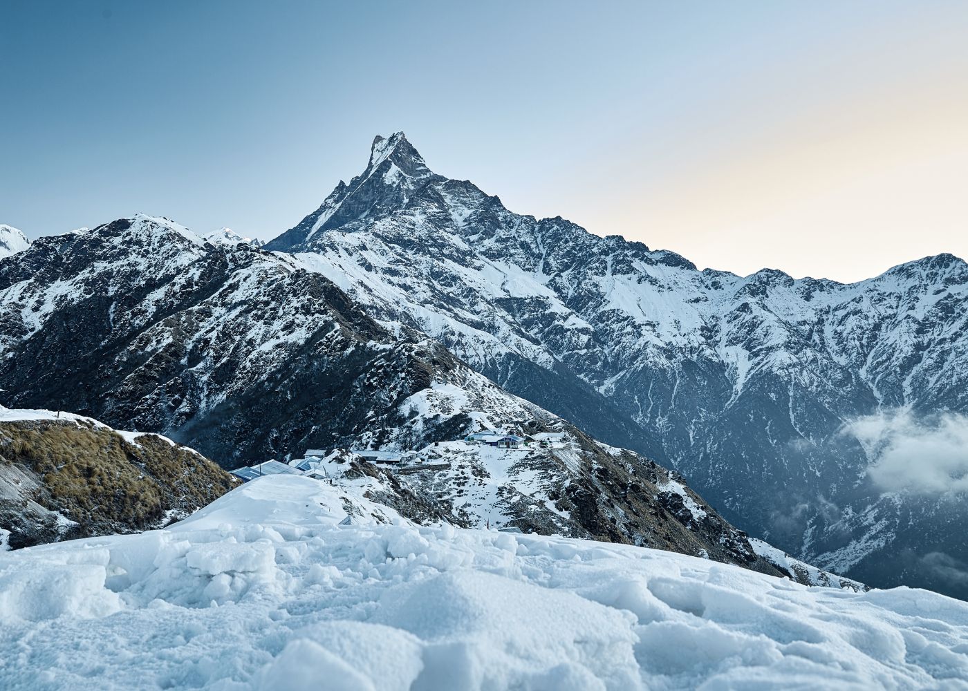
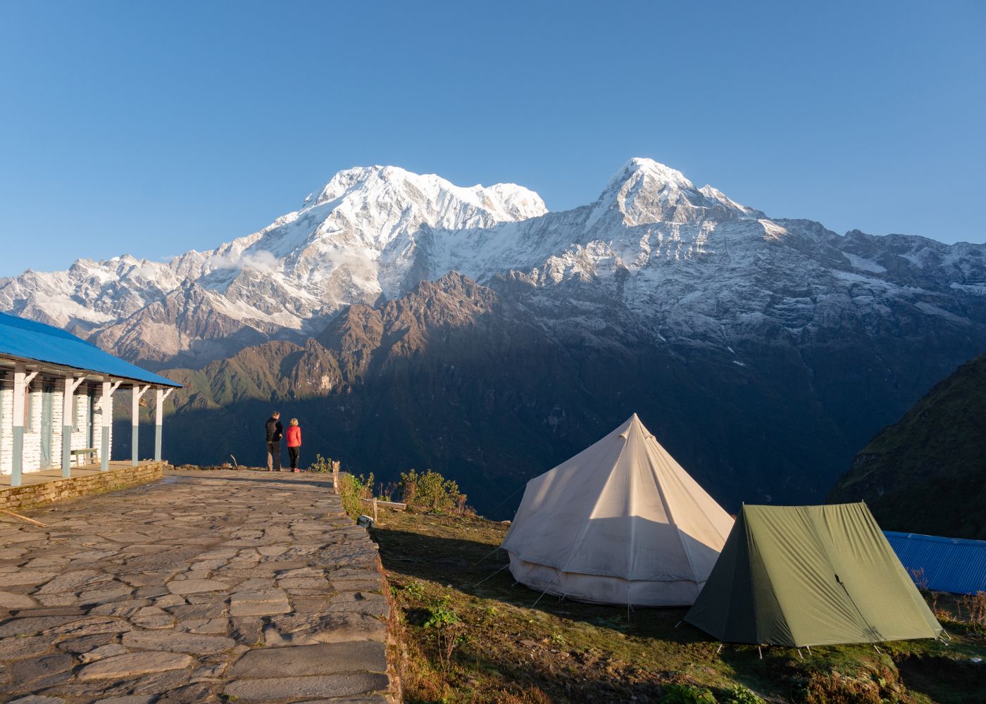
- High Camp (3,580m) — exposed ridgeline with 6 teahouses; first unobstructed views of Machhapuchhre (6,993m) and Annapurna South (7,219m)
The ascent from Forest Camp to High Camp gains 1,030 metres over 11 kilometres of trail. Average trail gradient across this segment is 9.4%, with steeper 20%+ sections on the final 2 kilometres approaching High Camp.
What Is the Difference Between the Viewpoint and Base Camp?
The Upper Viewpoint stands at 4,200m on the Mardi Himal ridge and serves as the standard turnaround point for most trekkers. Mardi Himal Base Camp sits at 4,500m, 300 metres higher and approximately 2 kilometres farther along the same ridge.
3 measurable differences separate these 2 destinations:
- Trail surface: The Upper Viewpoint is reachable on a maintained ridge path; the approach from Viewpoint to Base Camp crosses open scree and requires active route-finding without marked trail infrastructure
- Mountain panorama: The Base Camp adds a direct close-range view of the Mardi Himal summit pyramid (5,587m) at approximately 1.2 kilometres horizontal distance a view unavailable from the Viewpoint
- Risk level: The Base Camp zone sits above 4,300m, which increases wind exposure and AMS probability; no teahouse or shelter exists between the Viewpoint and Base Camp
Most guided 6-day itineraries treat the Upper Viewpoint as the primary destination. Base Camp is included as an optional same-day extension for trekkers who acclimatize well at High Camp on Day 3 and depart before 06:30 on Day 4.
Do Most Trekkers Finish via Siding or Go Back the Same Way?
Most guided itineraries finish via Siding village (1,700m) rather than retracing the ridge. The Siding descent takes 1 full walking day from High Camp, followed by a 2-hour road transfer back to Pokhara.
The Siding exit route delivers 3 advantages over the same-route return:
- New terrain on descent — the Siding trail passes through the Modi Khola valley floor and traditional Gurung village architecture not visible on the ascent ridge
- Reduced repetitive joint load — descending a different trail distributes trekking impact across new muscle groups and reduces knee stress from repeated footfall on the same stone steps
- Direct vehicle access at Siding — a shared jeep or private car from Siding to Pokhara eliminates 1.5 days of ridge retracing
Trekkers opting for the same-route return save approximately NPR 1,500 to NPR 3,000 (~USD 11 to USD 22.50) in transport costs but add 1 to 1.5 days to the total itinerary.
What Are the Top Highlights of the Mardi Himal Trek?
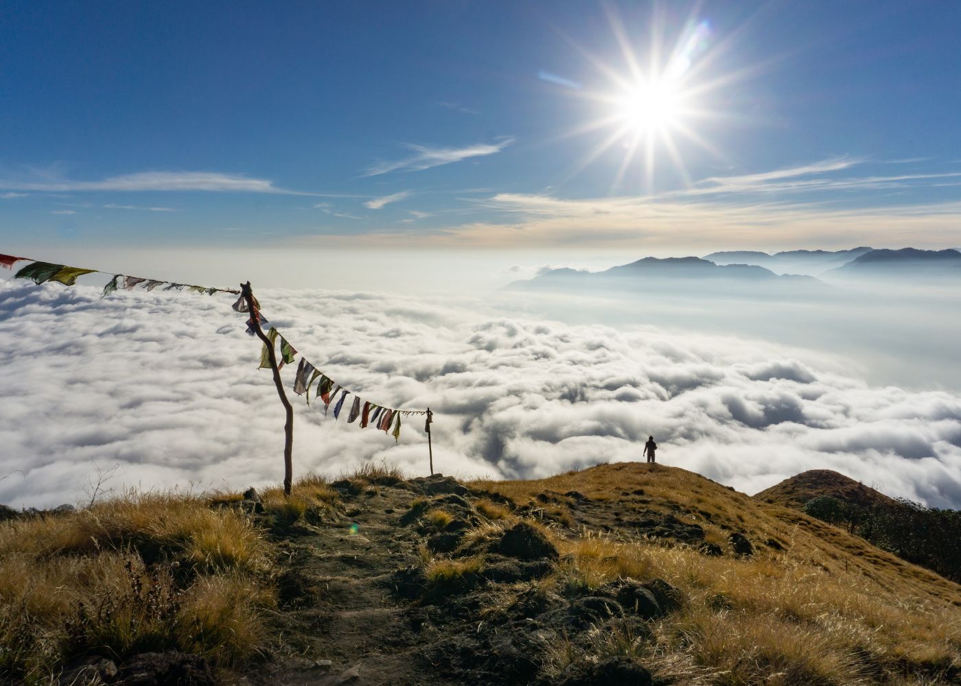
The Mardi Himal Trek delivers 4 primary highlights: an unobstructed close-range view of Machhapuchhre (6,993m) from High Camp (3,580m), 3 ecologically distinct forest zones below 3,200m, a high isolated ridge trail at 4,200m above valley cloud cover, and a direct Annapurna South (7,219m) panorama at sunrise. No other trekking trail originating from Pokhara reaches a 4,000m+ viewpoint within 3 days from the trailhead.
Which Mountain Views Stand Out on This Trail?
The Mardi Himal Trek places 6 Himalayan peaks within direct sightline from High Camp and the Upper Viewpoint:
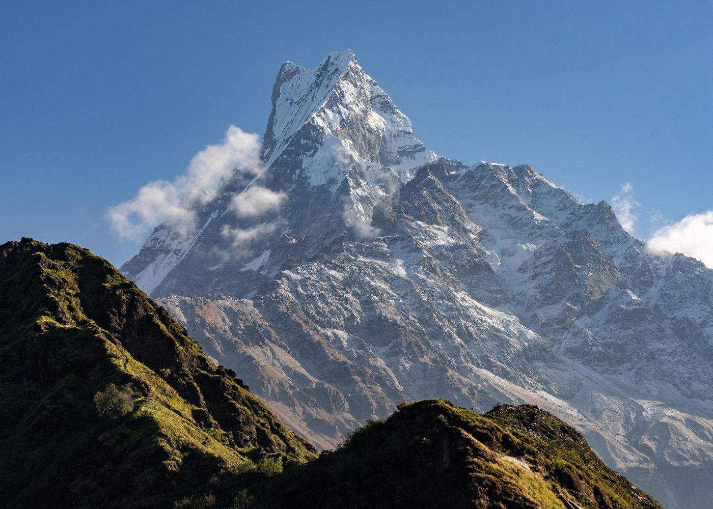
- Machhapuchhre (Fishtail) (6,993m) — the closest major summit to the trail, at approximately 8 kilometres horizontal distance from High Camp; its twin-peaked summit is the dominant landmark on the upper ridge
- Annapurna South (7,219m) — visible to the northwest, presenting the full southern face across the Modi Khola valley
- Hiunchuli (6,441m) — positioned southwest, identifiable by its steep triangular north face above the Annapurna Base Camp corridor
- Annapurna I (8,091m) — the 10th-highest mountain on Earth, visible behind Annapurna South on days with less than 20% cloud cover above 6,000m
- Annapurna III (7,555m) — visible to the north along the inner Annapurna range above the Marsyangdi valley
- Mardi Himal summit (5,587m) — the namesake peak, first summited by Jimmy Roberts in 1961; visible directly at close range from Base Camp (4,500m)
Machhapuchhre dominates the Upper Viewpoint sightline due to its proximity and isolation. The mountain's summit has been closed to all climbing expeditions under a 1957 Nepal government decree protecting its religious status as sacred to Shiva. The Mardi Himal ridge above 4,000m provides one of the few trekking positions in Nepal where Machhapuchhre is visible in close-range isolation without other summit structures occupying the foreground.
What Forests, Ridges, and Sunrise Spots Make It Special?
The Mardi Himal Trek crosses 3 distinct vegetation zones below 3,600m, each presenting a different trail environment:
Zone 1 — Subtropical forest (1,770m to 2,400m): Dense rhododendron, oak, and alder canopy. During March and April, approximately 15 rhododendron species bloom across this zone, including Rhododendron arboreum Nepal's national flower producing red, pink, and white canopies 8 to 15 metres above the trail.
Zone 2 — Temperate forest (2,400m to 3,150m): Bamboo, birch, and pine transition zone. Ground cover includes ferns, mosses, and seasonal wildflowers. Trail visibility drops in this closed-canopy zone, creating a forest-immersion experience distinct from the open ridgeline terrain above.
Zone 3 — Subalpine shrub (3,150m to 3,600m): Dwarf rhododendron, juniper, and low shrub community. The forest opens progressively, and the Mardi Himal ridge becomes visible approximately 2 kilometres before High Camp.
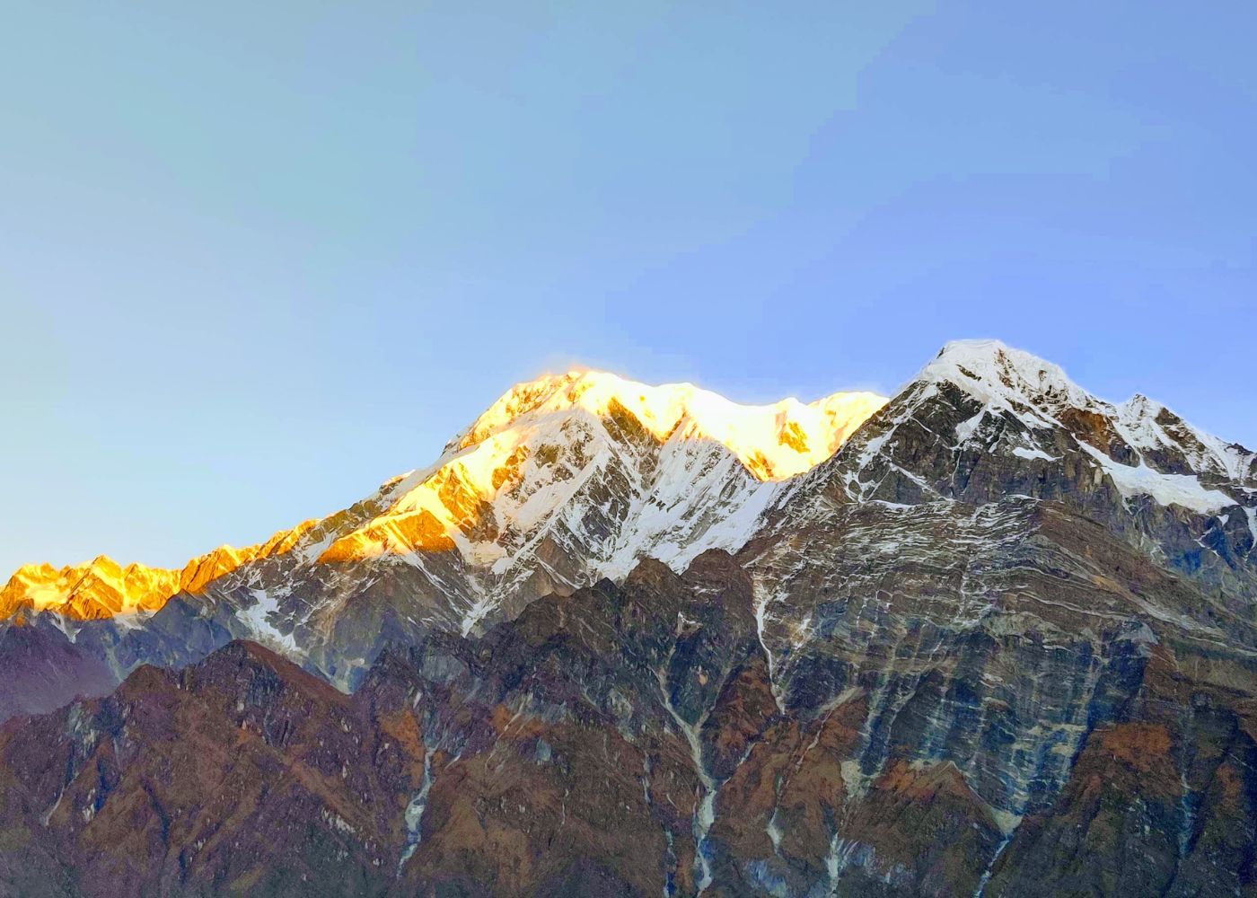
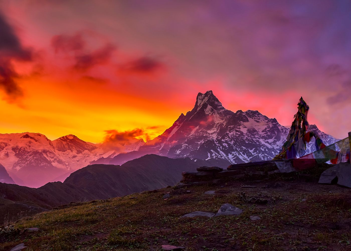
The best sunrise viewing position on the Mardi Himal Trek is the Upper Viewpoint at 4,200m. At sunrise in October (approximately 06:08 local time), alpenglow illuminates Machhapuchhre's east face first, followed by Annapurna South and the inner range within 12 to 16 minutes as the sun clears the eastern horizon above the Seti valley.
What Village and Teahouse Experiences Can You Expect?
The Mardi Himal Trek passes through or near 4 permanent villages: Lwang Ghalel (1,900m), Deurali (2,100m), Pitam Deurali (2,100m), and Siding (1,700m). These communities are predominantly Gurung in ethnicity, one of Nepal's major ethnic groups originating from the Gandaki Province highlands, with a documented history of Gurkha military service in the British and Indian armies dating to 1815.
Teahouses on the Mardi Himal route follow the ACAP-regulated teahouse format introduced across the Annapurna region in 1996. A standard room at a Mardi Himal teahouse costs NPR 300 to NPR 600 (~USD 2.25 to USD 4.50) per person per night in 2024, with mandatory meal purchase from the teahouse menu (a standard teahouse operating condition across ACAP-regulated trails).
The trail hosts 23 teahouses across 7 stages. High Camp has the highest concentration with 6 teahouses operating between September and November. During winter (December to February), teahouse availability drops to 8 to 10 operational lodges below 3,000m.
How Difficult Is the Mardi Himal Trek for Most Hikers?
The Mardi Himal Trek is rated moderate difficulty, accessible to trekkers with basic walking fitness and no prior Himalayan experience. The trail gains 2,430 metres over 22 kilometres of ascent across 3 to 4 days, with daily walking times of 4 to 6 hours per stage at a standard pace.
Is the Mardi Himal Trek Beginner-Friendly?
The Mardi Himal Trek is beginner-accessible under 4 conditions: the trekker carries no pre-existing altitude illness history, walks at the stage pace outlined in the standard itinerary, travels with a licensed guide, and carries layered cold-weather clothing above 3,000m.
The trail presents 3 technically simple terrain types:
- Maintained earthen trails below Forest Camp (2,550m)
- Stone-stepped trails between Forest Camp and High Camp (3,580m)
- Narrow ridge paths from High Camp to the Upper Viewpoint (4,200m)
No scrambling, fixed ropes, glacier crossings, or technical climbing sections exist on the standard route.
The beginner classification differs from easy. The trek demands 4 to 6 consecutive days of 4 to 6-hour walking at altitudes between 2,550m and 4,200m. A trekker completing this route for the first time without prior hill-walking experience above 2,000m experiences measurable physiological stress from altitude, reduced oxygen, and sustained cold, conditions that require physical preparation.
How Much Altitude Gain and Walking Should You Expect?
A standard 6-day Mardi Himal itinerary distributes 2,430 metres of total elevation gain across 4 ascending days:
- Day 1: Kande (1,770m) to Forest Camp (2,550m) — 780m gain, 9km, ~4 hours
- Day 2: Forest Camp to Low Camp (3,150m) — 600m gain, 4km, ~4 hours
- Day 3: Low Camp to High Camp (3,580m) — 430m gain, 4km, ~4 hours
- Day 4: High Camp to Upper Viewpoint (4,200m) and return — 620m gain and loss, 6km, ~4 hours
- Day 5: High Camp to Siding (1,700m) — 1,880m descent, 12km, ~6 hours
- Day 6: Siding to Pokhara — road journey, ~2 hours
Total walking distance across 6 days: approximately 55 kilometres. Total cumulative elevation gain: 2,430 metres. Total cumulative descent: 2,500 metres. The heaviest descent day is Day 5, a 1,880m single-day drop that places the highest demand on knee joints and leg muscle endurance.
Do You Need Acclimatization on This Trek?
The Mardi Himal Trek reaches the standard acclimatization threshold altitude of 3,000m on Day 2, with further gains to 3,580m on Day 3 and 4,200m on Day 4. The standard 6-day itinerary builds acclimatization time through pace distribution no single day ascends more than 780 vertical metres.
Acute Mountain Sickness (AMS) the symptom cluster triggered by rapid ascent above 2,500m, including headache, nausea, dizziness, and fatigue affects approximately 25% of trekkers who ascend above 3,500m without adequate acclimatization time. The Wilderness Medical Society defines a Lake Louise Score of 3 or higher (headache plus 1 additional AMS symptom) as the diagnostic threshold for AMS requiring intervention.
Trekkers presenting 2 or more AMS symptoms at High Camp descend immediately to Low Camp (3,150m), reducing altitude by 430 vertical metres. The standard treatment protocol at Low Camp includes complete rest, oral hydration at 3 to 4 litres per day, and clinical assessment for descent continuation.
What Trail or Weather Factors Make It Harder?
4 factors increase the Mardi Himal Trek's difficulty beyond baseline moderate:
- Monsoon trail conditions (June to September): Leeches colonize the forest trail below 3,000m; muddy surfaces increase slip risk by an estimated 40% on the steep sections between Kande and Forest Camp; cloud cover reduces mountain views to 0 to 2 clear hours per day
- Winter snowpack (December to February): Snow accumulation above 3,000m reaches 30 to 80 centimetres, requiring microspikes or crampons from High Camp upward; teahouse availability drops to 8 to 10 operational lodges below 2,500m
- Ridge wind exposure (year-round above 3,500m): The exposed ridge above High Camp channels westerly winds at 20 to 40 km/h average, with gusts reaching 70 km/h in post-monsoon October; wind chill drops effective temperature 8 to 12°C below ambient
- Trail width above High Camp: The ridge narrows to 0.5 to 1.5 metres from High Camp to Upper Viewpoint, with drop-offs of 200 to 400 metres on the eastern side; no safety railings or fixed ropes exist on this section
When Is the Best Time to Trek Mardi Himal?
The best time to trek Mardi Himal is October to November (post-monsoon autumn) and March to May (pre-monsoon spring). Autumn delivers the clearest mountain views, with visibility exceeding 80 kilometres on 70% of days. Spring adds rhododendron blooms across the 3 forest zones between 1,770m and 3,150m.
Why Are Spring and Autumn the Top Seasons?
Autumn (October to November) delivers the most reliable mountain view conditions on the Mardi Himal Trek. Post-monsoon skies clear over the Annapurna range within 2 to 3 weeks of the monsoon's retreat in late September. October daytime temperatures at High Camp average 5°C to 10°C, with nighttime temperatures at -5°C to 0°C.
Spring (March to May) produces the second-best trekking conditions. March and April mark the rhododendron bloom window across 15 species below 3,150m. Morning views remain clear on 60% to 70% of spring days before afternoon convection clouds obscure the lower peaks by 13:00 to 14:00.
3 measurable indicators confirm these 2 seasons as optimal:
- Average daily precipitation: 2.1mm in October vs. 6.8mm in July (Pokhara Meteorological Station data)
- Trail surface condition: dry to semi-dry for 90% of walking hours in October; wet or muddy for 60% of walking hours in July
- Mountain visibility window: 5 to 7 clear hours per day in October vs. 0 to 2 clear hours per day in August
What Should You Expect in Monsoon and Winter?
Monsoon season (June to September) reduces mountain visibility on the Mardi Himal trail by 60% to 75% compared to October. The Annapurna region receives 3,550mm of annual rainfall, with 80% concentrated in June through September. Pokhara records approximately 3,900mm of annual rainfall, the highest of any major city in Nepal.
Trail conditions during monsoon present 4 specific hazards:
- Leech density: 10 to 30 leeches per 100 metres of trail below Forest Camp (2,550m)
- Landslide risk: The steep sections between Kande and Deurali cross 3 historically active landslide zones that activate during sustained monsoon rainfall
- River crossings: The Siding descent route crosses 2 seasonal streams that carry flood-level water from July through September
- Trail erosion: Stone-stepped sections above Forest Camp lose 5 to 15 centimetres of surface annually during monsoon, creating uneven footing on the steeper pitches
Winter (December to February) reduces active teahouses to 8 to 10 lodges and restricts trail access above 3,500m without winter trekking equipment. Clear weather occurs on 80% of winter days, producing outstanding mountain views. Snowpack above 3,000m adds 2 to 4 hours to the High Camp ascent compared to the dry-season baseline.
How Do Clouds, Snow, and Trail Conditions Affect Views?
Mountain visibility on the Mardi Himal ridge depends on 3 atmospheric variables:
Cloud formation timing: Valley convection clouds form over the Modi Khola and Seti valleys by 10:00 to 11:00 in spring and 11:00 to 13:00 in autumn. Trekkers at High Camp or the Upper Viewpoint by 07:30 capture the full mountain panorama during the 3 to 5-hour clear window before cloud formation obscures the lower peaks.
Snow on the upper ridge: Fresh snowfall above 3,500m makes the trail from High Camp to Upper Viewpoint impassable without microspikes. Snow falls at High Camp an average of 12 days per year, concentrated in December through February. Trail snow typically clears within 48 to 72 hours of the final snowfall event in October and November.
Morning fog in the forest zone: Dense fog traps in the forest belt between 2,000m and 3,000m on 30% of mornings from November through March, reducing trail visibility to 10 to 30 metres for 1 to 3 hours after sunrise. Fog in this zone burns off as temperatures rise, clearing before most trekkers reach Low Camp by mid-morning.
What Permits, Costs, and Logistics Matter Most?
The Mardi Himal Trek requires 2 permits: an ACAP entry permit at NPR 3,000 (~USD 22.50) and a TIMS card at NPR 2,000 (~USD 15.00), both obtained in Pokhara. Total permit cost for a foreign national trekker stands at NPR 5,000 (~USD 37.50) as of 2024 Nepal Tourism Board and ACAP regulations.
Which Permits and Guide Rules Apply to This Trek?
The Mardi Himal Trek falls under the jurisdiction of 2 regulatory bodies:
ACAP (Annapurna Conservation Area Project): Established in 1986 under the National Trust for Nature Conservation (NTNC), ACAP manages the 7,629 km² Annapurna Conservation Area. The ACAP permit costs NPR 3,000 (~USD 22.50) per person and grants a single entry into the conservation area. ACAP checkpoints at Deurali and along the main ridge verify permits.
TIMS (Trekkers' Information Management System): Managed by the Trekking Agencies' Association of Nepal (TAAN), the TIMS card registers the trekker's identity, emergency contacts, and planned itinerary in the national trekking database. The card costs NPR 2,000 (~USD 15.00) for individual trekkers and NPR 1,000 (~USD 7.50) for trekkers booked through a registered Nepali agency.
Nepal's government introduced a mandatory licensed guide regulation for all designated trekking areas in April 2023. Under this regulation, all foreign nationals trekking in the Annapurna Conservation Area including the Mardi Himal Trail hire a guide licensed by the Nepal Tourism Board and registered with a trekking agency. Unguided trekking by foreign nationals in this corridor is not permitted under the 2023 regulation.
How Much Does the Mardi Himal Trek Usually Cost?
A complete 7-day Mardi Himal Trek budget for 1 foreign national trekker breaks into 6 cost categories. The following table presents the estimated cost breakdown for a 7-day Mardi Himal Trek in 2024, in Nepali Rupees (NPR) and US Dollars (USD).
|
Cost Category |
Budget Range (NPR) |
Budget Range (USD) |
|
ACAP Permit |
3,000 |
22.50 |
|
TIMS Card |
2,000 |
15.00 |
|
Licensed guide (7 days) |
21,000–28,000 |
157–210 |
|
Teahouse accommodation (6 nights) |
1,800–3,600 |
13.50–27 |
|
Meals (3 per day × 7 days) |
14,000–21,000 |
105–157 |
|
Transport (Pokhara–Kande–Siding–Pokhara) |
3,000–5,000 |
22.50–37.50 |
|
Total (budget range) |
44,800–62,600 |
335–470 |
|
Total (mid-range) |
62,600–95,000 |
470–712 |
Teahouse meal prices increase 30% to 50% at higher elevations. A dal bhat meal at High Camp (3,580m) costs NPR 800 to NPR 1,200 (~USD 6 to USD 9) compared to NPR 400 to NPR 600 (~USD 3 to USD 4.50) at Forest Camp (2,550m). This price gradient reflects the cost of porter-carried food supplies to altitude.
What Transport, Cash, and Teahouse Plans Should You Make?
3 logistics decisions determine the efficiency of the Mardi Himal Trek:
Transport: A private taxi from Pokhara Lakeside to Kande costs NPR 1,500 to NPR 2,000 (~USD 11 to USD 15) and takes 45 minutes. The local bus from Pokhara's Baglung Bus Park to Kande costs NPR 80 (~USD 0.60) and takes 1 hour 15 minutes with 1 route connection at Naya Pul or Lumle. The Siding return journey runs NPR 1,500 to NPR 3,000 (~USD 11 to USD 22.50) by shared jeep or private car.
Cash: The last ATM before the trail sits in Pokhara, no ATM or card payment facility exists anywhere on the Mardi Himal trail. Trekkers on a 7-day budget trek carry NPR 15,000 to NPR 25,000 (~USD 112 to USD 187) in cash, covering teahouse bills, meals, tips, and emergency expenses.
Teahouse reservation: Pre-booking teahouses is not standard practice on the Mardi Himal trail. Contacting High Camp teahouses directly is advisable for October peak season travel, as High Camp's 6 teahouses hold a combined total of approximately 60 to 80 beds capacity that fills during October's 3 busiest trekking weekends.
What Should You Pack and How Should You Prepare?
A Mardi Himal Trek packing list covers 4 systems: a layered clothing system for the -5°C to 25°C temperature range across 5 to 7 days, trekking footwear rated for muddy and rocky trails, sleeping equipment for teahouse stays above 3,000m, and a first-aid kit covering altitude illness response. Total packed weight for a 7-day teahouse trek stays between 8 and 12 kilograms.
Which Clothing and Gear Are Essential on This Route?
The Mardi Himal Trek spans a 25°C temperature variance between Kande (1,770m) and High Camp (3,580m) on the same day. A functional clothing system uses 4 layers:
- Base layer: Moisture-wicking synthetic or merino wool top and bottom, worn continuously above 3,000m; operating temperature range: 5°C to 20°C
- Mid layer: Fleece or down jacket rated to -5°C; essential from High Camp (3,580m) upward, particularly during pre-dawn departures for the Upper Viewpoint
- Shell layer: Waterproof and windproof jacket with hood; critical on the exposed ridge above 3,500m where sustained winds average 20 to 40 km/h
- Insulation layer: Down jacket rated to -10°C; worn during evenings and early mornings at High Camp where ambient temperatures drop to -5°C in October
Essential gear beyond clothing includes 8 specific items:
- Trekking boots with ankle support and Vibram or equivalent rubber sole the stone steps above 3,000m require lateral ankle stability that trail runners do not provide
- 2 trekking poles reduce knee joint load by 22% on steep descents, according to a 2009 study published in the Journal of Biomechanics by Schwameder et al.
- Headlamp with 200+ lumen output for pre-dawn departures from High Camp
- Sunscreen SPF 50+ ultraviolet radiation increases by approximately 10% per 1,000m of altitude gain above sea level
- 2-litre water carrying capacity (hydration pack or 2 reusable bottles)
- Sleeping bag rated to 0°C teahouse blankets are available at all stages but carry hygiene and insulation limitations at altitude
- Microspikes (rubber-attachment traction devices for trail footwear) for winter travel above 3,000m
- Oral rehydration salts (ORS) dehydration at altitude accelerates AMS symptom onset; ORS packets are available in Pokhara for NPR 30 to NPR 50 (~USD 0.22 to USD 0.37) each
How Should You Train and Plan for Altitude Safety?
A 6-week conditioning program prepares a sedentary trekker for the Mardi Himal Trek's daily 4 to 6 hours of continuous walking at altitude:
Weeks 1 to 2: 3 sessions per week of 45-minute brisk walking on flat terrain at 60% to 70% of maximum heart rate.
Weeks 3 to 4: 3 sessions per week of 60-minute uphill walking with 200 to 400m elevation gain per session. Introduce a loaded pack of 6 to 8 kg in Week 4.
Weeks 5 to 6: 2 extended sessions per week of 3 to 4 hours on varied terrain with full trek pack weight. Include 1 back-to-back walking day pair in Week 6 to simulate the multi-day fatigue accumulation of the trek.
Altitude safety planning includes 4 pre-trek decisions:
- Itinerary pacing: Select a 6-day or 7-day itinerary rather than a 5-day version; the additional stage night at Forest Camp or Low Camp reduces AMS risk by extending the altitude acclimatization gradient
- Diamox consideration: Acetazolamide (Diamox) a carbonic anhydrase inhibitor prescribed for AMS prevention is available at licensed pharmacies in Pokhara for NPR 300 (~USD 2.25) per 10-tablet strip; physician consultation is required before use, as contraindications include sulfa drug allergy and kidney disease
- Pre-trek health screening: Blood pressure assessment and basic fitness evaluation are available at Manipal Teaching Hospital (Pokhara) for NPR 1,500 to NPR 3,000 (~USD 11 to USD 22.50)
- Trekking insurance: Nepal trekking insurance with helicopter evacuation coverage costs USD 35 to USD 80 for a 7-day policy from providers including World Nomads and True Traveller; helicopter evacuation from High Camp costs USD 1,200 to USD 2,500 without insurance
What Mistakes Should First-Time Trekkers Avoid?
First-time Mardi Himal trekkers make 6 common mistakes that affect safety or trail success:
- Ascending too fast on Day 3: Moving from Low Camp (3,150m) to Upper Viewpoint (4,200m) in a single day bypasses the High Camp acclimatization night, increasing AMS probability by an estimated 35%
- Packing cotton clothing: Cotton retains moisture at altitude, dropping core temperature 3 to 5°C faster than synthetic or merino wool alternatives during wind exposure above 3,500m
- Carrying insufficient NPR cash: No ATM, no card payment, and no currency exchange facility exists beyond Pokhara; a 7-day trek requires NPR 15,000 to NPR 25,000 (~USD 112 to USD 187) carried in full from the city
- Starting the ridge section without wind protection: The High Camp to Upper Viewpoint segment crosses a fully exposed southwest-facing ridge; trekkers without a windproof shell layer experience effective temperatures 8 to 12°C below the ambient temperature reading
- Skipping permits in Pokhara: ACAP checkpoint staff below Deurali verify all permits; trekkers without valid ACAP and TIMS documents face on-trail fines of NPR 10,000 to NPR 30,000 (~USD 75 to USD 225)
- Treating altitude headache as fatigue: Headache at altitude is the primary early indicator of AMS; continuing ascent without addressing a persistent headache at High Camp risks progression to High Altitude Cerebral Edema (HACE), which carries a confirmed fatality risk without immediate descent and supplemental oxygen
How Should You Plan the Mardi Himal Trek with a Guide?
Planning the Mardi Himal Trek with a licensed Pokhara-based guide covers 5 logistics areas: permit procurement, itinerary design matched to the trekker's fitness level, daily trail pacing, teahouse communication in Nepali, and emergency response protocol. A registered agency consultation of 1 to 2 hours replaces 12 to 20 hours of independent pre-trek research and permit processing.
Can a Local Trekking Guide Help Plan the Mardi Himal Trek?
A licensed trekking guide registered with the Nepal Tourism Board and TAAN handles the 4 planning components that create the highest difficulty for independent foreign trekkers on the Mardi Himal route:
Permit processing: ACAP and TIMS permits require agency-side government portal registration. A registered Pokhara agency completes both permits in 1 working day, with a service fee of NPR 500 to NPR 1,000 (~USD 3.75 to USD 7.50) above the standard permit costs.
Teahouse network access: Licensed guides with Mardi Himal trail experience maintain direct phone contacts with High Camp teahouse owners. This enables same-day or 48-hour reservation confirmation during October peak season, a reservation channel unavailable to independent trekkers.
Real-time weather and trail reading: A guide familiar with the Mardi Himal ridge assesses valley cloud formation patterns from High Camp each morning and determines the optimal departure window for the Upper Viewpoint. Clear view time at 4,200m is a 2 to 5-hour daily window that shifts by 45 to 90 minutes depending on season.
Emergency coordination: A licensed guide contacts helicopter evacuation services directly and coordinates with ACAP checkpoint staff for rescue procedures. Average helicopter response time from High Camp to Pokhara Airport is 45 to 90 minutes under standard conditions.
What Should Readers Remember About the Mardi Himal Trek?
The Mardi Himal Trek delivers one of the 3 highest-density Himalayan view experiences accessible from Pokhara within 5 days of arrival from Kathmandu. The trail places 6 peaks including Machhapuchhre (6,993m), Annapurna South (7,219m), and Annapurna I (8,091m) into a single ridgeline sightline at altitudes between 3,580m and 4,200m.
5 defining characteristics distinguish the Mardi Himal Trek from the 8 other major trekking routes originating from Pokhara:
- Trailhead proximity: 28 kilometres from Pokhara city center the shortest road distance to a 4,000m+ ridge viewpoint in the Annapurna region
- Trail quietness: The Mardi Himal trail carried approximately 8,000 to 12,000 registered trekkers in 2023, compared to 90,000+ trekkers on the Annapurna Base Camp trail a 7:1 to 11:1 ratio of trail quietness per kilometre
- Machhapuchhre proximity: No other standard trekking trail in Nepal positions trekkers closer to the Machhapuchhre massif than the Mardi Himal ridge above 4,000m
- Ecological transition: The 3 vegetation zone transitions between Kande and High Camp represent one of the most compressed ecological gradients in the Annapurna Conservation Area subtropical forest to alpine shrub within 22 kilometres of ascent
- Accessibility: The NPR 5,000 (~USD 37.50) total permit cost, 23 operational teahouses across 7 stages, and mandatory guide structure make the Mardi Himal Trail the most logistically defined 4,000m+ ridge trek in the Pokhara trekking network.
Trekkers planning the Mardi Himal Trek begin in Pokhara with permit registration, guide confirmation, and a gear review 1 to 2 days before departing to Kande. The Mardi Himal Trail combines Himalayan ridge isolation, a 3-day forest ascent, and close-range access to Machhapuchhre, an experience profile unavailable on any other standard trekking route within the Annapurna Conservation Area.
