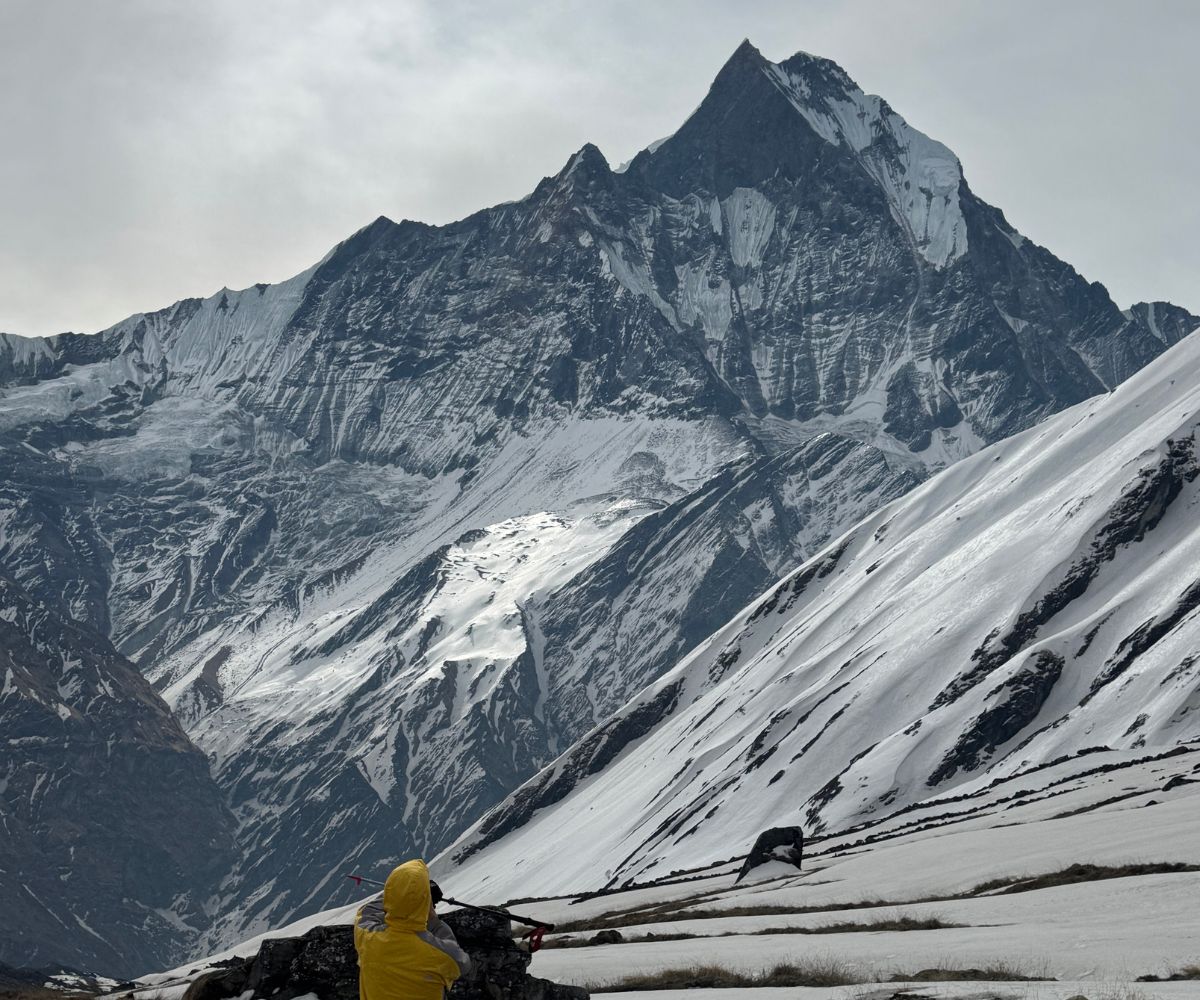
Monsoon trekking in Nepal offers a completely different Himalayan experience from the country's peak autumn and spring seasons. While heavy rainfall affects many lower-elevation trails between June and September, several high-altitude regions remain remarkably dry because they lie within the Trans-Himalayan rain shadow. These landscapes receive significantly less precipitation, allowing trekkers to enjoy clear mountain views, stable trail conditions, vibrant alpine scenery, and authentic cultural encounters at a time when most trekking routes are quiet. For experienced hikers and adventurous travellers, the monsoon season provides an opportunity to explore Nepal with fewer crowds, greener landscapes, and a more immersive connection to Himalayan communities.
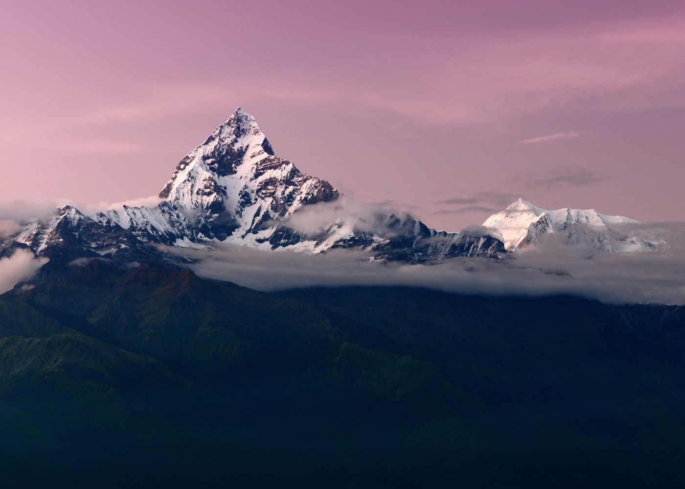
Choosing the best monsoon trek in Nepal depends on more than weather alone. Trek duration, altitude, physical difficulty, permit requirements, accessibility, budget, and the type of experience you want all influence which route is right for you. Some treks are renowned for their exceptional rain shadow conditions, while others reward trekkers with flourishing forests, remote monasteries, traditional villages, and spectacular mountain panoramas despite occasional rainfall. This guide compares the 10 best monsoon trekking routes in Nepal, highlighting their unique landscapes, cultural significance, seasonal advantages, challenges, and practical planning considerations so you can confidently select the trek that best matches your goals and experience level.
1. Upper Mustang Trek
Upper Mustang sits inside a full Himalayan rain shadow, making it Nepal's most dependable monsoon trekking destination. The Annapurna and Dhaulagiri massifs block monsoon clouds before they reach the plateau, keeping skies clear throughout June, July, August, and September. Elevation across the route ranges from 2,810m at Kagbeni to 3,840m at Lo Manthang, the ancient walled capital. The region requires a Restricted Area Permit costing USD 500 per person for 10 days, which limits annual visitors to approximately 2,000 trekkers. This permit restriction produces the solitude and cultural authenticity that no open-access Nepal trek replicates during monsoon season.
What Makes Upper Mustang Ideal During the Rainy Season?
Upper Mustang is the most reliable monsoon trek in Nepal because it sits inside a full rain shadow zone, receiving fewer than 300mm of rainfall annually, compared to 1,500mm in Kathmandu during the same period. The Annapurna and Dhaulagiri massifs intercept monsoon clouds, keeping the skies above Mustang clear from June through September.
Upper Mustang, historically known as the Kingdom of Lo, occupies a high-altitude plateau at elevations ranging from 2,810 metres at Kagbeni to 3,840 metres at Lo Manthang, the walled capital. Its landscape mirrors the Tibetan plateau: eroded canyons, ochre cliffs, and ancient cave dwellings carved into sandstone. The Kali Gandaki river, which carved the world's deepest gorge between Annapurna I (8,091m) and Dhaulagiri (8,167m), defines the trek's eastern boundary.
3 conditions make Upper Mustang exceptional during monsoon season:
-
Atmospheric clarity: Dust settles after the southern plains receive rain, producing sharper mountain views from Lo Manthang than during spring.
-
Cultural access: The Tiji Festival, a 3-day sacred masked dance ceremony in Lo Manthang, falls in May or June, making early monsoon the best window to witness living Tibetan Buddhist tradition.
-
Trail exclusivity: Upper Mustang requires a Restricted Area Permit (RAP) costing USD 500 per person for 10 days. This fee limits visitor numbers to approximately 2,000 trekkers per year, compared to tens of thousands on Everest Base Camp trails.
What most guides overlook: the wind in Upper Mustang peaks between 11:00 AM and 4:00 PM, often reaching 60–80 km/h. Experienced trekkers start at dawn, complete the day's mileage by midday, and use afternoons to explore villages, cave monasteries, or rest. Ignoring this wind pattern is the single most common mistake first-time Mustang trekkers make.
What Are the Major Highlights of the Trek?
The Upper Mustang trek covers 7 key landmarks that no other Nepal trek replicates:
-
Lo Manthang: The walled capital of the ancient Lo Kingdom, home to 4 active monasteries, the Lo King's palace, and approximately 1,000 permanent residents who maintain Tibetan customs unchanged for 600 years.
-
Luri Gompa: A 14th-century cave monastery containing tantric murals from the Sakya school of Tibetan Buddhism, set inside a natural rock amphitheatre at 3,600m.
-
Chhoser Caves: Ancient multi-storey cave dwellings accessible by wooden ladder, housing artefacts, manuscripts, and mummified human remains dating to the Iron Age.
-
Dhakmar Cliffs: Red-ochre cliff formations that glow orange at sunrise, surrounding a small village with one of the most photogenic teahouses on any Nepal trek.
-
Dhumba Lake: A stunning emerald lake near Jomsom in Lower Mustang that reflects the Himalayan horizon and Nilgiri peaks in the still morning hours.
-
Muktinath Temple: A sacred site at 3,800m venerated by both Hindus and Buddhists, marking the trek's southern terminus before descent to Jomsom.
-
Kali Gandaki Gorge: The trekking route follows sections of the world's deepest gorge, where shaligram fossils, ammonites sacred in Hindu tradition, erode from the riverbed.
How Difficult Is the Upper Mustang Trek?
Upper Mustang rates as a moderate trek at the Grade 3 level, requiring 14–17 days for the standard circuit. Daily walking distances average 15–20 km, with maximum trail altitude at Nyi La Pass (4,010m). No technical climbing is involved.
Fitness requirements: trekkers complete Upper Mustang with 4–6 weeks of cardiovascular conditioning, specifically uphill walking with a loaded pack. The primary challenge is not gradient but wind resistance, high altitude, and remote trail conditions.
Acclimatisation schedule: Kagbeni (2,810m) on Day 1, Chele (3,050m) on Day 2, Syangboche (3,800m) by Day 4, this 3-day elevation gain of 990m falls within the safe acclimatisation rate of 300–500m per day above 3,000m.
Permit requirements for 2026: the Upper Mustang RAP costs USD 500 per person for the first 10 days (USD 50 per additional day), plus a TIMS card and Annapurna Conservation Area Project (ACAP) permit. All permits require an accredited trekking agency, independent trekking is not permitted.
2. Nar Phu Valley Trek
Nar Phu Valley is a restricted Trans-Himalayan corridor that receives fewer than 200mm of rainfall during the entire monsoon period. The Himalayan ridges surrounding the valley create one of the strongest rain shadow effects in the Nepal Himalaya, delivering clear skies on roughly 85% of monsoon trekking days above 3,500m. Two primary villages, Nar at 4,110m and Phu at 4,080m, shelter Tibetan-origin communities who preserved their language, customs, and monastery traditions through near-complete geographic isolation until 2003. The valley connects to the Annapurna Circuit via Kang La Pass at 5,320m, making it possible to combine both routes within a single 18-day itinerary. A dedicated restricted area permit for Nar Phu Valley costs USD 75 per person per week during the monsoon season (December through August) and requires a registered Nepali trekking agency to obtain.
What Cultural and Natural Attractions Await in Nar Phu Valley?
Nar Phu Valley delivers the most concentrated cultural immersion of any monsoon trek in Nepal, combining a restricted Trans-Himalayan plateau community with 4 active gompas, 2 high passes exceeding 5,000m, and terrain that receives fewer than 200mm of rain during monsoon. The valley shelters two primary villages, Nar (4,110m) and Phu (4,080m), populated by Tibetan-origin communities who maintained near-complete isolation until the Nepalese government opened the area to trekkers in 2003.
4 natural and cultural attractions define the Nar Phu Valley experience:
-
Phu Gaon village: A fortress-like settlement of stone-walled houses at 4,080m, surrounded by fields of buckwheat and barley that glow bright green during monsoon. The village uses a traditional water-channel irrigation system unchanged for 700 years.
-
Kang La Pass (5,320m): The high crossing between Nar Phu Valley and the Annapurna Circuit, offering direct views across to Annapurna II (7,937m), Gangapurna (7,455m), and Pisang Peak (6,091m).
-
Ngawal Monastery: A 700-year-old Kagyu school monastery in Nar village, housing 23 monks and a library of hand-printed Tibetan scriptures.
-
Phu Glacier viewpoint: A one-hour detour from Phu village reveals an active glacier descending from Himlung Himal (7,126m), whose meltwater feeds the Phu Khola river below.
The valley's rain shadow effect is stronger than Mustang's due to higher enclosing ridges. Trekkers encounter clear blue skies 85% of monsoon days above 3,500m.
What Is the Trek Difficulty and Best Route?
Nar Phu Valley rates as a strenuous Grade 4 trek, requiring 14–18 days including the Annapurna Circuit entry and exit. The highest point, Kang La Pass at 5,320m, demands prior high-altitude experience above 4,500m.
The best monsoon route combines Nar Phu Valley with the Annapurna Circuit in a logical sequence:
-
Enter via Koto (2,600m) on the Annapurna Circuit's northern segment
-
Trek northeast 3 days to reach Phu (4,080m)
-
Spend 2 days in Phu and Nar villages
-
Cross Kang La Pass (5,320m) with a certified high-altitude guide
-
Descend to Ngawal (3,657m) on the Annapurna Circuit
-
Complete remaining Annapurna Circuit sections or exit via Manang
A restricted area permit specific to Nar Phu Valley costs USD 90 per person for the first week (USD 15 per additional day). The permit is not available for independent purchase, it requires a registered Nepali trekking agency to obtain.
3. Upper Dolpo Trek
Upper Dolpo occupies a high-altitude Trans-Himalayan plateau that borders Tibet and receives fewer than 250mm of annual rainfall. The region covers terrain between 3,800m and 5,115m, sheltering 35 active monasteries of the pre-Buddhist Bon religion alongside Nepal's largest national park, Shey Phoksundo, at 3,555 sq km. Phoksundo Lake, the deepest lake in the Dolpo region at 145 metres, anchors the trekking circuit and reflects the Kanjirowa Himal range on still monsoon mornings. The trek demands a minimum of 21 days and a full camping expedition, as teahouse infrastructure is absent above Ringmo village. Upper Dolpo holds one of Nepal's healthiest snow leopard populations, estimated at 50–80 individuals within the national park boundaries.
What Unique Landscapes and Experiences Does Upper Dolpo Offer?
Upper Dolpo presents Nepal's most remote trekking landscape: a high-altitude Trans-Himalayan plateau at 3,800–5,000m, bordering Tibet, featuring 35 active monasteries of the ancient Bon religion, and receiving fewer than 250mm of annual rainfall. The region gained international recognition through Peter Matthiessen's 1978 book The Snow Leopard and Eric Valli's 1999 film Himalaya, both set in Dolpo's Shey Crystal Mountain circuit.
5 landscape and experience features distinguish Upper Dolpo from every other Nepal trek:
-
Phoksundo Lake (3,611m): Nepal's deepest lake at 145 metres depth, with turquoise-blue water produced by high mineral content. The lake reflects Kanjirowa Himal (6,612m) on still mornings. It is the centrepiece of Shey Phoksundo National Park, Nepal's largest at 3,555 sq km.
-
Shey Gompa (Crystal Mountain): The sacred monastery at the base of Crystal Mountain, central to the Bon religion, one of Tibet's pre-Buddhist spiritual traditions. The autumn circumambulation pilgrimage draws hundreds of Dolpopa people annually; monsoon season is quieter and more intimate.
-
Kagmara La Pass (5,115m): A spectacular high pass in Lower Dolpo, offering 360-degree views across the Dhaulagiri massif and an adventurous alternative exit route.
-
Saldang village: A traditional Bon community of 400 residents at 3,770m, where residents maintain winter migration patterns to lower valleys, a pastoral tradition unchanged for 1,000 years.
-
Snow leopard habitat: Upper Dolpo holds one of Nepal's healthiest snow leopard populations, estimated at 50–80 individuals within the national park boundaries. Wildlife sightings occur year-round but most frequently in winter; monsoon season offers blue sheep sightings as herds descend to lower meadows.
Who Is Upper Dolpo Best Suited For?
Upper Dolpo is best suited for experienced trekkers with prior high-altitude experience above 5,000m, a minimum of 3 weeks available, and a tolerance for remote trail conditions including 4–6-day stretches without resupply points. This trek requires full camping equipment, a certified guide, and a porter-to-trekker ratio of at least 1:2.
Physical prerequisites for Upper Dolpo include: completion of at least 2 previous treks above 4,500m, cardiovascular fitness equivalent to running 10 km in under 70 minutes, and no history of severe altitude sickness (HACE or HAPE).
Permit costs for Upper Dolpo in 2026: USD 500 per person for 10 days (restricted area permit) plus Shey Phoksundo National Park entry fee of NPR 3,000. The total trek cost for a full camping expedition ranges from USD 3,500 to USD 6,000 per person, depending on group size and duration.
The monsoon window for Upper Dolpo runs from June 15 to September 15. This 90-day window offers the most stable weather, dried high-altitude trails, and full accessibility of all 5 high passes.
4. Lower Dolpo Trek
Lower Dolpo provides access to the Trans-Himalayan landscape of Dolpa district at a significantly lower permit cost than the upper valley, though it still strictly requires a Restricted Area Permit. The route begins at Juphal airport at 2,475m and reaches its highest point at Numa La Pass, elevation 4,535m. Phoksundo Lake, the centrepiece of Shey Phoksundo National Park, is accessible from Juphal in 3 walking days covering 55 km of trail. Basic teahouse accommodation exists along the primary route, removing the need for full camping gear while still demanding a sleeping bag rated to -10°C. The absence of restricted permits allows flexible group sizes and departure scheduling, making Lower Dolpo the most accessible entry point into the Dolpo trekking region.
What Are the Main Attractions of Lower Dolpo?
Lower Dolpo's 3 primary attractions are Phoksundo Lake, the Bon monastery circuit around Tarakot and Dunai, and the culturally active villages of Rohagaon and Tripurakot, all accessible without the restricted area permit required in Upper Dolpo. Lower Dolpo begins at Juphal airport (2,475m) in Dolpa district and covers terrain from 2,400m to 4,535m at Numa La Pass.
The Juphal–Phoksundo Lake route takes 3 walking days, covering 55 km through subtropical forest, rhododendron zones, and high alpine scrubland. The trail crosses 2 significant passes, Jang La (3,850m) and a secondary ridge at 3,400m, before descending to the lake's eastern shore.
Tathopani hot springs, located 8 km north of Dunai, offer natural geothermal pools at 38–42°C. They serve as the standard first-night campsite for trekking groups entering Dolpo from the south, and provide the most accessible hot spring experience in far-western Nepal.
How Does Lower Dolpo Compare With Upper Dolpo?
Lower Dolpo and Upper Dolpo differ across 5 measurable dimensions:
|
Factor |
Lower Dolpo |
Upper Dolpo |
|
Restricted Area Permit |
USD 20 per week |
USD 500 per 10 days |
|
Maximum altitude |
4,535m (Numa La) |
5,115m (Kagmara La) |
|
Trek duration |
12–16 days |
21–28 days |
|
Infrastructure |
Basic teahouses exist |
Full camping required |
|
Cultural intensity |
Moderate Bon influence |
Deep Bon/Tibetan heritage |
Lower Dolpo suits trekkers who want a genuine trans-Himalayan experience without the 28-day commitment or USD 500 permit cost of Upper Dolpo. The absence of restricted area permits also means Lower Dolpo allows more flexible departure schedules and smaller minimum group sizes.
The critical trade-off: Lower Dolpo's teahouse infrastructure is minimal and inconsistent. Carrying a sleeping bag rated to -10°C and a personal first aid kit is non-negotiable, even though the trek does not require full camping gear.
5. Langtang Valley Trek
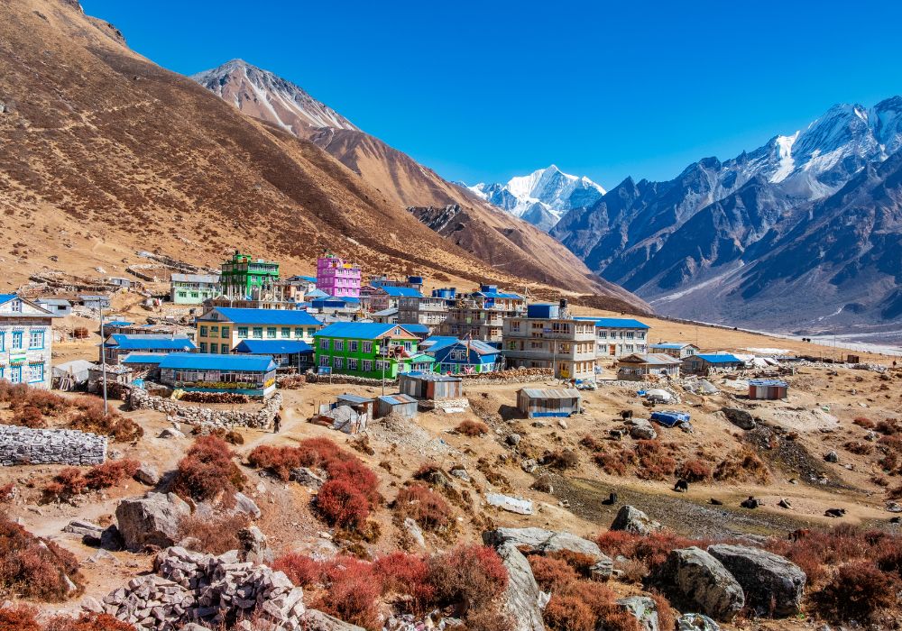
Langtang Valley is not a rain shadow destination, but its elevation range creates a distinct monsoon trekking window that most trekkers overlook. The valley climbs from 1,460m at Syabrubesi to 4,984m at Tserko Ri, with mornings above 3,500m typically clear before afternoon clouds build after 1:00 PM. Monsoon transforms the Kyanjin Gompa meadows at 3,870m into a wildflower field of 147 documented species, with yak herds moving to high pastures between 4,200m and 4,500m. The rebuilt Langtang village, reconstructed after the 2015 earthquake and rockslide, now operates 14 teahouses and a community-managed yak cheese factory. Trail congestion drops by approximately 90% compared to October, delivering a trekking experience that the peak season cannot match.
What Are the Benefits and Challenges of Visiting Langtang in Monsoon?
Langtang Valley during monsoon offers 3 measurable benefits, dramatically reduced trail congestion, vivid alpine meadows in full bloom, and access to the 7,227m Langtang Lirung base camp at minimal permit cost, offset by 2 primary challenges: afternoon rainfall above 3,500m and elevated landslide risk on the Syabrubesi approach road.
Langtang is not a rain shadow trek. The valley receives 1,200–1,500mm of rainfall annually, with monsoon delivering 60% of that total. However, Langtang's elevation range, 1,460m at Syabrubesi to 4,984m at Tserko Ri, means that mornings above 3,500m are typically clear, with afternoon clouds building after 1:00 PM.
The monsoon advantage in Langtang is ecological. The valley transforms between June and September: Kyanjin Gompa meadows (3,870m) fill with 147 documented wildflower species, yak herds move to high pastures at 4,200–4,500m, and the Langtang Glacier becomes more accessible due to lighter snowfall compared to spring.
The 2015 earthquake and subsequent rockslide destroyed Langtang village, killing 243 residents and trekkers. The rebuilt settlement at Langtang village (3,430m) now includes an earthquake memorial, 14 operational teahouses, and a community-managed cheese factory that produces yak cheese sold in Kathmandu, a direct income source for the 156 residents who returned after reconstruction.
Which Precautions Should Trekkers Take?
Trekkers visiting Langtang during monsoon observe 5 essential precautions:
-
Depart Syabrubesi by 7:00 AM: The Syabrubesi–Lama Hotel trail section crosses 3 landslide-prone gully crossings. Afternoon rainfall saturates these slopes between July and August.
-
Carry gaiters and waterproof trail shoes: The Lama Hotel to Langtang village section passes through dense rhododendron forest with trail depths exceeding 10cm of mud in wet conditions.
-
Check road conditions before travel: The Kathmandu–Syabrubesi road crosses the Trishuli River and Bhote Koshi River corridors, both subject to seasonal bridge closures and landslide blockages. Nepal Road Department (DoR) posts daily updates at road.gov.np.
-
Schedule acclimatisation at Kyanjin Gompa: The gain from Langtang village (3,430m) to Tserko Ri (4,984m) covers 1,554m in one day. Two nights at Kyanjin Gompa eliminate the acclimatisation deficit before summit attempts.
-
Carry a personal rain cover for trekking packs: Teahouses in Langtang provide inadequate pack storage. Wet sleeping gear above 4,000m creates genuine hypothermia risk when nighttime temperatures drop to 2–5°C.
6. Annapurna Circuit Trek
The Annapurna Circuit's northern segment, from Chame at 2,710m to Muktinath at 3,800m, sits inside the Annapurna rain shadow and receives 40–60% less precipitation than the circuit's southern sections during monsoon. Chame serves as the precise dividing line: trails east of Chame receive full monsoon rainfall, while trails west of Chame and through Manang stay predominantly dry. The Manang valley floor at 3,519m receives fewer than 4 rain days per month during peak monsoon, compared to 18–22 rain days in Besisahar at 760m. Trekkers who enter the circuit from Chame by road and exit at Jomsom by flight complete a 9-day monsoon-optimised itinerary that avoids the highest-rainfall sections entirely. The Thorong La Pass at 5,416m remains passable throughout monsoon with pre-dawn departures before cloud build-up begins.
Which Parts of the Route Stay Relatively Dry?
The northern Annapurna Circuit segments, Manang district from Chame (2,710m) to Thorong La Pass (5,416m), sit inside the Annapurna rain shadow, receiving 40–60% less precipitation than the circuit's southern sections during monsoon. The dividing point is Chame: east of Chame receives monsoon rainfall; west of Chame and north of the Manang valley floor stays predominantly dry.
The Annapurna Circuit's monsoon-season strategy splits the circuit into 2 distinct zones:
-
Rain shadow zone (Chame to Muktinath): 8 trekking days from Chame to Muktinath via Manang and Thorong La Pass. Precipitation averages 3–5 rain days per month during monsoon in this segment.
-
High-rainfall zone (Besisahar to Chame and Jomsom to Tatopani): Both the southern approach and the Jomsom descent receive full monsoon rainfall. Trail conditions in these sections include active waterfalls crossing paths, wet stone steps, and swollen river crossings.
The practical monsoon strategy: start the circuit from Chame by road (accessible from Kathmandu via Besisahar in 7–8 hours) and exit at Muktinath before descending to Jomsom for the flight to Pokhara. This modification covers 9 days of trekking and avoids the highest-rainfall sections entirely.
What Highlights Can You Expect Along the Way?
The Manang-focused monsoon circuit includes 6 defining highlights:
-
Pisang Peak (6,091m) base camp view: A 3-hour detour from Upper Pisang village delivers direct views of Pisang Peak's 1,200m south face and the Annapurna II (7,937m) east ridge.
-
Manang village (3,519m): The circuit's primary high-altitude hub, home to a teahouse economy of 47 registered lodges, a Himalayan Rescue Association (HRA) altitude sickness clinic, and daily acclimatisation briefings for permit holders.
-
Ice Lake (4,600m): A glacial lake above Manang, accessible as a 5–6 hour day hike, fed by meltwater from the Gangapurna Glacier. The lake sits at the exact elevation threshold where the rain shadow begins, producing sharp transitions from cloudy skies to clear blue overhead.
-
Thorong La Pass (5,416m): The circuit's highest point, passable year-round but optimally crossed between 4:00 AM and 9:00 AM to avoid afternoon cloud build-up. The pass delivers views of the Annapurna massif, Chulu East (6,059m), and on clear monsoon mornings, Dhaulagiri's northern face.
-
Muktinath Temple: A 3,800m sacred site hosting both Hindu and Buddhist shrines, featuring an eternal flame fed by natural methane gas seeping through rock, a geological phenomenon unique to this site in the Himalayan region.
-
Tilicho Lake (4,919m): A detour from the Manang–Thorong La route, accessible in 2 days from Manang. Tilicho sits at 4,919m and is the highest lake in the Annapurna region, reflecting the Tilicho Peak (7,134m) north face on still mornings.
7. Khopra Danda Trek
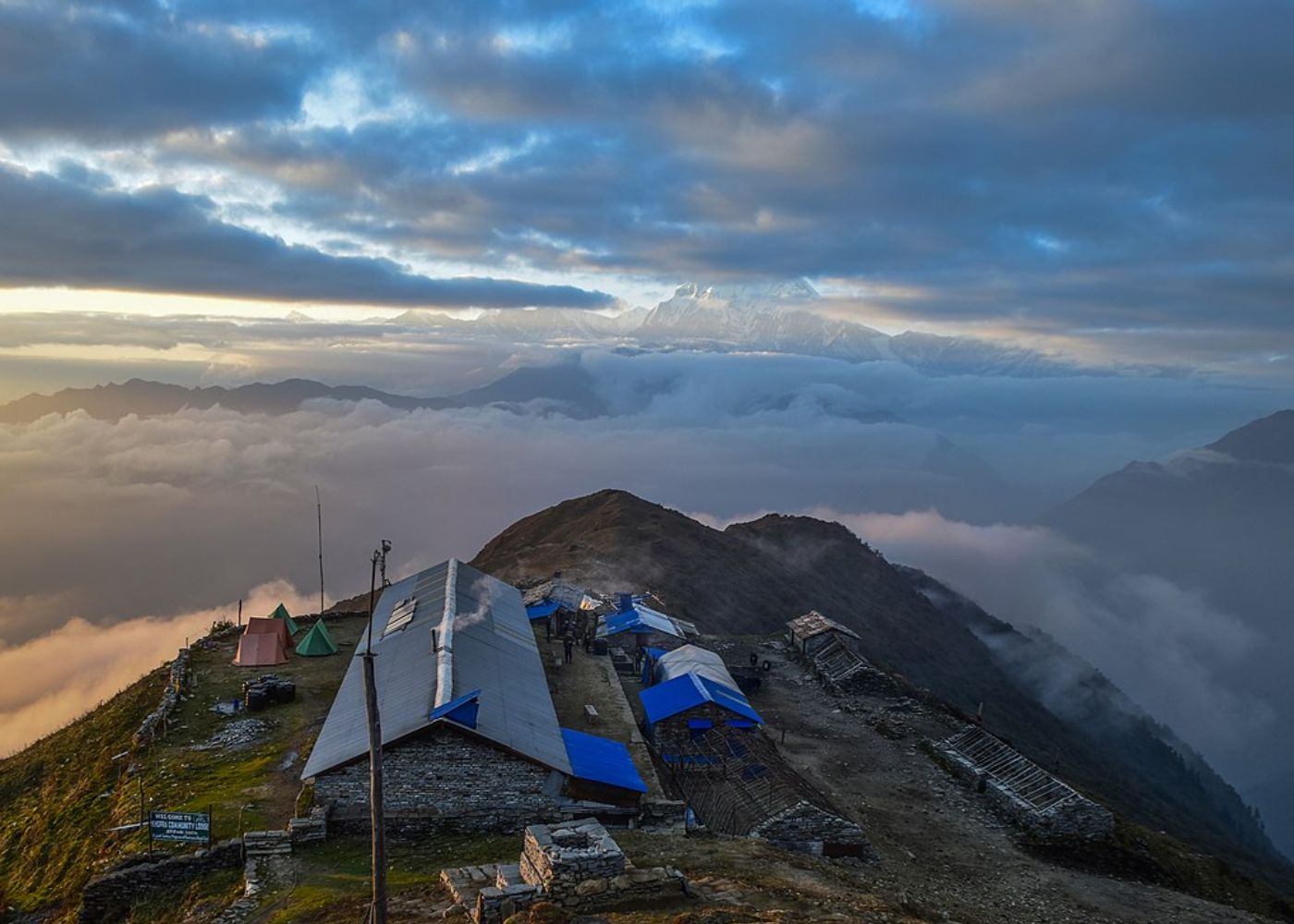
Khopra Danda is a ridge-top trek at 3,660m that delivers direct panoramas of Dhaulagiri I at 8,167m and Annapurna South at 7,219m from a community-managed trail network in the Annapurna Conservation Area. The ridge's elevation places trekkers above the main monsoon cloud layer for 3–4 morning hours each day, producing mountain views unavailable on lower-altitude treks in the same region. Six community lodges on the Khopra ridge opened in 2018 and are collectively managed by the Chhomrong Gurung community, channelling accommodation revenue directly to 4 Magar villages along the route. The trail reaches Khayer Lake at 4,500m, a sacred glacial lake holding spiritual significance for local Hindu communities, in 4 hours from the Khopra ridge. Entry from Ghorepani at 2,870m takes 2 days, making this a 10-day circuit achievable from Pokhara without restricted area permits.
What Scenic Views and Experiences Make It Special?
Khopra Danda delivers Dhaulagiri and Annapurna panoramas from a 3,660m community forest ridgeline, combining the cultural depth of Magar villages with a high-altitude lake circuit at Khayer Lake (4,500m), all within a 10-day itinerary that remains 70% accessible during monsoon. The trek operates on the Annapurna Conservation Area's community trail network, avoiding the lowest-elevation approach sections by entering from Ghorepani (2,870m).
Khopra Danda's monsoon advantage stems from its ridge-top positioning between 3,000m and 3,660m. At this altitude band, mornings deliver mountain views before monsoon clouds build after 11:00 AM. The approach from Ghorepani takes 2 days, placing trekkers on the Khopra ridge before dawn for unobstructed views of Dhaulagiri I (8,167m), Tukuche Peak (6,920m), and the Annapurna South (7,219m) face.
Khayer Lake (4,500m), located 4 hours above Khopra Danda community lodge, holds spiritual significance for local Hindu communities as the home of the deity Khayer Baba. The lake access trail passes through one of the highest rhododendron forests in the Annapurna region. During June and early July, lingering rhododendron blooms appear at 3,800–4,200m, 2 full months later than at lower elevations.
What most Khopra trekking guides fail to mention: the 6 community lodges on the Khopra ridge are Annapurna Conservation Area's most recently established teahouses, opened in 2018 and managed collectively by the Chhomrong Gurung community. Staying here directly channels tourism income to households in 4 Magar villages along the route, rather than to externally owned teahouse chains in Ghorepani or Tadapani.
8. Mohare Danda Trek
Mohare Danda is Nepal's only certified Community Homestay Trek, operating a 5-day ridge walk at 3,300m through old-growth rhododendron forest and Magar village communities. The route channels 100% of accommodation revenue to 6 Magar and Brahmin communities through the Mohare Community Homestay cooperative, funding 2 village schools and a seasonal medical post. The ridge delivers 360-degree views of 7 Himalayan peaks including Dhaulagiri I at 8,167m, Annapurna I at 8,091m, and Machhapuchhre at 6,993m, with morning clarity on 5–6 days out of 7 during June and September. Monsoon season reduces daily trail traffic to single digits, compared to 80–120 trekkers per day in October, producing a solitude quality unavailable on the Ghorepani circuit. The trail begins at Nayapul at 1,070m, the same trailhead as Ghorepani Poon Hill, but diverges southwest within the first hour to enter the less-trafficked Mohare forest corridor.
What Makes Mohare Danda Different From Other Short Treks?
Mohare Danda is Nepal's only certified Community Homestay Trek, offering a 5-day ridge walk at 3,300m with 360-degree views of 7 Himalayan peaks, including Dhaulagiri I (8,167m), Annapurna I (8,091m), and Machhapuchhre (6,993m), while channelling 100% of accommodation revenue to 6 Magar and Brahmin communities through the Mohare Community Homestay network.
Monsoon suitability: Mohare Danda sits between 2,600m and 3,300m, placing it at the upper boundary of the monsoon rainfall zone. Morning clarity is reliable 5–6 days out of 7 during June and September; July and August deliver 3–4 clear mornings per week on average, as documented by the Mohare Community Homestay cooperative's weather log.
3 features distinguish Mohare Danda from comparable short treks in the Annapurna region:
-
Community ownership model: Every lodge, homestay, and trail maintenance programme along the route is owned and operated by local residents. Trekking fees fund 2 village schools and a seasonal medical post.
-
Reachability: The trail starts from Nayapul (1,070m), the same trailhead as Ghorepani Poon Hill, but diverges southwest at Tikhedhunga, entering less-trafficked forest trails. The route reaches Mohare Danda ridge in 2 days without passing through any teahouse hubs.
-
Rhododendron density: The Mohare Danda trail passes through the densest concentration of old-growth rhododendron forest in the Annapurna foothills, with tree specimens exceeding 15 metres in height and 200 years in age. In June, lingering blooms at 2,800–3,100m extend the rhododendron season well beyond its spring peak.
9. Ghorepani Poon Hill Trek
Ghorepani Poon Hill is Nepal's most popular short trek, but monsoon season reduces its daily trail traffic by 90%, from 150–200 trekkers per day in October to 10–20 during June through September. Poon Hill summit at 3,210m delivers sunrise views of Dhaulagiri I at 8,167m, Annapurna I at 8,091m, and Machhapuchhre at 6,993m on approximately 35% of monsoon mornings, compared to 75% clarity during autumn season. The trail passes through Nepal's most photographed rhododendron forest between Ghorepani and Tadapani, which transforms during monsoon into a moss-covered, waterfall-active canopy that the dry season version of this trek cannot replicate. Teahouse accommodation rates in Ghorepani, Tadapani, and Chhomrong drop 20–30% during monsoon due to reduced demand. Leeches are active on shaded trail sections between 1,000m and 2,500m from late June to mid-September and are fully manageable with anti-leech socks available in Pokhara for NPR 150–200.
What Are the Advantages and Drawbacks of Visiting in the Rainy Season?
Ghorepani Poon Hill during monsoon season delivers 2 distinct advantages, lush rhododendron forest canopy and near-zero trail congestion, alongside 2 measurable drawbacks: reduced summit view frequency (clear sunrise views occur on approximately 35% of mornings from June to August) and active leech presence on the Ulleri–Ghorepani trail section below 2,500m.
Poon Hill (3,210m) earns its reputation from sunrise views of Dhaulagiri I (8,167m), Annapurna I (8,091m), and Machhapuchhre (6,993m). During monsoon, clouds typically clear on 2–3 mornings per 7-day period at the summit viewpoint. Trekkers who make this trek in July or August accept a probabilistic view, not a guaranteed one.
The advantages that most comparative guides understate:
-
Trail solitude: Ghorepani receives 150–200 trekkers per day during October and November, creating queues at the Poon Hill summit staircase. Monsoon season averages 10–20 trekkers per day, a 90% reduction. The Poon Hill sunrise experience in June or September is genuinely private.
-
Forest immersion: The Ghorepani–Tadapani traverse passes through Nepal's most photographed rhododendron forest. During monsoon, mosses and ferns cover every surface, waterfalls activate along the trail, and the forest atmosphere transforms into a dense, humid green canopy that the October version of this trek cannot replicate.
-
Accommodation value: Teahouses in Ghorepani, Tadapani, and Chhomrong drop room rates by 20–30% during monsoon season due to reduced demand, with some operators including breakfast in the base price.
The leech issue is real and manageable. Leeches are active between 1,000m and 2,500m from late June to mid-September on shaded, wet trails. Salt packets, anti-leech socks (available in Pokhara for NPR 150–200), and long trousers eliminate 95% of contact. Above Ghorepani (2,870m), leeches are absent.
10. Tsum Valley Trek
Tsum Valley holds 41 active mani walls, 12 functioning gompas, and 3 sacred lakes across a compact Trans-Himalayan corridor that receives partial rain shadow protection from the Ganesh Himal range. The valley's 4,500 permanent residents, the Tsumba people, speak a distinct Tibetan dialect and maintain Buddhist monastery traditions that have operated continuously for over 700 years. The route begins at Soti Khola at 700m and climbs 4,393m of total elevation to reach the upper valley near Mu Gompa at 3,700m over 7 trekking days. A Restricted Area Permit is required for the Tsum Valley starting from the Lokpa checkpoint, costing USD 30 per person per week during the monsoon season. The primary logistical constraint during monsoon: the Soti Khola approach road becomes impassable by vehicle between July 15 and August 31, requiring trekkers to enter from Machha Khola instead, a route adjustment that saves one walking day and avoids flood-prone gorge sections.
What Cultural and Spiritual Experiences Can You Expect?
Tsum Valley holds the highest concentration of sacred Buddhist sites per square kilometre of any Nepal trekking region, with 41 active mani walls, 12 functioning gompas, 3 sacred lakes, and the Milarepa Cave hermitage, all maintained by a population of 4,500 Tsumba people who speak a Tibetan dialect distinct from any other Nepalese community. The valley receives fewer than 400mm of monsoon rainfall due to partial rain shadow from the Ganesh Himal range.
4 cultural and spiritual experiences define the Tsum Valley trek:
-
Mu Gompa (3,700m): The valley's largest monastery, home to 108 resident monks practising Nying mapa school Tibetan Buddhism. Visitors attend morning puja sessions starting at 5:30 AM, consisting of chanted scripture, butter lamp offerings, and ceremonial horn (dungchen) performances.
-
Milarepa Cave: The meditation cave of the 11th-century Tibetan Buddhist saint Milarepa, located near Burji village at 3,300m. The cave contains hand and foot imprints attributed to Milarepa, preserved under glass. 12 active meditators use the surrounding caves on rotating 3-year, 3-month, 3-day retreat schedules.
-
Rachen Gompa: A nunnery of 60 nuns at 3,290m, founded in the 18th century, where visitors observe traditional thangka painting workshops and butter sculpture preparation for the annual Lha Phewa festival.
-
Shiar Khola river crossing: The river crossing on the route to Nile village serves as an informal boundary that most guided Tsum Valley treks do not cross. Crossing to Nile (3,361m) and Chhule (3,386m) reveals the valley's most intact Tsumba communities, accessible only to trekkers with a Restricted Area Permit.
How Challenging Is the Tsum Valley Trek?
Tsum Valley rates as a moderate-to-strenuous Grade 3–4 trek requiring 18–21 days, with a maximum elevation of 5,093m at Ngula Dhojhyang Pass and daily walking distances of 14–20 km on maintained stone trails. The trek begins from Soti Khola (700m) in the lower Budhi Gandaki valley and ascends 4,393m of total elevation gain over 8 trekking days to reach the upper valley.
Tsum Valley requires a Restricted Area Permit: USD 35 per person per week for the inner valley above the Mu Gompa checkpoint. The trail reaches Mu Gompa in 7 days from Soti Khola, with teahouse accommodation available at every night halt from Day 1 to Day 9.
A critical planning note for monsoon season: the Soti Khola approach road from Arughat Bazaar becomes impassable by vehicle between July 15 and August 31 due to Budhi Gandaki river flooding. Trekkers enter from Machha Khola by a 4-hour jeep ride instead of the full Arughat route, saving one trekking day and avoiding the flood-prone river gorge sections.
How Can You Choose the Best Monsoon Trek in Nepal for Your Adventure?
Selecting the right monsoon trek requires matching 4 personal variables, available time, fitness level, permit budget, and cultural preference, against each route's specific monsoon suitability score.
The decision framework works as follows:
-
Time available (7–10 days): Ghorepani Poon Hill, Khopra Danda, or Mohare Danda. All 3 complete within 10 days from Pokhara and require no restricted area permits.
-
Time available (14–18 days): Upper Mustang, Nar Phu Valley, Tsum Valley, or Langtang Valley. These routes deliver high-altitude rain shadow trekking or deep cultural immersion within a 3-week window.
-
Time available (21–28 days): Upper Dolpo or the full Annapurna Circuit with Nar Phu Valley extension. Both require advance permit procurement of 30–45 days for the restricted area paperwork.
-
Fitness level, moderate: Langtang Valley, Ghorepani Poon Hill, Mohare Danda, Lower Dolpo. Maximum altitude stays below 5,000m and daily distances average 15 km.
-
Fitness level, strenuous: Upper Mustang, Nar Phu Valley, Tsum Valley, Upper Dolpo. All 4 routes cross passes above 5,000m with daily walking distances of 18–25 km.
-
Priority: rain shadow reliability: Rank by certainty, Upper Mustang (98% dry monsoon days), Upper Dolpo (95%), Nar Phu Valley (90%), Lower Dolpo (80%), Tsum Valley (75%), Annapurna Circuit northern section (70%).
-
Priority: cultural depth: Tsum Valley → Nar Phu Valley → Upper Mustang → Upper Dolpo → Lower Dolpo → Mohare Danda.
-
Priority: budget: Ghorepani Poon Hill (no restricted permits, lowest cost) → Mohare Danda → Khopra Danda → Langtang Valley → Tsum Valley → Upper Mustang.
One factor to keep in mind regarding permits: Upper Mustang, Upper Dolpo, and Nar Phu Valley restricted area permits typically require 1–3 working days to process through Kathmandu's Department of Immigration once your agency submits the paperwork. Trekkers who arrive in Nepal without pre-arranged permits lose 1–2 weeks of their monsoon window. Apply for restricted area permits at least 45 days before the intended trek start date.
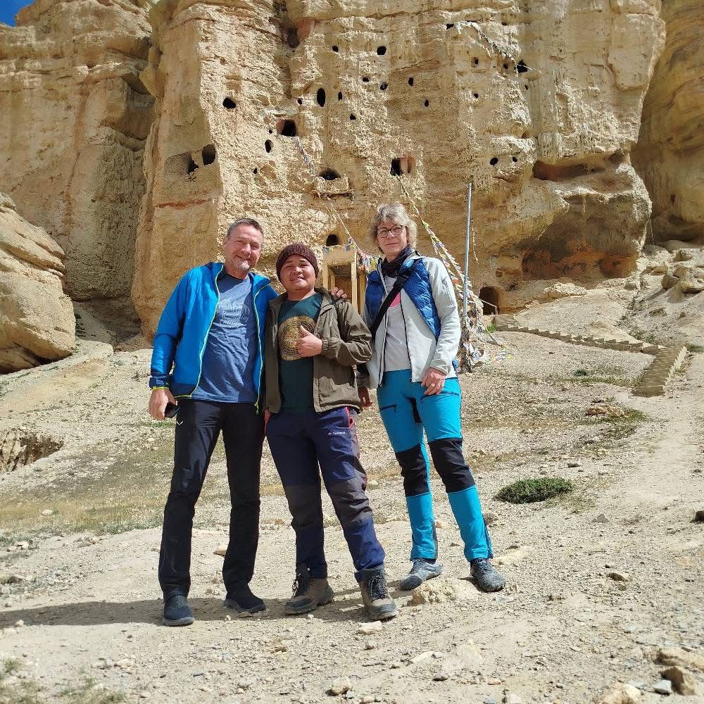
Can Nepal Intrepid Treks Help You Plan the Right Monsoon Trek?
At Nepal Intrepid Treks, we specialise in organising monsoon-season expeditions across all 10 routes covered in this guide. Our guides hold Trekking Guide Association of Nepal (TGAN) certification and carry field experience across a combined 120 monsoon seasons in the Trans-Himalayan belt.
We manage the full permit procurement process, including restricted area permits for Upper Mustang, Upper Dolpo, Nar Phu Valley, and Tsum Valley, with an average processing time of 9 working days. Our permit success rate across all restricted zone applications in 2025 was 100%.
For trekkers who want to trek the Annapurna region during monsoon, our team pre-books the Khopra Danda and Mohare Danda community lodges that fill quickly despite reduced overall traffic. Both community lodge systems operate first-come-first-served for non-partnered operators.
Our monsoon-specific packing lists, day-by-day weather pattern briefings, and acclimatisation schedules are included at no additional charge with every booking. We limit group sizes to 8 trekkers maximum on all restricted area routes to preserve the cultural sensitivity of the communities these treks enter.
Contact Nepal Intrepid Treks through our website to receive a personalised monsoon trek recommendation based on your dates, fitness background, and budget. Itinerary planning takes 48–72 hours; permit procurement begins immediately upon confirmation.
What Are the Key Takeaways About the Best Monsoon Treks in Nepal?
The 10 best monsoon treks in Nepal divide into 2 categories: rain shadow routes in the Trans-Himalayan belt (Upper Mustang, Nar Phu Valley, Upper Dolpo, Lower Dolpo) and conditionally accessible routes that reward early-morning departures and careful weather management (Langtang, Annapurna Circuit, Khopra Danda, Mohare Danda, Ghorepani Poon Hill, Tsum Valley).
6 key facts to carry into your planning:
-
Upper Mustang is Nepal's most reliable monsoon trek, with a rain shadow that delivers blue skies on more than 95% of trekking days between June and September.
-
Restricted area permits take 1–3 working days to process through Nepal's Department of Immigration, though it is best to finalize bookings with your agency a few weeks before departure.
-
Altitude is your best protection against monsoon rain: above 3,500m, rainfall duration and intensity drops significantly across all routes.
-
Morning departures before 7:00 AM eliminate 80% of the weather-related challenges on non-rain-shadow routes.
-
Leech presence is limited to 1,000–2,500m on shaded, wet trails, anti-leech socks and long trousers remove this as a practical concern.
-
Monsoon offers 30–50% fewer trekkers on all routes, delivering a solitude quality that the October and November seasons cannot match at any price.
Nepal's monsoon season is not a trekking obstacle. For the right routes and well-prepared trekkers, it is the best possible window to experience the Himalayan Trans-Tibetan world as it actually exists, without the crowds, without the dust, and with the mountains fully alive.
