The Mardi Himal Trek is one of the most scenic short Himalayan treks in Nepal, connecting Pokhara with the high alpine ridge below Mardi Himal Base Camp (4,500m) inside the Annapurna Conservation Area. The Mardi Himal Trek map explains the complete trekking route from Kathmandu and Pokhara through Kande, Dhampus, Deurali, Forest Camp, Low Camp, High Camp, Mardi Himal View Point, and the return trail via Sidhing Village and Lumre. The map combines route navigation, trekking stages, transport access, altitude checkpoints, elevation gain, and accommodation stops into a single planning guide for trekkers preparing for this Annapurna region journey. Trekkers use the route map and altitude chart to understand daily walking distances, identify major trail junctions, calculate altitude gain between camps, and safely plan acclimatization above 3,000m.
The Mardi Himal Trek route follows a ridge trail with panoramic views of Machhapuchhre (6,993m), Mardi Himal (5,587m), Himchuli (6,111m), Annapurna South (7,219m), and Annapurna I (8,091m). The trek rises from subtropical forest and Gurung villages below 2,000m to exposed alpine terrain above High Camp (3,550m), creating rapid elevation change across a relatively short trekking distance. The complete guide below explains the Mardi Himal Trek map in detail, including trekking distance, altitude profile, steep ascent sections, trail conditions, itinerary options, transport logistics, acclimatization strategy, accommodation facilities, seasonal weather, and navigation points that trekkers need before reaching Mardi Himal Base Camp.
What Does the Mardi Himal Trek Map Show?

The Mardi Himal Trek map shows a loop trekking circuit in the Annapurna region of Nepal, identifying altitude checkpoints, Himalayan peaks, transport modes, and a full altitude profile chart ranging from 822m at Pokhara to 4,500m at Mardi Himal Base Camp.
The map uses 5 distinct legend symbols: peak icons, road transport icons, trekking icons, flight route icons, and hotel/lodge icons. Each symbol marks the transport mode or accommodation type available at that specific location. The route is displayed as a single dark-blue looped path with numbered orange circle markers indicating the sequence of travel. An altitude chart at the bottom of the map plots 11 stations against their elevation in metres, providing a visual elevation profile of the entire trek. 3 mountain peaks, Himchuli (6,111m), Mardi Himal (5,587m), and Machhapuchhre (6,993m), are labelled with exact altitudes directly on the map.
Where Is the Mardi Himal Trek Located in Nepal?
The Mardi Himal Trek is located in the Kaski District of Gandaki Province, Nepal, within the Annapurna Conservation Area. The trek starts from Pokhara at 822m and ascends into the Mardi Himal ridge on the eastern flank of the Annapurna massif.
The Annapurna Conservation Area, managed by the National Trust for Nature Conservation of Nepal, is the largest protected area in Nepal at 7,629 sq km. Mardi Himal ridge forms the southeastern boundary of the Annapurna Sanctuary. The trek corridor runs between the Modi Khola river valley to the west and the Seti Khola drainage to the east. Pokhara, the gateway city, sits 200km west of Kathmandu by road and 25 minutes by flight.
How Far Is the Mardi Himal Trek From Pokhara?
The Mardi Himal Trek trailhead at Kande is 12km from Pokhara city, reached by a 30-minute jeep or bus ride. The trekking route from Kande to Mardi Himal Base Camp covers approximately 28km of uphill trail, gaining 3,678m of elevation across 3 to 4 days of ascent.
The route from Pokhara follows a road to Phedi (1,302m) or Kande (1,770m), where the trekking trail begins. The descent returns to Pokhara via Lumre (1,200m) and Sidhing Village (1,850m), completing a full loop of approximately 55km of total trail distance including both ascent and descent sections.
Which Mountains Can You See on the Mardi Himal Trek?
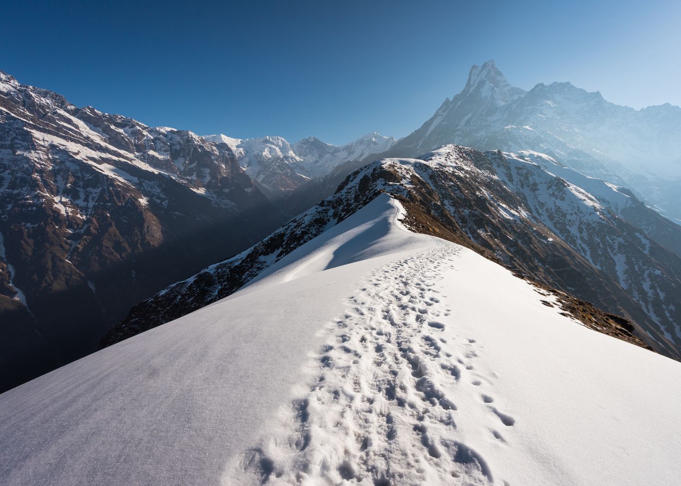
Trekkers on the Mardi Himal Trek see 3 major Himalayan peaks: Machhapuchhre at 6,993m, Himchuli at 6,111m, and Mardi Himal at 5,587m. The clearest panoramic views of all 3 peaks are visible from Mardi Himal View Point at 4,200m and High Camp at 3,550m.
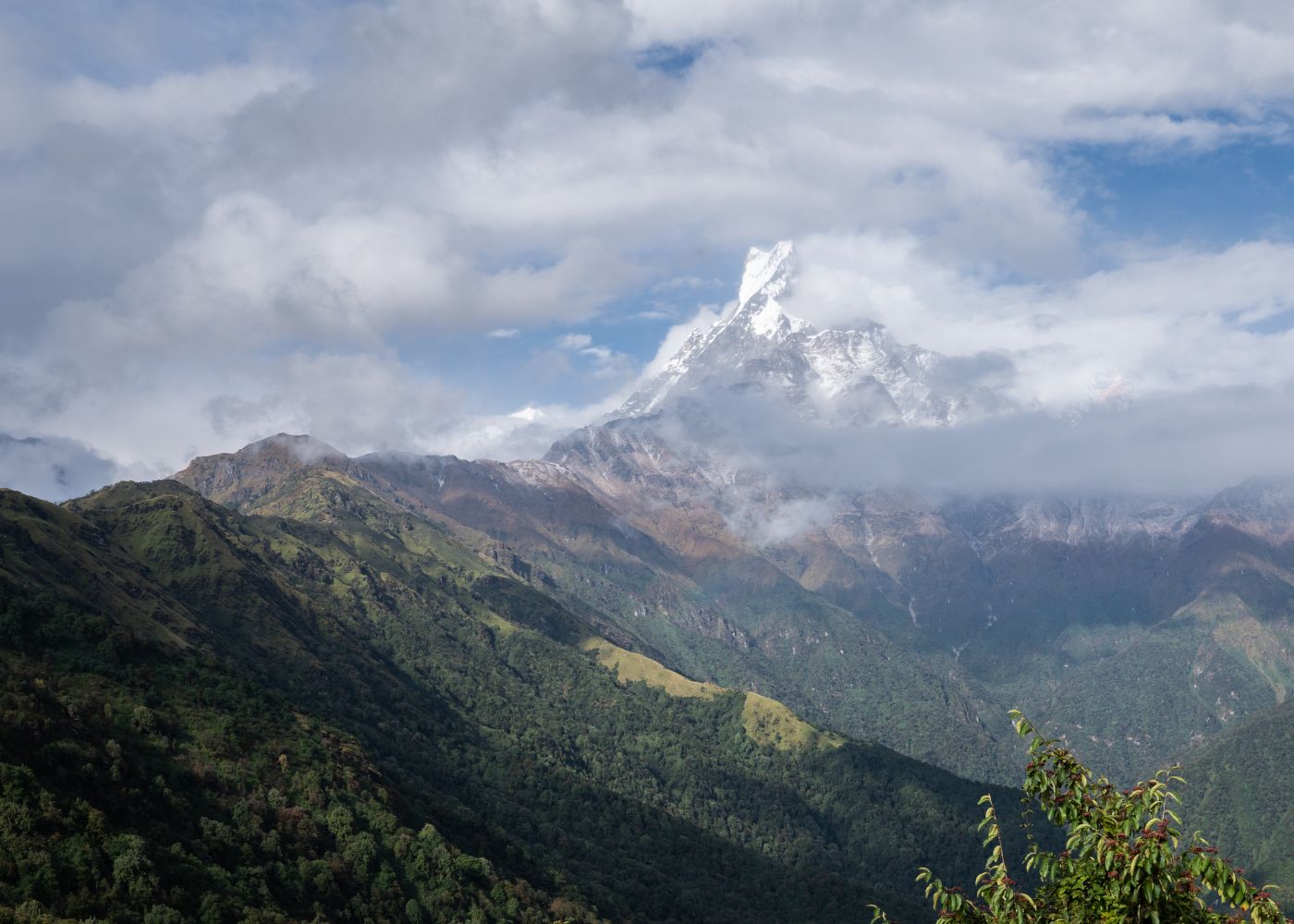
Machhapuchhre, also called Fishtail Mountain, is a sacred peak in the Annapurna massif located 26km north of Pokhara. It remains unclimbed due to its religious significance. Himchuli (6,111m) is a sub-peak of Annapurna South, visible to the northwest of the trail. Mardi Himal (5,587m) is the destination peak of this trek, sitting directly above the Base Camp at 4,500m. The unobstructed ridge trail above High Camp provides 270-degree views across the Annapurna range.
Why Is the Mardi Himal Trek Map Important for Trekkers?
The Mardi Himal Trek map is important because it provides 4 critical data layers for safe navigation: confirmed waypoint altitudes, route sequence with numbered markers, mountain identification with elevations, and transport mode indicators for each section of the journey.
Without the map, trekkers face 3 specific navigation risks: missing the trail junction at Deurali (2,150m) where the ridge path diverges from forest tracks, underestimating altitude gain from Low Camp (2,950m) to Base Camp (4,500m), a 1,550m climb, and failing to identify the descent route to Sidhing Village (1,850m), which differs from the ascent path. The altitude chart embedded in the map quantifies each climb segment, allowing trekkers to plan daily distance and rest schedules with accurate elevation data.
What Altitude Information Does the Trek Map Provide?
The trek map provides exact altitude readings for 14 locations, displayed both as inline labels on the route map and as a plotted altitude chart at the bottom of the map. Elevations range from 822m at Pokhara to 4,500m at Mardi Himal Base Camp.
The following table lists all 14 altitude checkpoints as marked on the Mardi Himal Trek map. Each altitude value is extracted directly from the map legend and altitude chart.
|
Station |
Altitude (m) |
Section |
|
Pokhara |
822 |
Start/End |
|
Phedi |
1,302 |
Road access |
|
Dhampus |
1,650 |
Day 1 |
|
Kande |
1,770 |
Day 1 |
|
Pothana |
1,990 |
Day 1 |
|
Deurali |
2,150 |
Day 1 |
|
Forest Camp |
2,600 |
Day 2 |
|
Rest Camp |
2,600 |
Day 2 |
|
Low Camp |
2,950 |
Day 2 |
|
Middle Camp (Badal Danda) |
3,250 |
Day 3 |
|
High Camp |
3,550 |
Day 3 |
|
Mardi View Point |
4,200 |
Day 4 |
|
Mardi Himal Base Camp |
4,500 |
Day 4 |
|
Sidhing Village |
1,850 |
Descent |
|
Lumre |
1,200 |
Descent |
The altitude chart plots the 11 main stations as a line graph, showing a continuous ascent from Pokhara (822m) to Mardi Himal BC (4,500m), followed by a sharp descent to Siding Village (1,850m) and Lumre (1,200m).
How Can the Map Help Prevent Trekking Mistakes?
The Mardi Himal Trek map prevents 4 common trekking mistakes: choosing the wrong trailhead, misjudging altitude gain between camps, missing the alternative descent route, and underestimating the High Camp to Base Camp distance.
The 3 most consequential navigation errors on this trek are identified below:
-
Trailhead confusion: Trekkers access the trail from either Kande (1,770m) by jeep or Phedi (1,302m) on foot. The map distinguishes both entry points with road transport icons, preventing trekkers from beginning 468m lower than necessary.
-
Altitude miscalculation: The 1,550m gain from Low Camp (2,950m) to Base Camp (4,500m) spans 2 days. Without the altitude chart, trekkers routinely attempt this section in a single day, increasing acute mountain sickness risk.
-
Descent route error: The descent path through Sidhing Village (1,850m) and Lumre (1,200m) uses a completely separate trail from the ascent route. The map's loop design clearly shows this divergence.
What Is the Complete Mardi Himal Trek Route?
The complete Mardi Himal Trek route covers 7 trekking stages from Kathmandu to Mardi Himal Base Camp and back to Pokhara, passing through 14 confirmed waypoints across 3 transport modes, flight, road, and foot trail.
The full route sequence runs in this order: Kathmandu (1,300m) → Pokhara (822m) by flight or 7-hour road → Phedi/Kande by local jeep → Dhampus (1,650m) → Pothana (1,990m) → Deurali (2,150m) → Forest Camp (2,600m) → Rest Camp (2,600m) → Low Camp (2,950m) → Middle Camp/Badal Danda (3,250m) → High Camp (3,550m) → Mardi Himal View Point (4,200m) → Mardi Himal Base Camp (4,500m) → descent via Sidhing Village (1,850m) → Lumre (1,200m) → Pokhara (822m). The total elevation gain from Pokhara to Base Camp is 3,678m.
How Do You Travel From Kathmandu to Pokhara?
Travelers reach Pokhara from Kathmandu by 2 transport modes: a 25-minute domestic flight or a 6–7 hour road journey by tourist bus or private vehicle. The map marks this section with a flight icon and dashed lines, indicating both options exist.
Domestic flights between Tribhuvan International Airport in Kathmandu and Pokhara Regional Airport depart multiple times daily. The one-way airfare averages NPR 5,000–8,000 (approximately USD 37–60). The road distance between Kathmandu and Pokhara is 204km via the Prithvi Highway (BP Highway). Tourist buses depart from Thamel, Kathmandu, and arrive at Baglung Bus Terminal in Pokhara. Private vehicle hire covers the same route in 5–6 hours.
How Do You Reach the Trek Starting Point From Pokhara?
Trekkers reach the Mardi Himal Trek starting point from Pokhara by local jeep or taxi to either Kande (1,770m) or Phedi (1,302m). The road journey from Pokhara to Kande takes 30 minutes and covers 12km on a paved highway. The map marks this section with a road transport icon between Pokhara and Phedi.
Kande serves as the higher trailhead at 1,770m, saving 468m of road-parallel walking compared to starting at Phedi (1,302m). Local jeep fares from Pokhara to Kande cost NPR 300–500 per person in shared transport or NPR 1,500–2,000 for a private vehicle. Taxis from Pokhara lakeside to Kande charge NPR 800–1,200. Dhampus (1,650m) is the first trekking village after Kande and is reached by 1 hour of uphill walking.
What Is the Route From Kande to Forest Camp?
The route from Kande (1,770m) to Forest Camp (2,600m) covers an 830m elevation gain across 3 intermediate villages: Dhampus (1,650m), Pothana (1,990m), and Deurali (2,150m). This section takes 5–6 hours of trekking on mixed forest and ridge trail.
The trail from Kande ascends 120m in 45 minutes to reach Dhampus (1,650m). From Dhampus, the path climbs 340m through rhododendron forest to Pothana (1,990m) in 1.5 hours. The trail continues 160m upward to Deurali (2,150m), a key junction point, in 45 minutes. From Deurali, the trail enters dense forest, gaining 450m over 2 hours to reach Forest Camp (2,600m). The trail passes Rest Camp (2,600m), also at 2,600m, which sits 30 minutes beyond Forest Camp on the same ridge line.
How Does the Trail Continue to Low Camp?
The trail from Forest Camp (2,600m) to Low Camp (2,950m) gains 350m of elevation along an exposed upper ridge trail above the treeline. This section takes 2–3 hours and marks the transition from forest canopy to open alpine terrain.
The trail exits Forest Camp heading north along the main Mardi Himal ridge. The vegetation changes from dense rhododendron forest to scrub and open grassland above 2,700m. Low Camp (2,950m) provides the first clear views of Machhapuchhre (6,993m) to the north. Trekking poles provide added stability on the narrow, exposed ridge sections between 2,600m and 2,950m.
What Is the Route From Low Camp to High Camp?
The route from Low Camp (2,950m) to High Camp (3,550m) climbs 600m along the open Mardi Himal ridge in 3–4 hours. Middle Camp at Badal Danda (3,250m) sits at the midpoint, 300m above Low Camp and 300m below High Camp.
The trail from Low Camp passes through Middle Camp (3,250m), locally called Badal Danda, meaning "cloud hill" in Nepali, in 1.5 hours. Middle Camp sits at the zone where cloud cover regularly forms in the afternoon. The final 300m climb from Middle Camp to High Camp (3,550m) takes 1.5–2 hours on a steep, rocky ridgeline. High Camp serves as the primary overnight stop before the summit push to Mardi Himal View Point and Base Camp.
How Do You Reach Mardi Himal View Point and Base Camp?
The route from High Camp (3,550m) to Mardi Himal Base Camp (4,500m) gains 950m in 3–4 hours, passing through Mardi Himal View Point (4,200m) at the 650m mark. This is the highest and most technically exposed section of the trek.
The trail from High Camp ascends above 3,550m on rocky terrain with minimal vegetation. Mardi Himal View Point (4,200m) is reached after 2–2.5 hours, offering unobstructed views of Machhapuchhre (6,993m), Himchuli (6,111m), and the Annapurna South face. From the View Point, the trail continues 300m upward to Mardi Himal Base Camp (4,500m) in 1–1.5 additional hours. The Base Camp at 4,500m sits directly below the Mardi Himal summit (5,587m). Trekking above 4,000m requires acclimatization and awareness of acute mountain sickness symptoms.
How Does the Return Route Pass Through Siding Village?
The return descent from Mardi Himal Base Camp (4,500m) to Pokhara (822m) follows a separate trail through Sidhing Village (1,850m) and Lumre (1,200m), completing the full loop shown on the map. This descent route differs entirely from the ascent path.
From Mardi Himal Base Camp, trekkers descend 1,650m to Sidhing Village (1,850m) via a southeast-facing trail in 4–5 hours. Sidhing is a Gurung community village with teahouse accommodation and local food. From Sidhing, the trail descends a further 650m to Lumre (1,200m) in 2 hours. Lumre connects to the road network, where local vehicles return to Pokhara (822m) in 30–40 minutes. The total descent elevation from Base Camp to Pokhara spans 3,678m.
What Are the Major Stops on the Mardi Himal Trek Map?
The Mardi Himal Trek map identifies 14 major stops, each with confirmed altitude readings. The 6 primary overnight stops on the standard itinerary are Dhampus (1,650m), Deurali or Forest Camp (2,600m), Low Camp (2,950m), High Camp (3,550m), Mardi Himal Base Camp (4,500m), and Sidhing Village (1,850m).
Each stop serves a distinct function in the trekking itinerary. Dhampus provides a mid-altitude acclimatization night. Forest Camp or Rest Camp at 2,600m allows trekkers to adapt to forest-altitude conditions. Low Camp at 2,950m transitions trekkers to subalpine terrain. High Camp at 3,550m is the final lodge stop before alpine terrain. Base Camp at 4,500m is the turnaround point for non-climbers. Sidhing Village provides a comfortable descent campsite before the road return to Pokhara.
What Can Trekkers Expect at Dhampus?
Dhampus (1,650m) is a Gurung village with 12–15 teahouses, a permanent population of approximately 400 residents, and direct views of Machhapuchhre (6,993m). Dhampus is the first established trekking settlement on the Mardi Himal route, located 1 hour above Kande trailhead.
The village occupies a terraced hillside with stone-paved lanes and traditional Gurung architecture. Teahouses offer dal bhat, noodles, omelettes, and lodge accommodation with private or shared rooms. Room rates at Dhampus range from NPR 200–500 per night, with meals priced at NPR 300–600 per plate. Dhampus is also a point on the Australian Camp trek circuit, making it a frequently serviced location with reliable facilities year-round.
Why Is Deurali an Important Stop on the Route?
Deurali (2,150m) is the primary trail junction on the Mardi Himal Trek where the ridge path to Forest Camp diverges from other forest routes. This junction at 2,150m requires accurate navigation to avoid joining the wrong trail into the Modi Khola valley.
Deurali means "mountain pass" in Nepali, referencing its position on the ridge crest. Teahouses at Deurali provide meals and basic accommodation for trekkers who complete the Dhampus–Deurali section as a day stage. The junction is marked with a signboard indicating the Mardi Himal trail heading northeast. The trail ascending to Forest Camp and beyond is narrower and less trafficked than the main Poon Hill or ABC trails that also pass through this zone.
What Facilities Are Available at Forest Camp?
Forest Camp (2,600m) has 4–6 teahouses offering accommodation, meals, and basic medical supplies. The camp sits inside dense rhododendron forest at 2,600m altitude, the same elevation as Rest Camp located 30 minutes further along the ridge.
Teahouses at Forest Camp provide single and double room accommodation on wooden or stone-built lodges. Meals include standard trekking fare: dal bhat, pasta, soups, and hot beverages. Solar power supplies electricity at most lodges. Water sources at Forest Camp come from filtered stream water or boiled drinking water at NPR 100–150 per litre. Forest Camp serves as the standard overnight stop for Day 2 of the classic 7-day Mardi Himal Trek itinerary.
What Is Low Camp Known For?
Low Camp (2,950m) is known as the first above-treeline camp on the Mardi Himal Trek, offering 360-degree ridge views including the first unobstructed sightline to Machhapuchhre (6,993m) from the northern side. Low Camp sits 350m above Forest Camp and 600m below High Camp.
The camp consists of 3–5 teahouses positioned directly on the open Mardi Himal ridge. Vegetation at this altitude is limited to alpine grasses and small shrubs. Wind exposure increases significantly above 2,800m on this ridge, making adequate windproof clothing essential from this point onward. Low Camp receives fewer trekkers than High Camp, giving it a quieter overnight atmosphere with direct early-morning mountain views unobstructed by cloud.
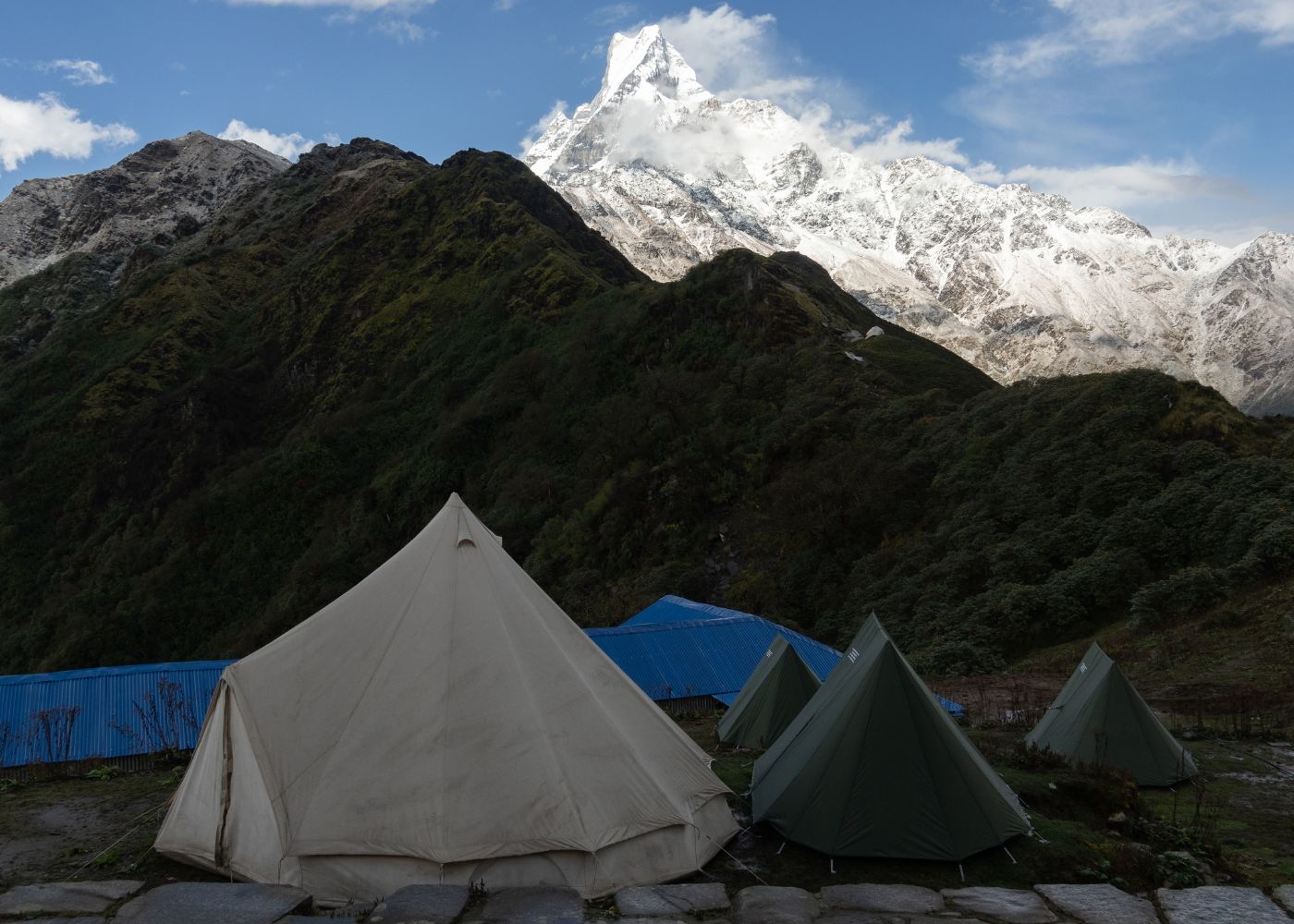
What Makes High Camp the Main Overnight Stop?
High Camp (3,550m) is the main overnight stop because it provides the highest lodge accommodation on the Mardi Himal Trek, immediate access to the summit trail toward the View Point (4,200m) and Base Camp (4,500m), and the most comprehensive panoramic views of the Annapurna range available from a lodge location.
High Camp has 6–8 teahouses, more than any other camp above 3,000m on the route. Facilities include dormitory and private rooms, hot shower service, and electricity from solar charging. The lodge positions on the open ridge produce unobstructed views of Machhapuchhre (6,993m), Himchuli (6,111m), Annapurna South (7,219m), and Mardi Himal (5,587m) at sunrise. Most trekkers depart High Camp at 5:00–6:00 AM to reach Mardi Himal View Point at sunrise and return before afternoon cloud cover reduces visibility.
What Can You See From Mardi Himal View Point?
Mardi Himal View Point (4,200m) delivers panoramic views of 5 confirmed Himalayan peaks: Machhapuchhre (6,993m), Himchuli (6,111m), Mardi Himal (5,587m), Annapurna South (7,219m), and Annapurna I (8,091m). The View Point sits 650m above High Camp and 300m below Mardi Himal Base Camp.
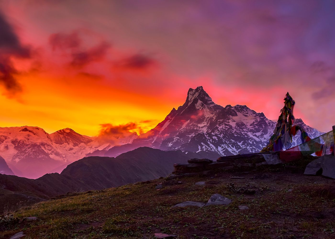
The View Point is the highest accessible photography position on the trek for trekkers without mountaineering equipment. On clear mornings between October and December and between March and May, the Annapurna massif is fully visible without cloud obstruction. Machhapuchhre's iconic double-summit silhouette is directly north of the View Point. The View Point also provides a direct sightline into the Mardi Himal glacier system above Base Camp (4,500m).
What Does the Mardi Himal Trek Altitude Chart Explain?
The Mardi Himal Trek altitude chart is a line graph plotting 11 trekking stations on the x-axis against altitude in metres on the y-axis, displaying the complete elevation profile from Pokhara (822m) to Mardi Himal Base Camp (4,500m) and the descent to Lumre (1,200m).
The chart uses numbered orange circle markers identical to those on the main route map, creating direct correspondence between map position and altitude data. The y-axis increments in 500m intervals from 0 to 4,500m. The chart shows a clear ascending curve from Pokhara to Base Camp followed by a steep descending curve through Siding Village and Lumre. The steepest section of the line graph appears between High Camp (3,550m) and Base Camp (4,500m), representing a 950m gain in a single day.
How Does the Elevation Change Throughout the Trek?
The elevation on the Mardi Himal Trek changes in 3 distinct phases: an ascent phase from 822m to 4,500m, a summit phase at Base Camp, and a descent phase from 4,500m to 1,200m before road return to Pokhara.
The ascent phase covers 3,678m of elevation gain across 6–7 stages. The steepest daily gain occurs between High Camp (3,550m) and Mardi Himal Base Camp (4,500m), a 950m rise in 3–4 hours. The flattest elevation section spans Forest Camp and Rest Camp, both at 2,600m. The descent phase drops 3,300m from Base Camp to Lumre (1,200m) across 2 stages. The total round-trip elevation change, ascent plus descent, is 7,178m accumulated altitude gain.
Which Sections Have the Steepest Altitude Gain?
The 3 steepest altitude gain sections on the Mardi Himal Trek are: High Camp to Base Camp (950m gain), Low Camp to High Camp via Middle Camp (600m gain), and Forest Camp to Low Camp (350m gain). All 3 sections are clearly visible as the steepest line segments in the altitude chart.
The High Camp to Base Camp section climbs 950m in 3–4 hours, averaging 238m per hour, the highest gain rate on the route. The Low Camp to High Camp section gains 600m across Middle Camp (Badal Danda at 3,250m), averaging 150–200m per hour over 3–4 hours. The Forest Camp to Low Camp section gains 350m in 2–3 hours across open ridge terrain above 2,600m. Acclimatization rest days are recommended at either High Camp or Low Camp before pushing toward Base Camp.
How Can Trekkers Avoid Altitude Sickness on This Route?
Trekkers avoid altitude sickness on the Mardi Himal Trek by limiting daily altitude gain to 300–400m above 3,000m, spending 2 nights at High Camp (3,550m) before ascending to Base Camp (4,500m), and descending immediately when 3 or more acute mountain sickness symptoms appear.
Acute mountain sickness (AMS) symptoms include headache, nausea, dizziness, fatigue, and loss of appetite. The standard acclimatization protocol for this route involves resting at High Camp on Day 3 before the summit push on Day 4. Diamox (acetazolamide) at 125–250mg twice daily reduces AMS risk when prescribed by a physician before departure. The descent from Base Camp (4,500m) to Sidhing Village (1,850m) resolves mild AMS symptoms within 3–6 hours due to the 2,650m altitude reduction.
How Many Days Does the Mardi Himal Trek Take?
The Mardi Himal Trek takes 5 to 8 days to complete, depending on the selected itinerary length, acclimatization days, and starting point. The standard recommended itinerary covers 7 days including travel from Kathmandu and return.
The 5-day version compresses the route by combining Dhampus–Deurali on Day 1 and Low Camp–High Camp on Day 3, with no acclimatization rest day. The 7-day standard version includes 1 acclimatization rest day at High Camp and a separate transit day in Pokhara. The 8-day extended version adds a rest day at Low Camp or Forest Camp for a more gradual altitude gain. The actual trekking distance from Kande to Base Camp and back to Lumre is approximately 55km of foot trail.
What Is the Standard Mardi Himal Trek Itinerary?
The standard 7-day Mardi Himal Trek itinerary covers 7 distinct stages from Kathmandu arrival to Pokhara departure. Each stage is defined by its start and end point with confirmed altitude data from the map.
The 7 stages are structured as follows:
-
Day 1: Kathmandu (1,300m) to Pokhara (822m) by flight or road
-
Day 2: Pokhara to Dhampus (1,650m) or Deurali (2,150m) via Kande trailhead
-
Day 3: Deurali (2,150m) to Forest Camp (2,600m) or Low Camp (2,950m)
-
Day 4: Low Camp (2,950m) to High Camp (3,550m) via Middle Camp (3,250m)
-
Day 5: High Camp (3,550m) to Mardi Himal Base Camp (4,500m) and return to High Camp
-
Day 6: High Camp (3,550m) descent to Sidhing Village (1,850m) via Lumre (1,200m)
-
Day 7: Pokhara (822m) to Kathmandu (1,300m) by flight or road
Can the Trek Be Completed in Shorter or Longer Routes?
The Mardi Himal Trek offers 3 route length options: a 4-day short version starting from Kande, a 7-day standard version including Kathmandu transit, and a 10-day extended version combining the Mardi Himal route with sections of the Australian Camp or Poon Hill circuit.
The 4-day short version is accessible directly from Pokhara without Kathmandu transit and omits the View Point push, ending at High Camp. The 7-day standard version covers the full loop as shown on the map, including Base Camp. The 10-day extended version connects the Mardi Himal ridge with the Ghorepani–Poon Hill circuit via Deurali, adding Ghorepani (2,853m), Poon Hill (3,210m), and Ulleri (1,960m) to the itinerary.
What Is the Difficulty Level of the Mardi Himal Trek?
The Mardi Himal Trek is rated moderate difficulty, requiring 5–7 hours of daily walking on steep ridge trails, with altitude exposure reaching 4,500m at Base Camp. The trek falls between easy teahouse treks like Ghorepani (3,210m) and demanding high-altitude routes like Thorong La (5,416m) on the Annapurna Circuit.
The 3 primary difficulty factors are: altitude gain rate (up to 950m in a single day between High Camp and Base Camp), exposed ridge trail sections between 3,000m and 4,500m with limited shelter from wind, and navigation complexity at the Deurali junction where 3 trail options diverge. The trek does not require technical climbing equipment, fixed ropes, or prior mountaineering experience. Physical fitness for 6–8 hours of uphill walking is the primary prerequisite.
Is Mardi Himal Trek Suitable for Beginners?
The Mardi Himal Trek is suitable for fit beginners with prior walking experience, provided they follow the 7-day itinerary with an acclimatization day at High Camp and carry appropriate trekking gear for 4,500m altitude. It is not suitable for untrained beginners attempting the 4-day compressed version.
Beginner trekkers completing this route for the first time benefit from 4 specific preparations: 3–4 weeks of pre-trek cardio training covering 5–8km uphill walks, familiarity with altitude sickness symptoms and first response, hiring a licensed guide for the Deurali junction and High Camp sections, and booking teahouse accommodation in advance during peak season (October–November and March–April).
What Trail Conditions Should Trekkers Expect?
Trekkers encounter 4 distinct trail surface types on the Mardi Himal Trek: stone-paved village paths from Kande to Deurali, forest dirt trail from Deurali to Low Camp, exposed rocky ridge from Low Camp to High Camp, and loose alpine scree from High Camp to Base Camp.
The stone-paved sections below 2,000m provide stable footing. Forest trail sections between 2,150m and 2,950m become muddy after monsoon rain from June to September. The ridge trail above 3,000m is exposed to wind, with unstable stone surfaces requiring trekking poles for descent safety. The scree section above 4,000m approaching Base Camp involves loose rock requiring careful foot placement. Snow appears on trail sections above 3,500m from December to February, requiring microspikes or crampons.
Which Season Offers the Best Trekking Experience?
The 2 best seasons for the Mardi Himal Trek are October–November and March–May. October and November deliver the clearest mountain views, stable weather, and dry trail conditions following the monsoon season. March–April delivers rhododendron blooms at 2,000–3,000m and reliable morning visibility.
October temperatures at High Camp (3,550m) range from −3°C at night to 12°C at midday. November temperatures drop to −8°C at night and 7°C at midday at High Camp. March brings daytime temperatures of 8–14°C at High Camp and −5°C at night. December–February brings heavy snow above 3,500m, reducing trekker numbers and closing some teahouses. June–September monsoon season brings rain, leeches below 2,500m, and reduced visibility, though the trail remains open.
What Should You Pack for the Mardi Himal Trek?
Trekkers pack 3 essential equipment categories for the Mardi Himal Trek: technical trekking gear for 4,500m altitude, clothing layers for −8°C to 15°C temperature variation, and personal health and documentation items. Total pack weight excluding water ranges from 8 to 12kg for the 7-day itinerary.
The Mardi Himal Trek requires gear appropriate for both subtropical forest sections below 2,000m and exposed alpine ridge above 4,000m. Packing decisions are determined by the temperature range of 23°C differential between Pokhara (minimum 15°C) and High Camp (minimum −8°C in October).
Which Trekking Gear Is Essential for This Route?
The 8 essential trekking gear items for the Mardi Himal Trek are: trekking poles (2 units), a 40–50L trekking backpack, a sleeping bag rated to −10°C, trekking boots with ankle support, a headlamp with spare batteries, a hydration system with 2L capacity, a first aid kit with Diamox and blister treatment, and trekking gaiters for snow sections above 3,500m.
Trekking poles are particularly critical on the descent from Base Camp (4,500m) to Sidhing Village (1,850m), where 2,650m of knee-loading descent occurs over 5–6 hours. Sleeping bags rated to −10°C provide adequate warmth at High Camp, where teahouse rooms reach 2–5°C at night. Headlamps are required for the pre-dawn 5:00 AM departure from High Camp to catch sunrise at Mardi Himal View Point (4,200m).
What Clothing Is Recommended for High Altitudes?
Trekkers wear a 4-layer clothing system for altitudes above 3,500m on the Mardi Himal Trek: a moisture-wicking base layer, a mid-layer fleece (250–300 weight), a down insulation jacket (600–800 fill power), and a waterproof windproof outer shell. This system manages the 23°C temperature differential between Pokhara and High Camp.
The 4 key clothing items for the above-treeline sections (3,000–4,500m) are: insulated gloves, a wool or synthetic beanie covering ears, thermal leggings under trekking trousers, and UV-protective sunglasses with category 3–4 lenses. Sun intensity at 4,200m elevation increases ultraviolet exposure by 40% compared to Pokhara at 822m, making sunscreen SPF 50+ and sun-protective lip balm essential daily applications.
How Should You Use a Mardi Himal Trekking Guide for Planning?
A Mardi Himal Trek map is used for planning in 5 specific steps: identifying the complete route sequence using numbered orange markers, reading the altitude chart to calculate daily elevation gain, locating accommodation icons to identify lodge-available stops, confirming transport modes for the Kathmandu–Pokhara and Pokhara–Kande sections, and cross-referencing camp altitudes with acclimatization protocols.
The map functions as the primary planning document for 3 trekking decisions: selecting an entry point (Kande at 1,770m vs Phedi at 1,302m), determining the number of nights at each camp based on the altitude chart profile, and choosing the exit route (descend via Siding Village and Lumre vs retracing the ascent trail). Trekkers combine the map with a 7-day itinerary schedule to allocate rest days and calculate daily walking times accurately.
Can a Local Trekking Guide Improve Navigation and Safety?
A licensed local trekking guide reduces navigation risk at 3 critical junctions on the Mardi Himal Trek: the Deurali trail fork (2,150m), the Badal Danda cloud zone (3,250m) with reduced visibility, and the Sidhing Village descent junction off the main ridge. Each of these points requires accurate directional knowledge to avoid joining a wrong trail.
Local guides certified by the Nepal Tourism Board provide 4 documented safety benefits: real-time weather assessment above 3,500m where conditions change within 2 hours, altitude sickness monitoring and emergency descent decisions, pre-arranged teahouse accommodation connections that reduce full-lodge-denial risk during peak season, and cultural interpretation of Gurung and Magar villages along the route. Porter hire is separate from guide hire, with standard rates set by the Trekking Agencies Association of Nepal (TAAN) at NPR 800–1,000 per porter per day.
What Are the Key Takeaways From the Mardi Himal Trek Map?
The Mardi Himal Trek map delivers 5 primary planning insights: a confirmed 14-checkpoint route from Pokhara (822m) to Base Camp (4,500m), an integrated altitude chart showing a 3,678m total ascent, a loop route design with separate ascent and descent trails, 3 identified Himalayan peaks visible from the route, and transport mode indicators covering all 3 journey phases.
The Mardi Himal Trek map encodes route structure, altitude data, transport logistics, and accommodation availability in a single reference document. Trekkers who study all 4 data layers of the map, route sequence, altitude chart, transport icons, and peak labels, arrive at each camp with accurate elevation expectations, reducing altitude sickness risk and navigation errors. The trek from Pokhara to Mardi Himal Base Camp and back to Pokhara represents one of Nepal's most complete ridge-line trekking experiences, combining teahouse comfort below 3,550m with alpine exposure above 4,000m, all documented in the confirmed map route shown in this guide.
