Mardi Himal Trek altitude is the elevation progression from Kande at 1,770 m to the Upper Viewpoint at 4,200 m on a short high-altitude ridge trek in Nepal’s Annapurna Conservation Area. The route gains 2,730 m across 7 main camps, moving from forested lower slopes to exposed alpine terrain above High Camp. Mardi Himal Trek elevation matters because each camp changes the physical effort, oxygen availability, sleeping altitude, and acclimatization demands on the body.
This guide breaks down the full Mardi Himal altitude profile, including camp-by-camp elevations, daily altitude gain, the steepest climbing sections, and the highest point on the standard route. It also explains where Acute Mountain Sickness (AMS) risk begins, how 4-day, 5-day, and 6-day itineraries affect acclimatization, and how weather, snow, wind, and season make the upper mountain feel harder. Trekkers comparing camps, planning a safer ascent, or judging whether the 4,200 m Upper Viewpoint fits their experience level will find the key altitude facts, risk points, and pacing strategies in one place.
What Is the Mardi Himal Trek Elevation Profile?
The Mardi Himal Trek elevation profile spans 7 camps from 1,770 m to 4,200 m, covering a total ascent of approximately 2,730 m and a total descent of 2,730 m on a return route, distributed across a northeast-facing ridge above Pokhara.
The Mardi Himal Trek is a short-distance, high-altitude trekking route in the Annapurna Conservation Area (ACA), Kaski District, Gandaki Province, Nepal. The route begins at Kande, a road-accessible trailhead at 1,770 m, and terminates at the Upper Viewpoint at 4,200 m. The ridge gained during this trek is the southeast ridge of Mardi Himal (5,587 m), a satellite peak of Annapurna massif.
The elevation profile divides into 3 distinct zones:
-
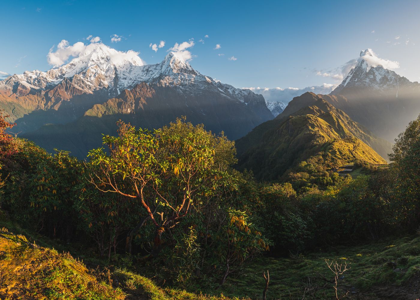
Lower zone (1,770 m – 2,550 m): Kande to Forest Camp, rhododendron and oak forest, moderate gradient
-
Middle zone (2,550 m – 3,580 m): Forest Camp to High Camp, mixed terrain with open ridgeline exposure
-
Upper zone (3,580 m – 4,200 m): High Camp to Upper Viewpoint, exposed alpine terrain above treeline
How Does Altitude Change From the Trailhead to the Viewpoint?
Altitude on the Mardi Himal Trek increases by 2,730 m from Kande (1,770 m) to Upper Viewpoint (4,200 m), advancing through 7 camps in a northeast direction along the Mardi Himal ridge.
The trailhead at Kande sits at 1,770 m above sea level. Pothana (1,890 m) marks the first 120 m gain. Pitam Deurali (1,990 m) adds another 100 m. Forest Camp at 2,550 m represents a 560 m gain from Pitam Deurali. Low Camp at 2,985 m adds 435 m. Badal Danda at 3,210 m adds 225 m. High Camp at 3,580 m adds another 370 m. The Upper Viewpoint at 4,200 m represents the final 620 m gain from High Camp.
The following table shows the camp-by-camp altitude progression along the Mardi Himal Trek route, from the trailhead to the highest point. Each row lists the camp, its elevation, and the gain from the previous stop.
|
Camp |
Elevation (m) |
Gain from Previous Camp (m) |
|
Kande (Trailhead) |
1,770 |
— |
|
Pothana |
1,890 |
120 |
|
Pitam Deurali |
1,990 |
100 |
|
Forest Camp |
2,550 |
560 |
|
Low Camp |
2,985 |
435 |
|
Badal Danda |
3,210 |
225 |
|
High Camp |
3,580 |
370 |
|
Upper Viewpoint |
4,200 |
620 |
The Upper Viewpoint (4,200 m) delivers the steepest single-day gain on the entire route. Trekkers ascending from High Camp (3,580 m) cover 620 m of vertical in 3 to 4 hours on summit day.
Which Sections Have the Steepest Daily Elevation Gain?
The steepest section on the Mardi Himal Trek is the High Camp to Upper Viewpoint leg, gaining 620 m in a single push on summit day. The second steepest section is Pitam Deurali to Forest Camp, gaining 560 m across dense forest terrain.
The 3 steepest daily gains on this route are:
-
High Camp (3,580 m) to Upper Viewpoint (4,200 m): 620 m gain in 3–4 hours
-
Pitam Deurali (1,990 m) to Forest Camp (2,550 m): 560 m gain in 3–4 hours
-
Low Camp (2,985 m) to Badal Danda (3,210 m) and onward to High Camp (3,580 m): 595 m combined gain over one long day or split across 2 days
The lower sections between Kande, Pothana, and Pitam Deurali gain only 100–120 m each, making them trail warm-ups rather than altitude challenges.
How Much Altitude Do Most Trekkers Gain Each Day?
Most trekkers on the Mardi Himal Trek gain between 400 m and 600 m per day across the middle sections, with summit day reaching 620 m from High Camp. The daily average across a 5-day ascent is 546 m.
A 5-day ascent distributes the 2,730 m total gain across 5 active trekking days. Daily breakdown on a standard 5-day itinerary runs as follows:
-
Day 1 – Kande to Forest Camp: 780 m gain (Kande 1,770 m → Forest Camp 2,550 m)
-
Day 2 – Forest Camp to Low Camp: 435 m gain
-
Day 3 – Low Camp to High Camp (via Badal Danda): 595 m gain
-
Day 4 – High Camp to Upper Viewpoint and return to High Camp: 620 m gain (summit push, then descent 620 m)
-
Day 5 – Descent: net loss of 2,730 m back to Kande
What Are the Altitudes of the Main Mardi Himal Trek Camps?
The 7 main camps on the Mardi Himal Trek range from Kande at 1,770 m to Upper Viewpoint at 4,200 m. Each camp serves as an overnight stop and altitude checkpoint distributed across 3 forest, 3 ridge, and 1 alpine zone.
The camps on this route are not fixed tea houses with uniform infrastructure. Accommodation ranges from lodge-style guesthouses at lower camps (Pothana, Forest Camp) to basic stone shelters at High Camp and seasonal tents near the Upper Viewpoint zone. Understanding the exact altitude of each camp allows trekkers to plan acclimatization stops and estimate AMS (Acute Mountain Sickness) risk windows accurately.
How High Are Kande, Pothana, and Pitam Deurali?
Kande stands at 1,770 m, Pothana at 1,890 m, and Pitam Deurali at 1,990 m. These 3 lower camps form the entry zone of the Mardi Himal Trek and gain a combined 220 m over the first 2 trekking hours from the road.
Kande (also spelled Kande Bhanjyang) is a road-accessible village on the Pokhara–Baglung Highway at 1,770 m. Jeep and bus transport connect Pokhara (820 m) to Kande in 45 minutes. Most trekkers begin walking from Kande without an overnight stay.
Pothana (1,890 m) is a small ridgeline settlement with 4–6 tea houses. It offers clear views of Annapurna South (7,219 m) and Hiunchuli (6,441 m) on clear mornings. Pitam Deurali (1,990 m) is the last paved-trail landmark before the route enters dense forest. The elevation difference between Kande and Pitam Deurali totals 220 m, classified as negligible altitude stress.
How High Are Forest Camp, Low Camp, and Badal Danda?
Forest Camp sits at 2,550 m, Low Camp at 2,985 m, and Badal Danda at 3,210 m. These 3 mid-altitude camps gain a combined 660 m and mark the transition from forested terrain into open ridgeline trekking.
Forest Camp (also called Kokar) at 2,550 m marks the end of the rhododendron forest belt. The camp hosts 5–8 lodges and is the standard Day 1 overnight stop on a 5-day itinerary. At 2,550 m, most trekkers experience no altitude symptoms.
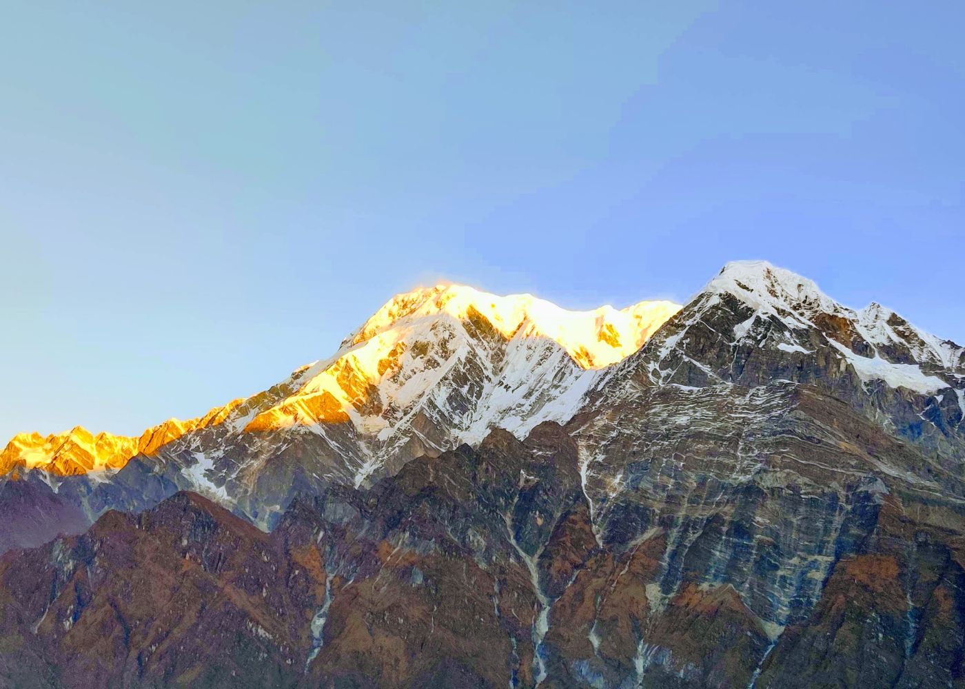
Low Camp (2,985 m) sits on the first open ridgeline section. The Annapurna range, including Annapurna I (8,091 m), Annapurna South (7,219 m), Machhapuchhre (6,993 m), and Hiunchuli (6,441 m), becomes fully visible from this point. Badal Danda (3,210 m), meaning "Cloud Ridge" in Nepali, is an exposed camp at the junction of two ridge arms. Some itineraries use Badal Danda as an acclimatization stop between Low Camp and High Camp.
How High Are High Camp and Mardi Himal Viewpoint?
High Camp stands at 3,580 m and serves as the final overnight stop before the summit push. Mardi Himal Upper Viewpoint sits at 4,200 m and is the highest point on the standard Mardi Himal Trek itinerary.
High Camp (3,580 m) holds 6–10 stone lodges and operates from October through May. At 3,580 m, the atmospheric pressure drops to approximately 64 kPa compared to 101 kPa at sea level, equivalent to 63% of sea-level oxygen availability. This pressure reduction is sufficient to trigger mild AMS symptoms in trekkers without prior acclimatization.
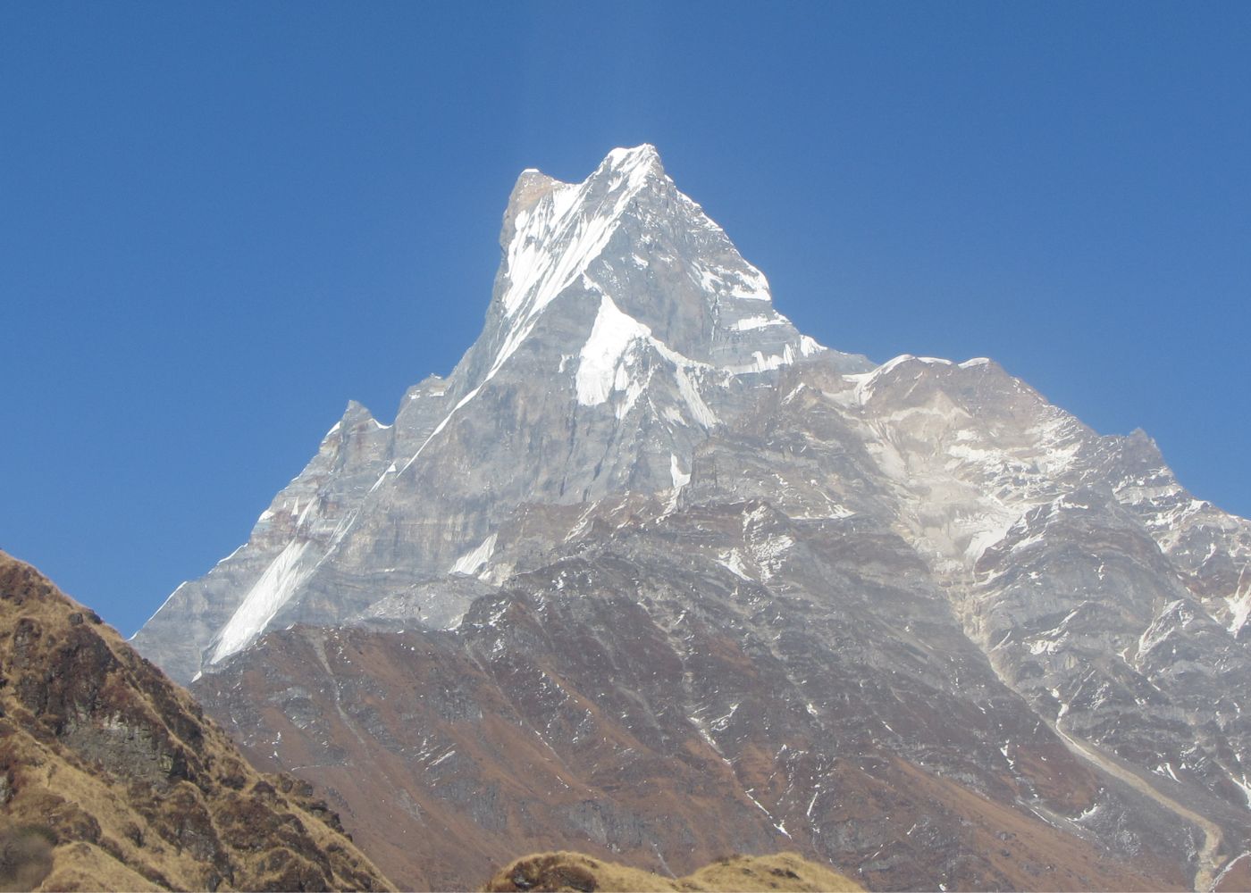
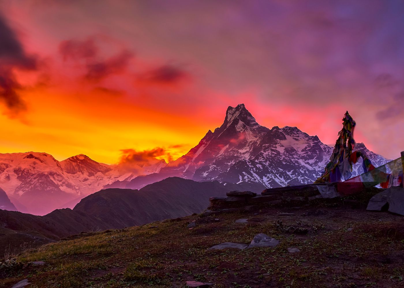
The Upper Viewpoint (4,200 m) is an unmarked alpine ridgeline point at the edge of Mardi Himal's southeast ridge. Atmospheric pressure at 4,200 m drops to approximately 57 kPa, delivering roughly 57% of sea-level oxygen. The viewpoint provides direct line-of-sight to Mardi Himal (5,587 m), Machhapuchhre (6,993 m), Annapurna I (8,091 m), and Dhaulagiri (8,167 m).
What Is the Highest Point on the Mardi Himal Trek?
The highest point on the standard Mardi Himal Trek is the Upper Viewpoint at 4,200 m above sea level. Mardi Himal summit itself at 5,587 m requires a technical mountaineering permit and is not part of the trekking route.
Altitude on this trek peaks at the Upper Viewpoint (4,200 m), reached on summit day from High Camp. The route does not require crampons, ropes, or mountaineering permits below this point. Trekkers without technical skills access the viewpoint via a steep but non-technical trail.
How High Is Mardi Himal Viewpoint Above Sea Level?
Mardi Himal Upper Viewpoint sits at 4,200 m (14,764 feet) above sea level. A lower viewpoint exists at approximately 4,200 m, accessible from the High Camp to Viewpoint trail as an intermediate stop. Most trekking agencies define the 4,500 m point as the official trek destination.
The altitude of 4,200 m places the Mardi Himal Viewpoint above the altitude threshold (3,500 m) where the Wilderness Medical Society recommends reducing further ascent speed to no more than 300–500 m of sleeping altitude gain per day. Trekkers ascending from High Camp (3,580 m) to Upper Viewpoint (4,200 m) do not sleep at 4,200 m on standard itineraries, they descend to High Camp the same day.
Is Mardi Himal Base Camp Part of the Standard Route?
Mardi Himal Base Camp at approximately 4,500 m is not part of the standard Mardi Himal Trek itinerary. The standard route passes the Lower Viewpoint zone near 3,050 m en route to the 4,200 m Upper Viewpoint but does not extend to the true mountaineering base camp used by Mardi Himal climbing expeditions.
Mardi Himal (5,587 m) is classified as a trekking peak by the Nepal Mountaineering Association (NMA). A separate climbing permit from NMA is required to ascend to Mardi Himal Base Camp in a mountaineering context. Trekkers on the standard trek reach 4,200 m and turn back at the Upper Viewpoint without entering the base camp zone.
How Many Days Does the Altitude Gain Usually Take?
The Mardi Himal Trek altitude gain of 2,730 m takes 4 days on the short itinerary and 5 to 6 days on the standard itinerary. A 4-day plan gains an average of 682 m per day; a 5-day plan gains an average of 546 m per day.
Itinerary length directly controls the rate of altitude gain per day. Faster itineraries compress the ascent, increase daily altitude gain, and raise the risk of AMS above 3,000 m. The Wilderness Medical Society recommends a maximum sleeping altitude increase of 500 m per day above 3,000 m. Stretching the itinerary to 5 or 6 days reduces daily gain and aligns more closely with this guideline.
What Is the Usual Altitude Gain on a 4-Day Itinerary?
A 4-day Mardi Himal Trek itinerary gains a total of 2,730 m at an average daily rate of 682 m. The 4-day plan compresses 3 middle camps (Forest Camp, Low Camp, High Camp) into 3 overnight stops, eliminating a rest day at Low Camp or Badal Danda.
Typical 4-day ascent schedule:
-
Day 1: Kande (1,770 m) → Low Camp (2,985 m): 1,215 m gain, above the 500 m/day guideline above 3,000 m
-
Day 2: Low Camp (2,985 m) → High Camp (3,580 m): 595 m gain
-
Day 3: High Camp (3,580 m) → Upper Viewpoint (4,200 m) → return High Camp: 620 m summit day
-
Day 4: High Camp → Kande: full descent
The Day 1 gain of 1,215 m on this itinerary is the primary risk factor. Trekkers with no prior acclimatization above 2,000 m face a significantly elevated AMS risk when reaching Low Camp (2,985 m) in one day from Kande.
What Is the Usual Altitude Gain on a 5-Day Itinerary?
A 5-day Mardi Himal Trek itinerary gains 2,730 m at a daily average of 546 m, with the highest single-day gain reaching 620 m on summit day from High Camp. The additional day is typically used at Forest Camp or Low Camp to allow partial acclimatization.
Typical 5-day ascent schedule:
-
Day 1: Kande (1,770 m) → Forest Camp (2,550 m): 780 m gain
-
Day 2: Forest Camp (2,550 m) → Low Camp (2,985 m): 435 m gain
-
Day 3: Low Camp (2,985 m) → High Camp (3,580 m) via Badal Danda (3,210 m): 595 m gain
-
Day 4: High Camp (3,580 m) → Upper Viewpoint (4,200 m) → return High Camp: 620 m summit push
-
Day 5: High Camp → Kande: full descent
All daily gains on the 5-day itinerary except summit day fall within the 500–600 m per day range, reducing AMS exposure during the sleeping altitude progression.
Does a Longer Itinerary Reduce Altitude Stress?
A 6-day Mardi Himal Trek itinerary reduces altitude stress by inserting a rest day at Low Camp (2,985 m) or High Camp (3,580 m), limiting sleeping altitude gain to below 500 m on the critical upper-mountain days.
Adding an extra acclimatization night at Low Camp (2,985 m) before pushing to High Camp (3,580 m) gives the body 24 additional hours to produce erythropoietin (EPO), a hormone that stimulates red blood cell production in response to reduced oxygen. Physiologically, sleeping altitude determines acclimatization progress more than hiking altitude. Resting at Low Camp for 2 nights before ascending to High Camp reduces AMS incidence among trekkers without prior high-altitude experience.
How Does the Camp-to-Camp Climb Feel on the Trail?
The camp-to-camp climb on the Mardi Himal Trek shifts from shaded forest walking in the lower zone to fully exposed ridge trekking above Low Camp (2,985 m). The physical demand increases with elevation due to reduced atmospheric pressure, lower temperature, and steeper gradient above High Camp.
Trail character changes at each camp transition. The lower zone (Kande to Forest Camp) follows wide rhododendron forest paths with 15–25° gradients. The middle zone (Forest Camp to High Camp) shifts to open ridgeline with 25–35° gradients and increasing wind exposure. The upper zone (High Camp to Upper Viewpoint) involves 35–45° gradients on rocky, sometimes snow-covered terrain.
Which Camp Change Feels the Most Demanding?
The High Camp (3,580 m) to Upper Viewpoint (4,200 m) section is the most demanding camp change on the Mardi Himal Trek. It gains 620 m in 3–4 hours on exposed alpine terrain at altitudes where oxygen availability drops to 57% of sea-level levels.
Trekkers ascending this section experience 3 compounding difficulty factors:
-
Altitude hypoxia: Atmospheric pressure at 4,200 m is 57 kPa, creating reduced oxygen per breath
-
Gradient: Slope angles reach 40–45° on the final approach ridge
-
Temperature: Pre-dawn temperatures at High Camp range from −5°C to −15°C in October and November, the most popular trekking months
The second most demanding transition is Pitam Deurali (1,990 m) to Forest Camp (2,550 m), where 560 m of gain through dense forest, with no views and high humidity, makes it physically taxing without the altitude compensation of ridge breezes.
Where Do Trekkers First Notice Thinner Air?
Trekkers on the Mardi Himal Trek first notice thinner air at Low Camp (2,985 m), the point where atmospheric pressure drops to approximately 70 kPa, 69% of sea-level oxygen. Symptoms at this elevation include slightly faster breathing during uphill sections and mild fatigue after sustained effort.
The physiological threshold where most unacclimatized individuals detect breathing change during exercise sits between 2,500 m and 3,000 m. Low Camp (2,985 m) falls precisely within this range. High Camp at 3,580 m intensifies the sensation, where atmospheric pressure reaches 64 kPa and resting breathing rate increases perceptibly for most trekkers.
How Does Sleeping Altitude Affect Recovery Each Night?
Sleeping altitude is the primary driver of acclimatization on the Mardi Himal Trek. Each night spent above 2,500 m triggers increased erythropoietin (EPO) production, raising red blood cell count and oxygen-carrying capacity over 48–72 hours.
The body acclimatizes primarily during rest, not during climbing. A trekker sleeping at Forest Camp (2,550 m) on Night 1 begins EPO production within 2 hours of exposure to reduced oxygen. By Night 2 at Low Camp (2,985 m), partial acclimatization from the previous night carries forward. This cumulative effect explains why a 5-day itinerary with a proper sleep progression produces better altitude tolerance at High Camp (3,580 m) than a 4-day itinerary that skips Forest Camp overnight.
What Are the Altitude Sickness Risks on Mardi Himal Trek?
AMS (Acute Mountain Sickness) risk on the Mardi Himal Trek begins at Low Camp (2,985 m) and peaks at High Camp (3,580 m) and the Upper Viewpoint (4,200 m). Approximately 25–30% of trekkers without prior high-altitude experience report mild AMS symptoms above 3,000 m on fast itineraries.
AMS (Acute Mountain Sickness) is a syndrome caused by hypobaric hypoxia, reduced oxygen availability at altitude due to decreased atmospheric pressure. The Lake Louise Consensus defines AMS as a headache plus at least one of the following: nausea, fatigue, dizziness, or difficulty sleeping, occurring within 6–12 hours of ascending above 2,500 m. AMS on the Mardi Himal Trek is most frequently reported at High Camp (3,580 m) and the Upper Viewpoint approach (4,200 m).
At What Altitude Can AMS Symptoms Start on This Trek?
AMS symptoms on the Mardi Himal Trek start as low as 2,500 m in susceptible individuals, with Low Camp (2,985 m) representing the most common onset altitude. Headache, reduced appetite, and disturbed sleep are the 3 most frequently reported early AMS symptoms at Low Camp.
The Wilderness Medical Society identifies 2,500 m as the lower boundary where AMS becomes clinically relevant. On the Mardi Himal Trek, this threshold falls between Forest Camp (2,550 m) and Low Camp (2,985 m). Trekkers with a history of AMS above 2,500 m on previous treks face elevated risk starting from Forest Camp.
The 3 early AMS symptoms most reported at Low Camp on this trek are:
-
Frontal headache worsening at night or on waking
-
Reduced appetite and mild nausea after dinner
-
Disrupted sleep with frequent waking and vivid dreams
Which Camps Are the Most Important for Monitoring Symptoms?
High Camp (3,580 m) is the most critical monitoring point for AMS on the Mardi Himal Trek. Any trekker displaying AMS symptoms at High Camp faces a summit push to 4,200 m the next morning, a 620 m gain that will worsen symptoms without acclimatization.
The 2 most important symptom checkpoints on this route are:
-
Low Camp (2,985 m): First overnight above 2,500 m; baseline AMS symptoms appear here in fast itineraries
-
High Camp (3,580 m): Last overnight before the summit push; symptoms at this point contraindicate ascending to 4,200 m
The Lake Louise AMS Score of 3 or higher (moderate AMS) at High Camp is an absolute contraindication for ascending to the Upper Viewpoint. A score of 6 or higher (severe AMS) at any camp requires immediate descent.
When Should Trekkers Descend Instead of Pushing Higher?
Trekkers descend immediately from any camp on the Mardi Himal Trek when they experience severe AMS symptoms: loss of coordination (ataxia), altered consciousness, or breathlessness at rest, signs of HACE (High Altitude Cerebral Edema) or HAPE (High Altitude Pulmonary Edema).
HACE (High Altitude Cerebral Edema) is a life-threatening progression of AMS involving brain swelling due to fluid accumulation. HAPE (High Altitude Pulmonary Edema) is a life-threatening accumulation of fluid in the lungs at altitude. Both conditions are medical emergencies requiring immediate descent of 500–1,000 m and administration of supplemental oxygen or dexamethasone where available.
The 4 symptoms requiring immediate descent on the Mardi Himal Trek are:
-
Ataxia (inability to walk a straight line)
-
Altered mental status (confusion, disorientation)
-
Breathlessness at rest (not during climbing)
-
Persistent vomiting preventing hydration
Descent from High Camp (3,580 m) to Low Camp (2,985 m), a 595 m drop, produces measurable symptom relief within 1–2 hours in mild-to-moderate AMS cases.
How Can You Acclimatize Safely on Mardi Himal Trek?
Safe acclimatization on the Mardi Himal Trek requires sleeping no more than 500 m higher each night above 3,000 m, maintaining hydration at 3–4 liters per day, ascending slowly above Low Camp, and recognizing AMS symptoms before pushing to the next camp.
Acclimatization is the physiological process by which the body adapts to reduced oxygen at altitude through 4 primary mechanisms: increased breathing rate, increased red blood cell production, increased 2,3-DPG (a molecule improving oxygen release to tissues), and cardiovascular adjustments. On the Mardi Himal Trek, the 4-night minimum acclimatization window from Kande to the Upper Viewpoint is the shortest window considered safe for trekkers with prior high-altitude experience above 3,000 m.
Should You Add an Extra Night Before High Camp?
Adding an extra night at Low Camp (2,985 m) before ascending to High Camp (3,580 m) reduces AMS risk at High Camp for trekkers without prior experience above 3,000 m. This additional sleep at 2,985 m provides 48 hours of EPO stimulation before the 3,580 m sleeping altitude, a clinically meaningful difference.
The Mardi Himal ridge trail supports a "climb high, sleep low" approach between Low Camp and Badal Danda. A trekker sleeping 2 nights at Low Camp (2,985 m), day-hiking to Badal Danda (3,210 m) on the layover day, and then ascending to High Camp (3,580 m) on Day 3 achieves better pre-acclimatization than a direct Low Camp to High Camp ascent in one day.
How Much Water and Rest Help With Acclimatization?
Drinking 3–4 liters of water daily above 3,000 m on the Mardi Himal Trek reduces altitude-related dehydration, which worsens AMS symptoms. Rest between 12:00 PM and 2:00 PM on arrival at each camp reduces physical oxygen demand during the critical acclimatization window of the first 6 hours at a new altitude.
Dehydration accelerates AMS onset by increasing blood viscosity and reducing plasma volume, impairing the cardiovascular adjustments needed at altitude. At High Camp (3,580 m), the cold, dry air causes respiratory water loss of 1–2 liters per day above normal rates. Replacing this loss through deliberate water intake is a primary preventive measure.
What Pace Helps Reduce Altitude-Related Problems?
A pace of 2–3 kilometers per hour on ascent days above 2,500 m on the Mardi Himal Trek maintains heart rate below the threshold where ventilation demand causes rapid fatigue at altitude. Resting for 5–10 minutes every 45–60 minutes of uphill trekking above Low Camp prevents excessive hyperventilation.
The Himalayan Rescue Association recommends the "REST STEP" technique above 3,500 m: a momentary knee-lock pause with each step forward, reducing quadriceps fatigue and controlling heart rate on steep sections. This technique is especially effective on the High Camp to Upper Viewpoint ascent, where gradient and altitude combine to produce the highest cardiovascular demand on the Mardi Himal Trek.
How Do Season and Weather Affect the Trek at Higher Altitudes?
Season and weather affect the Mardi Himal Trek altitude experience through temperature, wind speed, snow cover, and visibility. October–November and March–April are the 2 primary seasons where altitude conditions are most manageable; December–February and June–September present significantly increased risk above 3,580 m.
Season determines 4 variables that amplify or reduce the physiological difficulty of high-altitude sections: air temperature (affecting cold stress and respiratory function), wind speed (affecting wind chill and trail safety), snow and ice cover (affecting footing and route-finding), and cloud cover (affecting navigation and motivation). Each variable interacts with altitude to change the physical experience at High Camp (3,580 m) and the Upper Viewpoint (4,200 m).
Does Cold Weather Make the Higher Camps Feel Harder?
Cold weather at High Camp (3,580 m) and the Upper Viewpoint (4,200 m) makes altitude feel harder through 2 mechanisms: increased respiratory heat loss and reduced cognitive performance from combined cold and hypoxia.
October night temperatures at High Camp range from −5°C to −12°C. January temperatures drop to −15°C to −25°C, making High Camp extremely difficult for trekkers without four-season sleeping gear rated to −20°C. Cold air is denser, it contains more oxygen molecules per breath. This partially offsets altitude hypoxia. However, breathing cold, dry air at −10°C desiccates the respiratory tract and increases water loss, worsening dehydration-related AMS risk.
Can Snow or Wind Change the Effort Above High Camp?
Snow accumulation above High Camp (3,580 m) from December through February increases trail-breaking effort by 40–60% and makes route-finding to the Upper Viewpoint (4,200 m) dependent on experienced guide navigation. Wind speeds above High Camp reach 30–60 km/h during post-monsoon and winter periods, adding wind chill values of −10°C to −20°C to ambient temperature.
Snow depth on the High Camp to Upper Viewpoint section averages 20–60 cm in January and February. Trekkers without gaiters and microspikes face unsafe footing on iced sections above 4,000 m during winter months. Wind gusts above 50 km/h at the Upper Viewpoint ridgeline create lateral instability that increases fall risk on the exposed ridge approach.
Which Season Makes the Altitude Profile Easier to Manage?
October and November make the Mardi Himal Trek altitude profile easiest to manage across all camps. Post-monsoon clarity delivers 90–95% visibility days. Temperatures at High Camp range from −5°C to 5°C by day and −10°C to −15°C at night, cold enough to require proper gear, but not extreme enough to add winter-specific risks.
The 4 factors making October–November optimal for altitude management on this trek are:
-
Stable atmospheric pressure: Low pressure variability reduces unpredictable AMS onset
-
Dry trail conditions: No monsoon mud below 2,500 m; no significant snow above 3,500 m
-
Moderate temperatures: Manageable cold stress at High Camp without four-season extremes
-
Long daylight hours: 10–11 hours of usable daylight allowing unhurried summit-day pacing
March–April is the second-best window. Pre-monsoon haze reduces visibility compared to October–November, but rhododendron bloom below 3,500 m adds botanical interest to the lower-altitude sections.
What Should You Know Before Comparing Camps and Elevation Gain?
Before comparing camps and elevation gain on the Mardi Himal Trek, trekkers recognize that published altitudes vary by up to 50–100 m between sources, total ascent and descent differ from net elevation gain, and the 4,200 m Upper Viewpoint sits 14,764 feet above sea level, a figure relevant for comparing this trek with other Himalayan routes.
Altitude data for Mardi Himal Trek camps comes from 4 main source types: GPS measurements by individual trekkers, topographic maps from the Survey Department of Nepal, data from trekking agencies, and values in trekking apps. Each source uses different datums, measurement epochs, and rounding conventions, producing published altitudes that differ by 30–100 m for the same camp.
How Do Ascent and Descent Totals Differ on This Route?
The Mardi Himal Trek total ascent equals 2,730 m and total descent equals 2,730 m on a full out-and-back route from Kande to the Upper Viewpoint and return. Net elevation gain, the difference between start and finish altitude on a one-way route, equals 2,730 m only on the ascent leg. Descent days return the full 2,730 m to the Kande trailhead.
Some trekking agencies offer a circuit variation exiting via Siding village (1,660 m) instead of returning to Kande (1,770 m). This variant produces a slightly higher total descent of approximately 2,620 m from the Upper Viewpoint (4,200 m) to Siding (1,660 m) but reduces total ascent by eliminating the return climb to High Camp.
Why Do Trekking Apps and Maps Show Slightly Different Altitudes?
Trekking apps and maps show different altitudes for the same Mardi Himal Trek camps because they use different GPS datum references, barometric calibration methods, and data sources. Differences of 30–80 m between sources are normal for camps in this altitude range.
The 3 main sources of camp altitude discrepancy are:
-
Datum differences: WGS84 (used by GPS devices) and EGM96 geoid (used by survey maps) produce altitudes that differ by 10–30 m in the Nepal Himalaya region
-
Barometric GPS drift: Barometer-based altitude readings shift with weather pressure changes by up to 50 m in a single day
-
Source rounding: Some agencies round camp altitudes to the nearest 50 m or 100 m for simplicity, compressing true values
High Camp is most commonly cited at 3,580 m, but values of 3,450 m, 3,550 m, and 3,600 m appear in different published itineraries. The Upper Viewpoint is most consistently cited at 4,200 m across 80% of published sources.
What Should Beginners Expect From the Altitude on This Trek?
Beginners with no prior trekking experience above 2,000 m complete the Mardi Himal Trek to the Upper Viewpoint (4,200 m) on a 5-day itinerary with proper preparation. The route does not require technical climbing skills below 4,200 m.
3 altitude-specific challenges beginners face on this trek are:
-
Breathlessness on steep sections above 3,000 m: Sustained uphill effort at Low Camp (2,985 m) and above produces noticeably faster breathing than equivalent effort at sea level
-
Disrupted sleep at High Camp (3,580 m): Periodic breathing (Cheyne-Stokes respiration) disturbs sleep at altitudes above 3,000 m in unacclimatized trekkers
-
Reduced appetite at High Camp: Hypoxia suppresses appetite at altitude; eating adequate calories becomes effortful rather than automatic
Beginners with good cardiovascular fitness who train at sea level for 4–6 weeks before the trek, running 30–45 minutes, 4 days per week, complete the ascent to the Upper Viewpoint without AMS on a properly paced 5-day itinerary.
How Should You Plan Mardi Himal Trek Altitude With Support?
Planning Mardi Himal Trek altitude with professional support means engaging a licensed trekking guide registered with the Nepal Tourism Board (NTB), who carries a pulse oximeter, wilderness first aid training, and knowledge of AMS emergency descent protocols from High Camp (3,580 m) and the Upper Viewpoint zone (4,200 m).
A licensed trekking guide provides 4 altitude-specific services: real-time symptom monitoring using a pulse oximeter at each camp, daily pace management adjusted to individual fitness and acclimatization response, emergency descent coordination with porters when AMS escalates to HACE or HAPE, and knowledge of the nearest medical facility, the Himalayan Rescue Association clinic in Pokhara, 65 km from the Kande trailhead.
Can a Trekking Guide or Agency Help With Altitude Planning?
A registered Nepali trekking guide reduces AMS risk on the Mardi Himal Trek by monitoring oxygen saturation (SpO₂) with a pulse oximeter at each camp, adjusting ascent pace when SpO₂ drops below 85%, and identifying descent windows before symptoms escalate.
Normal SpO₂ at sea level is 95–100%. At High Camp (3,580 m), acclimatized trekkers maintain SpO₂ of 80–88%. At the Upper Viewpoint (4,200 m), SpO₂ of 75–85% is typical for healthy trekkers without prior altitude exposure. A guide with a pulse oximeter identifies trekkers whose SpO₂ drops below 75%, the threshold below which most physicians recommend halting ascent and beginning descent.
Trekking agencies offering Mardi Himal Trek packages provide mandatory trekking permits: the Annapurna Conservation Area Project (ACAP) permit and the TIMS (Trekkers' Information Management System) card. Both documents are required for legal entry to the trek.
What Are the Key Takeaways About Mardi Himal Trek Altitude?
The Mardi Himal Trek altitude rises from 1,770 m at Kande to 4,200 m at the Upper Viewpoint across 7 defined camps, gaining 2,730 m total over 4–6 days. High Camp (3,580 m) is the critical AMS monitoring point, and the Upper Viewpoint (4,200 m) is the highest non-technical destination on the standard route.
The 8 essential altitude facts for Mardi Himal Trek planning are:
-
Total elevation gain: 2,730 m from Kande (1,770 m) to Upper Viewpoint (4,200 m)
-
Highest point: Upper Viewpoint at 4,200 m (14,764 feet)
-
Critical AMS threshold: High Camp at 3,580 m, 37% below sea-level oxygen
-
Steepest daily gain: 620 m on summit day from High Camp
-
Optimal itinerary: 5–6 days for trekkers without prior altitude experience above 3,000 m
-
AMS onset altitude: Low Camp (2,985 m) for susceptible individuals on fast itineraries
-
Best season for altitude management: October–November (post-monsoon)
-
Recommended daily water intake above 3,000 m: 3–4 liters
Mardi Himal Trek altitude demands preparation, pacing, and symptom awareness, not technical mountaineering skill. Trekkers who plan their camp-by-camp sleeping altitude, monitor AMS symptoms at each stop, and ascend the High Camp to Upper Viewpoint section in pre-dawn conditions to avoid afternoon cloud cover complete the trek safely and return to Kande with the clearest views of Annapurna, Machhapuchhre, and Dhaulagiri in the Himalayas.