Everest elevation gain represents the net vertical ascent from a defined starting point to the summit at 8,848.86 meters above sea level. The South Base Camp route (5,364 m) produces a climbing gain of approximately 3,485 meters, while the North Base Camp route (5,150 m) results in a greater gain of about 3,699 meters due to its lower starting elevation and alternative approach through Tibet. This metric defines only the direct upward distance climbed, not the total effort required across an expedition.
Full Everest expeditions extend far beyond net elevation gain because climbers repeatedly ascend and descend between high-altitude camps for acclimatization and load carries. These rotations increase total accumulated vertical ascent to roughly 6,000 to 7,500 meters. The difference highlights a key distinction in high-altitude mountaineering: elevation gain measures the summit climb itself, while cumulative ascent reflects the complete physiological workload required to survive and succeed on Everest.
What Does "Elevation Gain" Mean on Everest?
Elevation gain on Everest measures the net vertical distance climbed from a starting point to the summit at 8,848.86 meters. The term differs from total altitude, topographic prominence, and cumulative vertical gain. Net elevation gain equals summit elevation minus starting elevation, expressed in meters.
Elevation gain is a climbing metric. It quantifies vertical ascent from a defined base point, typically a base camp, to the highest reached point.
Everest's summit sits at 8,848.86 meters above mean sea level, confirmed by the 2020 joint survey conducted by China's National Administration of Surveying, Mapping, and Geoinformation and Nepal's Survey Department.
3 core terms define Everest's vertical profile:
-
Elevation above sea level: the absolute altitude of the summit measured from mean sea level: 8,848.86 m
-
Elevation gain: the vertical distance climbed from a specific starting point to the summit
-
Topographic prominence: the vertical distance from the summit to the highest col connecting it to a higher peak
Everest's topographic prominence equals its full height of 8,848.86 meters, because no higher peak exists on Earth to define a connecting col.
Is Everest's Full Height 8,848.86 Meters Above Sea Level?
Everest's official summit elevation is 8,848.86 meters (29,031.7 feet) above mean sea level, established by the 2020 China-Nepal survey. This figure superseded the 1954 Survey of India measurement of 8,848 meters and the 1999 GPS measurement of 8,850 meters.
The 2020 measurement used GNSS (Global Navigation Satellite System) receivers, gravity correction data, and trigonometric leveling across 116 control points. Snow depth at the summit measured 92 centimeters, incorporated into the final figure.
The Nepalese survey team placed a GNSS receiver directly on the summit snowpack. Chinese surveyors established 5 baseline camps across Tibet. Both teams cross-validated results, producing the current internationally accepted elevation.
How Is Elevation Gain Different from Vertical Relief or Prominence?
Elevation gain measures ascent from a climber's starting point. Vertical relief measures the height difference between a peak's summit and its lowest surrounding terrain. Topographic prominence measures the height above the highest connecting col to any taller peak.
The following table shows the 3 vertical measurements for Everest, their definitions, and their values:
|
Measurement |
Definition |
Everest Value |
|
Elevation Above Sea Level |
Summit height from mean sea level |
8,848.86 m |
|
Elevation Gain (South Route) |
Net ascent from South Base Camp |
3,485 m |
|
Elevation Gain (North Route) |
Net ascent from North Base Camp |
3,699 m |
|
Topographic Prominence |
Height above highest connecting col |
8,848.86 m |
|
Vertical Relief from Tibetan Plateau |
Summit above regional base terrain |
~3,700 m |
Elevation gain varies by route. Topographic prominence remains fixed at 8,848.86 meters because Everest is Earth's highest peak. Vertical relief from the Tibetan Plateau base averages approximately 3,700 meters.
How Much Elevation Gain Is Everest From South Base Camp?
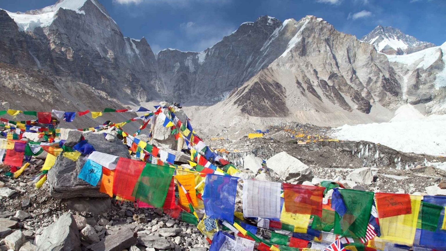
Everest's elevation gain from South Base Camp is 3,484.86 meters, calculated as 8,848.86 m (summit) minus 5,364 m (South Base Camp elevation), rounded to 3,485 meters. South Base Camp sits in the Khumbu region of Nepal at 27.9796° N, 86.8592° E.
South Base Camp (5,364 m) serves as the primary staging area for the Southeast Ridge route, the most commonly used Everest climbing route. The route passes through 4 high camps before the summit.
The 4 high camps on the South (Nepal) route and their elevations are:
-
Camp 1: 6,065 m (located above the Khumbu Icefall)
-
Camp 2: 6,500 m (Western Cwm, Advanced Base Camp)
-
Camp 3: 7,162 m (Lhotse Face)
-
Camp 4: 7,950 m (South Col, Death Zone threshold)
Net gain between successive camps: South Base Camp to Camp 1 gains 701 m; Camp 1 to Camp 2 gains 435 m; Camp 2 to Camp 3 gains 662 m; Camp 3 to Camp 4 gains 788 m; Camp 4 to summit gains 899 m. Total net gain: 3,485 meters.
Is the Gain About 3,485 Meters From 5,364 m to the Summit?
The net elevation gain from South Base Camp (5,364 m) to the Everest summit (8,848.86 m) is exactly 3,484.86 meters, standardly cited as 3,485 meters. This is the single-direction ascent figure, not the total vertical gain accumulated during the full expedition.
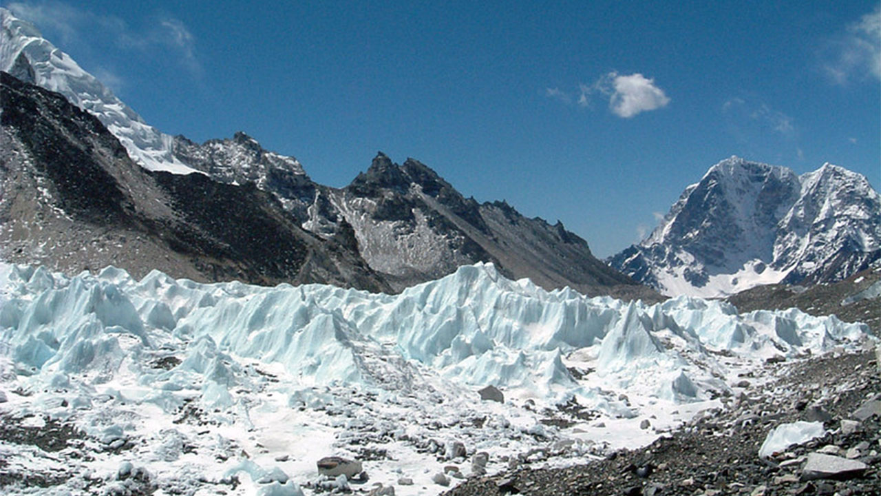
The Khumbu Icefall, the first major obstacle above South Base Camp, spans elevations 5,364 m to 6,065 m. Climbers cross this 701-meter section at night or early morning to reduce serac collapse risk, documented across expedition records compiled by the Himalayan Database.
The Death Zone begins at 8,000 meters. Above Camp 4 at 7,950 m, climbers ascend 50 meters to enter the Death Zone, then gain a further 849 meters to the summit. Total gain within the Death Zone on summit day: 899 meters.
Why Can Total Climbed Elevation Exceed the Simple Net Gain?
Total climbed elevation during a full Everest expedition exceeds the 3,485 m net gain because acclimatization rotations require climbers to ascend and descend multiple times between camps before the summit push. A standard South Route expedition accumulates 6,000 to 7,500 meters of total upward vertical gain.
Acclimatization is the process of physiological adaptation to reduced atmospheric oxygen pressure at altitude. The body responds by increasing red blood cell production (erythropoiesis), elevated breathing rate, and vascular adjustments. This process requires 6 to 8 weeks at Everest.
A standard acclimatization schedule on the South Route includes 3 rotations:
-
First rotation: South Base Camp (5,364 m) → Camp 1 (6,065 m) → Camp 2 (6,500 m) → return to base camp: 2,272 m round-trip gain
-
Second rotation: Base Camp → Camp 2 (6,500 m) → Camp 3 (7,162 m) → return: 3,596 m round-trip gain
-
Third rotation (optional): Base Camp → Camp 3 or Camp 4 → return: 4,172 to 5,172 m round-trip gain
-
Summit push: Base Camp → Camp 4 → summit → descent: 6,970 m round-trip gain
Summing partial rotation gains over a 60-day expedition, total upward vertical meters climbed ranges from 6,000 to 7,500 meters, nearly double the 3,485 m net gain figure.
How Much Elevation Gain Is Everest From North Base Camp?
Everest's elevation gain from North Base Camp is 3,698.86 meters, calculated as 8,848.86 m (summit) minus 5,150 m (North Base Camp elevation), rounded to 3,699 meters. North Base Camp sits on the Rongbuk Glacier in Tibet at 5,150 meters elevation.
The North Route, the Northeast Ridge, approaches Everest from Tibet through the Rongbuk Valley. This route is longer in horizontal distance than the South Route and involves different technical challenges: the First, Second, and Third Steps.
Is the Gain About 3,699 Meters From 5,150 m to the Summit?
The net elevation gain from North Base Camp (5,150 m) to the Everest summit (8,848.86 m) is 3,698.86 meters, standardly cited as 3,699 meters. North Base Camp sits 214 meters lower than South Base Camp, producing a 214-meter greater net elevation gain on the North Route.
The North Route passes through 4 camps before the summit:
-
Advanced Base Camp (ABC): 6,400 m (Rongbuk Glacier)
-
North Col (Camp 1): 7,020 m
-
Camp 2: 7,500 m (North Ridge)
-
Camp 3: 8,300 m (Northeast Ridge)
Net gain from North Base Camp to Advanced Base Camp: 1,250 m. From ABC to North Col: 620 m. From North Col to Camp 2: 480 m. From Camp 2 to Camp 3: 800 m. From Camp 3 to summit: 549 m. Total: 3,699 meters.
How Does the North-Side Route Change the Climbing Profile?
The North Route adds 214 meters of net elevation gain compared to the South Route and includes 3 technical rock steps, the First Step (8,501 m), Second Step (8,611 m), and Third Step (8,690 m), absent from the South Route. These steps require fixed rope climbing and add technical difficulty disproportionate to their vertical gain of 30 to 100 meters each.
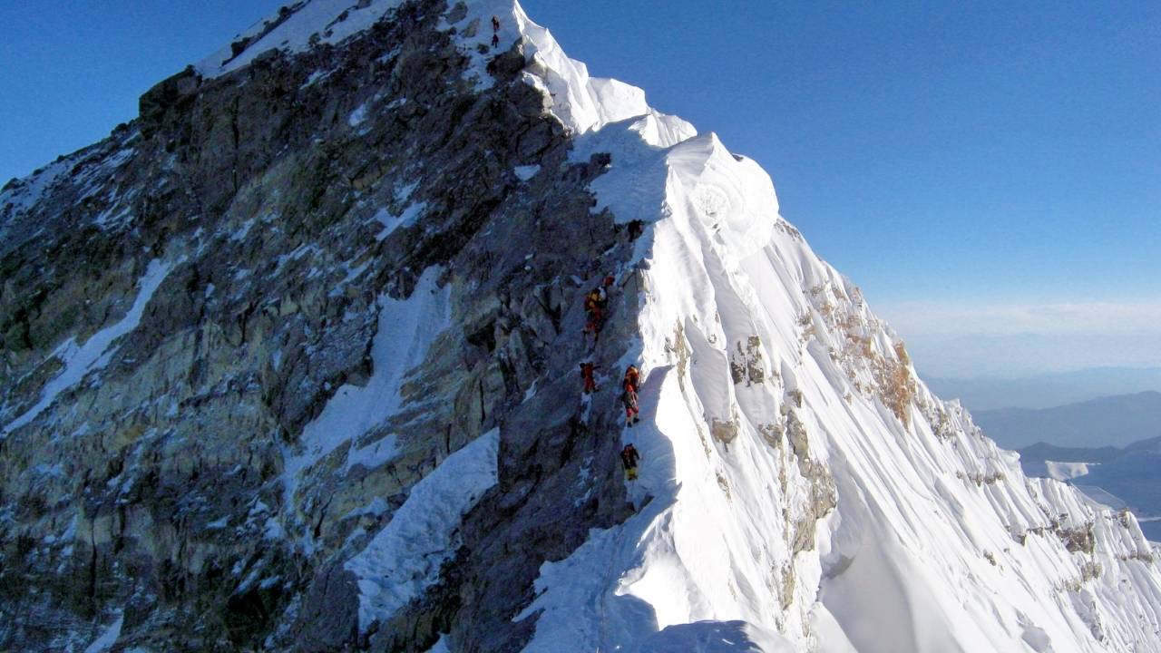
The Second Step is Everest's most technically demanding section above the Death Zone. Its near-vertical rock face rises 30 meters at 8,611 meters elevation. The Chinese Ladder, a metal ladder installed by the 1975 Chinese Everest Expedition, enables passage. Without it, the Second Step requires advanced rock climbing technique at extreme altitude.
The North Route also experiences faster high-altitude wind exposure. The Northeast Ridge above 8,300 meters sits exposed to the jet stream, with average wind speeds of 50 to 80 km/h recorded during pre-monsoon season. Climbers on the North Route face a longer exposed summit ridge, while the South Route’s final technical section is the upper southeast ridge near the former Hillary Step area.
Why Does Everest's Elevation Gain Feel Harder Than It Looks?
Everest's 3,485 m elevation gain feels disproportionately harder than equivalent vertical gain at sea level because atmospheric oxygen at the summit equals only 33% of sea-level concentration, reducing aerobic work capacity by 67% and forcing the body to operate at physiological limits incompatible with sustained performance. This effect compounds with cold, wind, dehydration, and sleep deprivation.
How Do Altitude, Oxygen, and Acclimatization Affect the Climb?
Atmospheric pressure at the Everest summit (8,848.86 m) is 33.7 kPa, compared to 101.3 kPa at sea level, a 66.7% reduction. This means each breath at the summit delivers one-third the oxygen molecules of a sea-level breath, even at the same breathing volume and rate.
Altitude affects the human body across 4 measurable thresholds:
-
3,500 m: Acute Mountain Sickness (AMS) onset threshold; symptoms include headache, nausea, and dizziness
-
5,500 m: VO2 max (maximal oxygen uptake) begins declining at 1% per 100 m above this altitude
-
7,500 m: acclimatized climbers sustain aerobic output at approximately 50% of sea-level capacity
-
8,000 m: Death Zone threshold; human physiology deteriorates faster than acclimatization can compensate
Acclimatization physiology produces 3 measurable adaptations over 6 to 8 weeks: hemoglobin concentration increases from a sea-level average of 15 g/dL to 18 to 20 g/dL; resting respiratory rate rises from 12 to 20 breaths/minute to 18 to 28 breaths/minute; capillary density in muscle tissue increases by 15 to 25%.
Everest climbers use supplemental oxygen above 7,000 m on most expeditions. Standard flow rates: 2 liters/minute during sleep at high camps, 3 to 4 liters/minute during summit day ascent. This raises effective inspired oxygen to approximately 40 to 45% of sea-level equivalency.
How Do Camps, Carries, and Rotations Add Extra Vertical Gain?
Carry trips, where climbers transport gear and supplies from lower camps to higher camps, add 1,000 to 2,000 meters of extra upward vertical gain per expedition beyond acclimatization rotations. A complete South Route expedition accumulates a total ascent of 6,000 to 7,500 meters including carries, rotations, and the summit push.
Carries serve 2 functions: load higher camps with oxygen cylinders, food, and equipment, and reinforce acclimatization by re-exposing climbers to altitude stress. Each oxygen cylinder weighs 3.5 kg. A climber using 12 cylinders across the expedition requires 6 to 8 carry trips above Camp 2.
Summit day from South Base Camp takes 10 to 14 hours of continuous ascent. Climbers depart Camp 4 (7,950 m) between 23:00 and 01:00 to reach the summit by 08:00 to 10:00. The 899-meter gain from Camp 4 to summit at 3 to 4 liters/minute oxygen flow takes an average of 8 to 10 hours for acclimatized climbers.
How Should You Plan for Everest's Elevation Gain?
Planning for Everest's elevation gain requires a structured 60 to 70-day expedition schedule, 3 acclimatization rotations reaching at minimum Camp 3 (7,162 m on the South Route), prior high-altitude experience above 7,000 m, and professional guided support from a licensed Himalayan expedition operator. Nepal has moved toward requiring prior climbing experience above 7,000 m before issuing an Everest permit, reflecting a stronger emphasis on safety and experience.
Preparation follows 5 key phases:
-
Base fitness, achieve VO2 max of 55+ ml/kg/min; complete 6 months of trail running, loaded carries, and aerobic conditioning
-
High-altitude experience, summit at least one 6,000 m peak (such as Mera Peak, Nepal, 6,476 m) and one 7,000 m peak (such as Aconcagua, Argentina, 6,961 m) in the 24 months before Everest
-
Technical training, acquire IFMGA-certified glacier travel, crevasse rescue, and fixed-rope ascending skills
-
Expedition acclimatization, complete 3 structured rotations at Everest over 40 to 50 days before summit attempt
-
Summit push logistics, secure weather window of 3+ calm days; coordinate supplemental oxygen, Sherpa team, and camp supplies
Can an Everest Expedition Guide Help Manage the Ascent?
A licensed Everest expedition guide manages the 6 critical ascent variables: acclimatization scheduling, oxygen logistics, weather window selection, fixed rope installation timing, high camp positioning, and emergency descent protocols. Guided expeditions with certified Himalayan operators show a summit success rate of 38 to 45%, compared to 22% for independent permit holders over the period 2005 to 2023, per Himalayan Database records.
Licensed expedition operators provide 4 essential services during the elevation gain management phase:
-
Acclimatization planning: structured rotation schedules aligned with individual physiological response
-
Sherpa high-altitude support: fixed rope installation on technical sections including the Khumbu Icefall (60+ rope lengths) and the Lhotse Face
-
Oxygen system management: calculation of cylinder quantities based on flow rate, camp count, and summit day duration
-
Real-time weather monitoring: Meteogroup and Summit Climb forecasts integrated with expedition go/no-go decisions
Nepal currently charges $15,000 for Everest permits in the spring season (April–May), with lower fees for autumn (September–November) and winter (December–February) climbs. Expedition costs including guide services, Sherpa team, logistics, oxygen, and permits range from $35,000 to $100,000 per climber.
What Are the Key Takeaways About Everest's Elevation Gain?
Everest's elevation gain measures 3,485 meters from South Base Camp and 3,699 meters from North Base Camp to the 8,848.86-meter summit, with full expedition vertical gain reaching 6,000 to 7,500 meters when acclimatization rotations and carry trips are included.
The 6 core facts about Everest's elevation gain are:
-
Summit elevation: 8,848.86 m, confirmed by the 2020 China-Nepal joint survey
-
South Route net gain: 3,484.86 m from South Base Camp at 5,364 m
-
North Route net gain: 3,698.86 m from North Base Camp at 5,150 m
-
Total expedition gain: 6,000 to 7,500 m including rotations and carries
-
Oxygen at summit: 33% of sea-level atmospheric concentration (33.7 kPa vs 101.3 kPa)
-
Death Zone entry: 8,000 m, where physiological deterioration outpaces acclimatization
Elevation gain alone does not define Everest's difficulty. The 67% oxygen reduction, Death Zone physiology, 8 to 10-hour summit day duration, and cumulative 6,000 to 7,500-meter expedition gain combine to make Everest's vertical ascent a multi-month physiological and logistical undertaking, not a 3,485-meter climb measured in isolation.
