The Gokyo Lakes Trek Map is a detailed route guide to one of Nepal’s most scenic high-altitude trekking corridors in the Khumbu Himalaya, tracing the journey from Lukla through Namche Bazaar, Dole, and Machhermo to Gokyo Village inside Sagarmatha National Park. The map connects the main villages, trail sections, elevation changes, Dudh Koshi Valley, Ngozumpa Glacier, and the six glacial Gokyo Lakes, while also showing the location of Gokyo Ri (5,357m) above Gokyo Village. From the 2,860m trailhead at Lukla to the 4,790m lakeside settlement of Gokyo, the route combines substantial elevation gain with changing alpine terrain, making distance, altitude, and acclimatization important parts of trek planning.
A complete Gokyo Lakes Trek Map also helps trekkers understand how the standard route connects with major viewpoints, lake excursions, and high-pass alternatives. Route distances and elevation profiles reveal the key ascent zones between Lukla, Namche, Dole, Machhermo, and Gokyo, while map details help identify acclimatization stops, navigation points, glacier approaches, and side trips to the upper lakes. The route can also extend beyond the standard Gokyo circuit through Cho La Pass, Renjo La, or the Gokyo–Everest Base Camp route, each introducing different elevations, distances, terrain, and technical requirements. This guide examines the complete Gokyo Lakes Trek route map so you can understand its geography, elevation profile, landmarks, lake locations, route variations, and practical navigation considerations before starting the trek.
Where Is the Gokyo Lakes Trek Located?
The Gokyo Lakes Trek is located in the Solukhumbu District of Koshi Province, northeastern Nepal, approximately 145 kilometers east-northeast of Kathmandu. The trek penetrates the high-altitude Khumbu Himalaya zone, threading through glacially carved valleys toward the Ngozumpa Glacier, the longest glacier in Nepal at 36 kilometers.
The trek sits entirely above 2,800m. All trailheads, villages, and viewpoints on the Gokyo Lakes Trek Map fall within a geographic corridor bounded by Cho Oyu (8,188m) to the northwest, Everest (8,849m) to the east, and Makalu (8,485m) to the southeast.
Which Region and National Park Does the Gokyo Lakes Trek Cross?
The Gokyo Lakes Trek crosses Sagarmatha National Park, a UNESCO World Heritage Site established in 1976 covering 1,148 square kilometers of alpine terrain. The nation of Nepal contains 8 of the world's 14 peaks above 8,000m, and the Sagarmatha National Park itself encompasses three of them (Everest, Lhotse, and Cho Oyu), making it one of the most concentrated high-altitude trekking zones on Earth.
Trekkers entering Sagarmatha National Park pay a NPR 3,000 (approximately USD 23) entry fee at the Monjo checkpoint, located at 2,835m between Phakding and Namche Bazaar. The Khumbu Pasanglhamu Rural Municipality Trek Card, costing NPR 3,000, is required instead of the traditional TIMS card and is issued upon arrival in Lukla or at the Monjo checkpoint.
Where Does the Gokyo Lakes Trek Start and Finish?
The Gokyo Lakes Trek starts and finishes at Lukla (2,860m), specifically at Tenzing-Hillary Airport, the primary gateway for all Khumbu-region treks. The standard route is circular: trekkers fly into Lukla, hike northeast toward Namche Bazaar, then northwest up the Dudh Koshi River valley to Gokyo, and return via the same trail or an alternative descent route.
A small subset of trekkers begin the Gokyo Lakes Trek from Jiri or Salleri via a 10–14 day overland approach, but the vast majority of trekkers begin at Lukla. During peak seasons (Spring and Autumn), flights are diverted from Kathmandu to Manthali Airport in Ramechhap, requiring a 4-to-5-hour midnight drive followed by a 20-minute flight to Lukla.
What Is the Gokyo Lakes Trek Route on the Map?
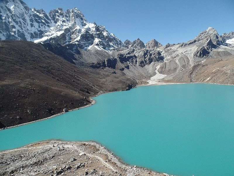
The Gokyo Lakes Trek route runs from Lukla northeast to Namche Bazaar, then northwest through the Dudh Koshi River valley via Dole and Machhermo to Gokyo Village, covering 5 distinct trail segments across 6 to 8 trekking days for the one-way ascent. The return follows the same valley or diverts via Cho La Pass.
Which Villages and Landmarks Are Included on the Route?
The standard Gokyo Lakes Trek Map includes 9 primary stopping villages and 4 major landmarks along the main corridor:
Villages on the Ascent Route:
Lukla (2,860m), flight arrival and trek start point
Phakding (2,610m), first overnight stop, 8 km from Lukla
Namche Bazaar (3,440m), the Khumbu's commercial hub and acclimatization center
Khumjung (3,790m), optional side village above Namche with Hillary School
Dole (4,038m), first high-altitude lodge stop beyond Namche
Lhabarma (4,220m), small teahouse settlement
Luza (4,360m), intermediate lodge village
Machhermo (4,470m), final major acclimatization stop before Gokyo
Gokyo Village (4,790m), trek destination beside the third Gokyo Lake
Major Landmarks on the Trek Map:
Hillary Suspension Bridge at Phakding (2,652m)
Sagarmatha National Park entrance gate at Monjo (2,835m)
Namche Bazaar Saturday Market, Khumbu's primary supply hub
Ngozumpa Glacier viewpoint above Gokyo Village
How Does the Route Connect Namche Bazaar and Gokyo Valley?
Namche Bazaar connects to Gokyo Valley via a 32-kilometer trail that follows the Dudh Koshi River northward before turning northwest at the Dole junction. The route climbs 1,350 meters of net elevation over 3 trekking days from Namche (3,440m) to Gokyo (4,790m).
The trail passes through a vegetation transition: rhododendron and juniper forests below 4,000m give way to open alpine meadows above 4,200m, and bare glacial moraine above 4,600m. This ecological shift is clearly visible when reading the route on any detailed Gokyo Lakes Trek Map against the contour lines.
Where Is Gokyo Ri Located on the Trek Map?
Gokyo Ri (5,357m) sits 567 meters above Gokyo Village (4,790m) on the northwest ridge, directly adjacent to the third Gokyo Lake. On the trek map, Gokyo Ri appears as a steep triangular peak 1.5 kilometers west of the main trail terminus at Gokyo Village. The summit ascent takes 2.5 to 3 hours from the village and is typically completed before 7:00 AM to avoid afternoon cloud cover.
From Gokyo Ri's summit, the 360-degree panorama includes 4 of the world's 6 highest peaks: Everest (8,849m), Cho Oyu (8,188m), Makalu (8,485m), and Lhotse (8,516m).
What Are the Main Distances and Elevations on the Gokyo Lakes Trek Map?
The Gokyo Lakes Trek covers a total one-way distance of approximately 52 kilometers from Lukla to Gokyo Village, with an additional 6 kilometers round-trip to reach the Gokyo Ri summit. The trek gains 1,930 meters of net elevation from Lukla's starting point to Gokyo Village, excluding the Gokyo Ri climb.
How Far Is Each Trekking Section?
The following table presents the 8 standard daily sections on the Gokyo Lakes Trek Map, with precise one-way distances, elevation changes, and approximate walking times:
Trek Section | Distance | Elevation Change | Walking Time |
Lukla → Phakding | 8 km | −250m (descent) | 2.5–3 hrs |
Phakding → Namche Bazaar | 11 km | +830m (ascent) | 5–6 hrs |
Namche → Dole | 15 km | +598m (ascent) | 5–6 hrs |
Dole → Machhermo | 8 km | +432m (ascent) | 3–4 hrs |
Machhermo → Gokyo | 10 km | +320m (ascent) | 4–5 hrs |
Gokyo → Gokyo Ri (return) | 6 km | +567m (ascent/descent) | 5–6 hrs total |
Gokyo → Fourth Lake (return) | 4 km | +190m (ascent/descent) | 2–3 hrs total |
Gokyo → Fifth Lake (return) | 7 km | +220m (ascent/descent) | 3.5–4 hrs total |
These distances reflect the main trail. Side routes, suspension bridge crossings, and glacier bypass trails can add 1–3 kilometers to individual sections depending on seasonal conditions.
What Are the Elevations of the Main Villages?
The 9 primary villages on the Gokyo Lakes Trek route sit at these confirmed elevations:
Lukla: 2,860m
Phakding: 2,610m
Namche Bazaar: 3,440m
Khumjung: 3,790m (optional side visit)
Dole: 4,038m
Lhabarma: 4,220m
Luza: 4,360m
Machhermo: 4,470m
Gokyo Village: 4,790m
One detail most trekkers miss: the descent from Lukla to Phakding (−250m) creates a false sense of ease on Day 1. The following day's climb from Phakding to Namche gains 830m, more vertical gain than any other single day on the trek, and catches underprepared hikers off guard.
Where Are the Major Ascents and Descents?
The Gokyo Lakes Trek Map reveals 3 major ascent zones and 2 notable descent sections:
Major Ascents:
Phakding to Namche Bazaar: 830m gain over 11 km, the trek's steepest single-day climb
Namche to Dole: 598m gain, sustained uphill through the Bhote Koshi valley junction
Machhermo to Gokyo: 320m gain, deceptively gradual but altitude impact is significant above 4,500m
Notable Descents:
Lukla to Phakding: 250m loss, a warm-up descent on Day 1
Any return from Gokyo to Lukla: 1,930m total loss over 4 days, knee stress is a real factor on the Phakding-to-Lukla final descent, where trail erosion creates uneven stone steps
What Does the Gokyo Lakes Trek Elevation Map Show?
The Gokyo Lakes Trek elevation map shows a progressive climb from 2,860m at Lukla to 4,790m at Gokyo, with an irregular ascent profile that includes one short descent on Day 1 and one planned acclimatization rest day at Namche Bazaar before the high-altitude push. The elevation profile is not linear, it features 3 distinct altitude jumps where acclimatization stress intensifies.
How Does the Trail Gain Altitude From Lukla to Gokyo?
The trail gains altitude across 5 elevation bands, each presenting different physiological challenges:
2,860m–3,440m (Lukla to Namche): Mild altitude symptoms common. Headache and shortness of breath typical on the Namche ascent's final 400m.
3,440m–4,038m (Namche to Dole): After the acclimatization rest day at Namche, trekkers enter moderate-altitude terrain. Tree line ends.
4,038m–4,470m (Dole to Machhermo): High-altitude zone begins. Sleep disturbances and reduced appetite are normal physiological responses.
4,470m–4,790m (Machhermo to Gokyo): Very high altitude. Altitude sickness risk peaks for trekkers who skipped proper acclimatization.
4,790m–5,357m (Gokyo to Gokyo Ri): Extreme altitude. Rate of ascent on summit day is the critical variable, the 3-hour climb gains 567m, which is manageable with slow pace and full hydration.
Where Are the Highest Points on the Route?
The 5 highest points on the Gokyo Lakes Trek Map are:
Gokyo Ri summit: 5,357m, highest point on the standard route
Fifth Gokyo Lake (Ngozumpa Tsho): 5,010m, highest lake typically visited
Fourth Gokyo Lake (Thonak Tsho): 4,980m, second highest accessible lake
Cho La Pass: 5,420m, highest point on the extended Cho La–EBC circuit (not standard route)
Gokyo Village plateau: 4,790m, highest permanent settlement on the route
How Can the Elevation Profile Help With Acclimatization?
The elevation profile from a detailed Gokyo Lakes Trek Map identifies 2 mandatory acclimatization stops and 3 recommended pacing adjustments:
Mandatory Acclimatization Stops:
Namche Bazaar (3,440m): One full rest day is standard. Trekkers who bypass this stop face a 73% higher rate of AMS (Acute Mountain Sickness) symptoms above 4,000m, according to Himalayan Rescue Association field data from Pheriche Aid Post.
Machhermo (4,470m): A half-day rest or early afternoon arrival is recommended. Sleeping above 4,400m without prior acclimatization at this elevation produces measurable SpO₂ (blood oxygen saturation) drops averaging 8–12 percentage points in unacclimatized trekkers.
Recommended Pacing Adjustments:
Cap daily altitude gain above 3,000m at 300–400m per night of sleep
Hike high, sleep low when possible, day hikes from Namche toward Khumjung (3,790m) before sleeping again at Namche follow this principle
Rest at Dole (4,038m) or Luza (4,360m) for groups with slower acclimatizers
Which Gokyo Lakes Are Shown on the Trek Map?
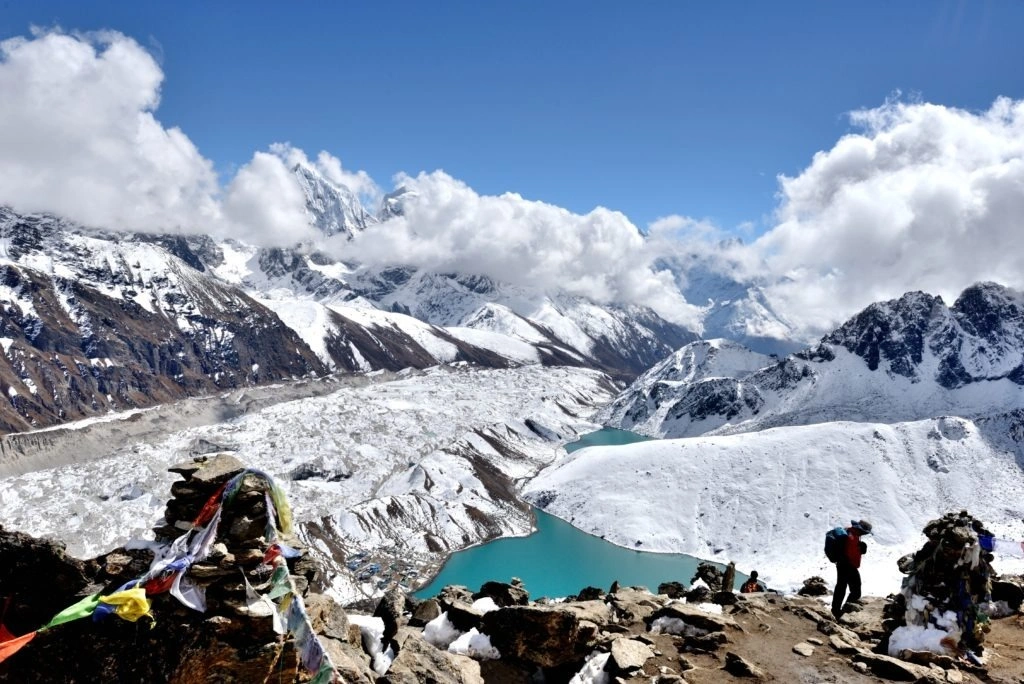
The Gokyo Lakes Trek Map shows 6 glacial lakes, collectively called the Gokyo Chho system or Dudh Pokhari system, located between 4,700m and 5,073m in the Gokyo Valley above the Ngozumpa Glacier. Each lake is a separate body of meltwater fed by glacial drainage. The Ramsar Convention designated the Gokyo Wetlands an internationally important wetland site in 2007.
Where Are the First, Second, and Third Gokyo Lakes?
The first 3 Gokyo Lakes are located on the eastern edge of the Ngozumpa Glacier, accessible from the main Gokyo Valley trail:
First Gokyo Lake (Longponga Tsho): Located at 4,700m, approximately 2 kilometers south of Gokyo Village. Trekkers pass this lake on the ascent from Machhermo without a detour. The lake surface measures roughly 800m × 300m.
Second Gokyo Lake (Taujung Tsho): Located at 4,720m, 500m north of the first lake along the valley trail. Visible from the main path.
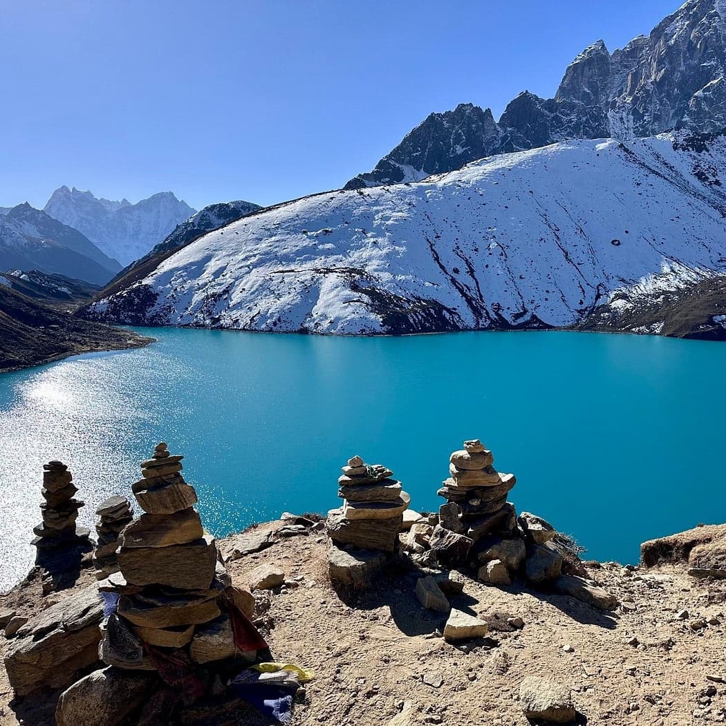
Third Gokyo Lake (Dudh Pokhari): Located at 4,790m, directly beside Gokyo Village. This is the largest and most visited lake, measuring approximately 1.5 km × 1 km. The name "Dudh Pokhari" translates to "Milk Lake" in Nepali, referencing the milky turquoise color of the glacial water caused by suspended rock flour.
Where Are the Higher Gokyo Lakes Located?
The upper 3 Gokyo Lakes require a dedicated half-day or full-day excursion from Gokyo Village, following the moraine ridge northward:
Fourth Gokyo Lake (Thonak Tsho): Located at 4,980m, 3 kilometers north of Gokyo Village on the moraine above the Ngozumpa Glacier. This lake is surrounded by debris-covered glacier ice and is not visible from the Gokyo Valley floor trail.
Fifth Gokyo Lake (Ngozumpa Tsho): Located at 5,010m, 4.5 kilometers north of Gokyo Village. This lake offers one of the closest accessible viewpoints to the Cho Oyu base camp approach zone.
Sixth Gokyo Lake (Gyazumpa Tsho): Located at 5,073m, the highest lake in the Gokyo system and 6 kilometers north of Gokyo Village. Visiting this lake in a single day from Gokyo Village is demanding, trekkers cover 12 kilometers round-trip at altitudes above 4,800m. Most groups visit only the fourth and fifth lakes.
How Does Gokyo Village Connect to the Gokyo Lakes?
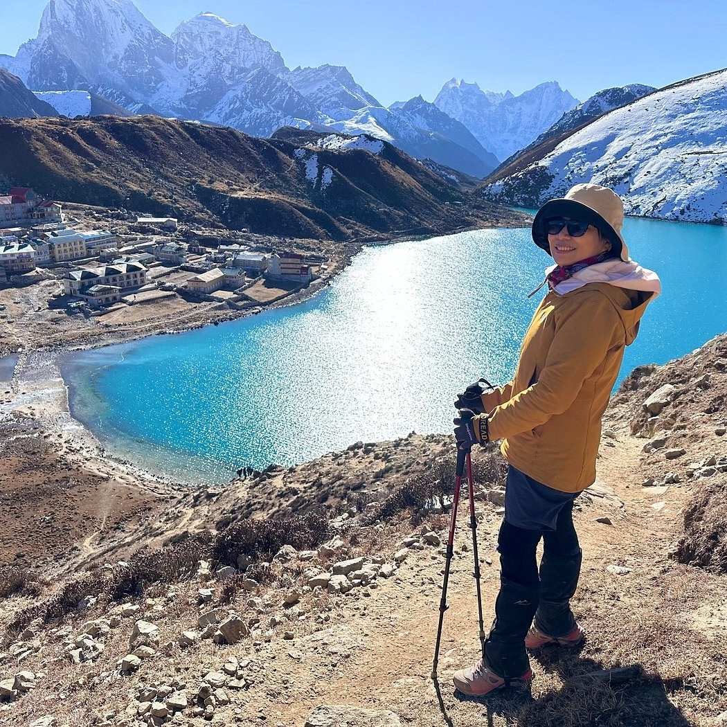
Gokyo Village (4,790m) sits on the eastern shore of the third Gokyo Lake (Dudh Pokhari), making it the natural base camp for exploring all 6 lakes. The village contains approximately 30 teahouses and lodges operating during trekking season (March–May and October–December). From Gokyo Village, trekkers reach:
First and second lakes: 2 km south, 30–45 minutes walk
Fourth lake: 3 km north, 60–90 minutes walk
Fifth lake: 4.5 km north, 90–120 minutes walk
Gokyo Ri summit: 3 km west, 2.5–3 hours ascent
Which Alternative Routes Are Shown on the Gokyo Lakes Trek Map?
The Gokyo Lakes Trek Map shows 3 distinct route options beyond the standard Lukla–Gokyo–Lukla loop: the Cho La Pass crossing to Everest Base Camp, the high-altitude Renjo La Pass route toward Thame, and the valley-floor return via the same Dudh Koshi corridor. Each alternative varies by difficulty, distance, and minimum acclimatization requirements.
Where Does the Cho La Pass Route Connect With Gokyo?
Cho La Pass (5,420m) connects Gokyo Valley to the Khumbu Valley (Everest Base Camp corridor) via a 7–8 hour crossing from Thagnak (4,750m) on the Gokyo side to Dzongla (4,830m) on the Khumbu side. On the trek map, Cho La Pass appears as a glacier-crossing notch in the ridgeline 5 kilometers east-southeast of Gokyo Village.
Key technical details of the Cho La crossing:
Distance: 10 kilometers from Thagnak to Dzongla
Elevation: 5,420m at the highest point
Glacier crossing: 1.5–2 km of glacier ice requiring crampons and trekking poles, mandatory equipment, not optional
Seasonal restrictions: The pass closes when heavy snowfall (typically November–February) makes glacier ice unstable. The narrow couloir on the eastern descent accumulates ice, creating fall risk without crampons.
Connection point: After crossing to Dzongla, trekkers reach Lobuche (4,940m) in 2–3 hours, then Gorak Shep (5,164m) and Everest Base Camp (5,364m) the following day.
How Does the Gokyo to Everest Base Camp Route Differ?
The Gokyo–Cho La–Everest Base Camp circuit differs from the standard Gokyo Lakes Trek in 4 measurable ways:
Total distance: The circuit covers 110–120 km versus 72 km for the standard Gokyo loop, a 67% increase in total trekking distance.
Duration: 16–18 days for the full circuit versus 12–14 days for the standard Gokyo route.
Maximum elevation: 5,550m at Kala Patthar (the standard EBC viewpoint) versus 5,357m at Gokyo Ri, a 193m increase in maximum altitude.
Technical requirements: Cho La Pass requires crampons and glacier experience. The standard Gokyo Lakes Trek requires no technical climbing equipment.
What most trekking guides fail to specify: the direction of the circuit matters significantly. Trekking Gokyo first, then Cho La east to EBC is preferable because trekkers acclimatize more gradually, sleeping at lower elevations before reaching the 5,420m pass. Reversing the direction, EBC first, then Cho La west to Gokyo, exposes trekkers to higher elevations with less preparatory acclimatization time.
Which Route Options Avoid or Include High Passes?
The Gokyo Lakes Trek Map identifies 3 route categories based on pass elevation and technical difficulty:
No High Pass (Standard Route):
Lukla → Namche → Gokyo → Return via same valley
Maximum elevation: 5,357m (Gokyo Ri)
Technical difficulty: Non-technical; no crampons required
Suitable for: First-time Himalayan trekkers with good base fitness
Single High Pass:
Gokyo → Cho La Pass (5,420m) → EBC → Lukla
Or: Gokyo → Renjo La Pass (5,360m) → Thame → Namche → Lukla
Maximum elevation: 5,420m (Cho La)
Technical difficulty: Moderate; crampons required for Cho La
Suitable for: Trekkers with prior high-altitude experience (above 4,500m)
Three High Passes Circuit:
Renjo La (5,360m) → Cho La (5,420m) → Kongma La (5,535m)
Maximum elevation: 5,535m (Kongma La, the highest of the 3 passes)
Technical difficulty: High; all 3 passes require acclimatization above 5,000m
Suitable for: Experienced high-altitude trekkers; minimum 20–22 days required
How Can You Use a Gokyo Lakes Trek Map for Planning?
A Gokyo Lakes Trek Map enables 4 critical planning functions: estimating daily walking distances for fitness preparation, identifying mandatory acclimatization stops, locating emergency helicopter evacuation points, and identifying water source locations for hydration planning. Using the map before departure, not just during the trek, significantly reduces navigational and pacing errors, helping to ensure a safe and successful acclimatization strategy.
How Can You Estimate Daily Walking Distances?
Daily walking distances on the Gokyo Lakes Trek map fall between 8 and 15 kilometers, with the longest day being the Namche-to-Dole stretch at approximately 15 km. Trekkers estimate daily time requirements using the formula: distance in kilometers ÷ 2.5 km/hour average trekking speed at altitude (accounting for elevation, pack weight, and terrain), plus 30–45 minutes for rest breaks.
Applying this formula:
8 km day (Lukla to Phakding): approximately 3.2 hours walking + breaks = 4 hours total
15 km day (Namche to Dole): approximately 6 hours walking + breaks = 7.5 hours total
The average trekking speed at altitude drops to 2.0–2.2 km/hour above 4,000m due to reduced oxygen partial pressure. At 4,790m (Gokyo Village), trekkers with proper acclimatization typically walk at 1.8–2.0 km/hour on the moraine trail toward the upper lakes.
How Can You Identify Acclimatization Stops?
The Gokyo Lakes Trek Map identifies acclimatization stops by cross-referencing elevation gain between consecutive villages against the 300m-per-night rule (the maximum safe sleeping elevation gain for acclimatized adults above 3,000m):
Phakding to Namche: 830m elevation gain, exceeds the 300m rule, making Namche a mandatory 2-night stop
Namche to Dole: 598m gain in one day, acceptable only because Namche acclimatization precedes it
Dole to Machhermo: 432m gain, within safe limits after Namche rest
Machhermo to Gokyo: 320m gain, at the upper boundary of safe daily gain at this altitude
Groups with members showing early AMS symptoms (persistent headache, nausea, fatigue, dizziness) must add an acclimatization rest day at Machhermo before proceeding to Gokyo. Descending 300–500m from Machhermo to Luza or Dole for one night, then re-ascending, resolves mild AMS in 80% of cases according to Himalayan Rescue Association treatment protocols.
What Map Features Are Most Useful During the Trek?
The 5 most actionable map features during the actual Gokyo Lakes Trek are:
Village markers with elevations: Confirm altitude gain between each stop; essential for daily acclimatization assessment
Suspension bridge icons: 11 suspension bridges cross the Dudh Koshi River between Lukla and Namche; map identification prevents wrong-valley navigation
Glacier boundary lines: The Ngozumpa Glacier boundary on the map identifies the 4th through 6th lake access routes above 4,900m
Emergency helipad locations: Marked at Namche Bazaar (3,440m), Machhermo (4,470m), and Gokyo (4,790m), the 3 evacuation points on the standard route
Water source symbols: Meltwater streams between Luza and Gokyo carry high turbidity from glacial sediment; map-marked stream locations help trekkers identify cleaner upstream sources
How Can Nepal Intrepid Treks Help You Navigate the Gokyo Lakes Trek?
Nepal Intrepid Treks provides guided Gokyo Lakes Trek packages with licensed mountain guides, detailed route maps, and full logistical support from Kathmandu to Gokyo and back. The agency specializes in Khumbu-region trekking and operates with TAAN (Trekking Agencies Association of Nepal) certification and guides holding NMA (Nepal Mountaineering Association) licensing.
Can Nepal Intrepid Treks Provide a Detailed Gokyo Lakes Trek Map?
Nepal Intrepid Treks provides trekkers with a 1:50,000 scale topographic Gokyo Lakes Trek Map as part of every guided package, along with a route profile card showing daily elevation gains, lodge names, emergency contact numbers, and GPS waypoints for the Gokyo Valley and optional Cho La Pass crossing.
For independent trekkers, Nepal Intrepid Treks offers:
Pre-trek route consultation with senior guides who have completed the Gokyo route 50+ times
Permit processing for Sagarmatha National Park entry (NPR 3,000) and the Khumbu Pasanglhamu Rural Municipality Trek Card (NPR 3,000)
Custom itinerary design for the 3-pass circuit, standard Gokyo route, or Gokyo–EBC combination
Ready to explore the Gokyo Lakes? Contact Nepal Intrepid Treks to receive your personalized Gokyo Lakes Trek Map, a detailed day-by-day itinerary, and a no-obligation cost breakdown tailored to your group size and available dates.
What Are the Key Takeaways From the Gokyo Lakes Trek Map?
The Gokyo Lakes Trek Map communicates the following 7 critical planning facts:
Total route distance: 52 km one-way from Lukla (2,860m) to Gokyo (4,790m), covering 5 major trail sections across 6–8 trekking days on the ascent
Elevation range: 2,610m at Phakding (lowest point) to 5,357m at Gokyo Ri (highest standard point)
Lake count: 6 glacial lakes between 4,700m and 5,073m; 3 visible from the main trail, 3 requiring dedicated excursions from Gokyo Village
Mandatory acclimatization stops: 2 confirmed stops, Namche Bazaar (2 nights) and Machhermo (1 night minimum), with optional pacing at Luza or Dole for slower acclimatizers
Alternative route count: 3 route options beyond the standard loop, Cho La Pass crossing, Renjo La Pass crossing, or the full Three Passes Circuit
Technical requirements: Standard route is non-technical; Cho La Pass requires crampons; Three Passes Circuit requires significant high-altitude experience
Permit requirements: 2 permits mandatory, Sagarmatha National Park entry (NPR 3,000) and the Khumbu Pasanglhamu Rural Municipality Trek Card (NPR 3,000), both of which can be processed in Lukla or at the national park gate.
The Gokyo Lakes Trek route map is the most reliable pre-trek planning tool for understanding altitude gain, pacing strategy, and route decision points. Combined with expert guidance from Nepal Intrepid Treks and proper acclimatization at Namche Bazaar and Machhermo, the route delivers one of the most visually rewarding high-altitude trekking experiences in the Himalayas, a 4,790m lakeside destination backed by 4 of the world's highest peaks.