Nepal is the global center of Himalayan trekking, offering some of the world’s highest-altitude trekking routes across the Everest, Annapurna, Langtang, Manaslu, Mustang, and Kanchenjunga regions. The best treks in Nepal range from short beginner-friendly routes like the Ghorepani Poon Hill Trek and Mardi Himal Trek to demanding high-altitude expeditions such as the Everest Base Camp Trek, Manaslu Circuit Trek, Annapurna Circuit Trek, and Kanchenjunga Base Camp Trek. These trekking routes pass through alpine forests, glacial valleys, suspension bridges, Buddhist monasteries, remote mountain villages, and high Himalayan passes including Thorong La Pass, Larkya La Pass, Cho La Pass, and Renjo La Pass. Trek durations vary from 4 days to 25 days, while maximum elevations range from 3,210 meters to 5,545 meters, making Nepal suitable for both first-time trekkers and experienced high-altitude hikers.
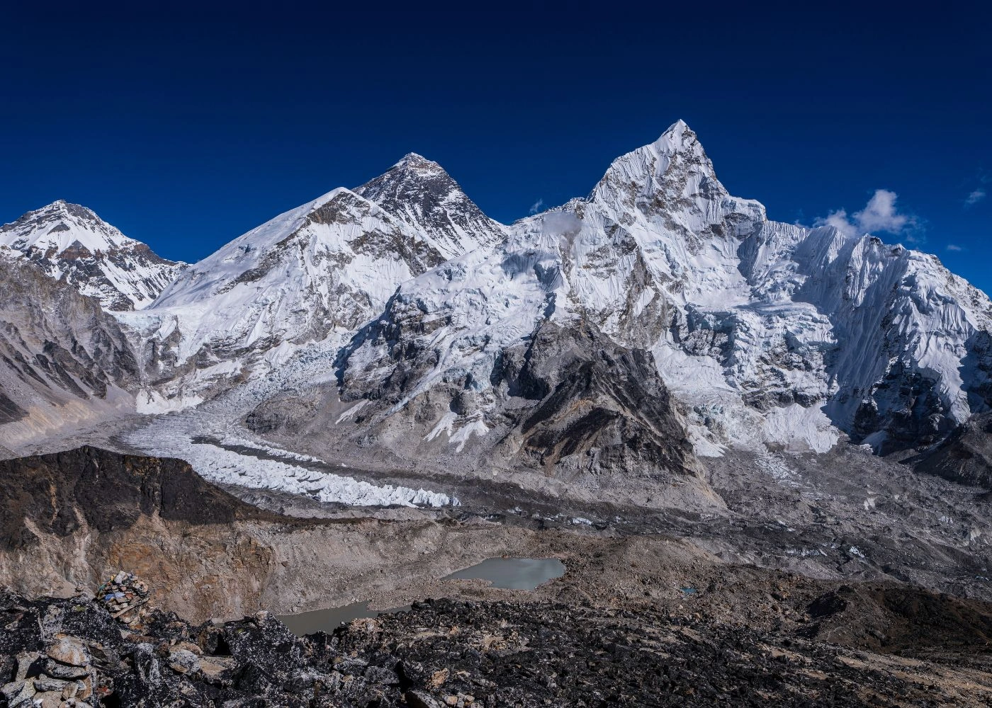
The 10 best treks in Nepal differ in route difficulty, elevation profile, trekking season, permit requirements, and geographic landscape. Popular trekking regions such as the Annapurna Conservation Area, Sagarmatha National Park, Langtang National Park, Manaslu Conservation Area, and Upper Mustang Restricted Area each offer distinct ecological and cultural environments shaped by the Himalayas. Trekkers encounter snow-covered peaks including Mount Everest (8,849m), Annapurna I (8,091m), Manaslu (8,163m), Dhaulagiri (8,167m), and Kanchenjunga (8,586m), alongside Tibetan Buddhist culture, Sherpa settlements, glacial lakes, and remote Trans-Himalayan terrain. Most Nepal trekking routes require permits issued by the Nepal Tourism Board, including Trekkers' Information Management System (TIMS) cards, Annapurna Conservation Area Project (ACAP), Manaslu Conservation Area Project (MCAP), Restricted Area Permits, and national park entry permits. Autumn (September to November) and spring (March to May) provide the best trekking conditions in Nepal due to stable weather, clear mountain visibility, safer trail conditions, and moderate temperatures at high elevations.
What Are the 10 Best Treks in Nepal? A Comparative Overview
The following table presents the 10 best treks in Nepal ranked by popularity, with their core metrics: duration, maximum elevation, total distance, difficulty rating (1 = easy, 5 = strenuous), and average permit cost.
Rank | Trek Name | Duration | Max Elevation | Distance | Difficulty | Permit Cost (USD) |
1 | Mardi Himal Trek | 5–7 days | 4,500m | 52 km | 2/5 | ~$30 |
2 | Manaslu Circuit Trek | 14–18 days | 5,106m | 177 km | 4/5 | ~$175 |
3 | Annapurna Base Camp Trek | 7–12 days | 4,130m | 110 km | 3/5 | ~$30 |
4 | Everest Base Camp Trek | 12–14 days | 5,545m | 130 km | 4/5 | ~$35 |
5 | Gokyo Lakes Trek | 12–15 days | 5,483m | 160 km | 4/5 | ~$35 |
6 | Langtang Valley Trek | 7–10 days | 4,984m | 65 km | 3/5 | ~$35 |
7 | Ghorepani Poon Hill Trek | 4–5 days | 3,210m | 43 km | 1/5 | ~$30 |
8 | Annapurna Circuit Trek | 15–20 days | 5,416m | 230 km | 4/5 | ~$30 |
9 | Upper Mustang Trek | 10–14 days | 3,840m | 177 km | 3/5 | ~$530 |
10 | Kanchenjunga Base Camp Trek | 20–25 days | 5,143m | 220 km | 5/5 | ~$55 |
Treks ranked 1–3 (Mardi Himal, Manaslu Circuit, Annapurna Base Camp) attract the highest volume of first-time Himalayan trekkers. Treks ranked 8–10 (Annapurna Circuit, Upper Mustang, Kanchenjunga) attract experienced high-altitude trekkers seeking remote wilderness.
1. Mardi Himal Trek
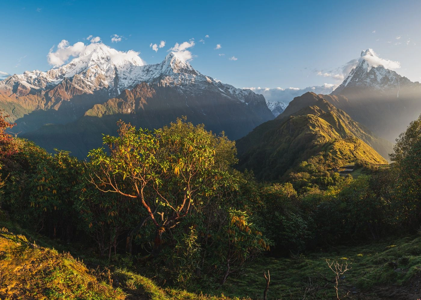
The Mardi Himal Trek is a 5–7 day moderate trekking route in the Annapurna Conservation Area, ascending from Kande village (1,770m) near Pokhara to Mardi Himal Base Camp at 4,500m, with a panoramic view of Mardi Himal (5,587m), Machhapuchhre (6,993m), and Annapurna South (7,219m).
The trek covers 52 km total with a daily elevation gain between 400m and 700m. Trekkers with a minimum of 3 days of previous hiking experience complete this route without technical mountaineering skills.
What Are the Key Stages of the Mardi Himal Trek?
The Mardi Himal Trek follows 5 distinct altitude zones across its 7-day standard itinerary:
Kande to Forest Camp (2,590m): 4–5 hours, dense rhododendron forest trail
Forest Camp to Low Camp (2,985m): 3–4 hours, transition from forest to alpine scrub
Low Camp to High Camp (3,580m): 4–5 hours, open ridge with 270° Himalayan panorama
High Camp to Mardi Himal Base Camp (4,500m): 3–4 hours, rocky moraine terrain
Descent via Sidhing village (1,700m): 6–7 hours, return to Pokhara valley
The trek operates within the Annapurna Conservation Area Project (ACAP), established in 1986 and managed by the National Trust for Nature Conservation (NTNC). The ACAP entry permit costs NPR 3,000 (approximately USD 22) per person.
What Is the Best Season for the Mardi Himal Trek?
The 2 best seasons for the Mardi Himal Trek are spring (March–May) and autumn (October–November). Spring brings rhododendron blooms across 2,000m–3,500m elevations, with daytime temperatures at High Camp ranging from 5°C to 12°C. Autumn delivers the clearest skies, with visibility exceeding 80 km from Mardi Himal Base Camp.
The monsoon season (June–August) reduces visibility to under 5 km on most trail days. December through February brings snowfall above 3,000m, requiring crampons and microspikes at High Camp and Base Camp sections.
2. Manaslu Circuit Trek
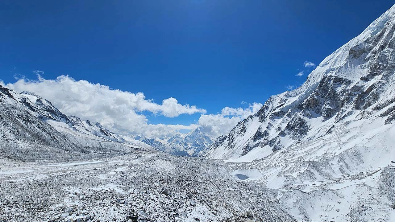
The Manaslu Circuit Trek is a 14–18 day strenuous circumnavigation of Mount Manaslu (8,163m), covering 177 km from Soti Khola (710m) in Gorkha District to Besisahar in Lamjung District, crossing the Larkya La Pass at 5,106m, the highest point of the route.
The trek passes through 4 distinct ecological zones: subtropical forest, temperate broadleaf forest, alpine meadow, and glacial moraine. Trekkers traverse 16 active glaciers and cross 3 river systems: the Budhi Gandaki, the Shyar Khola, and the Dudh Khola.
What Permits Are Required for the Manaslu Circuit Trek?
The Manaslu Circuit Trek requires 3 mandatory permits due to its restricted area status:
Restricted Area Permit (RAP): USD 100 per person per week from September to November; USD 75 per person per week from December to August. Issued only to groups of 2 or more trekkers with a licensed Nepali guide.
Manaslu Conservation Area Project (MCAP) permit: NPR 3,000 (approximately USD 22) per person.
Annapurna Conservation Area Project (ACAP) permit: NPR 3,000 (approximately USD 22) per person, required for the Larkya La section connecting to the Annapurna circuit.
The Manaslu restricted area designation was established by the Government of Nepal in 1991 under the Restricted Area Regulations to protect the cultural heritage of the Nubri and Tsum ethnic communities inhabiting the Budhi Gandaki valley.
What Is the Larkya La Pass and Why Is It Critical to the Manaslu Circuit?
The Larkya La Pass (5,106m) is the highest and most technically demanding section of the Manaslu Circuit Trek, connecting Dharamsala (4,460m) on the western side with Bimthang (3,590m) on the eastern side. Trekkers ascend 646m vertical gain over 6 km before descending 1,516m over 10 km.
The crossing requires a minimum 6-hour commitment in sub-zero temperatures ranging from −10°C to −5°C at dawn. According to the Manaslu Conservation Area Management Plan (2017), the pass remains safely crossable for 9 months per year, closing only during peak snowfall periods in January and February.
The Larkya La crossing falls under the joint management of ACAP and MCAP; per the National Trust for Nature Conservation's 2024 Annual Report, ACAP alone now spans 7,629 sq. km across 5 districts and 15 rural municipalities, serving over 100,000 residents.
3. Annapurna Base Camp Trek
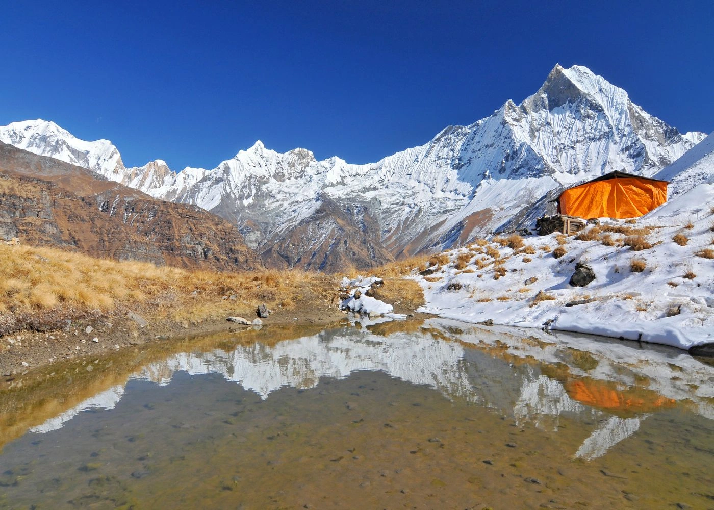
The Annapurna Base Camp (ABC) Trek is a 7–12 day moderate to strenuous trekking route reaching the glacial amphitheater at 4,130m, surrounded by 6 peaks above 7,000m: Annapurna I (8,091m), Annapurna South (7,219m), Hiunchuli (6,441m), Machhapuchhre (6,993m), Gangapurna (7,455m), and Annapurna III (7,555m).
The route covers 110 km total, starting from Nayapul (1,070m) in Kaski District and ascending through the Modi Khola river valley. The ABC sanctuary hosts the Annapurna glacier, covering approximately 30 km² within the horseshoe-shaped glacial cirque.
What Are the Altitude Milestones on the Annapurna Base Camp Trek?
The ABC Trek passes through 7 key elevation checkpoints across its standard 11-day itinerary:
Nayapul (1,070m): trek starting point, accessible by 1.5-hour drive from Pokhara
Tikhedhunga (1,540m): overnight camp at the Modi Khola confluence
Ghorepani (2,860m): rhododendron forest zone, optional Poon Hill sunrise detour
Tadapani (2,630m): mixed oak and rhododendron forest, Annapurna South views
Chhomrong (2,170m): gateway village to the ABC sanctuary
Machapuchare Base Camp (3,700m): Machhapuchhre glacier moraine camp
Annapurna Base Camp (4,130m): 360° panorama within the Annapurna sanctuary
The sanctuary zone above Chhomrong falls under a strict no-camping-outside-designated-teahouses policy enforced by the Annapurna Conservation Area Project since 2012.
4. Everest Base Camp Trek
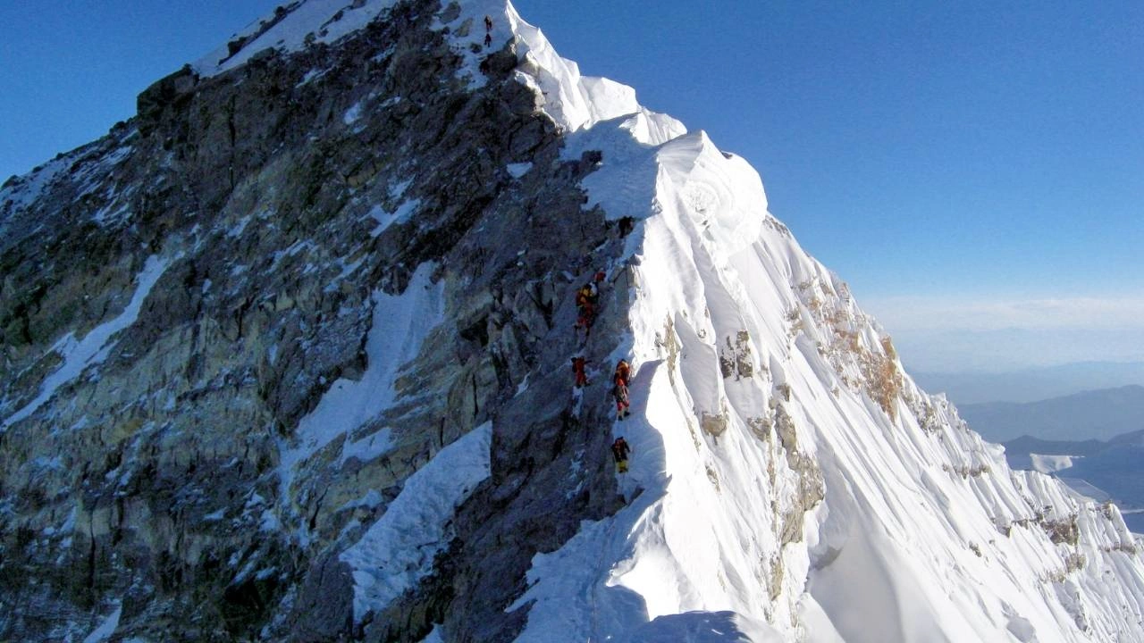
The Everest Base Camp (EBC) Trek is a 12–14 day strenuous route ascending to 5,545m at Kala Patthar, the viewpoint directly above Gorak Shep, offering the highest accessible ground-level view of Mount Everest's (8,849m) south face. The route covers 130 km round trip from Lukla (2,860m) through the Khumbu Valley.
The total cumulative elevation gain on the EBC trek reaches approximately 4,000m from Lukla to Kala Patthar. Trekkers ascend through 4 altitude zones: the Dudh Koshi river valley, the Namche Bazaar plateau (3,440m), the Tengboche ridge (3,867m), and the Khumbu glacier moraine.
What Is Acute Mountain Sickness (AMS) and How Does It Affect Everest Base Camp Trekkers?
Acute Mountain Sickness (AMS) is a physiological response to reduced atmospheric oxygen at elevations above 2,500m, caused by hypobaric hypoxia, the state in which atmospheric pressure drops below the level required for efficient oxygen absorption. At Everest Base Camp (5,364m), atmospheric oxygen concentration measures approximately 53% of sea-level values.
According to a PLOS ONE-published, HRA-affiliated epidemiological study of Nepalese high-altitude trekkers and pilgrims, 34.0% of trekkers ascending above 4,380m develop AMS symptoms, with women facing 1.57 times the risk of men. The standard acclimatization protocol requires 2 rest days at Namche Bazaar and 1 rest day at Dingboche (4,410m).
What Are the Key Landmarks on the Everest Base Camp Route?
The EBC route passes through 8 landmark locations with documented cultural and geographic significance:
Lukla Tenzing-Hillary Airport (2,860m): classified as one of the world's most dangerous airports, with a 527m runway at 11.7° incline
Namche Bazaar (3,440m): administrative capital of the Khumbu region, Sherpa cultural hub with a Saturday weekly market operating since the 1960s
Tengboche Monastery (3,867m): largest Gelugpa Buddhist monastery in the Khumbu, founded in 1916 and rebuilt after the 1934 earthquake and 1989 fire
Dingboche (4,410m): acclimatization village with primary Ama Dablam (6,812m) viewpoint
Lobuche (4,940m): last permanent settlement before the Khumbu glacier terminus
Gorak Shep (5,140m): highest permanent teahouse settlement on the route
Everest Base Camp (5,364m): seasonal camp for Everest south-face expeditions, occupied by 300–500 climbers during the April–May expedition season
Kala Patthar (5,545m): highest accessible viewpoint, offering direct sightlines to Everest, Nuptse (7,861m), and Pumori (7,161m)
5. Gokyo Lakes Trek
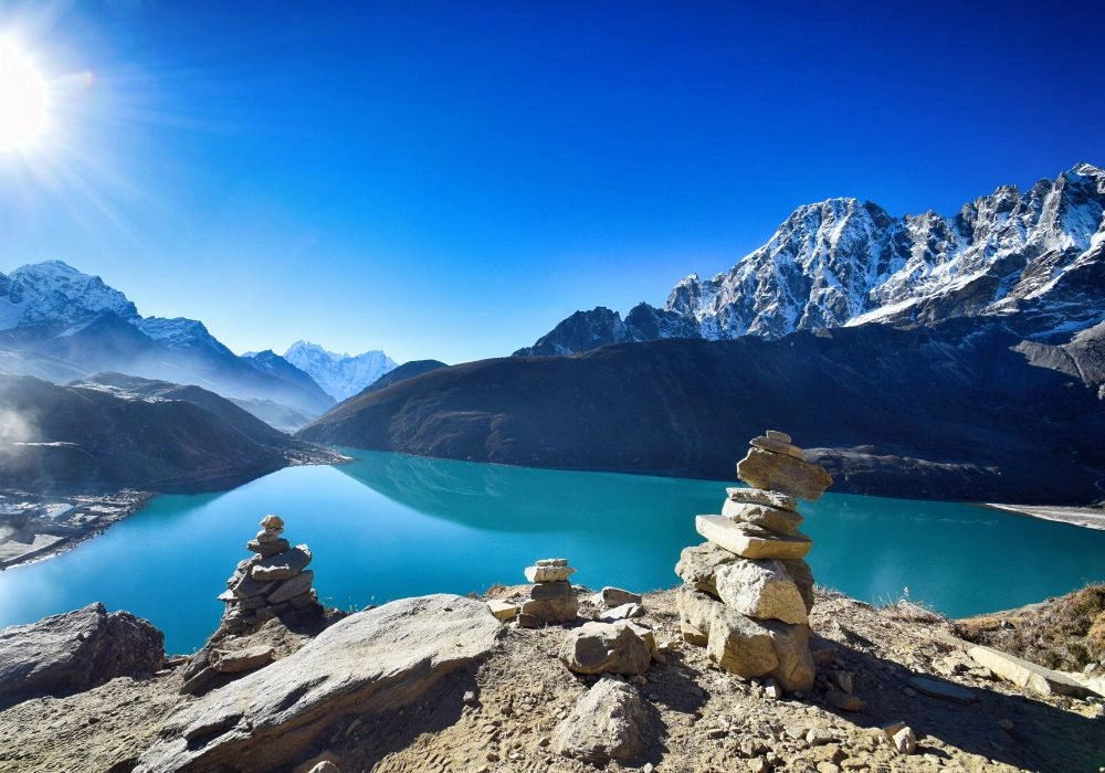
The Gokyo Lakes Trek is a 12–15 day strenuous route reaching the Gokyo Ri viewpoint at 5,357m and the Renjo La Pass at 5,483m, within the Sagarmatha National Park in Solukhumbu District. The route passes through 6 sacred turquoise glacial lakes collectively called the Gokyo Lakes, situated at 4,700m–4,990m along the Ngozumpa glacier, Nepal's longest glacier at 36 km.
The Gokyo Lakes Trek differs from the Everest Base Camp Trek in 3 fundamental ways:
Route direction: Gokyo ascends the Dudh Koshi's western tributary (Gokyo Khola) rather than the main valley
Lake ecosystems: Gokyo Lakes comprise 6 high-altitude Ramsar-designated wetlands, classified as internationally significant since 2007
Combined itinerary: The Gokyo-EBC Cho La Pass combination trek (18–21 days) connects both routes via the Cho La Pass (5,420m)
What Are the 6 Gokyo Lakes and Their Elevations?
The 6 Gokyo Lakes, known in the Sherpa language as Dudh Pokhari (Milk Lakes), form a north-to-south chain along the Ngozumpa glacier's eastern moraine:
Longponga Tsho (4,690m): lowest lake, 3 km south of Gokyo village
Taboche Tsho (4,700m): second lake, primary camping area
Dudh Pokhari (4,750m): third lake and largest, adjacent to Gokyo village
Thonak Tsho (4,830m): fourth lake, longest at 2.4 km
Ngozumpa Tsho (4,990m): fifth lake, closest to Cho Oyu (8,188m) base
Gyazumpa Tsho (4,990m): sixth and highest lake, accessible from fifth lake in 2 hours
6. Langtang Valley Trek
The Langtang Valley Trek is a 7–10 day moderate trekking route in Langtang National Park, ascending from Syabrubesi (1,460m) in Rasuwa District to Tserko Ri (4,984m), passing through the Langtang Khola river valley and the Kyanjin Gompa plateau at 3,870m. The total distance is 65 km with a maximum daily elevation gain of 800m.
Langtang National Park, established in 1976 as Nepal's first Himalayan national park, covers 1,710 km² and hosts 46 mammal species, including the red panda (Ailurus fulgens) and snow leopard (Panthera uncia).
How Did the 2015 Gorkha Earthquake Affect the Langtang Valley?
The April 25, 2015 Gorkha earthquake (7.8 Mw) triggered a massive glacial avalanche that buried Langtang village (3,430m) under 8 million cubic meters of ice, rock, and debris, killing 243 residents and trekkers. The disaster destroyed 80% of teahouse infrastructure between Langtang village and Kyanjin Gompa.
The Nepal government, in coordination with the Japan International Cooperation Agency (JICA), completed the Langtang Valley reconstruction by 2017. Kyanjin Gompa, the valley's primary teahouse hub, reopened with 12 operational lodges by March 2017. Current trail conditions between Syabrubesi and Kyanjin Gompa are fully operational with 45 teahouses available.
7. Ghorepani Poon Hill Trek
The Ghorepani Poon Hill Trek is a 4–5 day easy trekking route reaching Poon Hill viewpoint at 3,210m, offering a direct sunrise panorama of 7 Himalayan peaks above 7,000m: Dhaulagiri I (8,167m), Annapurna I (8,091m), Annapurna South (7,219m), Hiunchuli (6,441m), Gangapurna (7,455m), Machhapuchhre (6,993m), and Annapurna III (7,555m).
The route covers 43 km total from Nayapul (1,070m) to Birethanti (1,025m), operating entirely within the Annapurna Conservation Area. The maximum daily altitude gain measures 1,290m (Tikhedhunga to Ghorepani section), well within the acclimatization threshold of 1,500m per day recommended by the Wilderness Medical Society.
The Wilderness Medical Society's 2024 Clinical Practice Guidelines for Acute Altitude Illness rate gradual ascent as a Grade 1B strong recommendation for preventing AMS and high-altitude cerebral edema.
Ghorepani Poon Hill Trek is suitable for 3 specific trekker profiles:
First-time Himalayan trekkers with standard walking fitness
Family groups including children aged 10 and above
Short-itinerary travelers with 4–5 available days in Pokhara
What Is the Best Time to See the Poon Hill Sunrise?
The Poon Hill sunrise panorama is visible 300 days per year, with peak clarity occurring between October 15 and November 30 and between March 1 and April 30. The viewpoint opens at 5:00 AM for the sunrise, which occurs between 6:05 AM (November) and 5:45 AM (March) at this latitude.
December through February brings rhododendron-free trails but snow accumulation at Ghorepani (2,860m), requiring waterproof footwear. The 32 rhododendron species in the Ghorepani area bloom between February 15 and April 15, peaking at elevations of 2,400m–3,200m.
8. Annapurna Circuit Trek
The Annapurna Circuit Trek is a 15–20 day strenuous circumnavigation of the Annapurna massif, covering 230 km from Besisahar (760m) in Lamjung District to Nayapul (1,070m) in Kaski District, crossing the Thorong La Pass at 5,416m, the highest trekking pass in the Annapurna region.
The Annapurna Circuit traverses 3 climate zones in a single route: the subtropical Marsyangdi river valley, the temperate Manang plateau (3,500m), and the Trans-Himalayan Mustang rain shadow zone around Muktinath (3,760m). This climatic diversity results in a temperature range from 28°C at Besisahar to −15°C at Thorong La Pass in November.
What Is the Thorong La Pass and What Is the Risk of Altitude Illness?
The Thorong La Pass (5,416m) is the highest crossing point of the Annapurna Circuit Trek, ascending 1,000m from Thorong Phedi (4,450m) to the pass summit over 7 km, followed by a 1,600m descent to Muktinath (3,760m) over 9 km. The complete crossing takes 7–8 hours.
At 5,416m, atmospheric oxygen levels measure approximately 50% of sea-level concentration. According to the Himalayan Rescue Association, 15% of trekkers attempting the Thorong La crossing experience moderate AMS symptoms requiring rest or descent. Trekkers ascending without a minimum 3-day acclimatization stay at Manang (3,519m) face a 40% higher risk of severe AMS.
The pass closes completely during snowfall events between December 15 and February 28, averaging 8–12 closure days per year based on Nepal Meteorological Forecasting Division data from 2010–2023.
9. Upper Mustang Trek
The Upper Mustang Trek is a 10–14 day moderate to strenuous trekking route reaching Lo Manthang (3,840m), the walled capital of the former Kingdom of Lo, located 40 km north of Jomsom in Mustang District. The route covers 177 km in a rain shadow zone north of the Himalayan divide, making it the only major Nepal trek fully accessible during the June–August monsoon season.
Upper Mustang falls within the Lo Mustang Restricted Area, designated by the Government of Nepal in 1992. Independent trekking is prohibited within the restricted zone. All trekkers enter with a licensed Nepali guide.
What Is the Restricted Area Permit Cost for Upper Mustang?
The Upper Mustang Restricted Area Permit (RAP) costs USD 500 per person for the first 10 days, with an additional USD 50 per person per extra day. This permit is the most expensive single trekking permit in Nepal, reflecting the government's policy of limiting annual visitor numbers to protect Lo Mustang's Tibetan Buddhist cultural heritage.
Required permits for the Upper Mustang Trek total 3 documents:
Restricted Area Permit (RAP): USD 500 for 10 days (issued by the Department of Immigration, Kathmandu or Pokhara)
Annapurna Conservation Area Permit (ACAP): NPR 3,000 (approximately USD 22)
TIMS Card: NPR 2,000 (approximately USD 15)
What Is Lo Manthang and What Is Its Historical Significance?
Lo Manthang is a walled city at 3,840m elevation, founded in 1380 CE by Ame Pal, the first king of the Kingdom of Lo, and served as the capital of an independent Himalayan kingdom for 585 years until Nepal's unification in 1795. The city's mud-brick walls enclose 4 palaces, 4 monasteries, and approximately 150 residential compounds within a 1.2 km perimeter.
The city preserves 15th-century Tibetan Buddhist murals within the Thubchen Gompa and Jampah Gompa monasteries, classified as endangered cultural heritage by the American Himalayan Foundation in 1998. Restoration of Lo Manthang's monastery murals, conducted between 2000 and 2015, covered 1,600 m² of fresco surface.
10. Kanchenjunga Base Camp Trek
The Kanchenjunga Base Camp Trek is a 20–25 day strenuous trekking route in Far Eastern Nepal reaching Pangpema North Base Camp (5,143m) and Oktang South Base Camp (5,143m), within the Kanchenjunga Conservation Area in Taplejung District. The route covers 220 km and requires a flight from Kathmandu to Bhadrapur (2 hours) or Taplejung (35 minutes), followed by 1–2 days of jeep travel to the trek starting point.
Kanchenjunga (8,586m) is the world's third highest mountain, located on the Nepal-India border in Taplejung District. The Kanchenjunga Conservation Area, established in 1997, covers 2,035 km² and hosts the largest intact temperate forest ecosystem in the central Himalayas, including populations of 36 orchid species and 4 large mammal species classified as Vulnerable on the IUCN Red List.
What Are the Two Base Camps of Kanchenjunga?
The Kanchenjunga Base Camp Trek accesses 2 separate base camps on opposite flanks of the massif, making it Nepal's only trek offering simultaneous north and south face high-altitude base camp access:
Pangpema North Base Camp (5,143m): Located at the foot of Kanchenjunga's north face, accessible from Ghunsa (3,410m) in 3 days. Provides direct views of the 2,000m Kangchenjunga north wall.
Oktang South Base Camp (5,143m): Located at the foot of the Yalung glacier, accessible from Tseram (3,870m) in 1 day. The Yalung glacier extends 15 km south from the Kanchenjunga summit.
Connecting both base camps via the Mirgin La Pass (4,663m) adds 3 days to the itinerary and requires a mandatory Nepali guide and porter, as per Restricted Area Permit regulations.
What Permits Does the Kanchenjunga Base Camp Trek Require?
The Kanchenjunga Base Camp Trek requires 3 mandatory permits and 2 supplementary documents:
Restricted Area Permit (RAP): USD 20 per person per week (minimum 2 trekkers required)
Kanchenjunga Conservation Area Permit (KCAP): NPR 3,000 (approximately USD 22)
TIMS Card: NPR 2,000 (approximately USD 15)
Licensed Nepali guide (mandatory): Average guide fee of NPR 3,500–4,500 (USD 26–34) per day
Porter services (optional but strongly recommended): Average porter fee of NPR 2,000–2,500 (USD 15–19) per day
What Is the Best Season to Trek in Nepal?
The 2 optimal trekking seasons in Nepal are autumn (September 15–November 30) and spring (March 1–May 31), based on precipitation data from the Department of Hydrology and Meteorology and visibility data from the Himalayan Rescue Association.
Nepal's 2024 monsoon delivered 122.0% of normal precipitation and ran 13 days longer than average, according to the Department of Hydrology and Meteorology's State of the Climate of Nepal 2024 report.
Autumn delivers post-monsoon clarity with average daytime temperatures of 10°C–18°C between 3,000m–4,500m and precipitation below 10mm per month above 3,000m. Spring delivers blooming rhododendrons (February–April) and stable trail conditions, with daytime temperatures of 8°C–16°C at high elevations.
The 2 non-optimal seasons present 3 specific challenges:
Monsoon (June–August): 80% of Nepal's annual 1,500mm precipitation falls during this period, reducing trail visibility and increasing landslide risk on 60% of major trekking routes
Winter (December–February): Temperatures below −20°C occur at elevations above 5,000m; 6 high-altitude passes (Thorong La, Larkya La, Cho La, Renjo La, Mirgin La, and Kang La) close during January–February snowfall events
Upper Mustang Trek operates as the single exception, with a viable monsoon trekking window from June to August due to its Trans-Himalayan rain shadow position north of the Annapurna massif.

.avif&w=1920&q=75)
.avif&w=1920&q=75)