The Himalayas are the world’s highest mountain range and one of the most season-sensitive travel regions on Earth, where the best time to visit depends on weather, altitude, visibility, and route access. For most travelers, the best time to visit the Himalayas is spring (March to May) and autumn (September to November), when skies are clearer, trekking trails are more stable, and major routes across Everest, Annapurna, and Langtang remain fully accessible. These peak seasons offer the strongest conditions for trekking, mountain photography, and high-altitude travel across Nepal, while also creating the most reliable travel windows in several other Himalayan regions.
Himalayan travel changes sharply by elevation and geography, from low valleys below 2,000 m to snowbound passes above 5,000 m, so the right season also depends on what kind of trip you want to take. Spring brings rhododendron blooms, warmer trail conditions, and active climbing season around Everest, while autumn delivers the clearest post-monsoon mountain views and the most stable long-trek weather. Monsoon months work best in rain-shadow areas such as Upper Mustang, Dolpo, and Ladakh, while winter favors low-altitude sightseeing, cultural travel, and snow photography rather than major pass crossings. This guide explains when to visit the Himalayas by season, region, altitude band, and travel goal so you can plan the most suitable window for trekking, sightseeing, or mountain adventure.
What Makes One Season Better Than Another in the Himalayas?
A Himalayan season ranks higher when it delivers 3 measurable advantages: low precipitation (below 50 mm/month), above-average daytime visibility (above 30 km horizontal range), and open high-altitude passes (above 4,000 m). Spring and autumn satisfy all 3 criteria simultaneously, making them the dominant travel seasons across Nepal's trekking industry.
How Do Weather, Visibility, and Trail Conditions Change?
Weather, visibility, and trail conditions in the Himalayas change across 4 distinct seasons, each defined by monsoon influence, jet stream position, and temperature gradients between lowland valleys and high-altitude ridges.
The table below compares all 4 seasons across 5 critical travel parameters.
|
Season |
Months |
Avg. Visibility |
Precipitation |
Pass Accessibility |
|
Spring |
March–May |
25–50 km |
30–80 mm/month |
Fully open by April |
|
Summer/Monsoon |
June–August |
2–10 km |
200–450 mm/month |
Restricted above 4,500 m |
|
Autumn |
September–November |
40–80 km |
10–40 mm/month |
Fully open September–October |
|
Winter |
December–February |
30–60 km (clear days) |
5–20 mm/month |
Closed above 4,000 m |
Spring visibility peaks in April at roughly 50 km on clear mornings, driven by dry northwest winds. Autumn visibility reaches its annual high in October, when post-monsoon air washing produces a horizontal range of up to 80 km, the clearest mountain views recorded across the Khumbu region.
Trail conditions shift most dramatically between May and June, when the Southwest Monsoon arrives from the Bay of Bengal. Precipitation rises from 50 mm in May to over 300 mm in July across the Annapurna Conservation Area, saturating slopes and accelerating erosion on trails above 3,500 m.
How Do Altitude and Access Affect the Best Travel Window?
Altitude and access directly determine the best travel window because passes above 4,000 m remain snowbound for 3 to 5 months each year. The Thorong La Pass (5,416 m) on the Annapurna Circuit closes in January and February due to heavy snowfall, while the Cho La Pass (5,420 m) on the Everest Three Passes Trek closes from December through March.
Access constraints follow 3 altitude tiers in Nepal's Himalayas:
-
Below 3,000 m: Accessible year-round; 12-month trekking window
-
3,000 m to 4,500 m: Accessible 9 months per year (March–November); January and February carry avalanche risk
-
Above 4,500 m: Accessible 6 months per year (April–May and September–October optimal); winter snowfall and monsoon instability close routes
Road access also constrains timing. The Jiri–Salleri Highway and Araniko Highway to the Tibet border close periodically during monsoon due to landslides, particularly between Barabise and Tatopani. Kathmandu's Tribhuvan International Airport (elevation: 1,338 m) operates year-round, but mountain flights to Lukla Airport (elevation: 2,845 m) cancel at a rate of 30–40% during monsoon months due to low cloud cover and high wind.
Is Spring the Best Time to Visit the Himalayas?
Spring (March to May) ranks as 1 of the 2 best times to visit the Himalayas of Nepal, delivering warm daytime temperatures between 10°C and 20°C at mid-altitude, blooming rhododendron forests across 1,000–3,500 m elevations, and fully accessible high passes by mid-April.
What Are the Conditions Like From March to May in the Himalayas?
March to May conditions in the Himalayas progress from cool and partly cloudy in March to warm and increasingly hazy by late May, as the pre-monsoon moisture builds and afternoon clouds form over the high ridges.
March delivers daytime temperatures of 5°C to 12°C on trails above 3,000 m and 15°C to 22°C in Kathmandu (1,338 m). Snowfall on passes above 4,500 m remains likely through mid-March but clears by April. April ranks as the single most active trekking month in Nepal, with 28% of annual trekking permit sales concentrated in the 4-week window between April 1 and April 30. For a detailed seasonal breakdown of trail conditions and weather windows, see our guide on the best season for Everest Base Camp trek.
May extends the spring trekking season but introduces afternoon thunderstorms above 4,000 m starting around May 15–20 in most years. Morning starts before 7:00 AM secure the clearest skies and best mountain photography light. The summit windows for 8,000-m peaks, including Everest (8,848.86 m), Lhotse (8,516 m), and Makalu (8,485 m), open between April 20 and May 25, concentrating high-altitude climbing activity in this 5-week period.
Which Spring Activities and Views Stand Out Most?
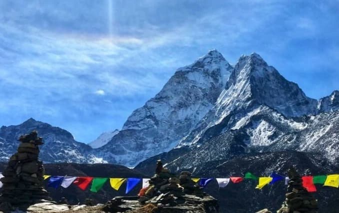
Spring offers 4 standout experiences not available in any other season: rhododendron blooms across 32 species, Everest Base Camp sunrise views, the Annapurna Circuit's full-pass crossing, and live high-altitude summit attempts visible from trekking routes.
Rhododendron forests (genus: Rhododendron, 32 species in Nepal) bloom from 1,500 m to 3,500 m between late February and late April. The Langtang Valley and Ghorepani–Poon Hill route record peak bloom density in the third week of March. Poon Hill (3,210 m) delivers unobstructed 180° views of the Annapurna Massif and Dhaulagiri (8,167 m), Nepal's 7th-highest peak, during spring mornings with sub-10% cloud cover.
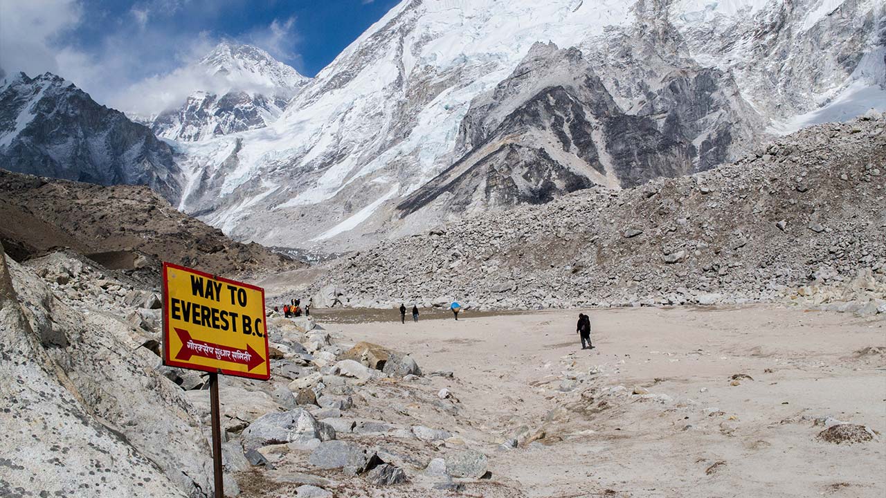
Everest Base Camp (5,364 m) in April hosts 400 to 600 climbers preparing for summit attempts, providing a unique high-altitude cultural atmosphere unavailable during autumn's post-season quiet.
Is Autumn the Best Time to Visit the Himalayas?
Autumn (September to November) is the single best season for trekking the Himalayas of Nepal, combining the year's highest visibility, the most stable weather patterns, and fully washed-clean air following 4 months of monsoon precipitation.
What Are September to November Conditions Like?
September to November conditions transition from warm and occasionally wet in early September to cold and crystalline clear by late October and November, representing the full arc of Nepal's post-monsoon stabilization.
September retains 30–60 mm of residual monsoon precipitation in the first 2 weeks. Trail conditions on lower routes below 3,000 m remain muddy through mid-September. By October 1, precipitation drops below 15 mm across the Khumbu, Annapurna, and Langtang regions. October daytime temperatures range from 8°C to 18°C at 3,500 m and 5°C to 12°C at 5,000 m. November temperatures drop significantly, with overnight lows reaching -10°C to -15°C at Everest Base Camp (5,364 m) by mid-month.
Trekking permit data from Nepal's Department of Immigration shows that October accounts for 31% of annual trekking permits issued, the highest single-month figure of any calendar month.
Why Do Travelers Prefer Post-Monsoon Mountain Views?
Travelers prefer post-monsoon mountain views because monsoon rainfall scrubs particulate matter from the atmosphere, producing horizontal visibility above 60 km on clear October mornings, a physical phenomenon driven by the drop in aerosol optical depth (AOD) from monsoon washout.
Aerosol optical depth above the Kathmandu Valley drops from a monsoon peak of 0.6–0.9 AOD units to a post-monsoon low of 0.05–0.15 AOD units by October, according to satellite data from NASA's MODIS Terra instrument. This dramatic AOD reduction produces the sharpest mountain silhouettes of the year, with Everest visible from Nagarkot (2,100 m), a horizontal distance of 58 km, on clear October mornings.
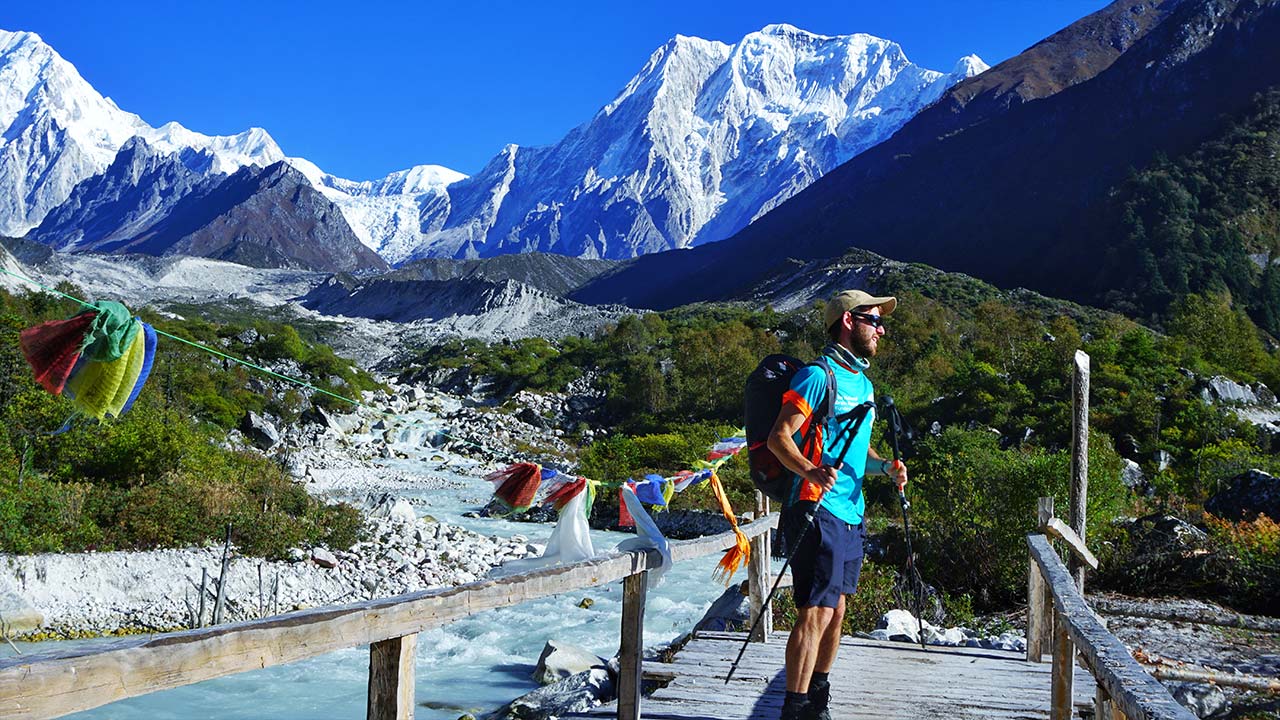
The post-monsoon landscape also presents lush green valleys, full rivers, and freshly recharged waterfalls across all trekking zones, a visual contrast unavailable during the dry, dusty spring environment.
Can You Visit the Himalayas During Summer or Monsoon?
Visiting the Himalayas during summer or monsoon (June to August) is viable in 3 specific rain-shadow regions, Upper Mustang, Dolpo, and Spiti Valley, that receive less than 80 mm of precipitation per month despite the active monsoon season.
Which Himalayan Areas Work Better From June to August?
3 Himalayan areas deliver reliable trekking experiences from June to August: Upper Mustang (Nepal), Dolpo (Nepal), and the Ladakh plateau (India), all positioned in Himalayan rain shadows that block 70–85% of monsoon moisture.
The Upper Mustang Trek, centered on Lo Manthang (3,840 m), records only 60–80 mm of total precipitation across the entire June–August period. The restricted-area trekking permit costs USD 500 for 10 days and limits daily visitor numbers to preserve the fragile Tibetan plateau ecosystem. Dolpo, home to Shey Phoksundo Lake (3,611 m), receives less than 100 mm from June to August, allowing the Snow Leopard Trek and Dolpo Circuit to operate throughout monsoon season.
Ladakh, India (elevation: 3,500 m average), receives 50–60 mm total annual precipitation, making it the driest inhabited Himalayan region. The Markha Valley Trek and Zanskar River Trek in Ladakh operate reliably between June 15 and September 30.
What Risks Come With Rain, Fog, and Landslides?
Rain, fog, and landslides during monsoon create 4 documented hazards on standard Himalayan trekking routes: trail washouts, bridge damage, reduced emergency evacuation access, and hyperthermia from wet cold exposure above 3,500 m.
Landslide frequency on Nepal's trekking corridors peaks between July 1 and August 15. The Jomsom–Pokhara route via the Kali Gandaki Gorge records an average of 12–18 significant landslide events per monsoon season, blocking trail sections for 6 to 48 hours at a time. The Annapurna Conservation Area recorded 47 trekker evacuations attributed to monsoon-related trail accidents in 2022, compared to 8 evacuations during the same period in autumn 2022.
Fog above 3,000 m reduces helicopter evacuation windows to 2–4 hours per day on most monsoon days, extending emergency response times from the typical 45-minute response to 6–24 hours in severe weather.
Is Winter a Good Time to Visit the Himalayas?
Winter (December to February) suits Himalayan travel for 2 specific purposes: cultural and heritage sightseeing below 2,000 m, and high-altitude snow photography on accessible ridges. Long-distance trekking above 4,000 m carries significant avalanche and hypothermia risk across all 3 primary trekking zones.
Which Places Are Best From December to February?
5 Himalayan destinations remain fully accessible and rewarding from December to February: Kathmandu Valley, Pokhara, Chitwan, the Langtang Valley below Kyanjin Gompa, and the lower Everest trail below Namche Bazaar (3,440 m).
Kathmandu Valley (elevation: 1,338 m) experiences minimal winter disruption, with daytime temperatures of 8°C to 18°C and fewer than 5 rainy days per month from December through February. The Swayambhunath Stupa, Pashupatinath Temple, and Boudhanath Stupa operate without weather-related closures throughout winter.
Pokhara (elevation: 822 m) offers winter mornings with clear Annapurna and Machapuchare (6,993 m) views before 9:00 AM, before valley haze builds. The short Sarangkot sunrise viewpoint hike (45 minutes, elevation gain: 500 m) remains fully accessible all winter.
The Ghorepani–Poon Hill trek (6–8 days, maximum elevation: 3,210 m) operates in December with appropriate gear, though snowfall affects trail conditions above 2,800 m after late December.
What Should You Know About Snow and Road Closures?
Snow above 3,000 m and road closures on 4 key mountain highways define the practical limits of winter Himalayan travel, requiring advance planning on route selection and logistics.
The Prithvi Highway (Kathmandu–Pokhara) stays open year-round but experiences 10–20 delay events per winter month due to fog in the Trisuli River valley. The Araniko Highway (Kathmandu–Tibet border) closes at Tatopani (1,200 m) for 15–45 days per winter due to snowfall on the Tibetan plateau above 4,000 m. Mountain flight routes to Lukla operate on 65–75% of winter days, compared to 55–60% during monsoon, a moderate improvement that still demands flexible scheduling.
High-altitude passes face complete closure as follows:
-
Thorong La Pass (5,416 m): Closed January–February; opens by mid-March
-
Cho La Pass (5,420 m): Closed December–March; opens by early April
-
Renjo La Pass (5,340 m): Closed December–February; opens by late March
How Does the Best Time Change by Himalayan Region?
The best travel time shifts by 2 to 6 weeks across different Himalayan regions because monsoon onset, rain-shadow positioning, elevation range, and latitude create distinct microclimates across the 2,500-km Himalayan arc.
Is Nepal Best in the Same Months as the Indian Himalayas?
Nepal and the Indian Himalayas share the same 2 optimal seasons, spring and autumn, but the Indian Himalayas extend the viable trekking window by 4 to 8 weeks in specific rain-shadow zones, particularly Ladakh, Spiti, and Kinnaur.
Nepal's prime trekking window spans March 15 to May 31 (spring) and September 15 to November 30 (autumn), a combined 5 months. Himachal Pradesh's Kullu Valley and Manali region mirrors Nepal's spring-autumn pattern closely, with prime months running April–June and September–October. Uttarakhand's Char Dham pilgrimage circuit opens in May (Akshaya Tritiya) and closes in November (Bhai Dooj), dictated by Hindu calendar timings rather than strictly weather.
The Indian Himalayas' western ranges, including Kangra Valley (Himachal Pradesh) and Kashmir Valley (Jammu and Kashmir), add June and July as high-trekking months due to a reduced monsoon influence compared to Nepal's central and eastern Himalayan ranges.
When Are Ladakh, Bhutan, and Tibet Easiest to Visit?
Ladakh is easiest to visit from June 1 to September 30, Bhutan from March to May and September to November, and Tibet from April to October, with entry restrictions and road conditions defining the practical limits in each territory.
-
Ladakh (Leh district, Jammu and Kashmir, India; elevation: 3,500 m): The Manali–Leh Highway (475 km) opens between June 1 and October 15 each year. The Srinagar–Leh Highway (434 km) opens between May 1 and November 30. Leh's Kushok Bakula Rimpochee Airport operates year-round but suspends flights during extreme winter cold (below -20°C) for 5–15 days in January.
-
Bhutan (Kingdom of Bhutan; capital: Thimphu, elevation: 2,334 m): The Tourism Council of Bhutan charges a Sustainable Development Fee of USD 100 per person per day (revised January 2023). Spring (March–May) and autumn (September–November) account for 78% of annual tourist arrivals. The Jomolhari Trek (8 days, maximum elevation: 4,930 m) and Snowman Trek (25 days, maximum elevation: 5,320 m) operate only between April 15 and October 31.
-
Tibet (Tibet Autonomous Region, China): The Tibet Travel Permit, separate from the Chinese visa, restricts independent travel entirely. Group tours operate reliably from April to October. The Lhasa–Gyantse–Shigatse route (370 km) faces snowfall closures on the Karo La Pass (5,010 m) from December to March.
Which Time Is Best for Trekking, Sightseeing, or Snow?
Trekking peaks in October, sightseeing works across 9 months (March–November), and snowfall photography concentrates in December and January, 3 distinct objectives requiring 3 different timing strategies.
When Should You Go for Clear Skies and Long Treks?
October 1 to October 31 delivers the clearest skies and best conditions for long treks, combining post-monsoon air clarity, stable high-pressure systems, open passes, and 12-hour daylight windows at Nepal's latitude of 27°–30°N.
Long treks in Nepal, those exceeding 14 days, require a minimum of 6 consecutive stable weather days at high altitude. October delivers stable high-pressure windows averaging 8–12 consecutive clear days. The 3 longest standard treks in Nepal rank as follows:
-
Great Himalaya Trail (GHT): 1,700 km; 150 days; requires April–October window across full route
-
Manaslu Circuit: 177 km; 14–16 days; best in October; restricted permit zone
-
Everest Three Passes Trek: 160 km; 18–20 days; best in October; crosses Kongma La (5,535 m), Cho La (5,420 m), Renjo La (5,340 m)
Spring (April–May) suits long treks equally well for passes but produces afternoon cloud buildup after 12:00 PM above 4,000 m, reducing summit view windows to 4–6 hours daily compared to October's 8–10 clear hours.
When Should You Go for Festivals, Flowers, or Snowfall?
Himalayan festivals concentrate in October–November, wildflower blooms peak in April, and photogenic snowfall on accessible ridges occurs in December and January, producing 3 non-overlapping seasonal objectives.
-
Festivals: Nepal's Dashain festival (15 days; October), Tihar/Deepawali (5 days; October–November), and the Mani Rimdu festival at Tengboche Monastery (3 days; November full moon) draw the highest cultural tourism across the Khumbu Valley. Tengboche Monastery (3,867 m) hosts Mani Rimdu with mask dances, fire puja, and Buddhist ritual performances.
-
Wildflower blooms: The Himalayan rhododendron bloom calendar starts at 1,500 m in late February and progresses to 3,500 m by late April. The Annapurna Conservation Area records 32 rhododendron species, including Rhododendron arboreum (Nepal's national flower), Rhododendron barbatum, and Rhododendron campanulatum. Primula, iris, and Himalayan blue poppy (Meconopsis betonicifolia) bloom at 3,500–4,500 m between May and June.
-
Snowfall photography: Nagarkot (2,100 m), Kakani (2,073 m), and Daman (2,322 m), all day-trip distances from Kathmandu, receive 2–5 snowfall events annually, concentrated in January and February. These locations deliver snow-covered foreground landscapes against Himalayan backdrops without requiring trekking permits or acclimatization protocols.
How Should You Plan a Himalayan Trip With a Travel Expert?
Planning a Himalayan trip with a certified travel expert reduces logistical failure points from 9 to 3, covering permit acquisition, altitude acclimatization scheduling, weather-window optimization, and emergency evacuation protocols, elements that independent planning consistently underestimates.
Can a Travel Expert Help You Pick the Right Season?
A certified Himalayan travel expert picks the right season by cross-referencing 5 variables: traveler fitness level, target elevation, trip duration, departure flexibility, and specific activity goals, such as summit photography, festival attendance, or technical trekking.
Nepal's 2,100+ licensed trekking agencies operate under Nepal Tourism Board (NTB) and Trekking Agencies' Association of Nepal (TAAN) regulation. Choosing a TAAN-registered agency guarantees compliance with trekker insurance requirements, licensed guide deployment, and TIMS (Trekkers' Information Management System) registration, a mandatory permit for all trekking routes as of 2023.
A travel expert delivers 4 concrete planning advantages:
-
Permit coordination: TIMS card (NPR 2,000 per person for SAARC nationals; NPR 3,000 for others), national park permits (NPR 3,000–NPR 15,000 depending on zone), and restricted-area permits (USD 50–USD 500 per week depending on region)
-
Acclimatization scheduling: Building rest days at Namche Bazaar (3,440 m), Dingboche (4,360 m), and Lobuche (4,940 m) to match the 500 m/day safe ascent rate above 3,000 m
-
Altitude illness recognition: Identifying early symptoms of altitude sickness in the Himalayas, headache, nausea, dizziness, before they progress to High Altitude Pulmonary Edema (HAPE) or High Altitude Cerebral Edema (HACE)
-
Weather-window booking: Identifying the 10–14 day stable-weather windows in October that align with pass crossings on multi-pass circuits
What Are the Key Takeaways About Visiting the Himalayas?
Visiting the Himalayas of Nepal produces the highest success rates when timed to 2 primary windows, April in spring and October in autumn, with secondary options in Ladakh (June–September), Bhutan (April–May; October), and rain-shadow Nepal zones (Upper Mustang; June–August).
The Himalayas span about 2,500 km, rise to 8,848.86 m at Everest, and divide into 5 regional travel contexts, Nepal, Ladakh, Himachal Pradesh, Uttarakhand, and Bhutan/Tibet, each responding to monsoon influence, elevation, and permit frameworks in distinct ways.
The 5 core principles for Himalayan trip planning:
-
Book spring (March–May) or autumn (September–November) for all routes above 4,000 m in Nepal
-
Target October for maximum visibility, with horizontal ranges above 60 km across the Khumbu on clear mornings
-
Use June–September only in rain-shadow regions: Upper Mustang, Dolpo, and Ladakh, with proper risk assessment
-
Secure TIMS, national park, and restricted-area permits at least 4–6 weeks before departure for autumn's peak season
-
Engage a TAAN-registered trekking agency to coordinate acclimatization schedules, weather-window timing, and AMS emergency protocols
The best time to visit the Himalayas of Nepal is April for rhododendron blooms and Everest summit activity, or October for the clearest views and most stable trekking conditions, 2 months that collectively define the Himalayan travel calendar. For first-time visitors wanting a seasonal taste of spring blooms and panoramic mountain views, the Ghorepani Poon Hill Trek is an ideal starting point that peaks in late March and early April.