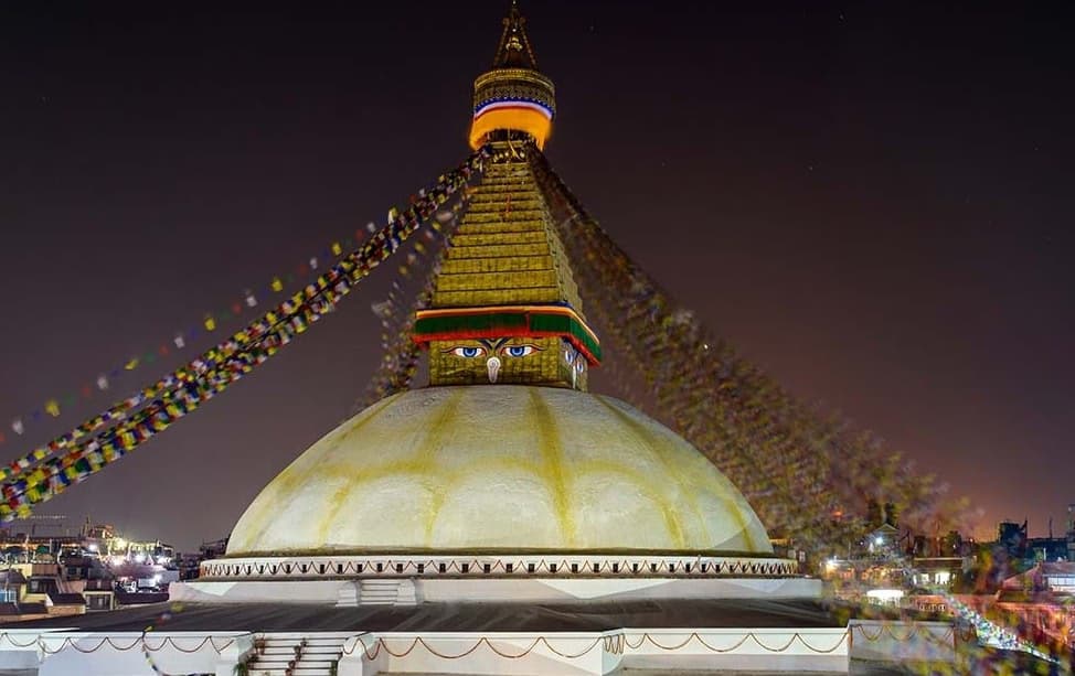
Less crowded treks in Nepal offer access to remote Himalayan valleys, high mountain passes, traditional villages, sacred monasteries, glacial landscapes, and some of the country's least-visited trekking regions. Routes such as the Manaslu Circuit, Kanchenjunga Base Camp, Upper Dolpo, Makalu Base Camp, Nar Phu Valley, Tsum Valley, Dhaulagiri Circuit, Ruby Valley, and Khopra Danda showcase a different side of Nepal, where Tibetan Buddhist culture, protected mountain ecosystems, and rugged wilderness remain largely untouched by mass tourism. Many of these trails pass through restricted areas or isolated national parks, creating experiences defined by solitude, authenticity, and dramatic Himalayan scenery.
The best less crowded treks in Nepal vary widely in duration, altitude, permit requirements, and physical difficulty, making them suitable for different types of trekkers. Some routes focus on cultural immersion and spiritual heritage, while others emphasize high-altitude passes, remote base camps, glacier landscapes, and extreme mountain challenges. Understanding the highlights, logistics, trekking difficulty, and ideal experience level for each route is essential when choosing the right adventure. This guide explores the 10 best less crowded treks in Nepal and explains what makes each destination unique, who it suits best, and what to expect when planning the journey.
1. Manaslu Circuit Trek
The Manaslu Circuit Trek is a 177-kilometer loop around Manaslu (8,163m), the world's 8th highest mountain, in the Gorkha District of northern Nepal. It crosses the Larkya La Pass at 5,106 meters and takes 14 to 18 days to complete. The Nepal government classifies it as a restricted trekking area, which requires a Restricted Area Permit (RAP) and a Manaslu Conservation Area Permit (MCAP).
What Are the Highlights of the Manaslu Circuit Trek?
The Manaslu Circuit delivers 4 distinct attractions: the Larkya La high-pass crossing at 5,106m, Birendra Lake at Samagaon, Tibetan-influenced Nupri culture across upper villages, and direct views of the Manaslu North Face. Unlike Everest routes where mountain views arrive at a single dramatic endpoint, Manaslu puts the peak in front of you for 5 consecutive days from Samagaon onward.
Samagaon village sits at 3,520 meters and functions as the circuit's cultural center. The village follows Tibetan Buddhist traditions, and the Pungyen Gompa monastery above the village dates to the 17th century. From here, most trekkers take a 2-day acclimatization walk to Manaslu Base Camp (4,850m) before attempting Larkya La.
The pass itself is the most exposed section of the entire route, a 6-hour ascent beginning at 3 AM from Dharamsala (4,460m). The descent to Bimthang takes another 3 to 4 hours. Crossing it in late October gives the clearest skies but the coldest temperatures, dropping below -15°C at the col.
One feature competitors rarely mention: the Manaslu Circuit connects directly to the Tsum Valley extension, adding 8 to 12 days and entering one of Nepal's most isolated Buddhist communities. Most trekkers skip it due to cost and time. Those who include it call it the better half of the trip.
How Challenging Is the Manaslu Circuit Trek?
The Manaslu Circuit Trek is rated strenuous. It requires crossing a 5,106m pass without acclimatization shortcuts, covering 10 to 20 kilometers daily on mixed terrain, and managing a 14-18 day route with limited medical evacuation access.
The RAP costs USD 100 per week from September through November and USD 75 per week for other months. The MCAP costs NPR 3,000. A licensed guide is mandatory, independent trekking is not permitted.
Tea houses operate throughout the circuit, though quality drops sharply above Samdo. Bring a -15°C sleeping bag regardless of tea house blankets. The upper sections between Samdo and Bimthang have no mobile signal.
2. Kanchenjunga Base Camp Trek
The Kanchenjunga Base Camp Trek reaches two separate base camps on the world's 3rd highest mountain (8,586m) in Nepal's far eastern Taplejung District. The North Base Camp sits at 5,143 meters and the South Base Camp at 4,580 meters. It takes 18 to 21 days and requires a restricted area permit.
What Can You Expect Along the Kanchenjunga Base Camp Route?
The Kanchenjunga route delivers an uncommon combination: two distinct high-altitude base camps, dense rhododendron forests at 3,000 to 4,000 meters, the culturally intact Limbu villages of Ghunsa and Lhonak, and almost zero trail congestion outside of October.
Ghunsa (3,595m) is the last major permanent settlement before the alpine zone. The Tibetan-influenced village has a functioning monastery and a community that has maintained the same trade routes to Tibet for centuries. From Ghunsa, trekkers split toward Lhonak and the North Base Camp, passing through yak pastures at Ramtang and Lhonak (4,780m).
The South Base Camp route goes through Yalung, with views across the Yalung Glacier that most trekkers never see because the combined North-South circuit adds 4 to 5 extra days. Most guides recommend doing both. The views from the South BC looking back toward Rathong and Kabru peaks are unlike anything on the North side.
Fewer than 1,500 trekkers complete this route in a full year. That low number comes from the 3-day approach from Taplejung to the trailhead, a 13-hour bus ride from Kathmandu, or a 1-hour flight to Bhadrapur followed by another 8-hour drive.
Who Should Consider the Kanchenjunga Base Camp Trek?
The Kanchenjunga Base Camp Trek suits experienced high-altitude trekkers who have already completed at least one Himalayan trek above 4,500m, have 21 days available, and are comfortable with remote logistics where rescue timelines exceed 24 hours.
This is not a route for first-time Nepal trekkers. The long approach, altitude gain, and weather exposure in a single season window (October to November being peak) make planning critical. Guides with specific Kanchenjunga experience are rarer than on Everest routes, verify this when booking.
3. Upper Dolpo Trek
The Upper Dolpo Trek covers the trans-Himalayan plateau region of Dolpo in northwestern Nepal, stretching from Juphal to Shey Phoksundo Lake (Nepal's deepest lake at 145 meters) and continuing to the Tibetan border near Shey Monastery. It takes 23 to 28 days and enters one of the most remote regions accessible by foot in the entire Himalayan range.
What Are the Major Attractions of the Upper Dolpo Trek?
Upper Dolpo's 4 primary attractions are Shey Phoksundo Lake's turquoise blue water at 3,611 meters, the Crystal Mountain circuit near Shey Gompa, the intact Bon-influenced culture of Do Tarap and Saldang villages, and direct access to the Lo Mustang border landscape without entering Lo Mustang.
Shey Gompa, also called the Crystal Mountain monastery, sits at 4,400 meters and is one of the oldest functioning Buddhist monasteries in Nepal. The monk population fluctuates between 12 and 30, depending on the season. The surrounding plateau at 4,000 to 5,000 meters looks more like Tibet than the Nepal most trekkers experience.
The David Snellgrove route (1956 Himalayan Pilgrimage) passes through this area, and locals still reference it. Trekking through Do Tarap in late September during the full moon festival gives access to one of the least-documented cultural events in the Himalayan region.
How Demanding Is the Upper Dolpo Trek?
Upper Dolpo demands 23 to 28 days on trail, a restricted area permit costing USD 500 per person for the first 10 days (then USD 50 per additional day), mandatory licensed guide and porter, and daily distances ranging from 10 to 18 kilometers at altitudes consistently above 4,000 meters.
Fewer than 500 trekkers enter Upper Dolpo annually. The restricted permit fee intentionally controls access. Accommodation above Phoksundo Lake is minimal, camping is the standard above Do Tarap. Pack carefully for -20°C nights at high camps.
4. Lower Dolpo Trek
The Lower Dolpo Trek covers the southern and more accessible sections of the Dolpo region, centered on the Phoksundo Lake area and the lower Tarap Valley. It takes 10 to 14 days and no longer requires a restricted area permit for the zones below the special restricted boundary, making it the more accessible entry point into Dolpo culture.
How Does Lower Dolpo Differ From Upper Dolpo?
Lower Dolpo differs from Upper Dolpo in 3 concrete ways: it requires no special restricted permit (only the standard Shey Phoksundo National Park entry fee of NPR 3,000), takes 10 to 14 days instead of 23 to 28, and stays at altitudes between 2,800 and 4,000 meters rather than the 4,000 to 5,200 meter range of the upper circuit.
The trade-off is access depth. Lower Dolpo reaches Phoksundo Lake and the lower Tarap Valley but does not cross into the high plateau where Shey Gompa and Crystal Mountain sit. For trekkers with 2 weeks and a moderate fitness level, Lower Dolpo gives a genuine taste of Dolpo's distinct landscape and culture without the cost or duration of the full upper circuit.
Juphal has a domestic airport with daily flights from Nepalgunj, cutting the approach to a single 1-hour flight. This makes Lower Dolpo one of the more logistically straightforward remote treks in Nepal.
What Are the Key Highlights of the Lower Dolpo Trek?
Lower Dolpo's 3 key highlights are Phoksundo Lake's blue-green water surrounded by ochre cliffs, the Ringmo village community (the only permanent settlement on the lake shore), and the lower Tarap Valley's red clay cliffs and Bon monastery architecture.
The lake itself is the central draw. It sits at 3,611 meters, is 6.1 kilometers long, and has a color caused by the calcium carbonate content of the surrounding geology, something the trail literature often gets wrong by calling it "glacial." Ringmo's 30 to 40 households maintain a traditional polyandry system still practiced in parts of Dolpo. This is documented and not a tourism exaggeration.
5. Makalu Base Camp Trek
The Makalu Base Camp Trek approaches the base camp of Makalu (8,485m), the world's 5th highest mountain, through the Barun Valley in eastern Nepal's Sankhuwasabha District. The full circuit takes 18 to 20 days and passes through the Makalu-Barun National Park, one of Nepal's least-visited protected areas.
What Scenic and Cultural Experiences Await on the Trail?
The Makalu Base Camp trail delivers 4 distinct environments: the subtropical forests of the lower Arun Valley below 2,000 meters, the temperate rhododendron and oak forests from 2,000 to 3,500 meters, the alpine meadows of the upper Barun Valley above 4,000 meters, and the glaciated terrain approaching base camp at 5,000 meters.
The Barun Valley above Mumbuk is rarely discussed even in Nepal trekking circles. This upper section sees fewer than 400 trekkers per year. The valley floor has a flat 5-kilometer section at 4,200 meters where Makalu, Baruntse (7,129m), and Chamlang (7,321m) are all visible simultaneously, a perspective that no other Nepal trek replicates.
The Rai and Sherpa villages along the lower route, particularly Num and Seduwa, have maintained traditional architecture. Num sits at a trail junction leading toward both Makalu and Kanchenjunga, and local tea house owners here have route knowledge of both.
How Difficult Is the Makalu Base Camp Trek?
The Makalu Base Camp Trek is rated strenuous to very strenuous due to the long daily elevation changes (800 to 1,200 meters on ascent days), 18 to 20 day duration, extreme remoteness above Mumbuk, and unpredictable weather in the transition zones above 4,500 meters.
The trail above Mumbuk has no permanent tea houses, camping gear and a cook crew are essential above this point. The route involves crossing the Shipton La (4,216m) and the Barun La (5,110m) on some circuit variations, adding technical complexity.
Mobile signal disappears above Tashigaon. Emergency evacuation from the upper valley takes a minimum of 2 days by foot before helicopter access becomes practical.
6. Nar Phu Valley Trek
The Nar Phu Valley Trek enters two hidden villages, Nar and Phu, in a restricted trans-Himalayan valley north of the Annapurna range in Manang District. The valley remained completely closed to trekkers until 2002. It takes 14 to 16 days as a standalone route.
What Villages and Landscapes Can You Explore?
The Nar Phu Valley contains 2 main settlements: Phu village at 4,090 meters (one of the highest year-round inhabited villages in Nepal) and Nar village at 4,110 meters, both with architecture dating to the 12th century and a combined permanent population of fewer than 400 people.
Phu village's gompa has 400-year-old murals that are rarely photographed because tour operators rarely promote this route aggressively. The valley itself is a rain shadow zone with less than 300mm of annual rainfall, it looks completely unlike the monsoon-heavy southern slopes of Annapurna that most trekkers experience.
The restricted area permit costs USD 100 per person per week during the autumn peak season (September to November), and USD 75 per week for the rest of the year. A minimum group size of 2 trekkers is required, along with a licensed guide.
How Can You Combine Nar Phu Valley With Other Treks?
Nar Phu Valley connects directly to the Annapurna Circuit via the Kang La Pass (5,306m), allowing a combined 18 to 22 day itinerary that includes both the circuit and the restricted valley without backtracking.
This combination is the most efficient way to use the Nar Phu permit. Trekkers enter through Koto on the Annapurna Circuit, complete the Nar-Phu valley loop, cross the Kang La back to Ngawal on the circuit, then continue through Manang and over the Thorong La to Muktinath. The Kang La crossing is non-technical but requires crampons in early season (pre-October).
The combined itinerary costs more due to both the Annapurna Conservation Area Permit (ACAP) and the Nar Phu restricted permit running simultaneously, but it reduces the total logistics overhead significantly compared to doing each as a separate trip.
7. Dhaulagiri Circuit Trek
The Dhaulagiri Circuit Trek is a 20 to 25-day loop around Dhaulagiri (8,167m), the world's 7th highest mountain, in Nepal's Myagdi District. It crosses two major passes, the French Pass (5,360m) and the Dhampus Pass (5,182m), and transits through the eerie Hidden Valley at 5,100 meters.
What Are the Main Challenges of the Dhaulagiri Circuit Trek?
The Dhaulagiri Circuit presents 4 specific challenges: the French Pass ascent gains 1,600 meters in a single day from the Chhonbardan Glacier base camp, the Hidden Valley has no reliable water source between October and April, the Italian Base Camp section involves glacier travel requiring crampons and ice axe, and the trail above 4,500 meters is completely unmarked.
This is one of the few Nepal treks where a GPS device is not a luxury, it is a navigation requirement. The glacier sections between Glacier Camp (4,230m) and French Pass have caused serious accidents, including falls into crevasses. Guides with specific Dhaulagiri experience are rare. When booking, ask directly how many times your guide has crossed the French Pass.
The approach from Beni (900m) to Darbang and Muri adds 3 trail days before the mountain terrain even begins, making this a commitment route in every sense.
What Makes This Route Less Crowded?
Dhaulagiri Circuit sees fewer than 800 trekkers per year because it combines 3 deterrents simultaneously: 25-day duration, glacier travel requirements, and no tea house infrastructure above Marpha on the descent side.
The trail difficulty filters out the casual trekking market completely. Most agency trekking packages don't even list this route prominently because the risk-reward calculation for operators without experienced Dhaulagiri guides is poor. Independent travelers need to carry full camping equipment, food supplies for 5 to 6 days above any resupply point, and rescue insurance with helicopter evacuation coverage minimum of USD 25,000.
Those who complete the circuit consistently report it as the most physically and mentally demanding trek they've done in Nepal, and the least photographed.
8. Tsum Valley Trek
The Tsum Valley Trek enters a sacred Himalayan valley in northern Gorkha District between the Nepal-Tibet border, enclosed on three sides by the Ganesh Himal, Sringi Himal, and Boudha Himal ranges. The valley remained closed to outsiders until 2008. It takes 14 to 18 days and requires a restricted area permit costing USD 40 per week from September to November, and USD 30 per week during other months.
Why Is Tsum Valley Known for Its Spiritual Heritage?
Tsum Valley is one of 3 "Beyul" (hidden sacred valleys) recognized in both Tibetan Buddhist and Bon religious traditions, containing the Milarepa Cave (where the 11th-century Tibetan yogi Milarepa is said to have meditated), the Mu Gompa monastery at 3,700 meters, and the Rachen Gompa nunnery, both active religious institutions with resident communities.
The valley's spiritual designation means hunting has been prohibited here by local custom for centuries. This pre-dates modern conservation laws. As a result, snow leopard sightings above 4,000 meters are reported at a higher rate here than in most other Nepal trekking zones, not guaranteed, but documented.
Tsumba people follow a strict set of local customs. Entering a monastery, you remove shoes and walk clockwise. Photography inside religious structures requires explicit permission. These are enforced community rules, not suggestions.
What Makes Tsum Valley Different From Other Himalayan Treks?
Tsum Valley differs from standard Nepal treks in 3 ways: the valley has its own distinct language (Tsumba, distinct from Tibetan and Nepali), local cultural preservation rules limit tourist infrastructure to prevent cultural dilution, and the valley's permit structure deliberately restricts visitor numbers to protect community integrity.
The tea house infrastructure is basic, mostly family-run guest houses in Chhekampar and Nile. This is a feature, not a limitation. Staying with Tsumba families gives direct access to daily life that no organized cultural tour delivers.
The combination of Tsum Valley with the Manaslu Circuit (accessible via the same approach from Arughat or Soti Khola) is one of Nepal's most comprehensive remote trekking combinations, covering 24 to 30 days total.
9. Ruby Valley Trek
The Ruby Valley Trek crosses through the Ganesh Himal area in Dhading and Gorkha Districts, named after the ruby and garnet deposits found in the region's metamorphic rock formations. It takes 10 to 14 days, starts from Trishuli Bazaar or Arughat, and does not require a restricted area permit.
What Cultural and Natural Attractions Can You Experience?
Ruby Valley delivers 4 concrete experiences: the traditional Tamang and Gurung village culture of Gatlang and Tipling, direct views of the Ganesh Himal range (highest peak: Ganesh I at 7,422m), the Tsum Valley approach trail shared in the upper sections, and access to ruby and garnet collection sites used by local miners for generations.
Gatlang village at 2,238 meters is one of the largest traditional Tamang settlements in Nepal, with a community temple, traditional flat-roofed stone houses, and a social structure that actively maintains pre-Hindu cultural practices. The trail between Gatlang and Tipling follows a ridge at 3,600 meters with consistent Ganesh Himal views for 4 to 5 hours.
The ruby mining sites near the Tsum Valley junction are not tourist attractions with signs and guides, they are working quarries where local miners sell stones directly. The rubies here are of low to moderate gem quality, but the geological formations are genuinely interesting.
Who Is the Ruby Valley Trek Suitable For?
The Ruby Valley Trek suits moderately fit trekkers with 10 to 14 days available, no prior high-altitude Himalayan experience required, a budget of USD 40 to 70 per day (guide, porter, accommodation, food combined), and an interest in cultural immersion over summit or glacier objectives.
This is one of the most accessible less-crowded treks in Nepal for people who have done Annapurna Foothills or Langtang but want something with fewer other trekkers on the same trail. Maximum altitude is around 3,600 meters, making serious altitude sickness unlikely for healthy adults who ascend at a normal pace.
The trail starts from a 4-hour drive from Kathmandu, cutting the approach logistics significantly compared to far-east or far-west Nepal routes.
10. Khopra Danda Trek
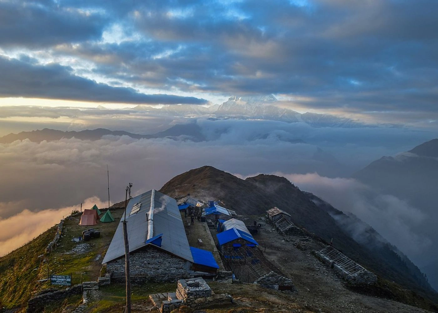
The Khopra Danda Trek is a short off-route loop off the Annapurna Circuit, reaching the Khopra Ridge at 3,660 meters and the Khayer Lake at 4,500 meters in Myagdi District. It takes 7 to 10 days. It shares its initial days with the standard Ghorepani Poon Hill and Annapurna Base Camp routes before branching off from Tadapani.
What Views and Experiences Make Khopra Danda Special?
Khopra Danda delivers 3 rare Annapurna-area experiences: a direct south-facing view of Dhaulagiri (8,167m) and Annapurna South (7,219m) from the ridge at 3,660 meters, access to Khayer Lake (4,500m), a sacred Shiva lake with active pilgrimage visits during spring, and near-complete trail solitude despite proximity to the Annapurna Circuit.
Trekkers on the Annapurna Circuit walk within 4 kilometers of this ridge and never see it because it's not on their route. Khopra Danda gets fewer than 3,000 visitors per year while the Annapurna Circuit directly beside it gets 150,000+. The difference is just one junction sign and a trail that most people's itineraries don't mention.
The tea houses on the ridge at Khopra are small, family-operated, and run on a community-based tourism model. The Khopra Community Homestay program distributes income directly to 7 local households rather than to a central operator.
How Difficult Is the Khopra Danda Trek?
The Khopra Danda Trek is rated moderate, with a maximum altitude of 4,500 meters at Khayer Lake, daily elevation gains between 600 and 900 meters, and full tea house accommodation throughout requiring no camping equipment.
This is the most beginner-accessible route on this list that still qualifies as genuinely less crowded. The ACAP permit (NPR 3,000) covers this area, no special restricted permit required. Under current Nepal Tourism Board regulations, hiring a licensed guide through a registered agency is legally mandatory for all foreign trekkers on this route, as solo trekking is no longer permitted.
The lake section from the ridge adds one full day (4 hours up, 3 hours down) and gains 840 meters. The trail above 4,000 meters here is narrow and requires attention, but presents no technical difficulty. Crampons are not needed except in early spring when ice remains on the upper section.
How Can You Choose the Right Less Crowded Trek in Nepal?
Choosing the right remote trek in Nepal depends on 4 factors working in combination: available time, prior high-altitude experience, budget for permits and support staff, and personal priority between physical challenge, cultural depth, and mountain views.
The 2 most important variables are time and experience. A trekker with 10 days and no prior Himalayan experience has 3 realistic options from this list: Khopra Danda, Ruby Valley, or Lower Dolpo (with flight access). A trekker with 20+ days, previous 5,000m experience, and USD 2,000+ for permits and logistics has access to everything, with Kanchenjunga and Upper Dolpo being the most rewarding for that profile.
Permit costs vary widely. Khopra Danda requires an ACAP permit (NPR 3,000) and a mandatory TIMS card (NPR 2,000), bringing total permit costs to approximately USD 38. Upper Dolpo costs USD 500 for the first 10 days. Most routes between these extremes run USD 50 to USD 100 per week in permit fees. Factor guide and porter costs separately, typically USD 25 to 40 per day for a guide and USD 15 to 25 per day for a porter.
Which Trek Matches Your Experience Level and Interests?
The table below maps each trek to 3 decision criteria: required experience level, primary appeal, and realistic minimum days.
Trek | Experience Level | Primary Appeal | Minimum Days |
Khopra Danda | Beginner-Moderate | Views + accessibility | 7 |
Ruby Valley | Beginner-Moderate | Culture + nature | 10 |
Lower Dolpo | Moderate | Lake + culture | 10 |
Tsum Valley | Moderate | Spiritual culture | 14 |
Nar Phu Valley | Moderate-Advanced | Hidden valley + culture | 14 |
Manaslu Circuit | Advanced | Full circuit + pass | 14 |
Kanchenjunga BC | Advanced | Remote base camps | 18 |
Makalu Base Camp | Advanced | Wild valley + views | 18 |
Upper Dolpo | Expert | Remote plateau | 23 |
Dhaulagiri Circuit | Expert | Glacier + extreme challenge | 20 |
Beginners doing their first Nepal trek: start with Khopra Danda or Ruby Valley. Both routes develop the altitude, terrain, and logistics management skills needed before committing to restricted area permits.
Experienced trekkers who have done EBC or the classic Annapurna Circuit and want something genuinely different: Manaslu Circuit, Tsum Valley, or Nar Phu Valley all deliver that transition from popular to remote without requiring glacier travel or a 3-week commitment.
What Are the Key Takeaways About Nepal's Less Crowded Treks?
Nepal's less crowded trekking routes are not obscure because they are inferior. They are less crowded because they require more planning, carry higher permit costs, demand better fitness, or sit farther from major domestic airports. These are filters, not flaws.
The 5 most important practical realities for planning any route from this list are:
A licensed guide is legally mandatory on all trekking routes in Nepal (both restricted and standard),
Helicopter rescue insurance with minimum USD 25,000 coverage is standard practice on remote routes,
Tea house availability drops to zero above certain elevations on Makalu, Upper Dolpo, and Dhaulagiri,
Spring (March to May) and autumn (October to November) are the only reliable windows,
All permits must be arranged through a registered Nepal trekking agency or directly through the Department of Immigration in Kathmandu.
The trails on this list collectively see fewer trekkers in a full year than Everest Base Camp sees in a single week. That ratio tells you everything about what's waiting on them.