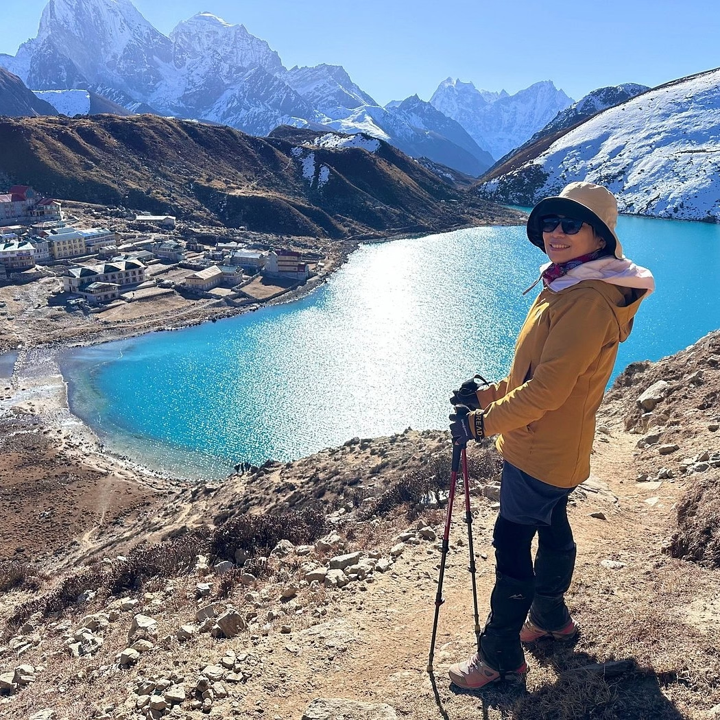
The Annapurna Base Camp Trek Route is a high-altitude Himalayan trekking route that leads from the Pokhara region into the Annapurna Sanctuary, following the Modi Khola valley through traditional Gurung villages, rhododendron and bamboo forests, steep river gorges, alpine landscapes, and glacial terrain to Annapurna Base Camp at 4,130 meters. The route typically covers 110–115 kilometers round trip and takes 7 to 14 days, with a 10-day itinerary providing a balanced pace for most trekkers. The journey passes through key stops including Nayapul, Birethanti, Ghandruk, Chhomrong, Sinuwa, Bamboo, Doban, Himalaya, Deurali, and Machhapuchhre Base Camp, gradually transitioning from subtropical foothills to the enclosed mountain amphitheater of the sanctuary. Along the approach, trekkers encounter Annapurna I (8,091 m), Annapurna South, Machhapuchhre, Hiunchuli, and Gangapurna, making the route a concentrated combination of Himalayan scenery, mountain culture, and high-altitude trekking.
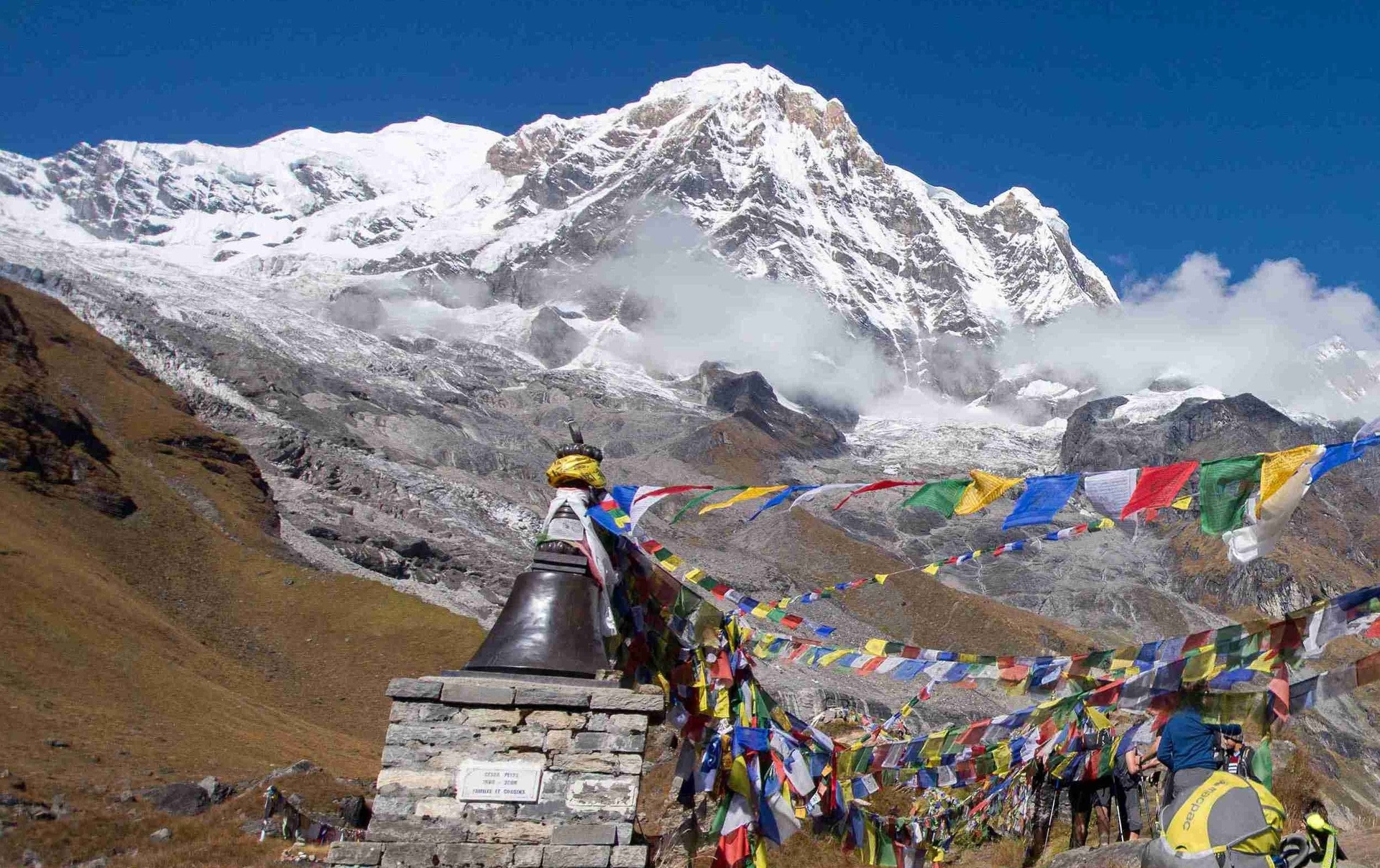
Planning the Annapurna Base Camp Trek Route requires understanding more than the trail itself. Distance and daily walking times, elevation gain, altitude acclimatization, weather conditions, seasonal trail accessibility, trekking difficulty, permits, accommodation, equipment, and physical preparation all influence the experience. October to November and March to May generally provide the most favorable conditions, while the route remains a moderate but demanding trek because of sustained ascents, stone staircases, changing mountain weather, and elevations above 4,000 meters. This guide covers the complete route from Pokhara and Nayapul to Annapurna Base Camp and back, including village-by-village stages, day-by-day distances and elevations, major viewpoints, mountain landscapes, best trekking seasons, altitude considerations, required permits, essential gear, and practical preparation for completing the trek safely and comfortably.
What Is the Standard Annapurna Base Camp Trek Route?
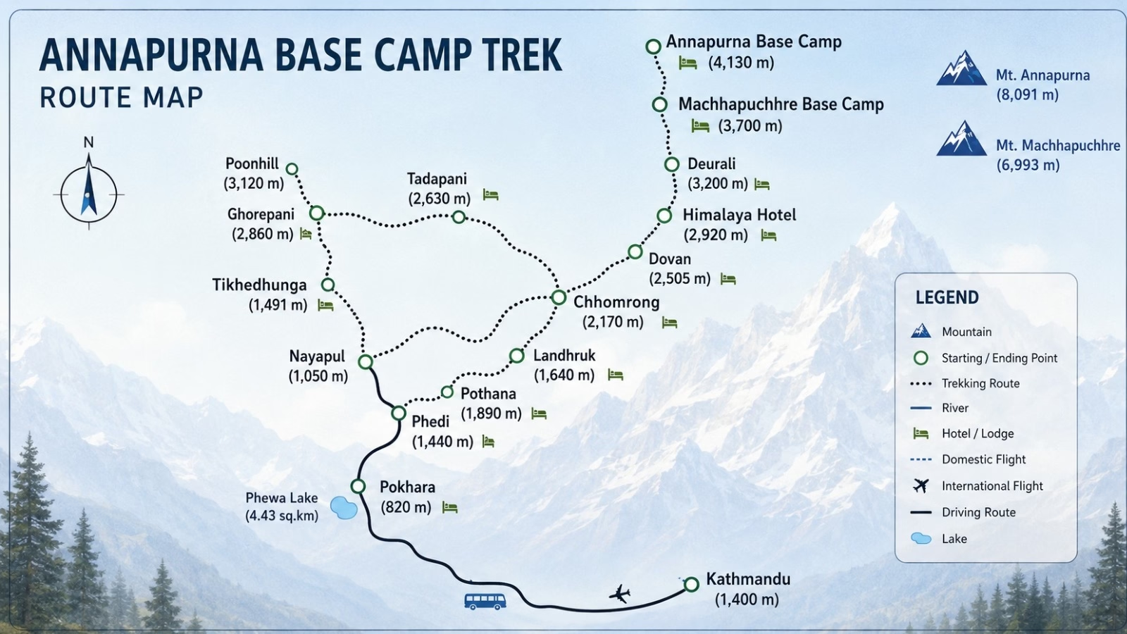
The standard Annapurna Base Camp Trek Route begins at Nayapul (1,070 m), ascends through Ghandruk, Chhomrong, and the Modi Khola river valley, reaches Machhapuchhre Base Camp (3,700 m), and culminates at Annapurna Base Camp (4,130 m), a total distance of approximately 55 kilometers one-way.
The route penetrates the Annapurna Sanctuary, a protected glacial basin enclosed by 3 distinct sub-ranges of the Annapurna massif. Entry into the sanctuary passes through a narrow gorge between Hiunchuli (6,441 m) and Machhapuchhre (6,993 m), a geological choke point that gives the inner sanctuary its dramatic, enclosed character.
The trail follows the Modi Khola river as its central axis. Trekkers ascend the eastern bank through terraced farmland and rhododendron forest before entering the narrower canyon terrain above Chhomrong. Above Deurali (3,200 m), the valley walls close in and the route transitions into the true high-altitude approach corridor leading to the glacier terminus.
The route is classified as moderate to moderately challenging. No technical climbing skills or specialized mountaineering equipment are required. The path consists entirely of stone-paved steps, dirt trail, and rocky alpine terrain, fully navigable by fit recreational hikers.
Where Does the Annapurna Base Camp Trek Start?
The Annapurna Base Camp Trek starts from Nayapul (1,070 m), a roadhead village located 42 kilometers southwest of Pokhara. Trekkers reach Nayapul by a 90-minute drive from Pokhara's tourist hub, then begin walking at the Birethanti trail junction immediately beyond the Modi Khola suspension bridge.
Most itineraries originate from Pokhara, Nepal's second-largest city and the primary gateway to the Annapurna region. Pokhara connects to Kathmandu by a 25-minute flight or a 6–7 hour drive on the Prithvi Highway. Private vehicles and local buses serve the Nayapul route from Pokhara daily, with departures beginning at 7:00 AM.
An alternative starting point is Kimche village, reachable by jeep from Pokhara. This option bypasses the lower valley stages and deposits trekkers directly at the Ghandruk elevation level, shortening the overall route by 1 walking day. Trekkers who prioritize speed over lower-valley landscape experience frequently use the Kimche approach.
The permit checkpoint at Birethanti marks the formal entry into the trekking route. Both ACAP and TIMS permits receive their first stamp at this checkpoint, trekkers without valid permits are turned back here.
Which Villages Does the Annapurna Base Camp Route Pass Through?
The Annapurna Base Camp route passes through 13 primary stops: Birethanti (1,025 m), Tikhedhunga (1,540 m), Ulleri (1,960 m), Ghorepani (2,874 m), Tadapani (2,590 m), Ghandruk (1,940 m), Chhomrong (2,170 m), Sinuwa (2,360 m), Bamboo (2,310 m), Doban (2,630 m), Himalaya (2,920 m), Deurali (3,200 m), Machhapuchhre Base Camp (3,700 m), and Annapurna Base Camp (4,130 m).
The following table documents each village with its elevation and key characteristic:
Village / Stop | Elevation | Key Feature |
Nayapul / Birethanti | 1,070 m | Trek start, permit checkpoint |
Tikhedhunga | 1,540 m | Waterfall viewpoint, stone steps begin |
Ulleri | 1,960 m | 3,444-step Gurung village ascent |
Ghorepani | 2,874 m | Gateway to Poon Hill sunrise viewpoint |
Tadapani | 2,590 m | Rhododendron forest junction |
Ghandruk | 1,940 m | Gurung Museum, cultural hub |
Chhomrong | 2,170 m | Last ATM, final cellular connection |
Sinuwa | 2,360 m | Canyon entry, teahouse cluster |
Bamboo | 2,310 m | Bamboo forest zone |
Doban | 2,630 m | River confluence, suspension bridges |
Himalaya | 2,920 m | Hiunchuli south wall viewpoint |
Deurali | 3,200 m | Sanctuary boundary, snow zone begins |
Machhapuchhre Base Camp (MBC) | 3,700 m | Fishtail Mountain close approach |
Annapurna Base Camp (ABC) | 4,130 m | 360-degree summit panorama |
Ghandruk and Chhomrong are the two largest inhabited villages on the route. Both serve as commercial teahouse hubs with internet access, full meal services, and medical kit availability. Ghandruk holds 1,200 permanent Gurung residents and is classified as one of Nepal's most significant Gurung heritage settlements.
Above Bamboo, permanent settlements end. Himalaya, Deurali, MBC, and ABC operate exclusively as seasonal teahouse facilities, open from October through May. These upper stations close or significantly reduce services during June through September monsoon season.
How Long Is the Annapurna Base Camp Trek Route?
The standard Annapurna Base Camp Trek Route covers 110 to 115 kilometers round-trip over 7 to 14 days. The minimum duration to reach ABC and return to Pokhara is 7 days. The recommended duration for comfortable trekking with adequate acclimatization is 10 to 12 days.
The one-way distance from Nayapul to Annapurna Base Camp is approximately 55 kilometers. Total ascent from trailhead to base camp accumulates 3,060 meters of elevation gain across the route.
Duration breakdown by itinerary type:
7-day express route: For physically fit trekkers with prior high-altitude experience and minimal rest stops.
10-day standard route: For moderately fit trekkers with average hiking experience, including 1 full rest day at Ghandruk or Chhomrong.
12–14 day extended route: For first-time high-altitude trekkers or those exploring side routes, Poon Hill sunrise, Jhinu Danda hot springs, or the Mardi Himal viewpoint detour.
The 10-day standard itinerary represents the most balanced approach. It provides sufficient time for altitude adjustment, cultural exploration at Ghandruk, and comfortable daily walking distances averaging 12–16 kilometers per day.
What Is the Day-by-Day Annapurna Base Camp Trek Route?
The day-by-day route from Pokhara to Annapurna Base Camp and back follows a linear ascent-descent pattern through 5 distinct terrain zones: lower valley subtropical forest, terraced Gurung farmland, upper river canyon, alpine meadow, and the glacial Annapurna Sanctuary. Below is the standard 10-day breakdown.
What Is the Route From Pokhara to Ghandruk?
The route from Pokhara to Ghandruk covers 3 stages: a 90-minute drive to Nayapul (1,070 m), a 4-hour trek to Tikhedhunga (1,540 m) on Day 1, a 5–6 hour ascent through Ulleri to Ghorepani (2,874 m) on Day 2, and a descent to Ghandruk (1,940 m) on Day 3 via Tadapani, a total of 33 trekking kilometers across 3 days.
Day 1, Pokhara to Tikhedhunga (1,540 m): The drive from Pokhara to Nayapul takes 90 minutes on the Baglung Highway. From Nayapul, the trail crosses the Modi Khola river at Birethanti and follows the Bhurungdi Khola river upstream through subtropical forest and scattered farmsteads. Walking distance: 9 km. Duration: 3–4 hours. Altitude gain: 470 m.
Day 2, Tikhedhunga to Ghorepani (2,874 m): The most demanding lower-section stage climbs 3,444 stone steps through the Gurung village of Ulleri (1,960 m) before ascending through dense rhododendron and oak forest to Ghorepani. This stone staircase represents one of the steepest sustained climbs on the entire route. Walking distance: 11 km. Duration: 5–6 hours. Altitude gain: 1,334 m.
Day 3, Ghorepani to Ghandruk (1,940 m): The morning begins with an optional 1.5-hour side trip to Poon Hill (3,210 m) for panoramic sunrise views of Dhaulagiri (8,167 m) and the full Annapurna range. The descent from Ghorepani to Tadapani and onward to Ghandruk passes through Nepal's most extensive rhododendron belt, which blooms in red, pink, and white between March and April. Walking distance: 13 km. Duration: 5–6 hours.
How Does the Route Continue From Ghandruk to Chhomrong?
The route from Ghandruk to Chhomrong descends 700 meters into the Modi Khola river gorge and then climbs 930 meters to Chhomrong (2,170 m), a 5–6 hour walking day covering 10 kilometers with two significant elevation changes that test trekkers' legs before the canyon stages ahead.
Ghandruk (1,940 m) serves as the route's primary cultural centerpiece. The village preserves traditional stone-paved lanes, slate-roofed homes, and a functioning Gurung Museum documenting mountain community history across 4 centuries. Most trekkers spend a rest morning in Ghandruk before continuing north.
The descent from Ghandruk to the Modi Khola river crossing at Kimrong Khola takes 2 hours. The subsequent climb to Chhomrong (2,170 m) ascends 930 meters over 3 hours of sustained uphill trail. Chhomrong is the last village with reliable ATM access and cellular phone connectivity. Trekkers replenish cash reserves here, teahouses above Chhomrong operate on a cash-only basis.
A common mistake at this stage: underestimating the stone staircase exit from Chhomrong on the following morning. The steep ascent from Chhomrong toward Sinuwa takes 1 full hour before the gradient eases.
What Is the Trekking Route From Chhomrong to Himalaya?
The trekking route from Chhomrong to Himalaya village (2,920 m) covers 2 stages over 2 days, Chhomrong to Bamboo (2,310 m) via Sinuwa, and Bamboo to Himalaya via Doban (2,630 m), all within the deep Modi Khola canyon where the trail alternates between bamboo groves, rhododendron forest, and exposed rocky riverbank terrain.
Day 4, Chhomrong to Bamboo (2,310 m): From Chhomrong, the trail descends 700 meters to the canyon floor before the canyon walls narrow and vegetation transitions from subtropical to temperate. Sinuwa (2,360 m) arrives after 2 hours as a small teahouse cluster. Bamboo village, named for the dense bamboo forest surrounding it, operates 8 teahouses and serves as the mid-canyon rest stop. Walking distance: 9 km. Duration: 4–5 hours.
Day 5, Bamboo to Himalaya (2,920 m) via Doban: The trail follows the Modi Khola river closely, crossing it on suspension bridges 3 times between Bamboo and Himalaya. Doban, meaning "two rivers" in Nepali, marks the confluence of the Modi Khola's 2 primary feeder streams. The trail surface becomes progressively rockier above Doban. Himalaya village (2,920 m) sits directly beneath the imposing southern wall of Hiunchuli (6,441 m). Walking distance: 10 km. Duration: 4–5 hours. Altitude gain: 610 m.
Landslide risk zones exist between Bamboo and Himalaya, particularly above Doban. Teahouse operators and local guides monitor trail conditions daily, always consult them before departure during May and October shoulder months.
How Does the Route Reach Annapurna Base Camp From Deurali?
The route reaches Annapurna Base Camp (4,130 m) from Deurali (3,200 m) in 2 ascending stages: a 3-hour climb to Machhapuchhre Base Camp (3,700 m) and a further 2-hour ascent to Annapurna Base Camp, a total altitude gain of 930 meters across 10 kilometers of exposed alpine and glacial moraine terrain.
Day 6, Himalaya to Deurali (3,200 m): The trail above Himalaya village enters the sanctuary's outer approach corridor. Vegetation thins to scrub juniper and alpine grasses. The canyon narrows further at the Hinku Cave section, a natural rock overhang visible from the trail. Deurali (meaning "high pass" in Nepali) marks the geographic boundary of the inner Annapurna Sanctuary. Walking distance: 5 km. Duration: 3 hours. Altitude gain: 280 m.
Day 7, Deurali to Annapurna Base Camp (4,130 m): The final ascent opens dramatically above Deurali. At the gorge narrows between Machhapuchhre's south wall and Hiunchuli's north ridge, the trail enters the full sanctuary basin. Machhapuchhre Base Camp (MBC, 3,700 m) arrives after 3 hours and serves as a mandatory acclimatization and weather assessment stop.
From MBC, a 2-hour final push across snow-dusted moraine terrain leads to Annapurna Base Camp, a flat, open glacial platform at 4,130 meters completely encircled by Annapurna I (8,091 m), Annapurna South (7,219 m), Gangapurna (7,455 m), and Machhapuchhre (6,993 m). Walking distance: 10 km. Duration: 5–6 hours. Altitude gain: 930 m.
The sanctuary walls block direct sunlight at ABC from approximately 2:00 PM. Temperatures drop below freezing every night year-round at this elevation. Trekkers depart MBC no later than 7:00 AM for the final push to ABC.
What Is the Route From Annapurna Base Camp Back to Pokhara?
The return route from Annapurna Base Camp to Pokhara retraces the ascent trail in reverse across 3 descending days, ABC to Bamboo on Day 8, Bamboo to Jhinu Danda (1,780 m) on Day 9 for hot spring recovery, and Jhinu Danda to Pokhara via Nayapul by vehicle on Day 10.
The descent from ABC (4,130 m) to Bamboo (2,310 m) in a single day covers 1,820 meters of altitude loss across 19 kilometers. The pace is faster than the ascent due to the downhill gradient, but knee joint stress is significantly higher on descent. Trekking poles reduce descent-related joint strain, a key reason experienced guides recommend 2-pole systems rather than 1.
Jhinu Danda (1,780 m) delivers the final reward: natural hot spring pools at 38–42°C, located 15 minutes below the village on the Modi Khola riverbank. Most descending trekkers soak here for 1–2 hours to relieve accumulated muscle fatigue before the final return to Pokhara.
An alternative descent exits via Ghandruk and Nayapul rather than Jhinu Danda, preferred by trekkers who want more time in the Ghandruk cultural village setting. Both routes converge at Nayapul for the vehicle return to Pokhara.
What Are the Main Highlights Along the Annapurna Base Camp Route?
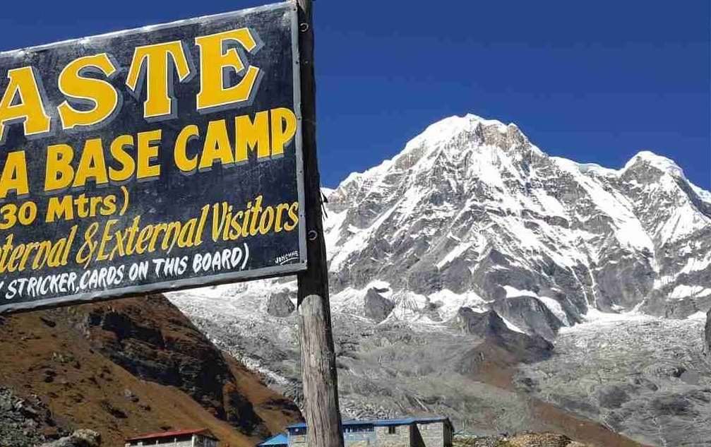
The Annapurna Base Camp route delivers 5 distinct categories of highlight: glacial sanctuary access, 360-degree Himalayan panoramas, Gurung cultural village experiences, diverse ecological transition zones, and the personal achievement of reaching a 4,130-meter base camp shared with serious Himalayan mountaineering expeditions.
What Can You See From Machhapuchhre Base Camp?
From Machhapuchhre Base Camp (3,700 m), trekkers see the full south face of Machhapuchhre (6,993 m) from a direct approach distance of approximately 3.3 kilometers, the closest point any trekker legally reaches to this sacred, unclimbed Nepali mountain, permanently closed to climbing expeditions since 1964.
Machhapuchhre, translated as "Fishtail Mountain" in English, takes its name from its distinctive twin-peaked summit profile, visible clearly from Pokhara city 55 kilometers to the south. The Government of Nepal declared Machhapuchhre a sacred peak and closed it to climbing after the only ascent attempt by a British expedition in 1957 reached within 50 meters of the summit.
From MBC, 4 additional peaks appear at close range: Annapurna South (7,219 m), Hiunchuli (6,441 m), Gangapurna (7,455 m), and the Annapurna III massif (7,555 m) to the northeast. The glacial moraine fields stretching from MBC toward ABC extend as a 5-kilometer ice-and-rock plain between the surrounding walls.
Sunrise at MBC illuminates the south face of Machhapuchhre in a gold-to-orange light sequence before the sun clears the sanctuary rim, a 15-minute light progression that trekkers and landscape photographers consistently identify as the most visually intense sunrise experience in the Annapurna region.
Which Mountain Views Can You Expect Along the ABC Trek Route?
Along the ABC trek route, trekkers see 14 Himalayan peaks above 6,000 meters, including Annapurna I (8,091 m), Dhaulagiri (8,167 m), Annapurna South (7,219 m), Gangapurna (7,455 m), Machhapuchhre (6,993 m), Hiunchuli (6,441 m), and Lamjung Himal (6,931 m), each visible from specific vantage points along the ascent corridor.
Peak visibility by location:
Poon Hill (3,210 m): Dhaulagiri (8,167 m) and Annapurna I appear in full profile at sunrise. This vantage delivers the widest panorama of the trek, a 180-degree arc from Dhaulagiri in the west to Manaslu (8,163 m) in the east.
Ghandruk (1,940 m): Annapurna South and Hiunchuli dominate the northern skyline. Ground-level village photography places the peaks directly above traditional stone houses for compositional contrast.
Annapurna Base Camp (4,130 m): The 360-degree summit encirclement at ABC defines the trek's visual climax. No other easily accessible trekking destination in Nepal positions trekkers inside a ring of 8,000-meter peaks.
What most trekkers overlook: the viewpoint from Tadapani (2,590 m) at sunset delivers an east-facing profile of Annapurna II (7,937 m) and Annapurna IV (7,525 m) unavailable from any other standard stop on the route. Spending a night at Tadapani to access this sunset view requires no additional walking distance, only a different overnight stop choice.
Which Villages and Landscapes Make the ABC Trek Route Special?
3 landscape zones distinguish the ABC trek route: the lower subtropical forest belt from 1,070 to 2,000 meters containing rhododendron forest, waterfalls, and terraced Gurung farmland; the mid-altitude canyon zone from 2,000 to 3,200 meters defined by the Modi Khola gorge, bamboo forest, and alpine meadow; and the upper sanctuary zone from 3,200 to 4,130 meters of glacial moraine, bare rock, and ice-field terrain.
Ghandruk is the route's primary cultural landmark. The village preserves 400-year-old Gurung stone architecture and active religious sites, including a functioning Gurung Museum funded by the Annapurna Conservation Area Project (ACAP). Gurung community members with direct family involvement in Gurkha military service populate both Ghandruk and Chhomrong, retired Gurkha soldiers who served in the British and Indian armies are common conversational encounters at local teahouses.
The rhododendron forest between Ghorepani and Tadapani spans 26 square kilometers and represents the densest rhododendron concentration in the entire Annapurna region. During March and April, 5 rhododendron species bloom simultaneously: red (Rhododendron arboreum), pink (Rhododendron barbatum), white (Rhododendron campanulatum), yellow (Rhododendron lepidotum), and lavender (Rhododendron cinnabarinum).
Jhinu Danda's natural hot springs, geothermal waters at 38–42°C located on the Modi Khola riverbank below the village, provide a muscle recovery experience unavailable on any other standard Nepal trekking route.
What Is the Best Time to Trek the Annapurna Base Camp Route?
The best time to trek the Annapurna Base Camp Route is October through November (autumn) and March through May (spring). Autumn delivers the clearest mountain visibility and the most stable trekking weather. Spring delivers warmer temperatures, rhododendron blooms, and excellent peak views before pre-monsoon cloud build-up begins in late May.
Which Seasons Offer the Best Trekking Conditions?
4 seasons define trekking conditions on the Annapurna Base Camp Route: autumn (October–November) with 80–90% peak visibility and stable weather; spring (March–May) with moderate temperatures and rhododendron blooms; winter (December–February) with cold temperatures and uncrowded trails; and monsoon (June–September) with heavy rainfall, landslide risk, and minimal mountain visibility.
Autumn (October–November): The post-monsoon period delivers the most reliable trekking conditions on the ABC route. Daytime temperatures at ABC range from -2°C to 5°C in October. Night temperatures at ABC drop to -15°C during late November. Sky clarity peaks in October, mountain visibility exceeds 90% of trekking days. Trail traffic peaks during this period, with teahouses filling to capacity on weekends and requiring advance booking above Chhomrong.
Spring (March–May): Daytime temperatures are warmer than autumn, reaching 5°C to 10°C at ABC in April. Rhododendron blooms peak between mid-March and mid-April across the Ghorepani–Tadapani–Ghandruk forest corridor. Pre-monsoon cloud build-up begins in May, reducing afternoon visibility from around 2:00 PM onward. Spring is the preferred season for trekkers who prioritize botanical landscape and warmer trail conditions over maximum sky clarity.
Winter (December–February): Temperatures at ABC drop to -20°C at night. Snow covers the trail above Deurali from December through February. The route remains open but demands full cold-weather gear and sleeping bags rated to -20°C. Teahouses above Chhomrong operate with reduced menu services in January. Trail traffic drops 60% below autumn peak, a significant advantage for trekkers who value solitude and uncrowded teahouse stays.
Monsoon (June–September): The route experiences 200–300 mm of monthly rainfall from June through August. Landslide risk above Bamboo increases substantially. Leeches populate the lower trail sections below Ghandruk. The Annapurna Conservation Area does not officially close during monsoon, but trail conditions above Himalaya village deteriorate significantly.
How Does Weather Affect the Annapurna Base Camp Route?
Weather affects the Annapurna Base Camp Route in 4 direct ways: cloud cover reduces mountain visibility, rainfall makes stone trail surfaces slippery and landslide-prone, temperature drops below 3,700 meters require active layering management, and sudden afternoon storms above the sanctuary require trekkers to reach Deurali or MBC before 2:00 PM.
Afternoon weather changes above MBC arrive without advance warning. Clear mornings at ABC transition to complete cloud cover by noon on 40% of trekking days throughout the season. Trekkers descending from ABC to MBC after 1:00 PM risk encountering whiteout conditions in the narrow gorge between Deurali and MBC.
The Annapurna Sanctuary sits in a geographic bowl that amplifies afternoon storm intensity. Storm cells entering from the Modi Khola valley accelerate as they funnel through the gorge below Deurali. What begins as afternoon cloud cover at Himalaya village (2,920 m) reaches ABC as full storm conditions 3–4 hours later.
The decision rule applied by experienced guides: depart ABC no later than 7:00 AM for all descending trekkers, and begin the final ascent from Deurali no later than 6:00 AM on summit day.
How Difficult Is the Annapurna Base Camp Trek Route?
The Annapurna Base Camp Trek Route is rated moderate to moderately challenging. The route reaches 4,130 meters altitude and accumulates 3,060 meters of total ascent across 10 days, accessible to fit recreational hikers without technical mountaineering experience, but demanding consistent aerobic fitness and prior multi-day hiking experience.
How Much Daily Walking Does the Route Involve?
Daily walking on the Annapurna Base Camp Route averages 12 to 16 kilometers per day, with individual days ranging from 5 kilometers (Himalaya to Deurali) to 19 kilometers (ABC descent to Bamboo). Daily walking duration averages 5 to 7 hours at a moderate pace with standard teahouse rest breaks.
The 3 hardest walking days on the route are:
Tikhedhunga to Ghorepani (Day 2): 1,334 meters of altitude gain over 11 km, including 3,444 stone steps through Ulleri, the steepest single ascent on the route.
Deurali to ABC and return to MBC (Day 7): 930 meters of altitude gain over 10 km at elevations above 3,200 meters, where atmospheric oxygen is 30% lower than at sea level.
ABC to Bamboo descent (Day 8): 1,820 meters of altitude loss over 19 km, the greatest daily elevation change of the entire route and the highest knee-stress day.
How Does Altitude Affect the Trek?
Altitude affects the Annapurna Base Camp Trek Route at 3 critical elevation thresholds: headache risk begins above 2,500 m near Chhomrong; Acute Mountain Sickness (AMS) risk increases significantly above 3,500 m at Machhapuchhre Base Camp; and severe altitude illness requiring immediate descent becomes a medical risk at ABC (4,130 m) for trekkers without prior high-altitude experience or proper acclimatization.
Annapurna Base Camp sits at 4,130 meters, an elevation where atmospheric oxygen pressure is 39% lower than at sea level. At this altitude, trekkers experience reduced exercise capacity, elevated resting heart rate, and disrupted sleep as normal physiological responses to hypobaric hypoxia.
AMS symptoms include headache, nausea, dizziness, and loss of appetite. These symptoms affect 20–30% of trekkers reaching ABC without prior high-altitude experience, according to altitude medicine research conducted at Kathmandu's CIWEC Hospital Travel Medicine Center.
The standard AMS prevention protocol used by Nepal Intrepid Treks guides:
Ascend no more than 500 meters per day above 3,000 meters
Spend 1 acclimatization night at MBC (3,700 m) before ascending to ABC
Maintain daily fluid intake of 3–4 liters
Carry acetazolamide (Diamox) if prescribed by a physician
The emergency descent protocol: descend immediately at the first signs of confusion, loss of balance, or difficulty breathing. These symptoms indicate High Altitude Cerebral Edema (HACE) or High Altitude Pulmonary Edema (HAPE), both life-threatening conditions above 4,000 meters requiring immediate loss of altitude as the primary treatment.
What Fitness Level Is Needed for the Route?
The Annapurna Base Camp Trek Route requires moderate fitness, the ability to walk 5–6 hours daily on steep terrain for 7–10 consecutive days. Trekkers with regular aerobic exercise habits of 4–5 sessions per week of running, cycling, or hiking achieve comfortable route completion without specialized mountain training.
The 8-week preparation program recommended for first-time ABC trekkers:
Weeks 1–4: 4 aerobic sessions per week, each 45–60 minutes, at moderate intensity (65–75% maximum heart rate). Running, cycling, and swimming all qualify.
Weeks 5–8: 2 dedicated hiking sessions per week, each 3–5 hours, on hilly terrain with a 6–8 kg daypack. Stair climbing with a loaded pack specifically prepares the Ulleri ascent and the Chhomrong exit staircase.
Trekkers with knee conditions benefit from targeted strengthening of the quadriceps and hip flexors, these muscle groups absorb the greatest load during the Ulleri 3,444-step ascent and the 19-kilometer ABC descent day.
Age is not a limiting factor. Nepal Intrepid Treks has guided trekkers between ages 16 and 72 to Annapurna Base Camp on the standard 10-day route.
What Should You Know Before Trekking the Annapurna Base Camp Route?
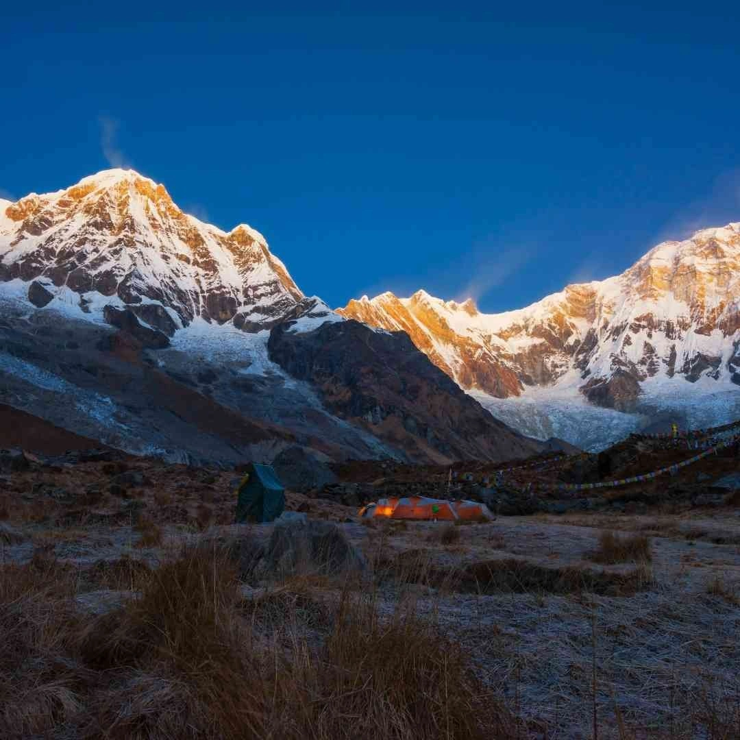
Preparation for the Annapurna Base Camp Trek Route covers 3 practical domains: permit acquisition, gear selection, and weather management strategy. Trekkers who address all 3 domains before departure in Pokhara complete the route with significantly fewer logistical disruptions than those who improvise upon arrival.
What Permits Are Required for the Trek?
Two permits are mandatory to trek the Annapurna Base Camp Route: the Annapurna Conservation Area Project (ACAP) permit at NPR 3,000 (approximately USD 22) per person, and the TIMS (Trekkers' Information Management System) card at NPR 2,000 per person. Note that independent trekking is banned in Nepal; all foreign trekkers must obtain these permits through a licensed trekking agency and trek with a registered guide. While ACAP permits can be verified at the Nepal Tourism Board offices, your TIMS card must be processed and issued directly by your chosen government-registered trekking agency before the trek begins.
ACAP Permit: The Annapurna Conservation Area Project permit authorizes entry into the 7,629 square kilometer Annapurna Conservation Area, the largest protected area in Nepal, managed by the National Trust for Nature Conservation (NTNC). The ACAP permit is mandatory for all foreign trekkers. SAARC nationals pay an ACAP fee of NPR 1,000 per person, while Nepali citizens pay NPR 100. The permit stamps at 6 checkpoints: Birethanti, Ghandruk, Chhomrong, Sinuwa, Himalaya, and Deurali.
TIMS Card: The Trekkers' Information Management System card records trekker identity and itinerary for safety tracking and emergency response purposes. The TIMS card fee is a flat NPR 2,000 per person for all non-SAARC foreign trekkers and NPR 1,000 for SAARC nationals, as all trekkers must now be part of an agency-guided tour. TIMS cards are no longer issued directly to individual trekkers at tourism offices; they are processed digitally by your licensed trekking agency through the official Trekking Agencies' Association of Nepal (TAAN) online portal.
To process these permits, you will need to provide your trekking agency with a passport-size photograph and a copy of your passport's photo page. Your agency will handle the backend processing with the tourism board during standard business hours prior to your trek departure. Trekkers without valid permits face fines at checkpoint stations and potential turnaround at Chhomrong, the last mandatory verification point before sanctuary entry.
What Should You Pack for the Annapurna Base Camp Route?
The Annapurna Base Camp Route requires a 10–15 kg pack containing a 4-layer clothing system, waterproof outer shell, sleeping bag rated to -15°C, trekking poles, water purification system, and first-aid supplies with altitude medication. Teahouses provide meals and accommodation throughout the route, eliminating the need for camping equipment or cooking gear.
Essential gear list organized by category:
Clothing system (4 layers):
Base layer: moisture-wicking thermal underwear, 2 sets
Insulating layer: 300-weight fleece or synthetic jacket
Outer shell: waterproof and windproof hardshell jacket and pants
Summit layer: down jacket rated to -20°C for ABC nights
Footwear:
Waterproof trekking boots, ankle-height or higher, broken in before the trek
2 pairs of wool trekking socks per hiking day
Camp sandals or lightweight shoes for teahouse use
Sleep and shelter:
Sleeping bag rated to -15°C (teahouse blankets are available but insufficient at ABC)
Silk sleeping bag liner, adds 5°C warmth and protects against shared bedding
Navigation and safety:
2 trekking poles, collapsible
Headlamp with spare lithium batteries
UV-blocking sunglasses (400 nm rating)
SPF 50+ sunscreen and lip balm
Health and hydration:
2-liter water capacity via bottles or hydration bladder
Water purification tablets or SteriPen UV purifier
Acetazolamide (Diamox), requires physician prescription before departure
Basic first aid: blister treatment, ibuprofen, oral rehydration salts, gauze, and medical tape
Trekking poles are optional below Chhomrong and essential above Deurali. Snow and ice on the trail above MBC during December through February require microspikes or crampons, available for rent in Pokhara at approximately NPR 300–500 per day.
How Can You Prepare for Changing Mountain Weather?
Prepare for changing mountain weather on the ABC route with 3 strategies: keep all 4 clothing layers accessible in the daypack at all times, plan daily departure before 7:00 AM above 3,000 meters, and read teahouse weather boards at Himalaya village and Deurali before beginning the sanctuary ascent stages.
Layering is the core weather management skill on the ABC route. Temperature at Chhomrong (2,170 m) reaches 18°C at midday in October and drops to 2°C at 6:00 AM the same morning, a 16°C daily swing that requires active clothing adjustment every 2–3 hours. Trekkers who pack rain gear at the bottom of their main pack spend 10 minutes reorganizing when afternoon rain arrives; experienced trekkers keep waterproofs in the daypack's top pocket.
Above 3,500 meters, afternoon rain at lower altitudes falls as snow. A dry base layer is the single most critical comfort factor during high-altitude nights at Deurali and ABC. Wet base layers at sub-zero temperatures create rapid heat loss and increase hypothermia risk.
Teahouse owners at Himalaya (2,920 m) and Deurali (3,200 m) receive daily weather updates via local radio and maintain chalk boards with trail condition reports. Reading these boards before the Deurali-to-ABC push prevents the most avoidable weather-related route errors on the entire trek.
How Can You Trek the Annapurna Base Camp Route With Nepal Intrepid Treks?
Nepal Intrepid Treks is a licensed Nepal trekking company specializing in Annapurna region treks, operating with government-registered English-speaking guides, certified high-altitude first-aid trained staff, and a full portfolio of Annapurna Base Camp packages ranging from 7 to 14 days.
Can Nepal Intrepid Treks Help You Plan the Annapurna Base Camp Route?
Nepal Intrepid Treks provides full-service Annapurna Base Camp trek packages including permit acquisition, mandatory licensed guide and porter arrangement, teahouse accommodation booking, airport transfers, and customized daily itineraries, ensuring you seamlessly meet all of Nepal's legal trekking requirements.
The 6 services Nepal Intrepid Treks handles for ABC trekkers:
ACAP and TIMS permit processing: Obtained in full on behalf of the trekker in Kathmandu or Pokhara before departure day.
Licensed guide assignment: Government-registered, English-speaking guides with a minimum of 3 years of ABC route experience and wilderness first-aid certification.
Porter arrangement: Trained, insured porters carrying loads of up to 15 kg per porter, allowing trekkers to walk with 3–5 kg daypacks rather than full expedition packs.
Teahouse booking: Advance teahouse reservations during peak October and April season, essential when ABC-level teahouses fill to capacity 3–5 days in advance.
Emergency evacuation coordination: Helicopter evacuation access via radio communication from Chhomrong onward, with travel insurance liaison support.
Flexible itinerary customization: Route adjustments including Poon Hill sunrise addition, Jhinu Danda hot spring recovery stop, and Mardi Himal viewpoint detour on request.
Nepal Intrepid Treks offers the Annapurna Base Camp trek as a group package, joining scheduled departures with 2 to 10 participants, or as a private trek with custom departure dates and an exclusive guide and porter team. Private departures operate year-round, including winter months for trekkers seeking uncrowded trail conditions.
Reach out to Nepal Intrepid Treks to share your fitness level, preferred travel dates, and ABC route customization priorities. The team responds within 24 hours with a detailed day-by-day itinerary proposal and full cost breakdown.
What Are the Key Takeaways About the Annapurna Base Camp Trek Route?
The Annapurna Base Camp Trek Route is a 110-kilometer, 10-day trail reaching 4,130 meters inside the Annapurna Sanctuary, a glacial basin enclosed by 14 peaks above 6,000 meters, passing through 13 Gurung and Magar cultural stops, and accessible to moderately fit trekkers with proper permit documentation, layered gear preparation, and a reliable licensed guide.
The 7 essential facts every trekker confirms before the ABC route:
Start point: Nayapul (1,070 m), 42 km from Pokhara, reached by 90-minute vehicle transfer from Pokhara's Lakeside district.
End point: Annapurna Base Camp (4,130 m), the only trek destination in Nepal positioning trekkers inside a 360-degree ring of 8,000-meter peaks from a non-technical trail.
Duration: 7 days minimum, 10 days standard, 12–14 days extended route with side trips.
Best season: October–November for the clearest sky conditions; March–May for rhododendron landscape and warmer temperatures.
Mandatory permits: ACAP permit (NPR 3,000 / ~USD 22) and TIMS card (NPR 2,000 / ~USD 15), both of which must be processed by your registered trekking agency before departure.
Difficulty rating: Moderate, no technical climbing required; fitness equivalent to 5–6 hours of sustained hill walking per day across 10 consecutive days.
Defining highlight: The 360-degree summit panorama at ABC framing Annapurna I (8,091 m), Annapurna South (7,219 m), Gangapurna (7,455 m), and Machhapuchhre (6,993 m) simultaneously from a single standing position, a view earned through 7 days of approach.
The Annapurna Base Camp route rewards preparation. Trekkers who research the trail stages, acquire permits in advance, pack the correct layered clothing system, and walk with an experienced licensed guide reach ABC with energy remaining to fully absorb one of the world's most spectacular concentrated mountain viewpoints.