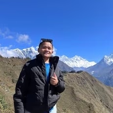
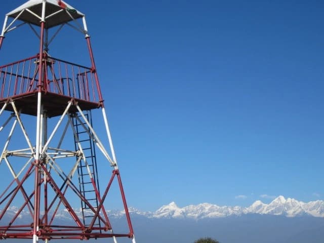
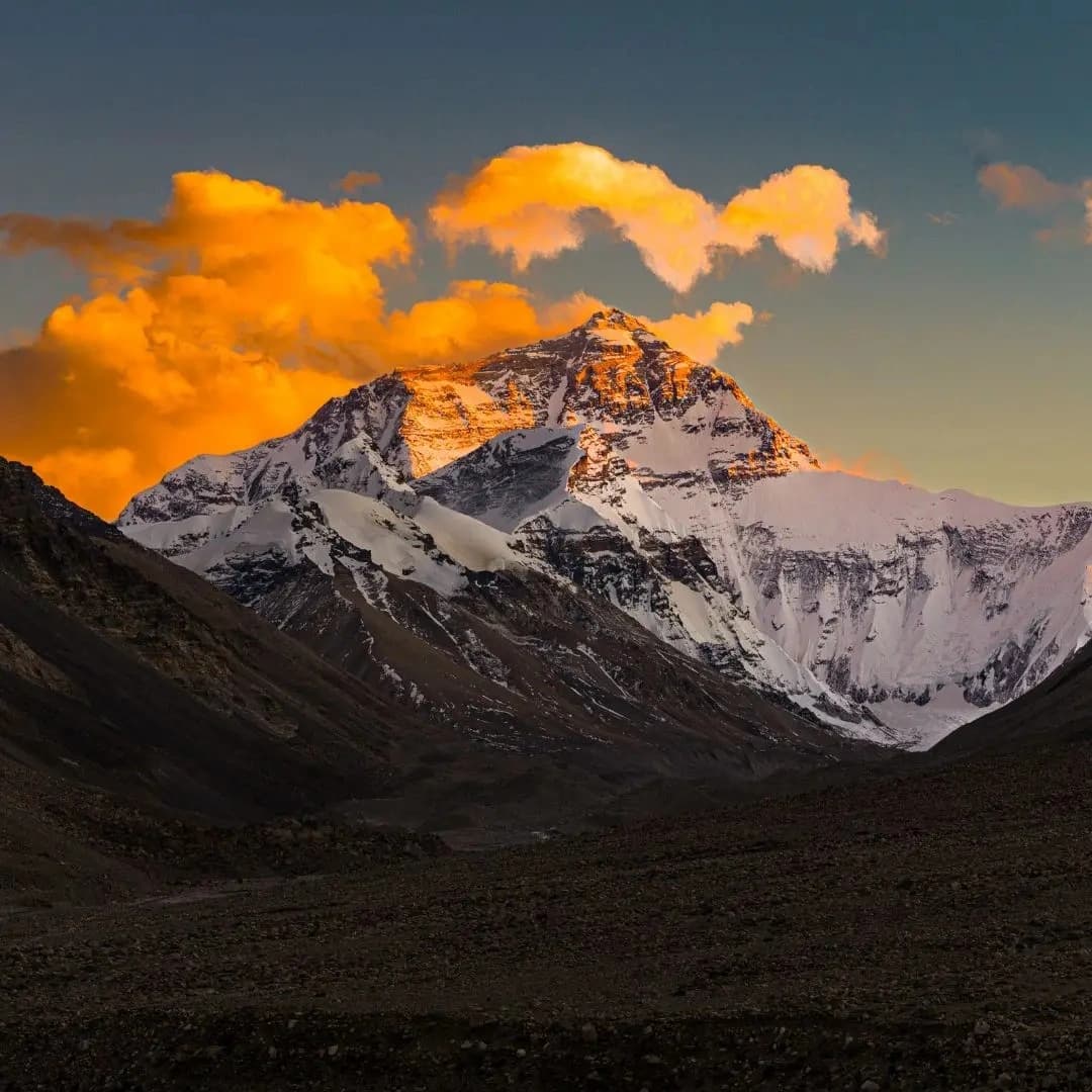
Nepal’s hardest treks are high-altitude Himalayan journeys that combine sustained elevation, demanding terrain, remote mountain valleys, limited infrastructure, and prolonged physical effort. The most challenging routes in Nepal include the Dhaulagiri Circuit, Tashi Lapcha Pass, Amphu Lapcha Pass, Upper Dolpo, Makalu Base Camp, Kanchenjunga Circuit, Rolwaling Valley, Everest Three Passes, Tilicho–Mesokanto La, and Nar Phu Valley. These routes reach elevations of roughly 4,580 to 5,780 meters and range from 14 to 32 days, with difficulty shaped not only by altitude but also by glaciated passes, steep moraine, exposed traverses, restricted areas, navigation demands, camping requirements, and limited emergency access.
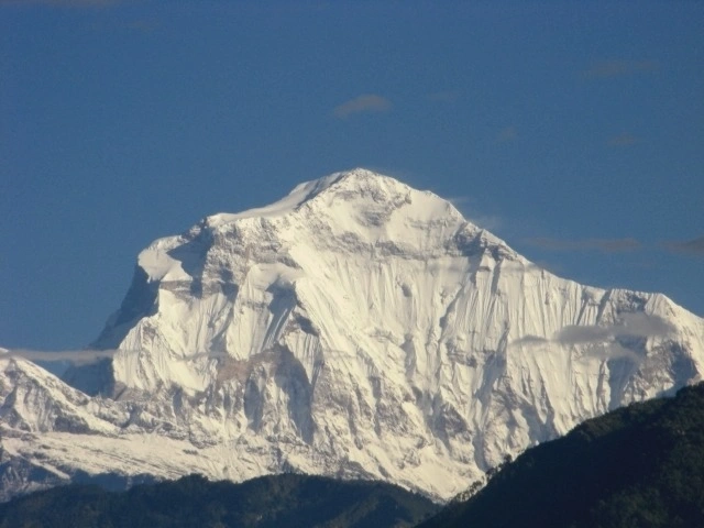
Experienced trekkers choosing among Nepal’s hardest trekking routes need to match the route’s demands with their previous altitude, endurance, navigation, and technical mountain experience. Tashi Lapcha and Amphu Lapcha require advanced rope, crampon, glacier-travel, and rappel skills, while Dhaulagiri, Upper Dolpo, Kanchenjunga, and Makalu place greater emphasis on expedition logistics, isolation, sustained altitude exposure, and multi-week endurance. The Everest Three Passes, Tilicho–Mesokanto La, Rolwaling, and Nar Phu routes offer different combinations of high passes, remote valleys, cultural landscapes, and technical terrain. The following guide examines these 10 hardest treks in Nepal by elevation, duration, technical difficulty, remoteness, permits, preparation requirements, and overall demands to help experienced trekkers identify the route that best matches their capabilities.
1. Dhaulagiri Circuit Trek
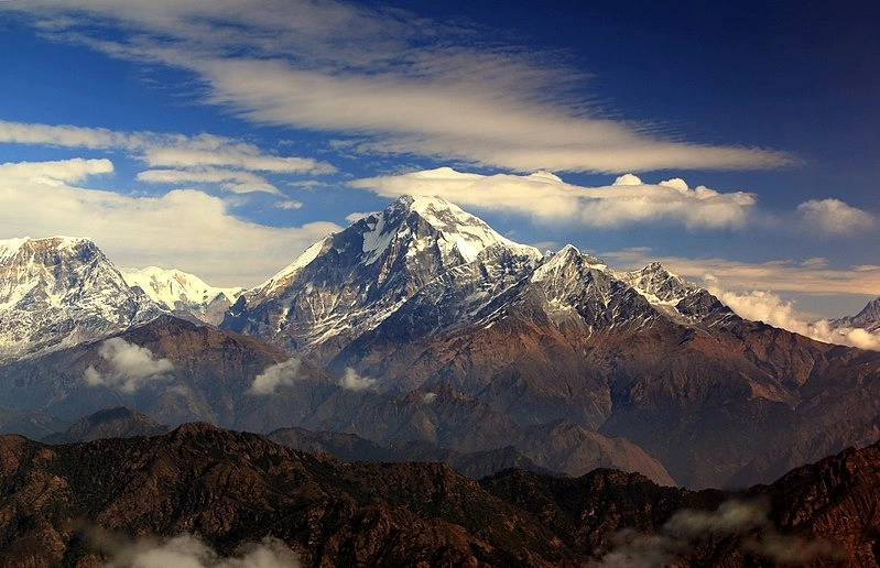
The Dhaulagiri Circuit Trek circumnavigates the world's 7th highest peak at 8,167 meters. It crosses two glaciated passes above 5,180 meters with no teahouse support. The route demands 22–25 days of full expedition camping logistics. It ranks as the most technically complete circuit trek in Nepal.
Why Is the Dhaulagiri Circuit Trek One of Nepal's Hardest Treks?
The Dhaulagiri Circuit Trek earns its difficulty rating because it crosses two high mountain passes, French Col at 5,360 meters and Dhampus Pass at 5,180 meters, while circumnavigating Dhaulagiri I (8,167 m), the world's 7th highest peak, across 22–25 days of remote, trail-scarce terrain.
No other circuit trek in Nepal places trekkers inside the Hidden Valley, a high-altitude enclosed plateau at 5,100 meters, with zero teahouse infrastructure. This trek demands full camping expedition logistics, including porter teams and kitchen crews, from day one.
What Are the Main Challenges of the Dhaulagiri Circuit Trek?
The 4 primary challenges of the Dhaulagiri Circuit are:
Glaciated pass crossings: French Col involves navigating a crevassed glacier where fixed ropes are seasonal and unreliable after late October
Extreme weather windows: The Hidden Valley traps wind systems, producing whiteout conditions that strand trekkers for 2–3 days at 5,100 meters
Total isolation: The Italian Base Camp and Dhaulagiri Base Camp sections have no emergency evacuation road; helicopter landings depend on rare weather clearance windows
Rapid altitude gain: Trekkers ascend from Marpha (2,670 m) to the Hidden Valley (5,100 m) in 5 days, gaining 2,430 meters faster than acclimatization guidelines recommend
What most trekkers overlook: the descent from French Col onto the Chhonbardan Glacier involves a 45-degree ice slope. Falls on this section account for the majority of serious incidents on this route.
What Skills and Experience Are Needed for the Dhaulagiri Circuit Trek?
Trekkers need 3 specific prerequisites before attempting the Dhaulagiri Circuit:
Prior high-altitude experience: documented completion of at least one trek above 5,000 meters, such as Everest Base Camp or Annapurna Circuit
Ice axe and crampon competency: glacier travel on French Col requires self-arrest skills tested in real conditions, not just training environments
Expedition camping fitness: daily loads for self-supported trekkers range from 12–18 kg; porter support is mandatory for most groups
When Is the Best Time to Attempt the Dhaulagiri Circuit Trek?
The 2 reliable windows for the Dhaulagiri Circuit are late September to early November and late April to late May. The October window offers the clearest skies and most stable pass conditions. Pre-monsoon (April–May) carries a 30% higher precipitation risk due to residual winter snowpack on the passes. December through March closes both high passes completely.
2. Tashi Lapcha Pass Trek
The Tashi Lapcha Pass Trek connects Rolwaling Valley to the Khumbu region at 5,755 meters. It is the second-highest trekking pass in Nepal and requires roped glacier travel. Fixed-line descents on near-vertical rock bands make this a mountaineering objective, not a standard trek. Parties without a qualified rope team have a documented fatality record on this route.
Why Is the Tashi Lapcha Pass Trek So Difficult?
The Tashi Lapcha Pass Trek is Nepal's most technically demanding valley-to-valley crossing, linking Rolwaling Valley to the Khumbu at 5,755 meters, the second-highest trekking pass in Nepal, across ground that requires roped glacier travel and fixed-line descent on near-vertical rock bands.
This is not a trekking route in the conventional sense. The Tashi Lapcha crossing is a mountaineering objective with a trekking approach. Parties without a rope team and qualified climbing guide have a documented fatality record on this pass.
What Makes Tashi Lapcha Pass Crossing Challenging?
The crossing presents 3 distinct technical hazards:
Dragpa Ri and the upper snowfield: the 400-meter ascent to the pass features 50–60 degree snow and ice slopes; crampon attachment is mandatory from 5,400 meters
Fixed-rope descent on the Khumbu side: a 30-meter near-vertical rock step at the top of the Ngojumba Glacier requires abseil technique; this section turns back 20% of guided parties in adverse conditions
Crevasse exposure: the Drolamboa Glacier approach from Rolwaling involves active crevasse zones; route-finding errors in poor visibility have caused 4 recorded fatalities since 2010
What Trekking Experience and Preparation Does Tashi Lapcha Require?
Tashi Lapcha Pass requires 4 confirmed preparations:
Completion of at least one glaciated trekking peak, Island Peak (6,189 m) or Mera Peak (6,476 m), demonstrating rope work competency
A licensed high-altitude guide with documented Tashi Lapcha crossings (minimum 3 verified ascents)
Full technical kit, 40-meter rope, ice axe, crampons, harness, and prussik cords per person
Emergency satellite communication device with a pre-registered rescue protocol
3. Amphu Lapcha Pass Trek
The Amphu Lapcha Pass Trek accesses the Hongu Basin, one of the Himalaya's most isolated valleys, at 5,780 meters. It requires a full 60-meter rappel descent on the Khumbu side. The entire approach covers 6–8 days through terrain with zero teahouse infrastructure. It carries the highest technical entry requirement of any non-peak trekking route in Nepal.
Why Is the Amphu Lapcha Pass Trek Considered Extremely Challenging?
Amphu Lapcha Pass (5,780 m) stands as Nepal's most technically demanding trekking pass because it accesses the Hongu Basin, one of the most isolated valleys in the Himalaya: and requires a minimum of 4 hours of roped climbing on the ascent and a full rappel descent of 60 meters on the Khumbu side.
The trek to Amphu Lapcha base originates from Chhukung (4,730 m) in the Everest region, crossing the remote Hongu Valley over 6–8 days before the pass. No teahouses exist in the Hongu Basin; the entire approach demands full camping expedition support.
What Technical Challenges Can Trekkers Expect on Amphu Lapcha Pass?
Amphu Lapcha delivers 3 compounding technical challenges unmatched on any other trekking pass in Nepal:
Double glacier crossing: both the approach and descent sides involve active glaciers with bergschrunds; the bergschrund on the south face has widened by an estimated 2 meters annually since 2015 due to glacial recession
Mixed rock-ice terrain at the col: the final 150 meters to the col combines loose shale, ice patches, and exposed ridge traversing requiring simultaneous movement on short-roped teams
Extreme cold exposure: summit temperatures drop to -20°C at night; teams crossing late in October have documented frostbite incidents at the col
What Experience and Preparation Are Needed for Amphu Lapcha Pass?
Amphu Lapcha demands the highest preparation standard of any non-peak trekking route in Nepal. Trekkers need:
Verified completion of a 6,000-meter trekking peak with technical ascent (Island Peak recommended as direct preparation)
A certified IFMGA/NMA guide with Amphu Lapcha experience
Minimum 25-day itinerary, compressed timelines below 22 days cause the majority of altitude-related turnarounds
Liaison with a trekking agency registered with the Nepal Tourism Board for high-altitude expedition logistics, as Amphu Lapcha is located within Makalu-Barun and Sagarmatha National Parks and does not require a Restricted Area Permit.
4. Upper Dolpo Trek
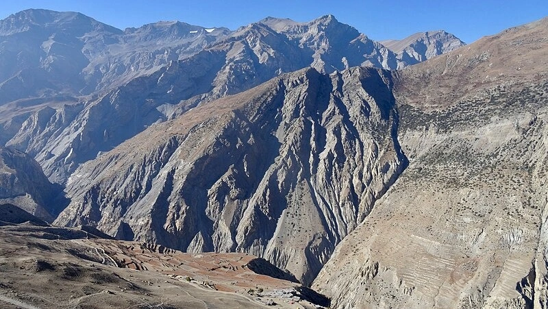
The Upper Dolpo Trek traverses a restricted trans-Himalayan zone bordering Tibet across 28–32 days. No roads, mobile networks, or resupply points exist in the interior. The route crosses 4 passes above 5,000 meters without descending to lower elevation for recovery. It holds Nepal's most expensive restricted area permit at USD 500 per person for 10 days.
Why Is the Upper Dolpo Trek One of Nepal's Most Remote Hard Treks?
The Upper Dolpo Trek is Nepal's most geographically isolated trekking route, located in a restricted trans-Himalayan zone bordering Tibet at altitudes between 3,600 and 5,360 meters across 28–32 days, with no road access, no mobile network, and the nearest emergency helicopter base more than 90 minutes' flight time from the interior.
Upper Dolpo, the region surrounding Shey Gompa and Phoksundo Lake, was closed to foreigners until 1989. The Tibetan Buddhist culture, trans-Himalayan plateau geography, and near-total logistical self-sufficiency required make this trek categorically different from every other Himalayan route.
What Challenges Does the Remote Upper Dolpo Region Present?
Upper Dolpo presents 4 compounding logistical and physical challenges:
Altitude of daily walking terrain: the route maintains sustained elevation between 4,200 and 5,360 meters for 14 consecutive days; altitude-related illness rates among unprepared trekkers reach 35%
4 high passes above 5,000 meters: Kagmara La (5,115 m), Numa La (5,190 m), Baga La (5,070 m), and Shey La (5,090 m) are crossed in sequence without descent to lower elevation for recovery
Monsoon-season timing: unlike most Nepal treks, Upper Dolpo sits in the rain shadow of the Dhaulagiri range; the primary trekking window is June–September, when the rest of Nepal experiences heavy rainfall
Zero resupply points: teams carry 28–32 days of food and fuel from Juphal; no provisions are available in Shey or Saldang for emergency re-stocking
What Permits and Preparation Are Required for Upper Dolpo?
Upper Dolpo requires 3 specific government permits:
Restricted Area Permit (RAP): USD 500 per person for 10 days, then USD 50 per additional day; applicable from the Nepal Department of Immigration
Dolpo National Park Entry Permit: NPR 3,000 per person (approximately USD 23)
TIMS Card: required for standard trekking areas, though trekkers holding a Restricted Area Permit (RAP) for regions like Upper Dolpo are explicitly exempt from the TIMS card requirement.
The RAP for Upper Dolpo is the most expensive trekking permit in Nepal.
5. Makalu Base Camp Trek
The Makalu Base Camp Trek approaches the 5th highest mountain on earth through the Barun Valley gorge system. It passes through 5 distinct climate zones from subtropical forest to glacial terrain. The base camp sits at 5,050 meters inside the Makalu-Barun National Park with no teahouses beyond Khongma. Cumulative elevation gain across 18–22 days exceeds 4,200 meters.
Why Is the Makalu Base Camp Trek Physically Demanding?
The Makalu Base Camp Trek ranks among Nepal's most physically demanding routes because it gains 4,200 meters of elevation over 18–22 days through the Barun Valley: one of Nepal's steepest gorge systems, while passing through 5 distinct climate zones from subtropical forest to permanent glacial terrain.
Makalu (8,485 m) is the 5th highest mountain on earth. The base camp sits at 5,050 meters inside the Makalu-Barun National Park, a protected wilderness with strictly limited infrastructure.
What Terrain and Altitude Challenges Does the Makalu Trek Involve?
The Makalu Base Camp Trek delivers 3 terrain challenges that separate it from standard Nepal trekking routes:
The Barun Gorge trail: the trail between Tashigaon (2,100 m) and Khongma (3,550 m) climbs 1,450 meters over 2 days through jungle terrain with no flat camping sections; trail erosion during monsoon makes this section dangerous between July–August
Sherpani Col approach option: trekkers extending to Sherpani Col (6,135 m) enter technical mountaineering terrain requiring rope teams and crampon skills; this extension adds 5 days
Weather instability above 4,500 meters: the Makalu region sits at the eastern edge of Nepal's jet stream exposure zone; afternoon snowfall above Makalu Base Camp occurs on 40% of days between November–December
How Should Trekkers Prepare for Makalu Base Camp?
Preparation for Makalu Base Camp centers on 3 physical and logistical priorities:
Cardiovascular base fitness: trekkers complete 60+ minutes of sustained aerobic activity daily for 8 weeks before departure, targeting the sustained uphill output required on the Barun Valley approach
Prior trek at comparable altitude: completion of Everest Base Camp (5,364 m) or Annapurna Base Camp (4,130 m) within the 24 months preceding the Makalu trek
Guide and camping gear: Makalu Base Camp has no teahouses beyond Khongma; full camping expedition with a licensed guide from the Nepal Tourism Board is the only viable logistics model
6. Kanchenjunga Circuit Trek
The Kanchenjunga Circuit Trek reaches both base camps of the world's 3rd highest mountain at 8,586 meters. It spans 220+ kilometers across 26–30 days through extreme eastern Nepal. Annual visitor numbers stay below 2,000, leaving trail infrastructure among the least developed of any major Nepal route. Six river crossings with no fixed bridges require seasonal route adjustments every year.
Why Is the Kanchenjunga Circuit Trek One of Nepal's Longest Hard Treks?
The Kanchenjunga Circuit Trek is Nepal's longest standard trekking route at 26–30 days, reaching both the North Base Camp (5,143 m) and South Base Camp (4,700 m) of Kanchenjunga, the world's 3rd highest mountain (8,586 m), across extreme eastern Nepal where teahouse availability remains sparse and trail infrastructure is the most underdeveloped of any major Nepal trek.
The circuit is often called Nepal's "last great wilderness trek" because its eastern location and restricted permit requirements limit annual visitor numbers to under 2,000 trekkers, compared to 100,000+ on the Annapurna Circuit.
What Makes the Kanchenjunga Circuit Physically Challenging?
The 3 dominant physical demands of the Kanchenjunga Circuit are:
Total trekking distance: the full circuit covers 220+ kilometers over terrain that gains and loses 18,000 meters of cumulative elevation
Extended high-altitude exposure: trekkers spend 8 consecutive days above 3,500 meters between the two base camps; this sustained exposure causes cumulative fatigue not experienced on shorter routes
Trail quality: unlike the Annapurna or Everest regions, Kanchenjunga trails include 6 river crossings with no fixed bridges; flood damage between July–September reroutes the trail annually
What Experience and Preparation Are Recommended for Kanchenjunga?
Kanchenjunga Circuit preparation requires 3 non-negotiable elements:
Restricted Area Permit: obtained only through a registered Nepal trekking agency; independent permits are not issued; minimum group size is 2 trekkers
30-day fitness window: the minimum body adaptation period for 26+ days of consecutive trekking; trekkers arriving without a recent multi-week trek base report the highest dropout rates on this route
Eastern Nepal logistics knowledge: flight connections to Suketar Airport (Taplejung) require domestic Nepal Airlines bookings 60+ days in advance due to limited frequency and weather cancellations
7. Rolwaling Valley Trek
The Rolwaling Valley Trek enters a glacially carved valley in Dolakha District above 3,700 meters. It passes Tsho Rolpa, Nepal's largest glacial lake at 4,580 meters, monitored continuously for outburst flood risk. No permanent teahouses exist above Beding village for the upper valley and pass sections. Trail markings disappear entirely above 4,200 meters, requiring GPS navigation.
Why Is the Rolwaling Valley Trek Considered a Difficult Himalayan Route?
The Rolwaling Valley Trek is one of Nepal's most challenging mid-length routes because it accesses a glacially carved valley at 3,700–5,000 meters in Dolakha District, home to Tsho Rolpa, Nepal's largest glacial lake at 4,580 meters, through trail sections with minimal marking, glacial moraine crossings, and no permanent teahouses above Beding village.
The Rolwaling Valley hosts some of the highest documented glacial lake outburst flood (GLOF) risk zones in Nepal. Nepal's Department of Hydrology and Meteorology monitors Tsho Rolpa with continuous sensors due to its GLOF threat to downstream communities.
What Makes the Rolwaling Valley Terrain Challenging?
The 3 most technically demanding terrain features of the Rolwaling Valley Trek are:
Moraine traverses above 4,500 meters: the glacier moraine leading to the upper Rolwaling is unstable, unconsolidated debris terrain; footing errors cause ankle injuries more frequently here than on any other comparable Nepal route
Tsho Rolpa shoreline path: the trail follows the eastern shore of Tsho Rolpa on a narrow, exposed shelf above the lake; sections washed out by wave action require detours with no fixed alternative markings
Tashi Lapcha Pass access: groups extending to Khumbu via Tashi Lapcha (5,755 m) begin a full mountaineering objective from the valley; this extension demands all technical prerequisites described in the Tashi Lapcha section
How Should Trekkers Prepare for the Rolwaling Valley Trek?
Rolwaling Valley preparation focuses on 3 targeted readiness elements:
Navigation competency: GPS device with Rolwaling Valley offline maps loaded; trail markings are absent above 4,200 meters and outdated on available paper maps
Cold weather shelter: temperatures drop to -15°C in Na (4,180 m) between November–February; sleeping bags rated to -20°C are the minimum standard
Emergency communication: satellite messenger (Garmin inReach or equivalent) is the only reliable emergency contact tool in the Rolwaling Valley
8. Three Passes Trek
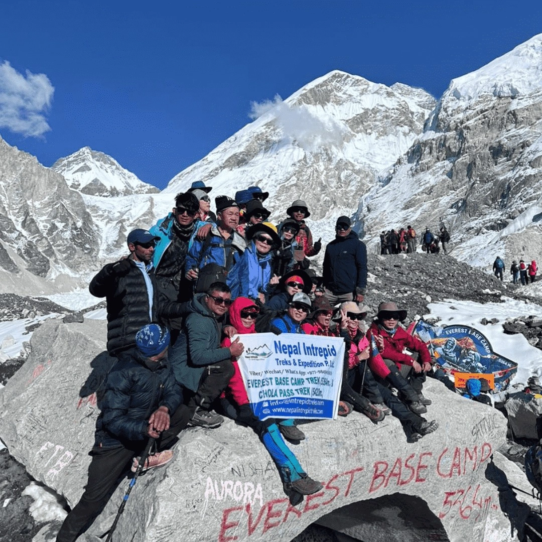
The Three Passes Trek crosses Kongma La (5,535 m), Cho La (5,420 m), and Renjo La (5,360 m) in addition to Everest Base Camp. It covers 160+ kilometers with more than 12,000 meters of cumulative elevation gain. Trekkers spend 6 consecutive days above 5,000 meters across the central Khumbu section. The Cho La Glacier crossing requires crampons from mid-October onward every season.
Why Is the Everest Three Passes Trek So Challenging?
The Everest Three Passes Trek is Nepal's most demanding multi-pass Everest region route, crossing 3 glaciated passes, Kongma La (5,535 m), Cho La (5,420 m), and Renjo La (5,360 m), in addition to Everest Base Camp (5,364 m) and Kala Patthar (5,645 m) across 18–21 days, combining the Everest Base Camp route with 3 additional high-altitude crossings.
This route covers 160+ kilometers of Khumbu trail and accumulates more than 12,000 meters of cumulative elevation gain, more than the Annapurna Circuit or Langtang Trek.
Which High Passes Make the Three Passes Trek Difficult?
Each of the 3 passes carries a specific technical profile:
Kongma La (5,535 m): the highest of the three passes, approached via moraine fields above Chhukung; the final 200-meter ascent involves loose boulder terrain with a 35-degree gradient
Cho La (5,420 m): requires crossing the Cho La Glacier, a 400-meter ice field with a 30-degree pitch; crampons are required from October 15 onward and recommended from September 15
Renjo La (5,360 m): often considered the least technical of the three, but its Gokyo-side ascent or descent involves a steep 500-meter trail on loose scree situated on the ridge west of Gokyo village, physically separated from the Ngozumpa Glacier.
How Do Altitude and Weather Affect the Three Passes Trek?
Three Passes trekkers face altitude-related illness risk on 6 consecutive days above 5,000 meters. The Khumbu region's altitude profile means trekkers who skip acclimatization days between passes develop acute mountain sickness (AMS) at a rate 3 times higher than trekkers who add 1 rest day between each pass crossing.
Weather windows close rapidly after November 10. Above-pass snowfall after this date has made the Cho La impassable for 12-day stretches in documented November–December years.
What Experience Is Needed for the Everest Three Passes Trek?
Three Passes requires 2 documented prior trekking achievements:
Successful Everest Base Camp completion: familiarity with Khumbu altitude profile reduces AMS risk by 40% among returning trekkers
Prior experience on one glaciated terrain section: either a trekking peak approach or a glaciated col crossing in Nepal or an equivalent alpine environment
9. Tilicho Lake–Mesokanto La Trek
The Tilicho Lake–Mesokanto La Trek reaches one of the world's highest lakes at 4,919 meters before crossing the Mesokanto La Pass at 5,322 meters. The pass descent involves 6 kilometers of unmarked moraine terrain into the Mustang zone. Wind gusts above 80 km/h occur on 30% of crossings based on recorded weather data from 2018–2024. No teahouse infrastructure exists above Manang for the Tilicho and Mesokanto sections.
Why Is the Tilicho Lake–Mesokanto La Trek One of Nepal's Hardest Routes?
The Tilicho Lake–Mesokanto La Trek is Nepal's hardest Annapurna-region route because it combines Tilicho Lake (4,919 m), one of the world's highest lakes, with the Mesokanto La Pass (5,322 m), which descends into the Mustang zone via a 600-meter technical slope across 18–22 days of high-altitude terrain with minimal logistical support above Manang.
What separates this trek from the standard Annapurna Circuit is the Mesokanto La crossing. The pass is rarely included in commercial itineraries because its south-facing descent combines ice-covered rocky terrain, route-finding complexity, and a 3–4 hour exposed traversal with no shelter above 4,800 meters.
What Makes Mesokanto La Pass Challenging?
Mesokanto La presents 3 challenge factors not found on the standard Annapurna Circuit:
Sustained north-facing ice on the ascent: the Tilicho side of the pass retains ice on the 400-meter upper face until mid-May; crampons are mandatory for this section from October through April
Lack of established trail markers: the descent into Jomsom involves 6 kilometers of unmarked terrain across moraine and boulder fields; a certified guide familiar with this specific descent is the only reliable navigation resource
Wind channel exposure: Mesokanto La sits in the Annapurna wind corridor, where gusts above 80 km/h occur on 30% of crossings based on recorded weather events between 2018–2024
What Skills and Preparation Are Needed for This Trek?
This trek requires 3 specific preparation steps:
Annapurna Conservation Area Permit (ACAP) and TIMS Card: processed in Kathmandu or Pokhara; no additional campsite or daily entry fees are required for the Tilicho Lake area.
Acclimatization in Manang (3,500 m): a minimum 2-night stay in Manang before ascending to Tilicho Lake reduces AMS risk; departing Manang without this stop produces AMS symptoms in 60% of first-time high-altitude trekkers
Guide with Mesokanto La-specific experience: this pass requires a guide who has completed the descent within the previous 24 months, as trail conditions and moraine positions change seasonally
10. Nar Phu Valley Trek
The Nar Phu Valley Trek accesses two hidden Tibetan Buddhist valleys, Nar at 4,160 meters and Phu at 4,080 meters, through a government-restricted zone. The Nepal government caps daily visitor numbers to protect the valley's cultural integrity. Kang La Pass (5,320 m) retains a 40-degree snow slope from October through May. The route is the shortest of Nepal's 10 hardest treks at 14–18 days, making it the strongest entry point for trekkers building toward more technical Himalayan routes.
Why Is the Nar Phu Valley Trek More Challenging Than Popular Annapurna Routes?
The Nar Phu Valley Trek surpasses standard Annapurna routes in difficulty because it accesses the hidden valleys of Nar (4,160 m) and Phu (4,080 m) through a restricted area requiring a special Nar Phu Valley Permit, crossing Kang La Pass (5,320 m) and Meta Pass (3,560 m), across 14–18 days in terrain unchanged by tourism infrastructure for 30+ years.
The Nar Phu Valley is a culturally protected Tibetan Buddhist enclave. The Nepal government limits daily visitor numbers to preserve the valley's cultural integrity. This restriction creates a trekking environment where trail maintenance, teahouse availability, and emergency infrastructure are minimal by design.
What High-Altitude Challenges Does the Nar Phu Valley Trek Involve?
The Nar Phu Valley Trek presents 3 altitude-driven challenges specific to its geography:
Kang La Pass gradient: the pass ascends 700 meters from base to col over 3 kilometers; the final 200 meters involves a 40-degree snow slope from October through May
Cold nights in Phu village: Phu sits at 4,080 meters in a deep valley with limited solar exposure; nighttime temperatures drop to -18°C in November; the 4 available teahouses have no central heating
Altitude of daily walking: the route maintains 3,500–4,500 meters for 10 of 14 trekking days; trekkers without a prior 4,000-meter-plus experience base show a 45% AMS incidence rate on this route
What Experience and Preparation Are Recommended for Nar Phu Valley?
Nar Phu Valley preparation centers on 3 documented requirements:
Nar Phu Valley Restricted Area Permit: USD 100 per week per person (September–November) and USD 75 per week (December–August), issued only through registered Nepal trekking agencies; individual permits are not available.
Licensed, Nepal Tourism Board-registered guide: the permit regulations mandate a guide for all Nar Phu trekkers; unguided trekking in the restricted zone carries a government penalty
Prior trekking above 4,000 meters: Nar Phu is well-matched as a stepping-stone route to more technical Annapurna-region treks such as Tilicho Lake–Mesokanto La or the Dhaulagiri Circuit
How Can Trekkers Choose the Right Hard Trek in Nepal?
Choosing the right hard trek in Nepal depends on 4 selection criteria:
Technical skill level: routes with glaciated passes (Tashi Lapcha, Amphu Lapcha) require rope work and crampon skills; routes without glacier crossings (Upper Dolpo, Kanchenjunga) demand endurance and altitude tolerance instead
Available trek duration: Kanchenjunga Circuit (26–30 days) and Upper Dolpo (28–32 days) require more leave time than Nar Phu (14–18 days) or Three Passes (18–21 days)
Budget for permits and logistics: Upper Dolpo's Restricted Area Permit costs USD 500 for 10 days; Three Passes requires the Khumbu Pasang Lhamu Rural Municipality Entry Permit and Sagarmatha National Park entry at a fraction of that cost, as the Everest region no longer utilizes the TIMS card system.
Preference for cultural versus wilderness experience: Nar Phu and Upper Dolpo deliver the deepest Tibetan Buddhist cultural immersion; Makalu Base Camp and Rolwaling Valley prioritize pristine wilderness and wildlife zones
The table below summarizes each trek's key parameters for direct comparison:
Trek | Max Elevation | Duration | Technical Level | Permit Cost |
Dhaulagiri Circuit | 5,360 m (French Col) | 22–25 days | High | Standard |
Tashi Lapcha Pass | 5,755 m | 20–23 days | Very High | Standard |
Amphu Lapcha Pass | 5,780 m | 22–24 days | Very High | Standard |
Upper Dolpo | 5,190 m (Numa La) | 28–32 days | High | USD 500+ |
Makalu Base Camp | 5,050 m | 18–22 days | High | Standard |
Kanchenjunga Circuit | 5,143 m (N. Base Camp) | 26–30 days | High | Restricted |
Rolwaling Valley | 4,580 m (Tsho Rolpa) | 18–21 days | Medium-High | Standard |
Three Passes Trek | 5,535 m (Kongma La) | 18–21 days | High | Standard |
Tilicho–Mesokanto La | 5,322 m (Mesokanto La) | 18–22 days | High | ACAP |
Nar Phu Valley | 5,320 m (Kang La) | 14–18 days | Medium-High | USD 100/week |
Which of These 10 Hardest Treks Is Best for Experienced Trekkers?
For experienced trekkers with high-altitude history but no technical climbing background, the Three Passes Trek, Makalu Base Camp, and Nar Phu Valley Trek offer the strongest combination of challenge, scenic reward, and manageable logistics. For trekkers with documented mountaineering skills, Tashi Lapcha Pass and Amphu Lapcha Pass deliver the highest difficulty ceiling in Nepal outside of peak climbing permits.
The 3 most frequently mismatched treks, where trekkers overestimate their readiness, are:
Upper Dolpo, because its difficulty comes from duration and isolation rather than altitude, which is harder to train for in advance
Kanchenjunga Circuit, because 26–30 days of cumulative fatigue degrades decision-making and physical reserves in ways that shorter treks do not simulate
Tashi Lapcha Pass, because trekkers with Everest Base Camp experience assume it prepares them for glaciated pass crossings, it does not
How Can Nepal Intrepid Treks Help With Planning a Difficult Nepal Trek?
Nepal Intrepid Treks provides end-to-end planning services for all 10 of the hardest treks in Nepal, including permit acquisition for restricted area zones, certified high-altitude guide assignment, camping expedition logistics, and custom itinerary structuring based on each trekker's verified experience profile.
Planning a technical Nepal trek involves 6 core logistics tasks:
Permit applications through the Nepal Department of Immigration and relevant national park authorities
Domestic flight bookings to access trailheads (Juphal for Dolpo, Taplejung for Kanchenjunga, Lukla for Khumbu-region treks)
Guide and porter team formation with NTB-licensed staff
Camping equipment procurement, tents, sleeping systems, and cooking equipment rated for above-5,000-meter conditions
Medical kit preparation, including Diamox (acetazolamide), pulse oximeters, and blister management supplies
Emergency evacuation protocol registration with the nearest helicopter rescue service and the trekker's travel insurance provider
Connecting with Nepal Intrepid Treks 90 days before departure gives enough lead time for restricted area permits and domestic flight reservations, both of which have documented booking bottlenecks during October–November peak season.
What Are the Key Takeaways About the 10 Hardest Treks in Nepal?
The 10 hardest treks in Nepal share 5 defining characteristics that separate them from standard Himalayan trekking routes:
Sustained elevation above 4,000 meters: all 10 routes spend the majority of trekking days in altitude zones where oxygen availability drops to 60% of sea-level concentration
Restricted access or limited infrastructure: 6 of the 10 routes require restricted area permits, though independent trekking for foreign nationals has been banned nationwide across standard TAAN-regulated routes since 2023; additionally, the 4 non-restricted routes lack teahouse infrastructure above their midpoint elevations.
Technical terrain on at least one route section: glacier crossings, glaciated passes, or technical descents appear on 7 of the 10 routes
Duration above 18 days: all routes demand sustained physical output over multi-week periods; fitness training for these treks begins 12 weeks before departure, not 4
Professional guide requirement: all 10 routes carry documented incident histories for unguided or under-prepared trekkers; Nepal's Trekking Agencies' Association of Nepal (TAAN) classifies each of these routes as "expert category" trails
Nepal's hardest treks deliver the most transformative Himalayan experiences available to non-climbers, from the trans-Himalayan plateau culture of Upper Dolpo to the world-record glaciated pass crossings of Tashi Lapcha and Amphu Lapcha. Each route rewards trekkers who arrive prepared with precision, training, and professional support.